February Precipitation Highlights:
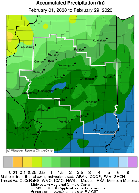 |
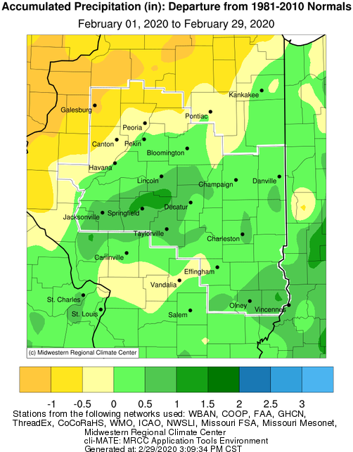 |
February Snowfall Highlights:
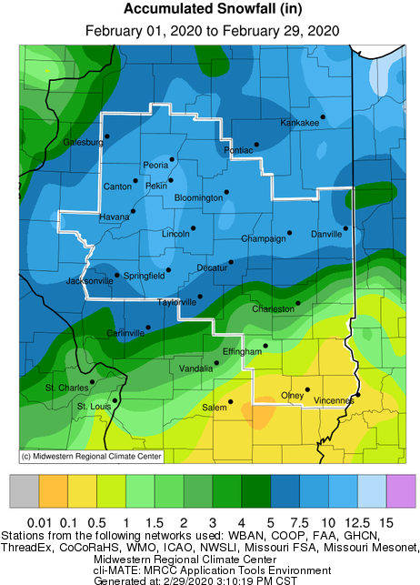 |
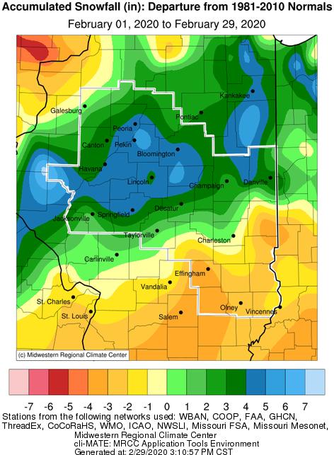 |
February Temperature Highlights:
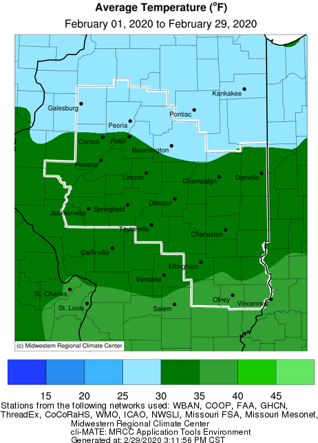 |
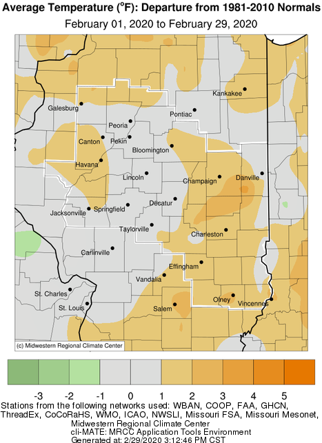 |
February Climate Statistics:
|
City |
Precipitation |
Departure from Normal | Snow |
Departure |
Average Temperature |
Departure from Normal |
|
Charleston |
3.83" | +1.32" | 3.5" | -1.1" | 34.4 | +1.3 |
| Danville |
2.71" |
+0.50" | 5.0" | +0.1" | 31.7 | +0.3 |
|
Decatur |
2.75" | +0.75" | 7.1" | +2.9 | 31.6 | -0.6 |
| Effingham | 2.50" | -0.22" | 1.1" | -4.2" | 34.0 | +1.9 |
|
Flora |
3.35" | +0.71" | N/A | N/A | 35.9 | +2.1 |
|
Galesburg |
0.44" | -1.19" | 2.0" | -3.9" | 27.2 | +1.1 |
|
Havana |
1.56" | -0.54" | 9.3" | +2.2" | N/A | N/A |
|
Jacksonville |
2.07" | +0.38" | 8.0" | +3.4" | 32.2 | +1.7 |
|
Lincoln |
2.40" | +0.58" | 9.3" | +3.5" | 30.9 | +0.5 |
|
Normal |
1.84" |
-0.11" | 8.5" | +3.4" | 29.3 | +1.4 |
|
Olney |
3.30" | +0.56" | 0.4" | -2.9" |
35.5 |
+2.3 |
|
Paris |
2.51" | +0.17" | 1.9" | -4.0" | 31.2 | +0.9 |
|
Peoria |
1.71" | -0.08" | 11.0" | +4.8" | 29.8 | +0.3 |
| Springfield |
3.28" |
+1.47" | 10.7" | +5.2" | 31.9 | +0.7 |
|
Taylorville |
2.52" | +0.53" | 3.4" | N/A | 32.5 | N/A |
|
Tuscola |
2.31" | +0.11" | 7.1" | +2.7" | 31.9 | +2.8 |
|
Urbana |
2.67" | +0.54" | 8.5" | +2.7" | 30.7 | +1.7 |
The following links are the monthly climate summaries for area cities. Only the summaries for Peoria, Springfield, and Lincoln are considered "official", meaning they are the station of record for their respective locations. The other summaries are "supplemental", meaning another location in the area is the official climate station for the city.
Climate data for other cities is available at http://w2.weather.gov/climate/xmacis.php?wfo=ilx
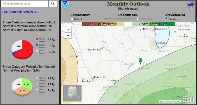
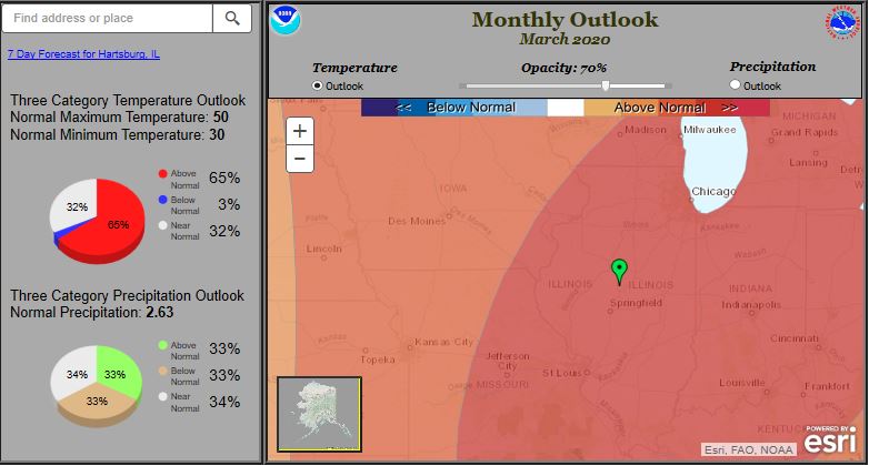
March Look Ahead:
  |
-------------------------------------------------------------------------------------------------------------------------------------------------------------
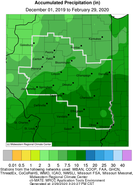
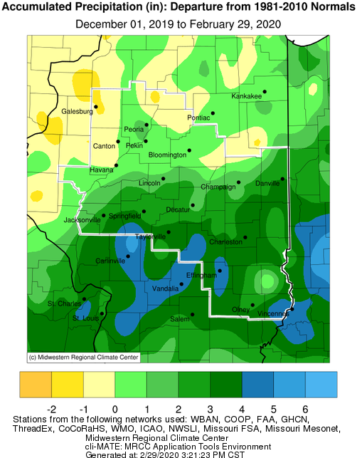
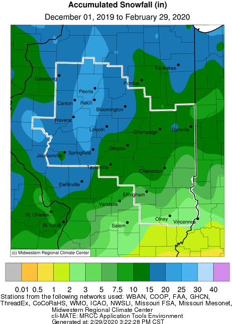
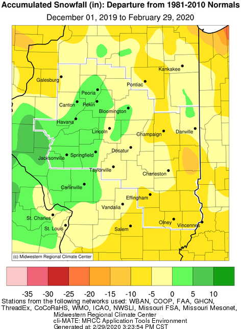
Winter Season Overview
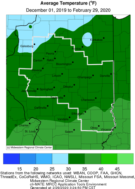
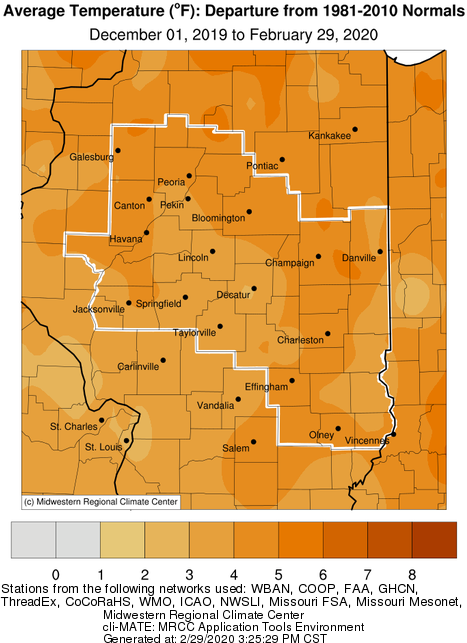
Meteorological winter, spanning the months of December through February, saw temperatures that averaged well above normal, and snowfall that varied from above normal for parts of central Illinois, to well below normal over eastern and southeast Illinois. The above normal snowfall from the Peoria and Bloomington areas, southwest into west central Illinois was the result of several low to medium sized snowfall events. This winter saw a notable lack of heavy snow events. Overall liquid precipitation was above normal, with the highest surpluses of 2-5" occurring south of the I-72 corridor. Seasonal temperatures were 2-4 degrees above normal, largely due to a lack of significant Arctic air. The coldest winter temperatures occurred on the morning of Feb. 14 when widespread below zero temperatures were reported, along with wind chills of -20 to -25.
Winter Season: Precipitation, Snowfall, Temperature, and Departure from Normal Maps
Links below are the seasonal climate summaries for area cities. Only the summaries for Peoria, Springfield and Lincoln are considered "official", meaning they are the station of record for their respective locations. The other summaries are "supplemental", meaning another location in the area is the official climate station for that city.
Climate data for other area cities is available at http://www.nws.noaa.gov/climate/xmacis.php?wfo=ilx

