|
|
|
|
 |
|
Tornado touchdown near Yates City, IL. Photo by Jarrod Cook. |
Convective outlook from Storm Prediction Center, issued 3 pm. |
Tornado outlook from Storm Prediction Center, issued 3 pm. Blue hatched area indicates a 10% or greater chance of tornadoes at least EF-2 intensity. |
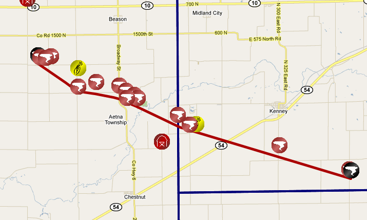
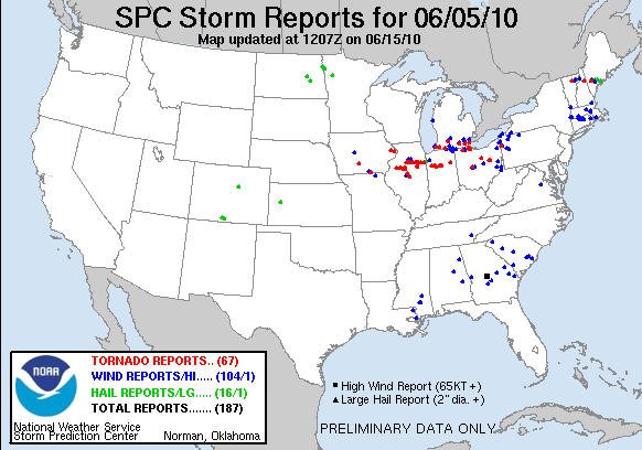
Mapping of storm reports |
(click images to enlarge)
A total of 19 tornadoes touched down across the northern half of Illinois, the evening of Saturday, June 5, 2010. Damage surveys conducted by NWS offices in Lincoln, Chicago, and the Quad Cities indicated the following tornado intensities:
This page details the 8 tornadoes that affected the Lincoln NWS coverage area. Click images to enlarge.
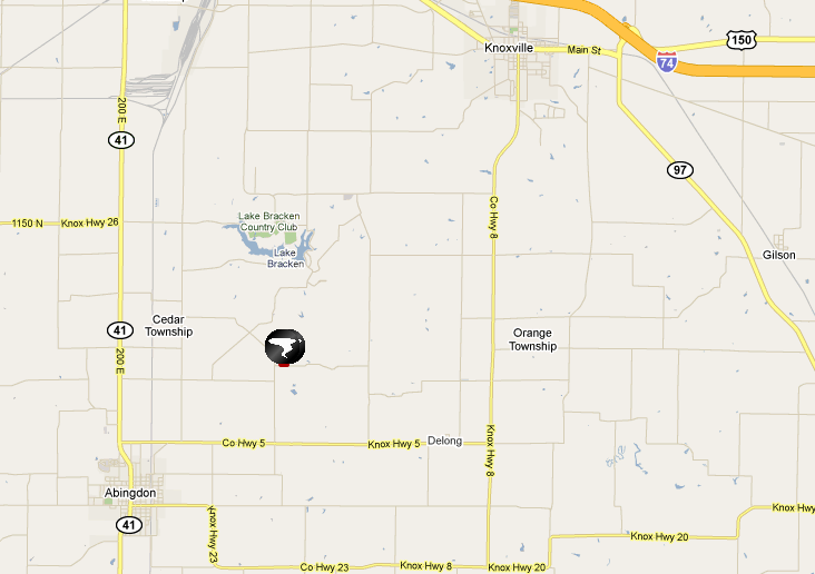
| Tornado #1: Abingdon (Knox County) | |
 |
|
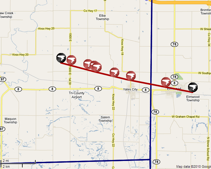
| Tornado #2: Yates City (Knox County) and Elmwood (Peoria County) | |
 |
|
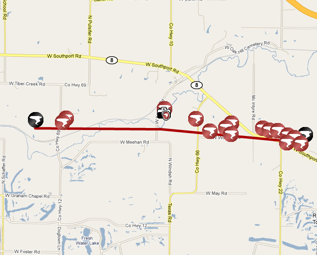
| Tornado #3: Oak Hill (Peoria County) | |
 |
|
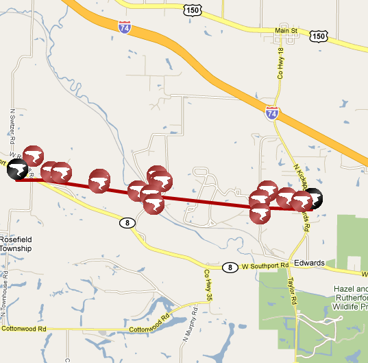
| Tornado #4: Edwards (Peoria County) | |
 |
|
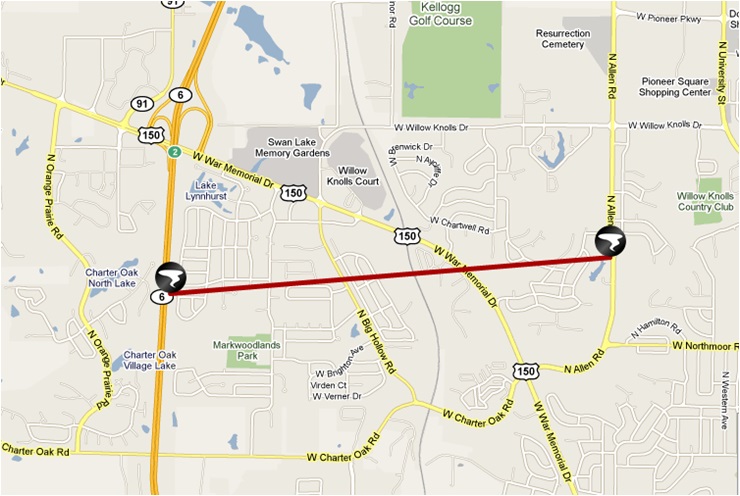
| Tornado #5: Peoria - Lynnhurst subdivision to Allen Road (Peoria County) | |
 |
|
| Tornado #6: Marshall/LaSalle Counties | |
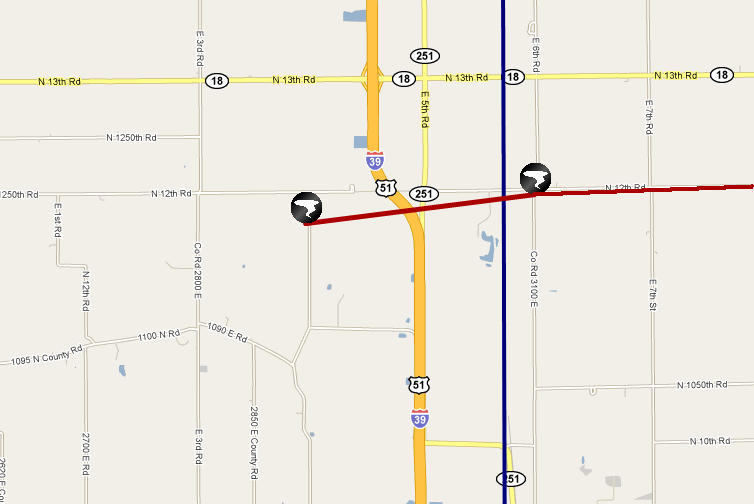 |
This tornado crossed into LaSalle County 3.7 miles north-northwest of Wenona - across I-39, at 8:35 pm, and continued east through Streator before lifting near the Livingston County border. |
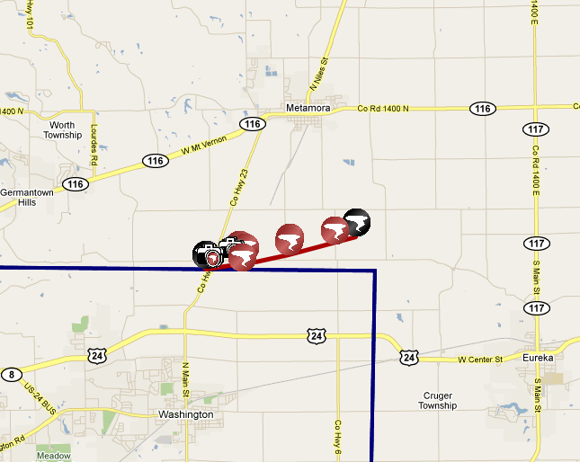
| Tornado #7: Tazewell/Woodford Counties | |
 |
|
| Tornado #8: Logan/DeWitt Counties | |
|
|
|
Radar Images (click to enlarge):
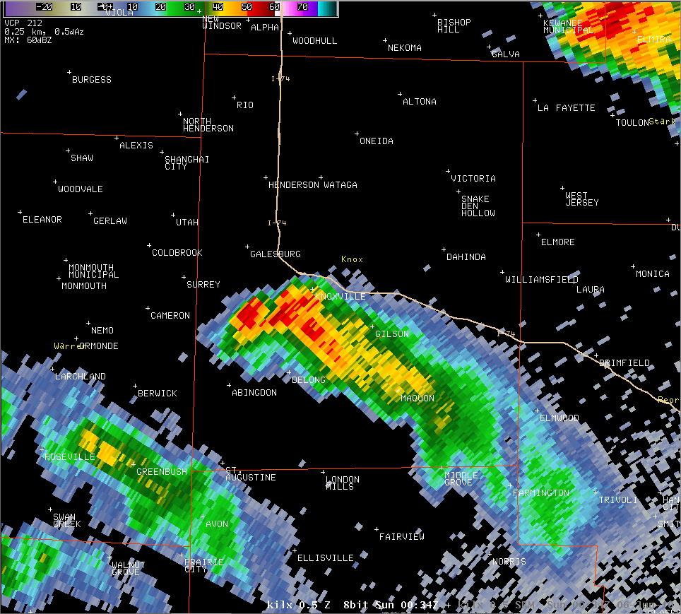 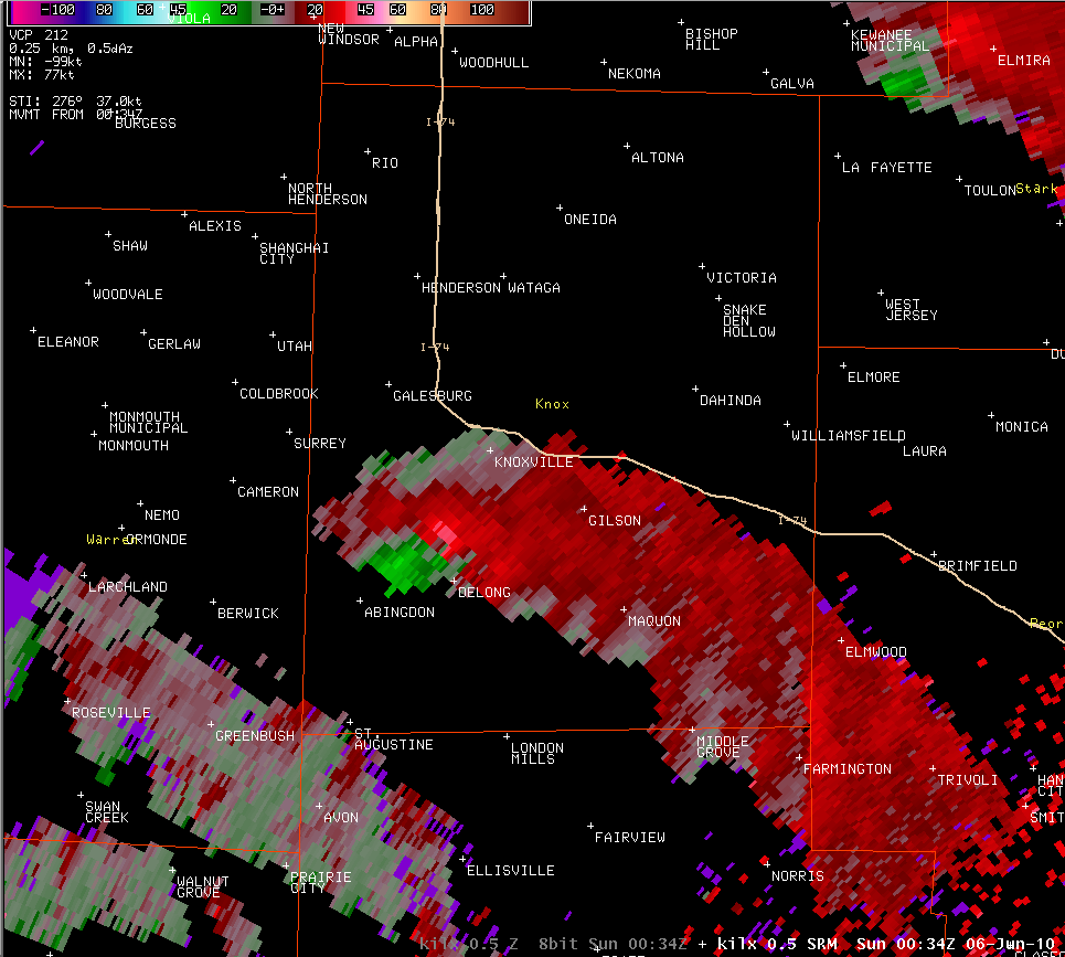 |
7:34 pm: Tornado touches down northeast of Abingdon. While the reflectivity image (left) does not show a well organized structure, the velocity image (right) shows a significant rotation northeast of Abingdon, as indicated by the bright green and bright red shades near each other. |
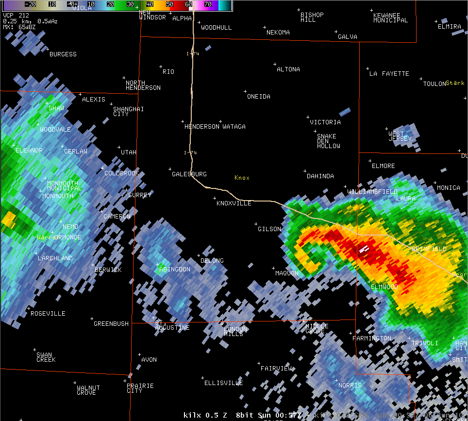 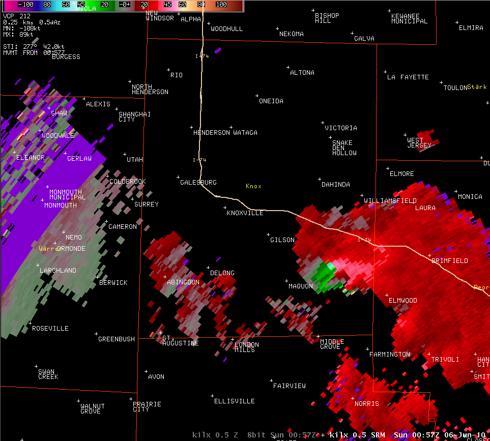 |
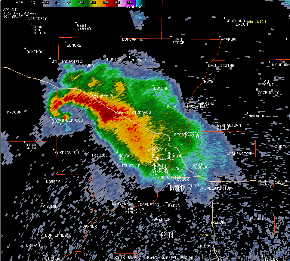
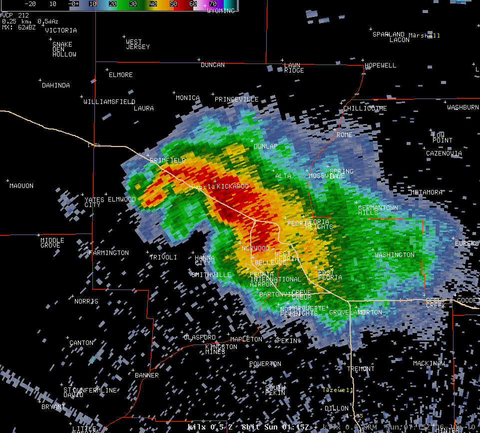
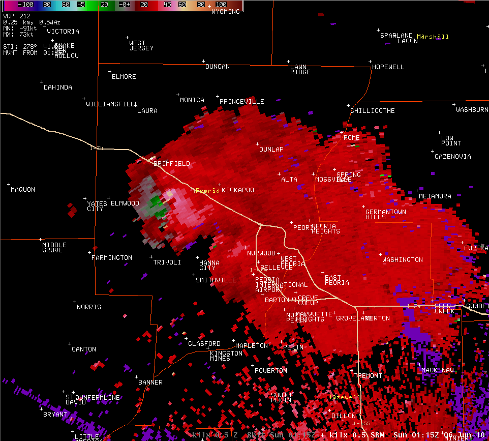
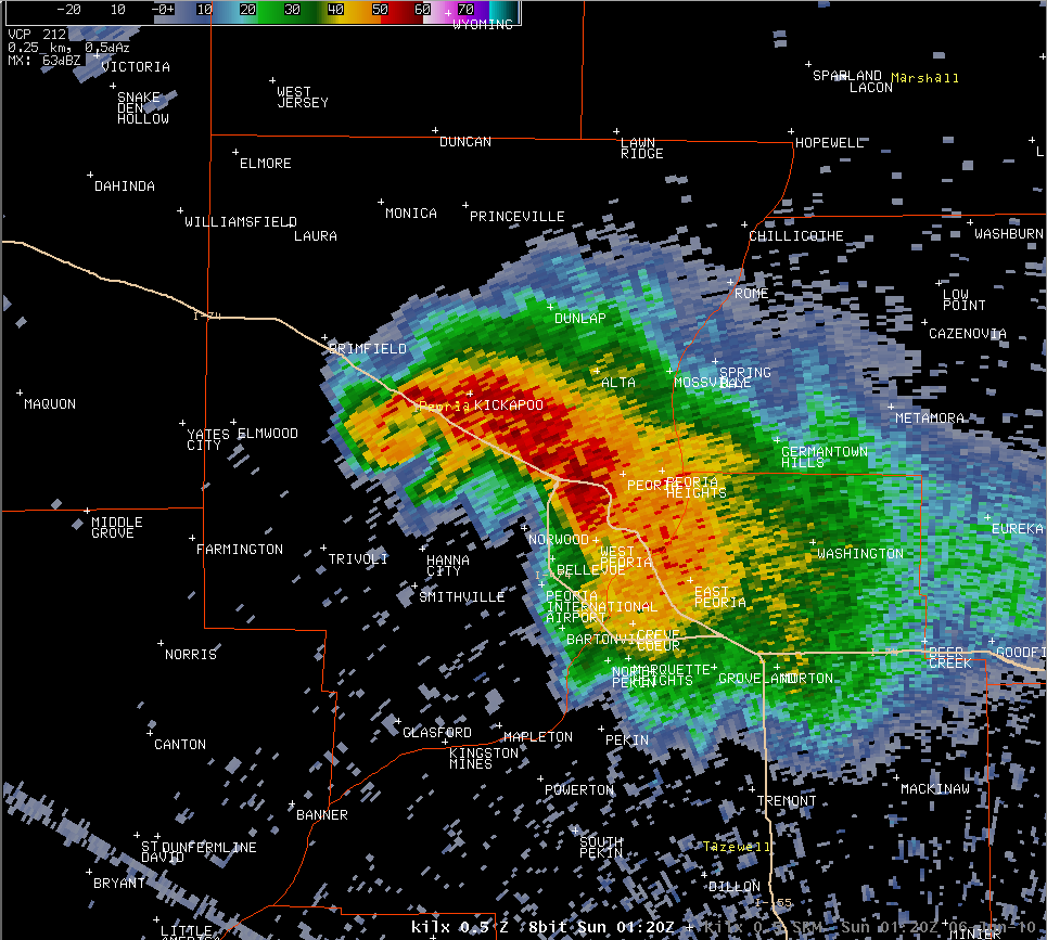
7:57 pm: These images were taken about 1 minute after a tornado touched down northwest of Yates CIty. The reflectivity image on left shows the classic "hook echo", while the circulation in the velocity image is stronger than earlier. The hook echo began to appear around 7:43 pm, although storm reports and damage surveys did not show any tornado occurring between 7:35 and 7:56 pm. |
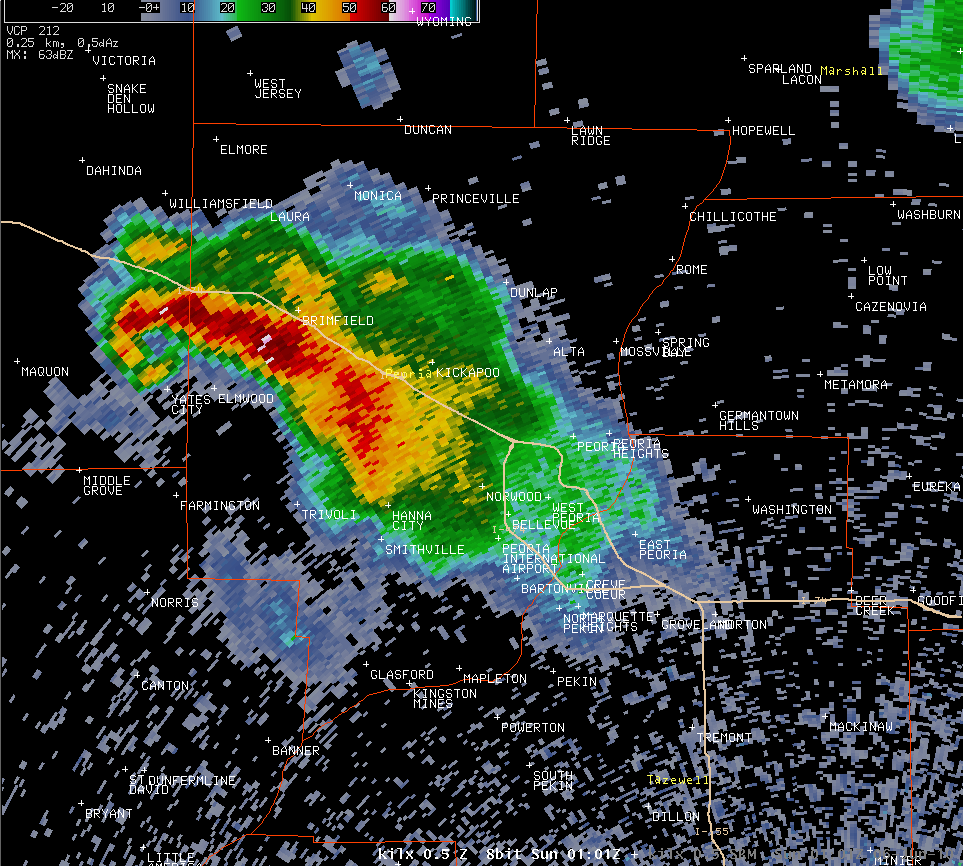 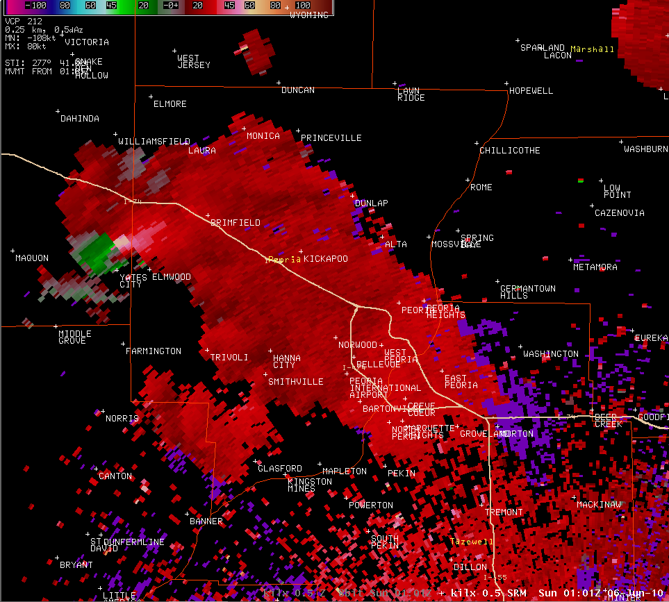 |
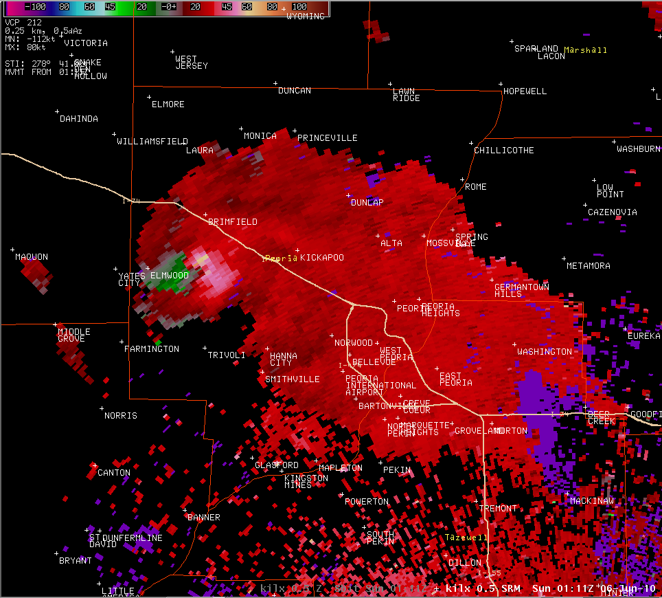
8:01 pm: The tornado is just north of Yates City, and is close to crossing the border into Peoria County. |
 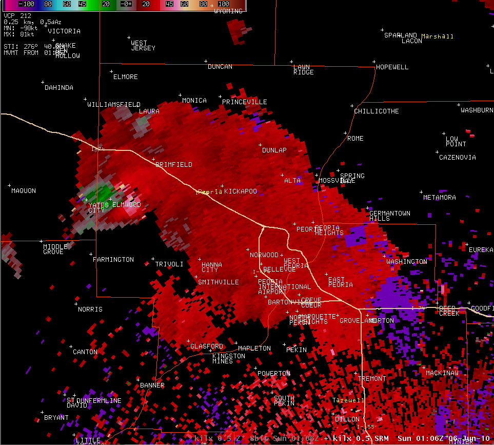 |
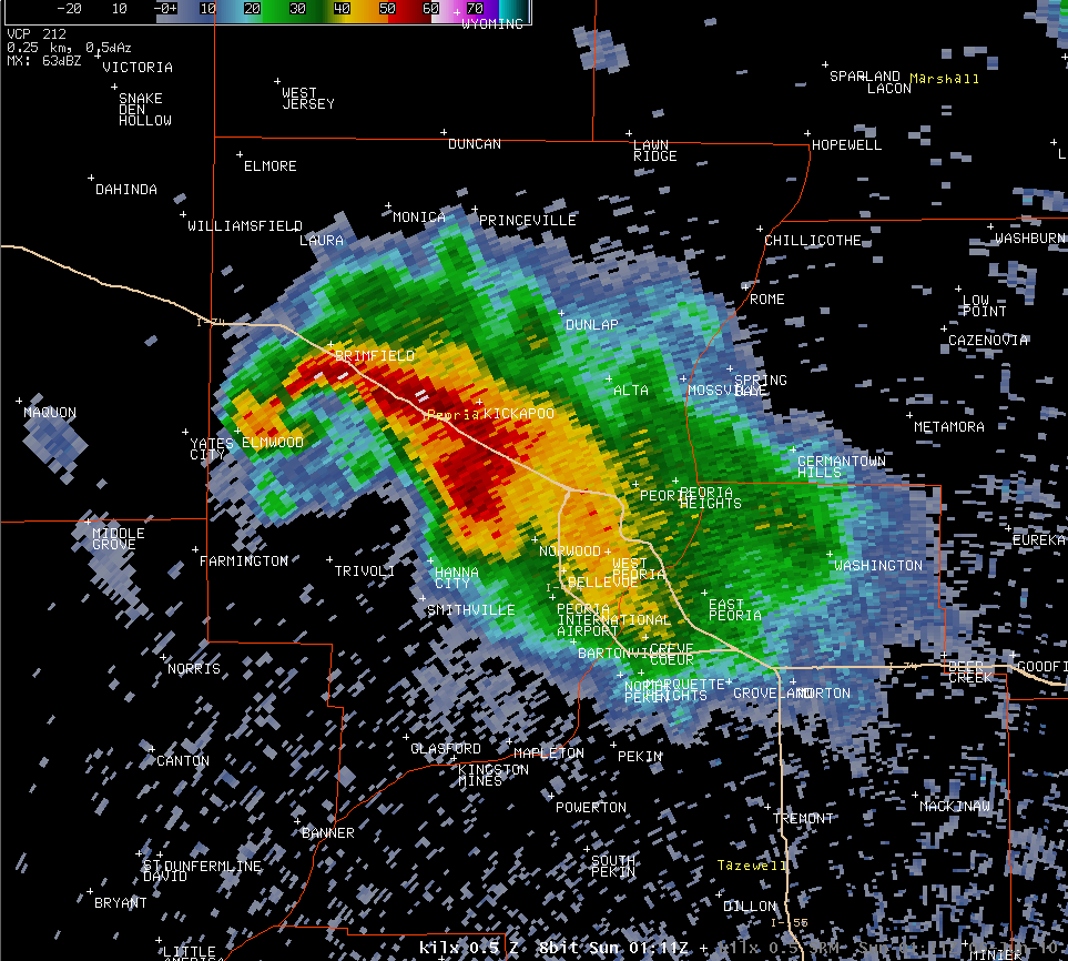
8:06 pm: The tornado is moving through Elmwood, and will lift 1 minute later. The hook echo persists. The higher reflectivities on the tip of the hook (red pixels directly over Elmwood in the left image) is likely being caused by debris being detected by the radar. |
  |
8:11 pm: A new tornado has touched down 1 minute earlier, about 2.6 miles east of Elmwood. |
  |
8:15 pm: The tornado remains on the ground between Elmwood and Kickapoo, and will lift 3 minutes after these images were taken. |
 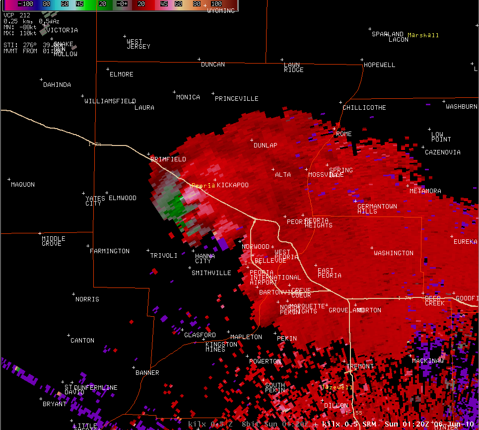 |
8:20 pm: The previous tornado has lifted, and a new tornado touches down 4 miles west-southwest of Kickapoo at 8:18 pm. The radar still shows strong rotation (right image) and a hook echo (left image). |
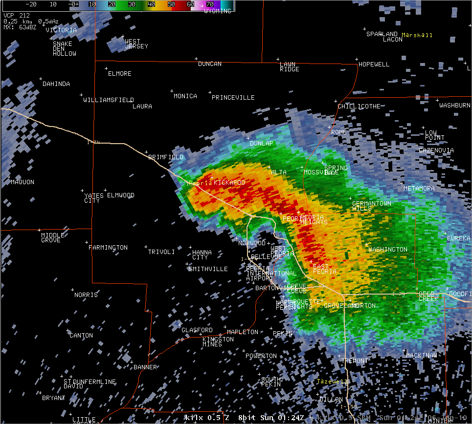 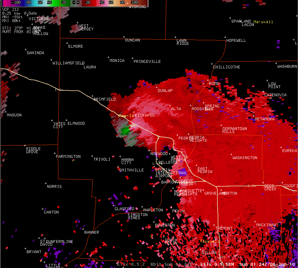 |
8:24 pm: The tornado lifts just north of Edwards at this time. While a strong rotation is still indicated, the hook echo is losing its structure. |
Photo Gallery
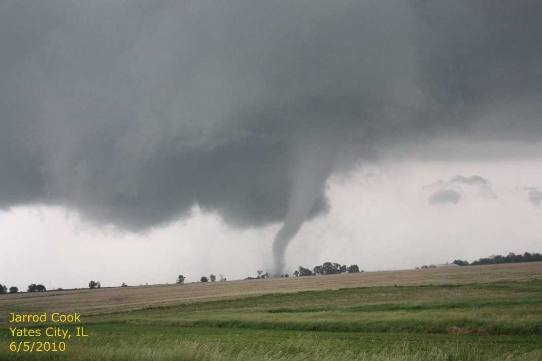 Photo by Jarrod Cook |
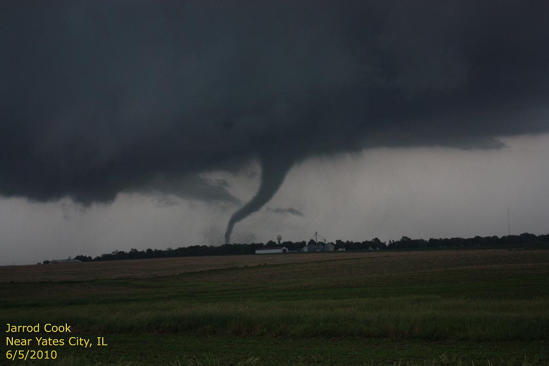 Photo by Jarrod Cook |
.jpg) Photo by Jarrod Cook |