Overview
|
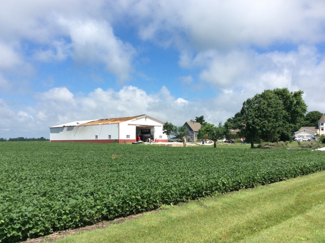
A few thunderstorms developed during the evening hours on June 26 in Champaign county. One storm developed rotation, and a tornado touched down just before 8:30pm southeast of Rantoul. The tornado impacted mainly rural areas of Champaign county before dissipating to the west-northwest of Gifford, producing damage to outbuilding roofs, trees, and crops. Click here for a link to the NWS Public Information Statement regarding the tornado damage survey. |
 Photo by Jeff Frame |
Tornadoes:
|
Tornado - Rantoul/Gifford
Track Map  
|
||||||||||||||||
The Enhanced Fujita (EF) Scale classifies tornadoes into the following categories:
| EF0 Weak 65-85 mph |
EF1 Moderate 86-110 mph |
EF2 Significant 111-135 mph |
EF3 Severe 136-165 mph |
EF4 Extreme 166-200 mph |
EF5 Catastrophic 200+ mph |
 |
|||||
Photos:
 |
 |
 |
 |
| Tornado lofting debris, shortly after touchdown. Photo from Ryan Ideus |
Roof and tree damage near the start of the tornado path Photo by NWS Lincoln |
Damage along the path of the tornado Photo from Jeff Frame |
Roof damage near the end of the tornado path Photo by NWS Lincoln |
Radar:
 |
 |
 |
| Lincoln Doppler Radar 6/26/18 8:23 PM CDT 4-panel radar image shortly before the tornado touched down. Weak rotation was observed to the southeast of Rantoul (circled). Radar echo tops were lower than 20,000 feet, indicating the storm's updraft was weak. |
Lincoln Doppler Radar 6/26/18 8:27 PM CDT 4-panel radar around the time the tornado touched down. The approximate track of the tornado is denoted by the white line (top panels). |
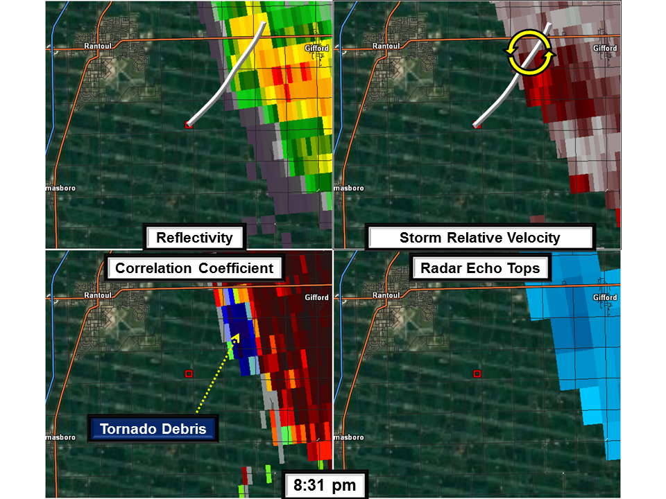
Lincoln Doppler Radar 6/26/18 8:31 PM CDT 4-panel radar around the time the tornado lifted. Dark blue values of correlation coefficient (bottom left panel) indicate debris from the tornado. |
 |
Media use of NWS Web News Stories is encouraged! Please acknowledge the NWS as the source of any news information accessed from this site. |
 |