
 |
 |
 |
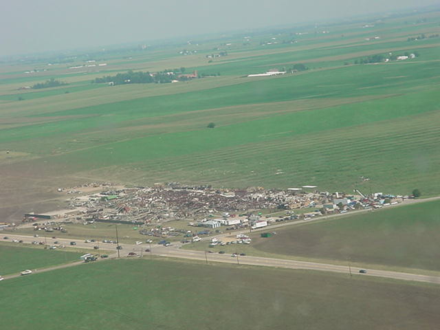 |
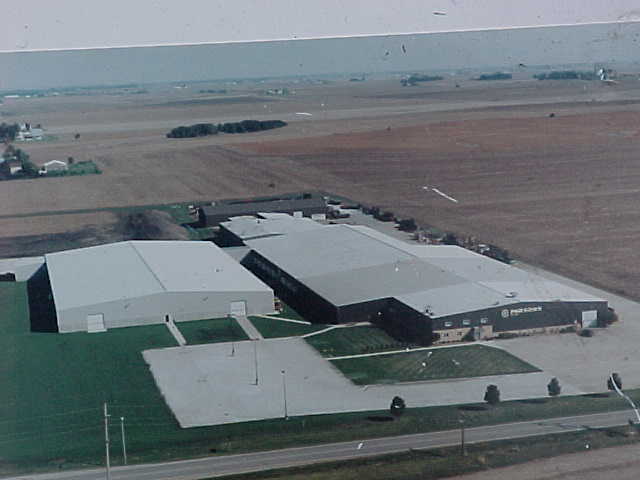
| Parsons Manufacturing Plant before the tornado (undated photo) | F4 Tornado striking Parsons Manufacturing Plant (courtesy of Scott Smith) | Track of tornado, from north of Metamora to south of Roanoke | Remains of Parsons Manufacturing Plant, taken July 15 (courtesy of Woodford County ESDA) |
Jump to: Weather Setup, Radar Images, Pictures
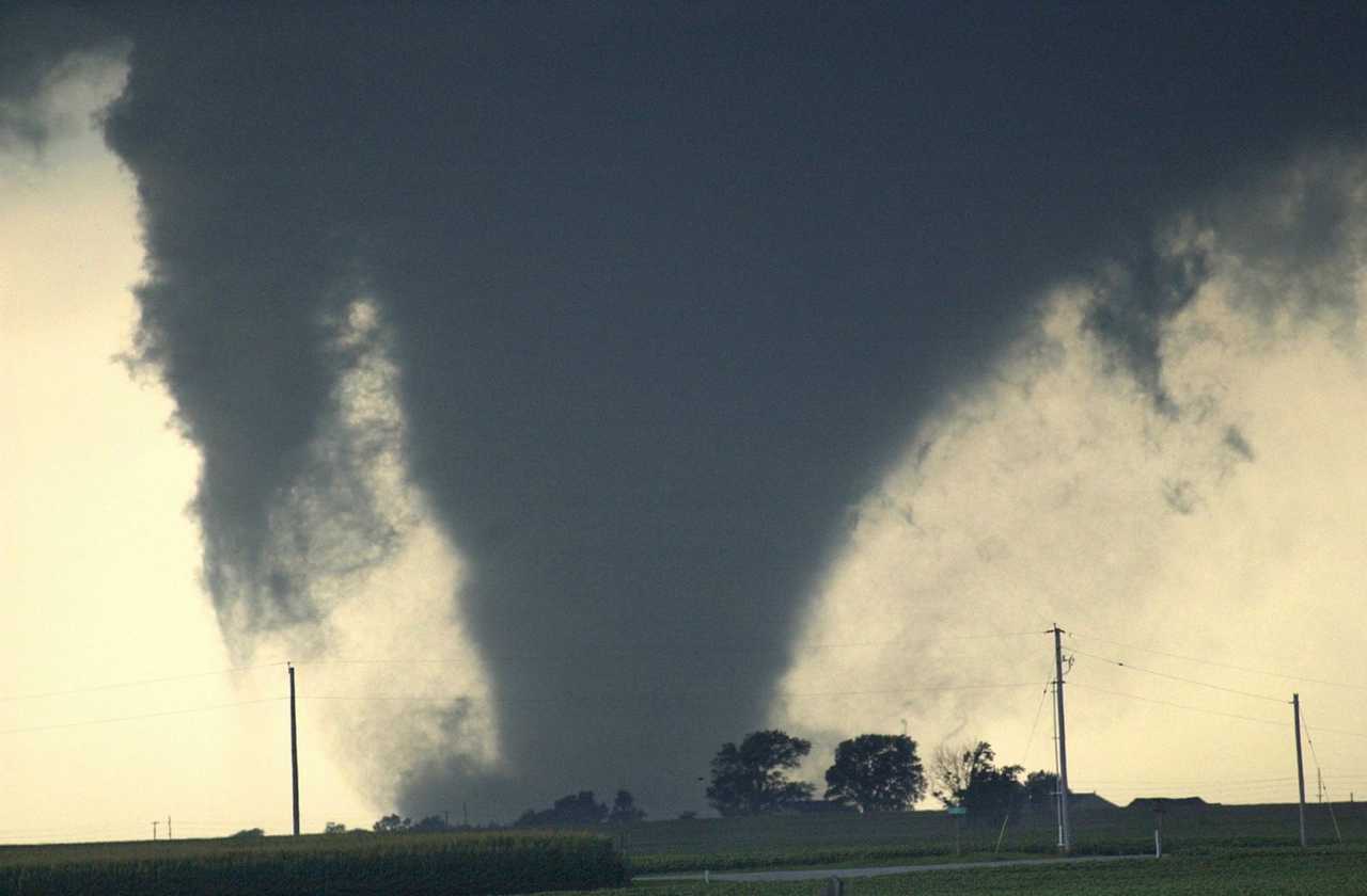
Supercell thunderstorms tracked across northern and central Illinois the afternoon and evening of July 13, 2004. A violent tornado tracked for 9.6 miles across Woodford County, with the tornado reaching F4 intensity along a 1-mile stretch between Metamora and Roanoke.
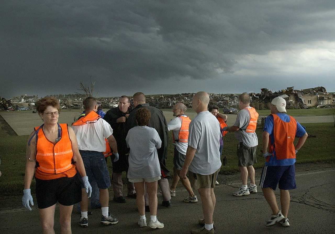
Damage surveys were completed by National Weather Service and Woodford County ESDA personnel on July 14 and 15. Specific details on the tornado's track follows.
The tornado touched down approximately 1.8 miles north of Metamora, a few hundred yards southeast of the intersection of Illinois Route 89 and county road 1600N. The tornado was initially of F0 (40-72 mph) strength. It moved southeast, and strengthened to F2 intensity (113-157 mph) near the time it reached county road 1300E. It then began a temporary eastward movement for about a half mile, before curving southeast again. It crossed Route 116 just west of the Route 117 junction, and was at F3 strength (158-206 mph) at this point.
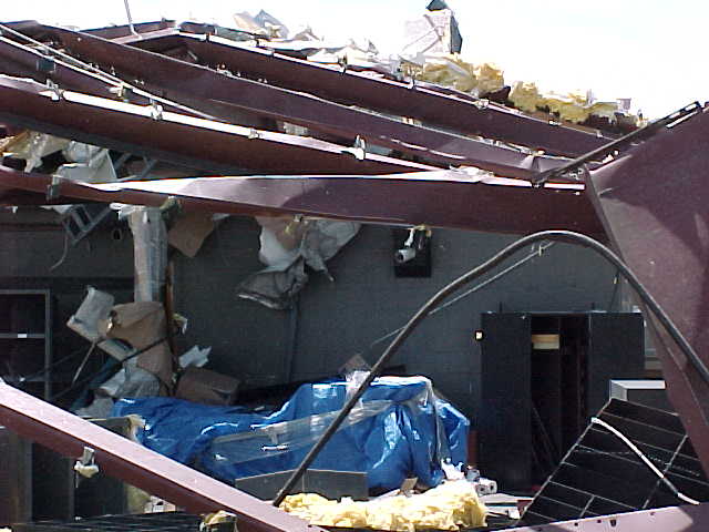
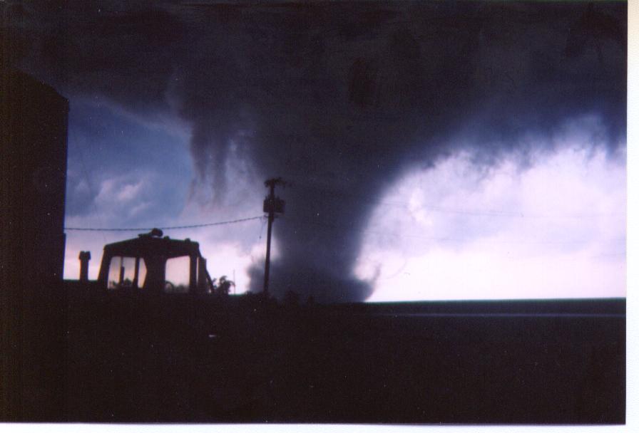
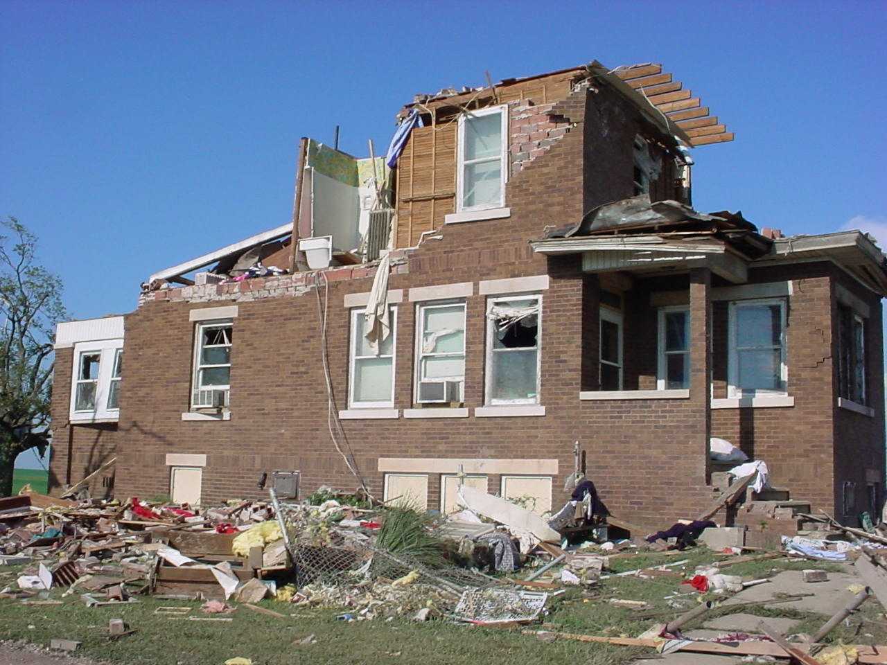
The tornado increased to F4 intensity (approximately 210-240 mph) as it crossed Route 117, demolishing the Parsons Manufacturing Plant at this intersection. Approximately 140 people were in the plant at the time, but all made it to storm shelters in time (approximately 3-5 minutes before the tornado arrived). Steel beams and metal siding from the plant were found approximately 3/4 mile east in a farm field.
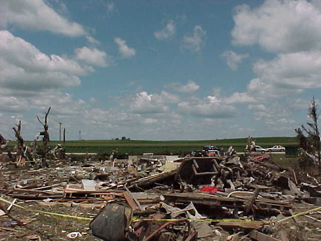
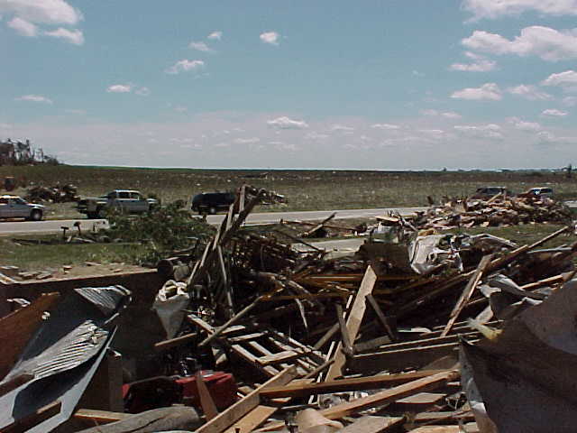
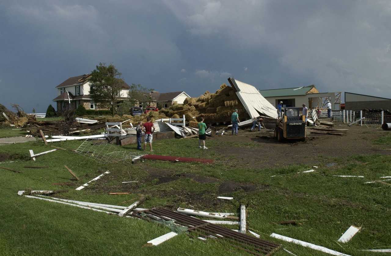
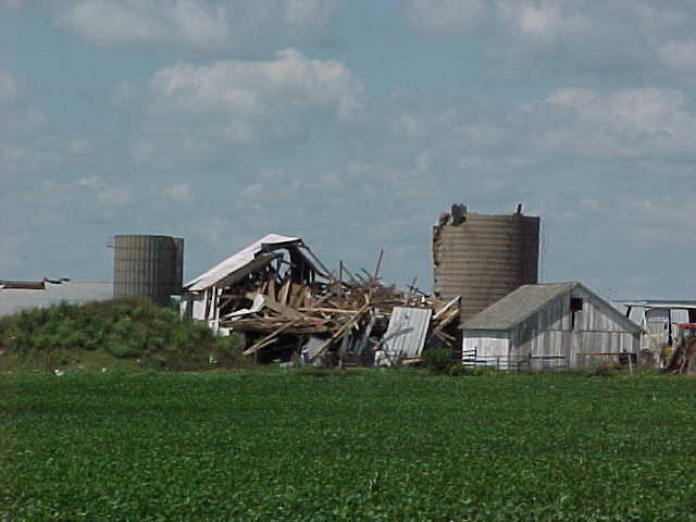
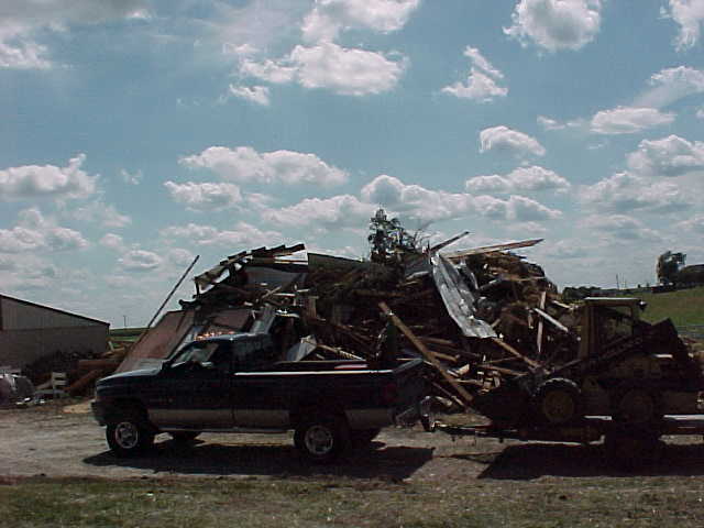
From the plant, the tornado continued east, just south of Routes 116/117, affecting 4 farmsteads approximately 1/2 to 1 mile east of the plant. Two of the farmsteads closest to the plant (about 1/2 to 3/4 mile east) had the 2-story houses completely blown away, with only debris remaining in the basements and nearby property. The other two farmsteads had significant damage to the 2-story houses, with outbuildings demolished. The center of the tornado's track was about 100 yards south of the farmsteads on the south side of the highway.
From the plant to the farmsteads, the storm was F4 intensity. The average width of the tornado during this time was 400 yards, and was close to 1/4 mile wide at times.
At this point, the tornado began to travel in a more east-southeast direction, and caused significant damage to a barn near the intersection of county roads 1300N and 1700E. It caused significant damage at a farmstead at the southeast corner of 1300N and 1800E. The tornado crossed 1300N shortly afterward, and lifted around 2:57 pm about 2.5 miles southeast of Roanoke, at county road 1900E.
The tornado was on the ground for approximately 23 minutes.
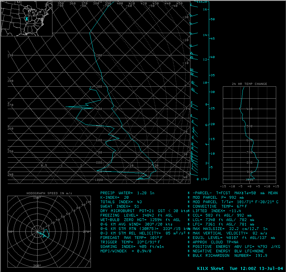 |
This is the upper-air sounding taken at Lincoln at 7 am (12Z) July 13. The air is already quite unstable, with a lifted index of -11. |
 |
A special upper-air sounding was taken that day. The 1 pm (18Z) sounding showed CAPE values were over 6400 J/kg, the lifted index had decreased to -14.7, and wind shear in the lower levels of the atmosphere were increasing. |
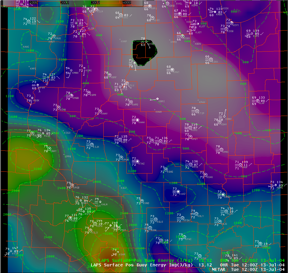 |
This is a surface weather plot of Illinois from 7 am. CAPE values are overlaid and shaded. Dewpoint values in the lower 70s were common over the area. |
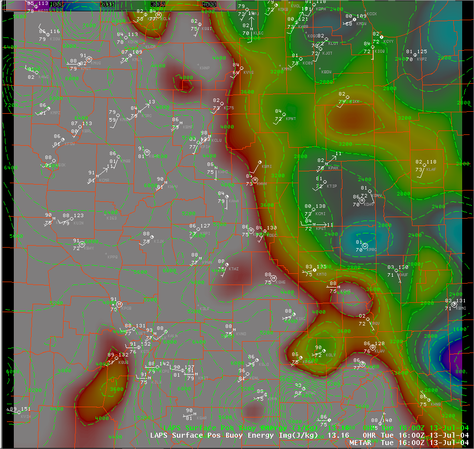 |
The surface plot at 11 am indicated dewpoint values rising across the southwest half of the state, and were close to 80 degrees. The CAPE values consequently rose, and were over 4500 J/kg in the white areas on the map. |
 |
By 2 pm, the oppressive heat and humidity had spread east to the I-57 corridor. CAPE values well over 6000 J/kg were common, and heat index values were in the 105 to 110 degree range. |
 |
This is a 4-panel visible satellite image of the supercell storms that moved across Illinois. Starting clockwise from the upper left panel, image times were 11:01 am, 1:15 pm, 3:15 pm, and 5:02 pm. Roanoke is located at the green X labeled "Home" in the image. |
 |
This is the 0.5 degree reflectivity image from the Lincoln Doppler radar at 2:01 pm. The Roanoke storm will quickly evolve from the shower located just east of Spring Bay. The site of the Parsons plant in this and subsequent images is indicated by the blue X labeled "Home". |
 |
By 2:11 pm, the storm begins to grow as it approaches a separate strong thunderstorm located across north central Woodford County. |
 |
At 2:16 pm, moderate to heavy rain is occurring at the Parsons plant, with the most intense part of the storm still to the northeast, approaching Benson. |
 |
The 0.5 degree Storm Relative Motion (SRM) image taken at the same time does not show evidence of a circulation from the southwest part of the storm. (The radar site is located about 45 miles south of the "Home" location on the image.) |
 |
The image from 2:21 pm shows the storms beginning to merge, with the western storm starting to become the more dominant storm. |
 |
The SRM image at 2:21 pm shows the beginnings of a circulation between Chillicothe and Metamora. |
 |
At 2:26 pm, the heart of the storm is moving through Roanoke. Note the appendage extending northwest to between Chillicothe and Metamora. |
 |
The SRM image at 2:26 pm is beginning to show an intensifying circulation in the previously mentioned appendage. A Tornado Vortex Signature (TVS) is indicated by the radar, as the purple triangle in the image. |
 |
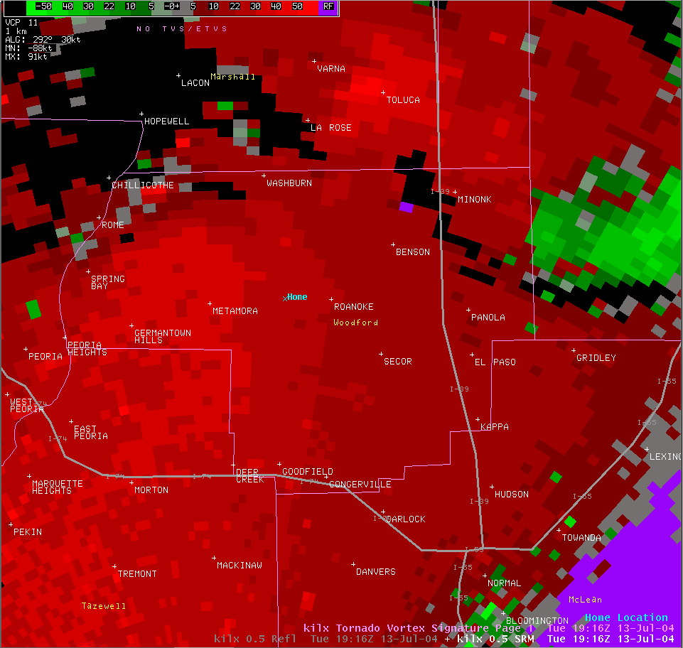
The 2:31 pm radar image showed the Parsons plant beginning to see the rain taper off. However, the appendage on the northwest part of the storm is becoming more concentrated, with a definite hook-shape indicated (at the purple triangle labeled "S1" in the picture). |
 |
The 0.5 degree SRM image at 2:31 pm shows the mesocyclone significantly more intense than 5 minutes ago. Later storm damage surveys indicate that a tornado has touched down around this time. |
 |
At 2:36 pm, the hook echo is quickly approaching the Parsons plant from the northwest. |
 |
About a mile or so to the west of the plant, the SRM images at 2:36 pm continue to show the tornado's intensification. The bright-green and bright-red squares next to each other indicate what radar operators call "gate-to-gate shear", with winds in excess of 50 knots (58 mph) in opposite directions next to each other. |
 |
At 2:41 pm, the Parsons plant is being demolished by the tornado (location indicated by the white circle). The increase in reflectivity strength (red shades in the hook echo) may be due to debris being drawn upward, enhancing the radar beam's reflectivity. |
 |
The SRM image at 2:41 pm shows the gate-to-gate shear couplet over the plant site. |
 |
At 2:46 pm, the tornado is moving east-southeast from the plant, with the appendage/hook still visible on the west edge of the storm. |
 |
The gate-to-gate shear couplet is now located between the Parsons plant and the town of Roanoke. |
 |
The 2:51 pm radar image shows the appendage feature now over the town of Roanoke... |
 |
and the SRM image shows the circulation moving just south of town. However, the shear is not quite as strong as earlier. |
 |
At 2:56 pm, the appendage is no longer readily visible, as the storm pulls away from the Roanoke area. |
 |
The SRM image still shows a very broad circulation across central Woodford County, but no longer indicates a potential tornado. |
 West of Roanoke (photo by Justin Weber) |
 North of Eureka (photo by Sam Bertschi) |
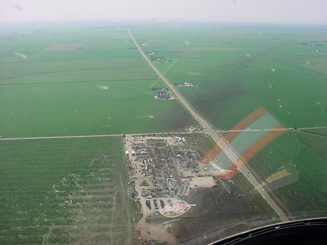 Parsons Plant (photo by Woodford County ESDA) |
 Parsons Plant (photo by Woodford County ESDA) |
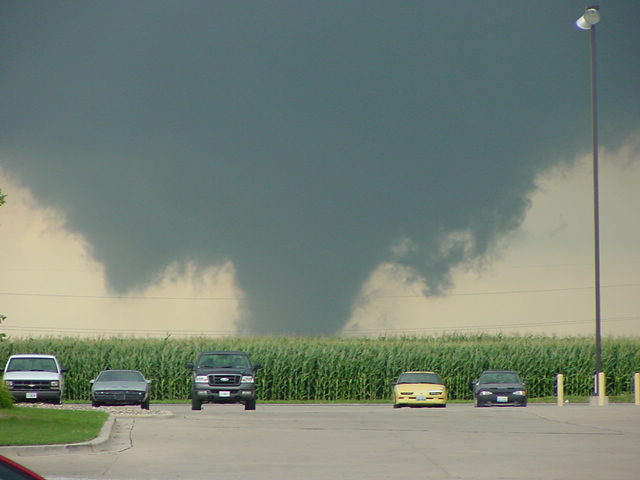
 Tornado approaches Parsons Plant (photo by Scott Smith) |
 Tornado strikes Parsons Plant (photo by Scott Smith) |
 Tornado strikes Parsons Plant (photo by Scott Smith) |
 Tornado passes Parsons Plant (photo by Scott Smith) |
 Parsons Plant (photo by Fred Zwicky) |
 Parsons Plant (photo by Fred Zwicky) |
 Parsons Plant (photo by Matt Dayhoff) |
 Parsons Plant (photo by Matt Dayhoff) |
 Parsons Plant |
 Parsons Plant |
 Parsons Plant |
 Parsons Plant |
 Parsons Plant |
 East of Parsons Plant |
 Parsons Plant |
 East of Parsons Plant |
 Parsons Plant (photo by Steve Smedley) |
 Parsons Plant (photo by Steve Smedley) |
 Parsons Plant (photo by Steve Smedley) |
 Parsons Plant (photo by Steve Smedley) |
 Parsons Plant |
 Parsons Plant |
 Parsons Plant |
 West of Roanoke (photo by Justin Weber) |
 West of Roanoke |
 West of Roanoke |
 West of Roanoke |
 West of Roanoke |
 West of Roanoke |
 West of Roanoke |
 West of Roanoke |
 West of Roanoke |
 West of Roanoke |
 West of Roanoke |
 West of Roanoke |
 South of Roanoke (photo by Steve Smedley) |
 Southwest of Roanoke |
 South of Roanoke |
 South of Roanoke |
 North of Eureka (photo by Sam Bertschi) |
 Roanoke (photo by Sharol Minger) |
 Roanoke (photo by Sharol Minger) |
 Roanoke (photo by Sharol Minger) |
 Roanoke (photo by Sharol Minger) |
 Northeast of Eureka (photo by Glade Stutzman) |
 Northeast of Eureka (photo by Glade Stutzman) |
 Notheast of Eureka (photo by Glade Stutzman) |
 Northeast of Eureka (photo by Glade Stutzman) |
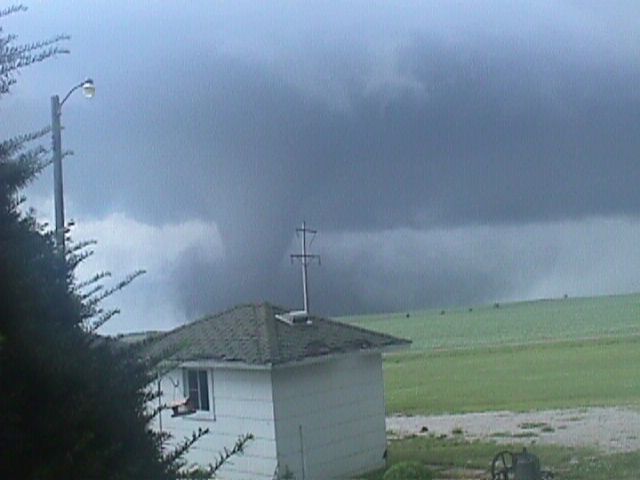
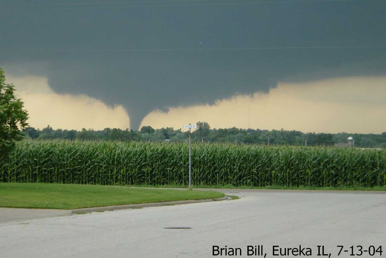
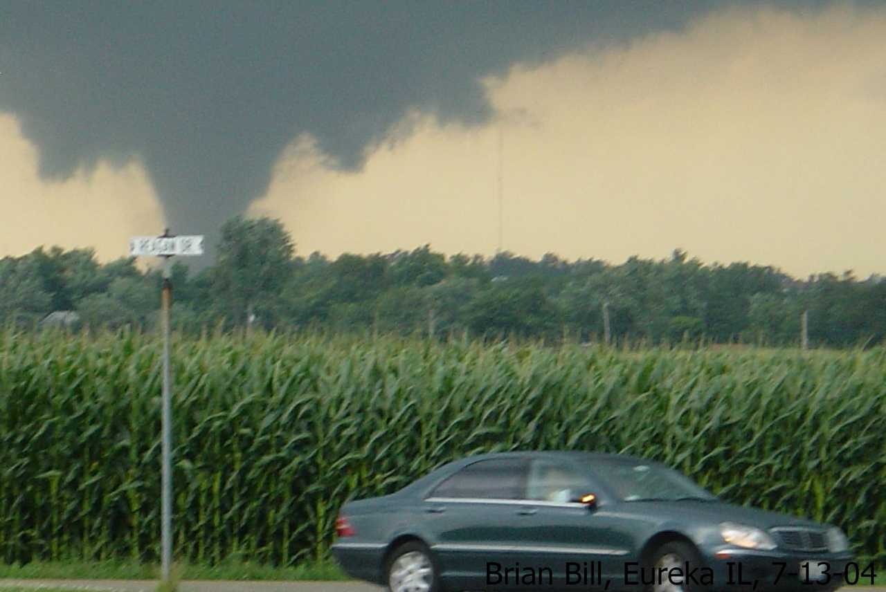
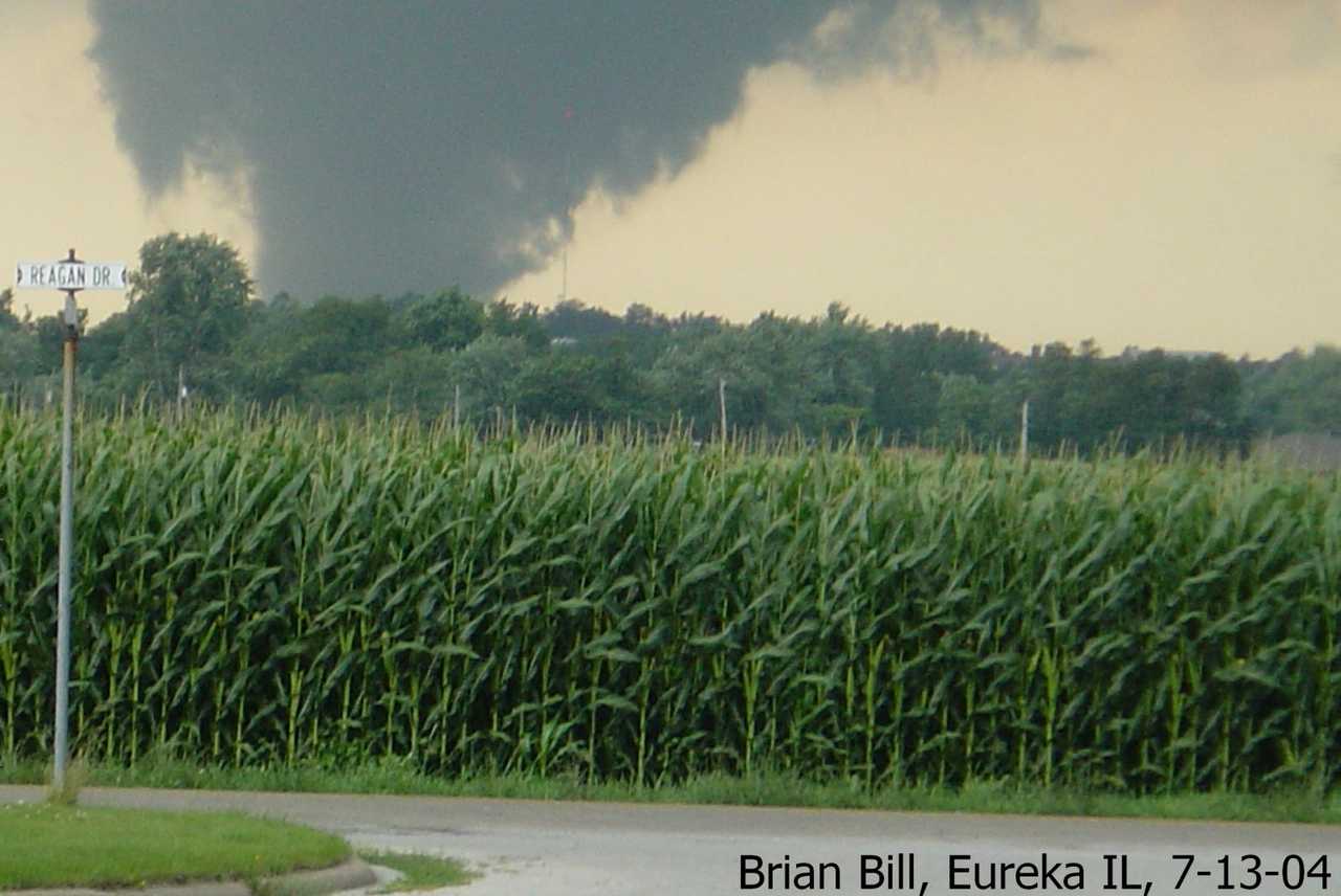
 North of Eureka (photo by Brian Bill) |
 North of Eureka (photo by Brian Bill) |
 North of Eureka (photo by Brian Bill) |
 North of Eureka (photo by Brian Bill) |
 North of Eureka (photo by Brian Bill) |
 North of Eureka (photo by Brian Bill) |
 North of Eureka (photo by Brian Bill) |
 North of Eureka (photo by Brian Bill) |
 West of Roanoke (photo by Steve Smedley) |
 West of Roanoke (photo by Steve Smedley) |
 West of Roanoke (photo by Steve Smedley) |
 West of Roanoke (photo by Steve Smedley) |
 North of Metamora (photo by Jason Malson) |
 East of Metamora (photo by Jason Malson) |
 East of Metamora (photo by Jason Malson) |
 East of Metamora (photo by Jason Malson) |
 Parsons Plant (photo by Jason Malson) |
 Parsons Plant (photo by Jason Malson) |
 East of Parsons Plant (photo by Jason Malson) |
 Parsons Plant (photo by Jason Malson) |

