Overview
|
Just a week removed from an early season blizzard, a late season severe weather outbreak resulted in several tornadoes across central and southwest Illinois on December 1st. Storm surveys and reports have indicated that 29 tornadoes occurred across the state, the largest December outbreak since 1957. The town of Taylorville, located southeast of Springfield in Christian County, was hardest hit. This particular supercell took a long path from the eastern fringes of the St. Louis metro area, to east of Bloomington. Other supercells tracked up the Illinois River valley in west central Illinois. This page will continue to be updated over the next few days. Check back for the latest information. Information on the event from other NWS offices:
|
 Near Beardstown at 3:25 pm (photo copyright Andrew Pritchard) |
 |
 |
 |
| Taylorville (photo copyright Kevin Lighty) | Track map of all tornadoes | Taylorville (photo copyright Robert Wolfe) |
Tornadoes:
|
Tornado #1 - Taylorville
|
||||||||||||||||
|
Tornado #2 - Brooklyn
|
||||||||||||||||
|
Tornado #3 - Beardstown
|
||||||||||||||||
|
Tornado #4 - Bluff City/Lewistown
|
||||||||||||||||
|
Tornado #5 - Easton/Forest City
|
||||||||||||||||
|
Tornado #6 - SW of South Pekin
|
||||||||||||||||
|
Tornado #7 - Morrisonville
|
||||||||||||||||
|
Tornado #8 - SSW of LeRoy
|
||||||||||||||||
|
Tornado #9 - Moraine View State Park
|
||||||||||||||||
|
Tornado #10 - SW of Ellsworth
|
||||||||||||||||
|
Tornado #11 - Colfax
|
||||||||||||||||
|
Tornado #12 - SSE of Maroa
|
||||||||||||||||
|
Tornado #13 - Stonington
|
||||||||||||||||
|
Tornado #14 - West of Boody
|
||||||||||||||||
|
Tornado #15 - Harristown
|
||||||||||||||||
|
Tornado #16 - near Meredosia
|
||||||||||||||||
|
Tornado #17 - SW Cass County
|
||||||||||||||||
|
Tornado #18 - Chain Lake/SW Mason Co
|
||||||||||||||||
|
Tornado #19 - near Mechanicsburg
|
||||||||||||||||
|
Tornado #20 - near St. David
|
||||||||||||||||
The Enhanced Fujita (EF) Scale classifies tornadoes into the following categories:
| EF0 Weak 65-85 mph |
EF1 Moderate 86-110 mph |
EF2 Significant 111-135 mph |
EF3 Severe 136-165 mph |
EF4 Extreme 166-200 mph |
EF5 Catastrophic 200+ mph |
 |
|||||
Photos & Video:
Taylorville
 |
 |
 |
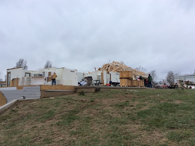 |
| Aerial photo of damage (photo by IL State Police) |
Tree damage (photo by IL State Police) |
Damage in Taylorville (NWS survey photo) |
House damage in Taylorville (NWS survey photo) |
Beardstown
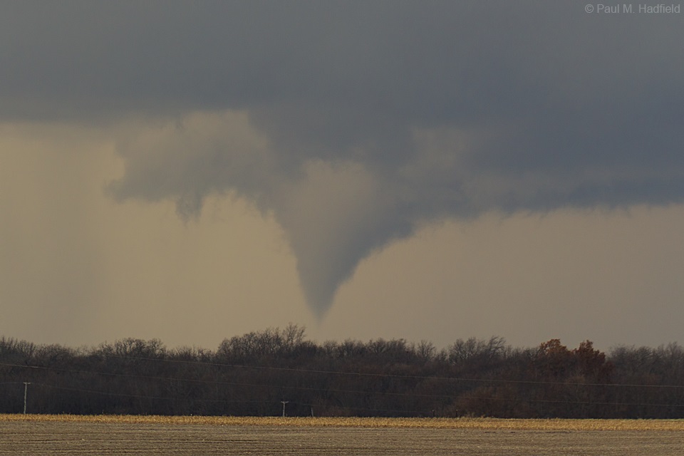 |
 |
||
| Beardstown tornado (photo by Paul Hadfield) |
East of Beardstown (photo by Andrew Pritchard) |
Damage in Beardstown (NWS survey photo) |
Northeast of Beardstown (NWS survey photo) |
Easton/Forest City
 |
 |
||
| Near Poplar City (photo by Chris Yates) |
Near Easton (photo by Jodi Irvin) |
Southeast of Topeka (NWS survey photo) |
South of Topeka (NWS survey photo) |
Schuyler and Fulton Counties
 |
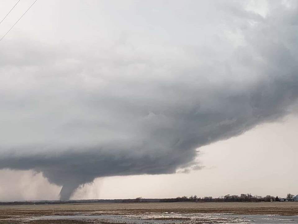 |
||
| Looking north of Bath (Mason Co.) (photo by Chris Yates) |
Southeast of Lewistown (photo by Jody Miller) |
Near Schuyler/Fulton Co. line (NWS survey photo) |
Southeast of Lewistown (NWS survey photo) |
Video
Many videos by storm chasers and media are available on YouTube. Use search terms such as "December 1 2018 tornado" to check them out.
Radar:
Detecting Tornadoes Using Radar
 |
 |
| 4-Panel of Taylorville tornado, 5:20 pm | 4-Panel of Fulton County tornado, 4:08 pm |
The Doppler radars underwent an upgrade several years ago, where the radar can analyze horizontal and vertical components of the radar beam (referred to as "dual polarization"). In severe weather, this can help meteorologists determine whether circulations aloft are actually reaching the surface. The two radar images above show an example of this process.
Each of the images shows 4 separate radar products:
Traditionally, the reflectivity and SRM products have been used to determine the presence of circulations. Using the Fulton County image above, a strong circulation is shown in the top right part of the image, in the area northwest of Bath where the green/blue shades meet the red/orange shades. The reflectivity in the top left also shows evidence of a "hook echo" in that same area. However, the CC and ZDR products give additional confirmation. In the CC image (lower right), note the large area of blue that lines up with the circulation. Such low values (below 0.8 on the scale) correspond to non-meteorological targets. In quiet weather, this could be caused by things like birds and insects. During severe weather, this could be caused by large hail or debris. Lining up with the circulation, this gives the warning forecaster confidence that the rotation aloft is actually making it to the surface (i.e. as a tornado).
In the Taylorville image, similar patterns are also detected.
We have created a PDF document (2.7 MB) with examples of the reflectivity and SRM images for each of the tornadoes.
Storm Reports
Click on the map above for an interactive listing of reports.
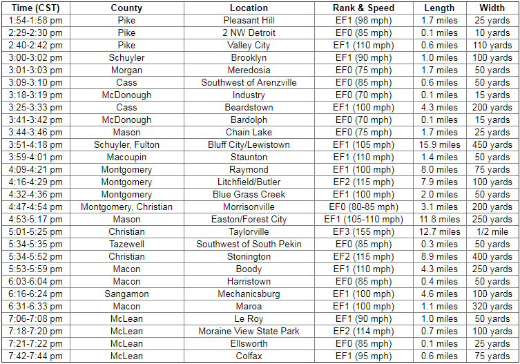
Summary of all tornadoes in Illinois from this event:
Environment
An historic tornado outbreak occurred across Illinois on December 1st, with a total of 28 tornadoes touching down across the central part of the state. Within the National Weather Service Lincoln County Warning Area (CWA), 20 tornadoes touched down...with the most significant being an EF-3 tornado that tore through the city of Taylorville in Christian County. Despite several communities being directly impacted and experiencing major damage, there were no fatalities reported.
Surface analysis from 18z/12pm December 1st showed a 986mb low over northeast Kansas...with an occluded front arcing E/SE across eastern Missouri and a warm front lifting northward through central Illinois. The airmass north of the warm front remained cool and damp, as evidenced by widespread fog and midday temperatures in the lower 40s along and north of a Macomb to Minonk line. Further south into the warm sector, S/SE winds had helped boost temperatures into the upper 50s and lower 60s across the remainder of central and southeast Illinois. Dewpoints were unseasonably high as well, with readings climbing into the middle 50s.
For maps related to this event go to: https://www.weather.gov/ilx/swop-120118
Additional Information
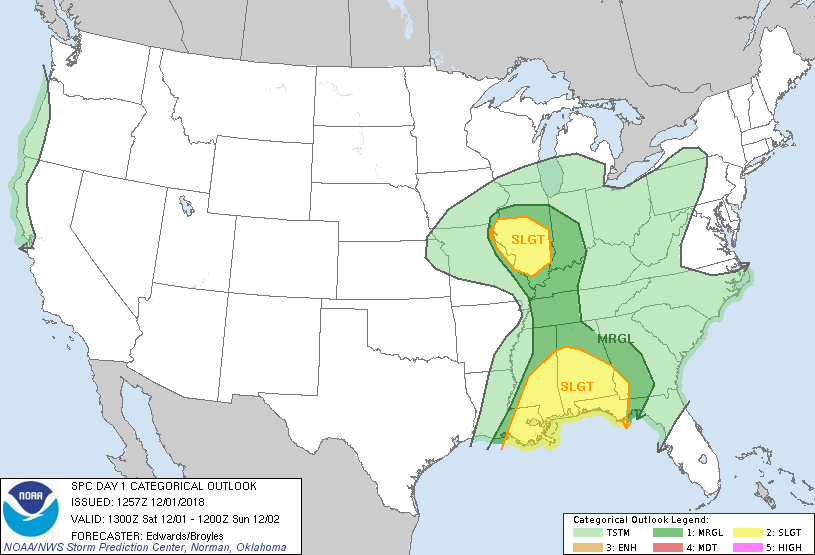
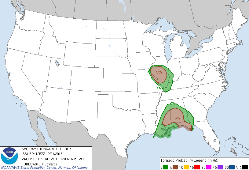
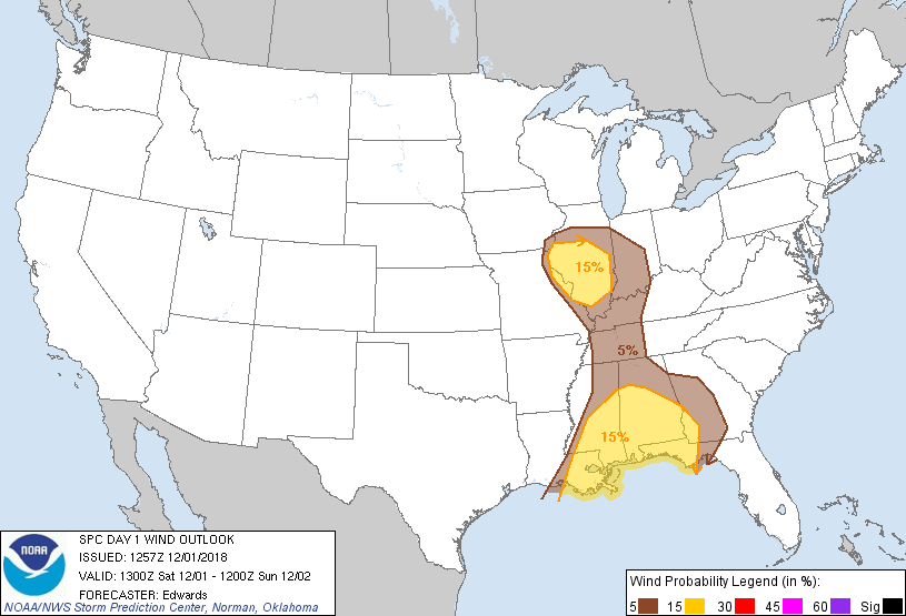
The Forecast
 |
 |
 |
 |
| SPC Day 1 Categorical Outlook | SPC Day 1 Tornado Outlook | SPC Day 1 Hail Outlook | SPC Day 1 Wind Outlook |
Watch and Warning Issuances
| Counties & Issuance Time | Notes |
| Key: TOR -- Tornado Warning. SVR -- Severe Thunderstorm Warning. | |
| 2:17 pm -- Tornado Watch issued along and west of I-55 | |
| 2:21 pm (SVR) -- Northwest Schuyler | |
| 2:49 pm (TOR) -- Northwest Scott, southwest Cass, northwest Morgan | |
| 2:58 pm (SVR) -- Northwest Schuyler | |
| 3:04 pm (TOR) -- Northwest Schuyler | Associated with Brooklyn tornado |
| 3:24 pm (TOR) -- Northwest Cass, southeast Schuyler, southwest Mason | Associated with Beardstown tornado |
| 3:47 pm (TOR) -- Southern Fulton, east central Schuyler, central Mason | Associated with Bluff City/Lewistown tornado |
| 3:57 pm (TOR) -- Southeast Knox, northwest Peoria | |
| 4:22 pm (TOR) -- Southeast Fulton, western Tazewell, north central Mason, southwest Peoria | |
| 4:37 pm (TOR) -- West central Christian | Associated with Raymond tornado in Montgomery Co. |
| 4:39 pm (TOR) -- Southern Christian | Associated with tornado southeast of Morrisonville. Included Taylorville in the path |
| 4:42 pm (TOR) -- Central Mason | Associated with Easton/Forest City tornado |
| 4:53 pm (TOR) -- Northeast Fulton, southwest Peoria | |
| 5:12 pm (TOR) -- Southwest Tazewell, northeast Mason | |
| 5:15 pm (TOR) -- Central Christian ("Tornado Emergency") | Reissuance to upgrade to "Tornado Emergency" for Taylorville. "Tornado Emergency" later issued for Stonington |
| 5:15 pm (SVR) -- Eastern Menard, southwest Logan, northwest Sangamon | 74 mph wind gust at Springfield airport |
| 5:29 pm (SVR) -- Northern Peoria | |
| 5:43 pm (TOR) -- Northeast Christian, southwest Macon | Associated with tornadoes west of Boody and in Harristown |
| 5:46 pm (SVR) -- Northeast Tazewell | |
| 5:54 pm (SVR) -- East central Menard, Logan | |
| 6:13 pm (TOR) -- Southwest De Witt, northwest Macon | Associated with Maroa tornado |
| 6:42 pm (TOR) -- Central De Witt, south central McLean | Associated with Le Roy tornado |
| 7:13 pm (TOR) -- Southeast McLean | Associated with tornadoes near Moraine View State Park |
| 7:47 pm (TOR) -- Northeast McLean | Issued based on Colfax tornado |
 |
Media use of NWS Web News Stories is encouraged! Please acknowledge the NWS as the source of any news information accessed from this site. |
 |