|
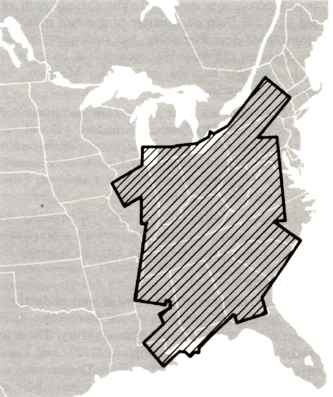
Aerial Damage Photos | Ground Damage Photos | Xenia F5 Track Map The April 3-4, 1974 Super Outbreak affected 13 states across the eastern United States, from the Great Lakes region all the way to the Deep South. In all, 148 tornadoes were documented from this event, of which 95 were rated F2 or stronger on the Fujita scale and 30 were F4 or F5. Aside from all the castastrophic damage they left behind, the tornadoes resulted in 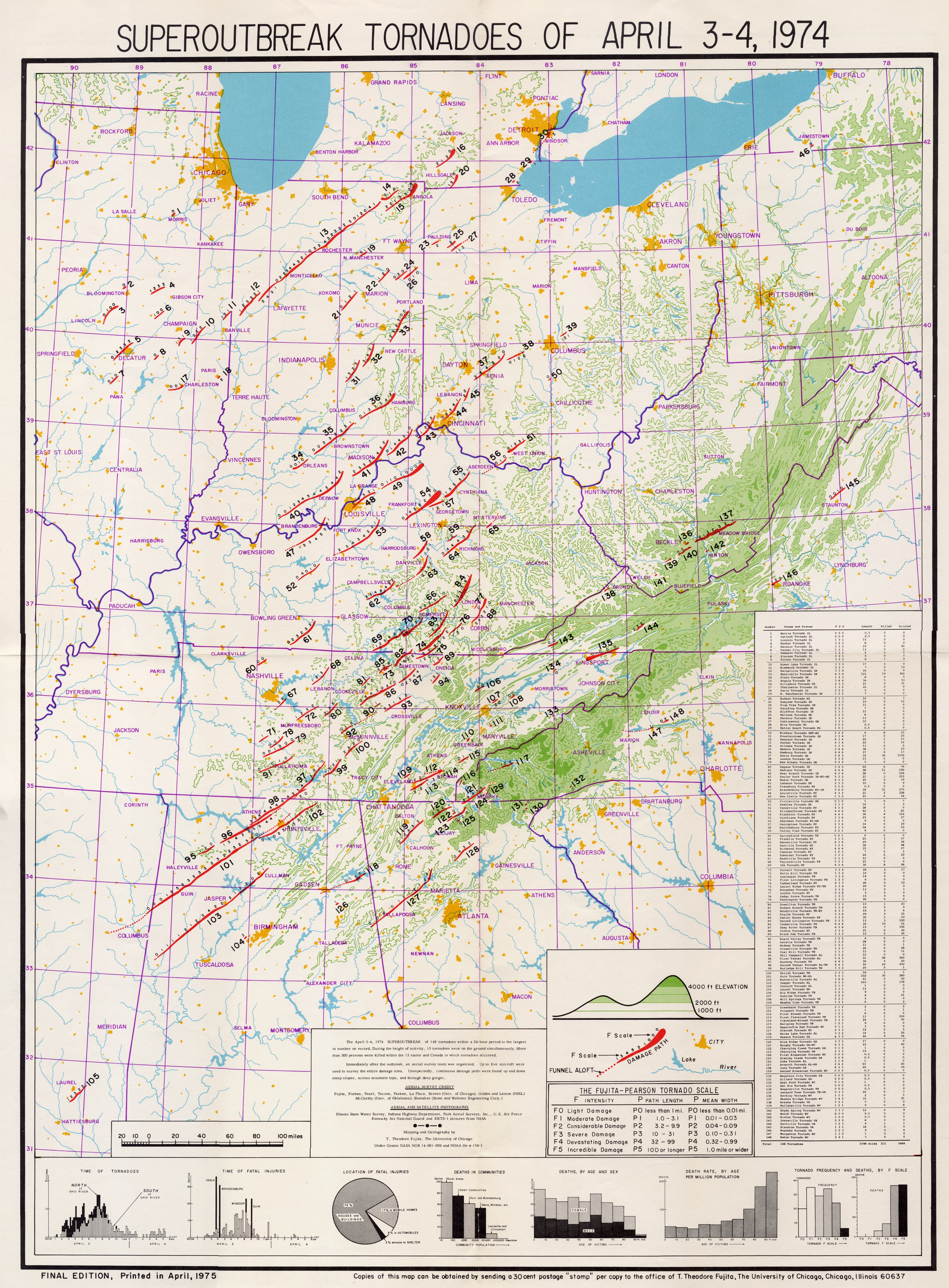
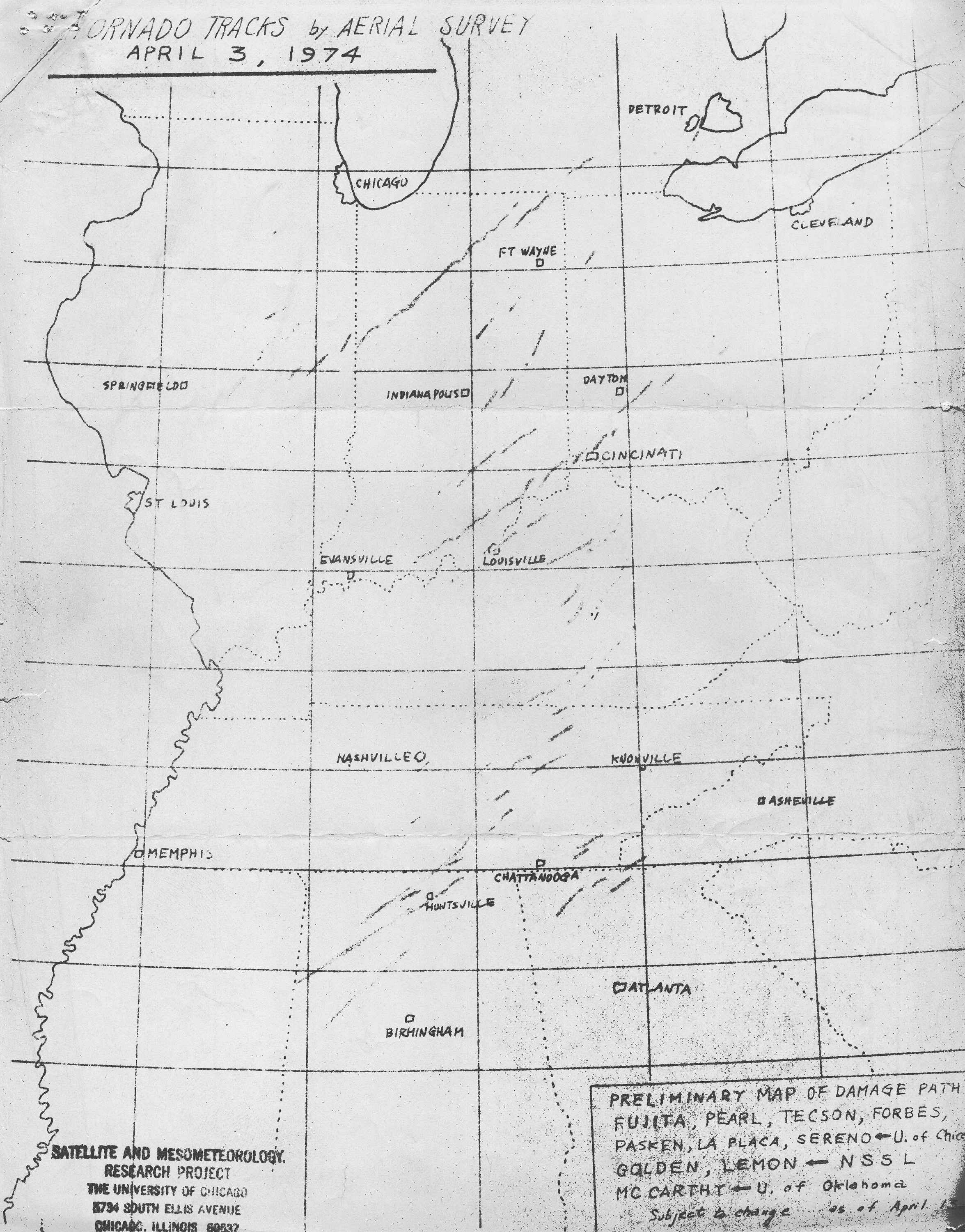
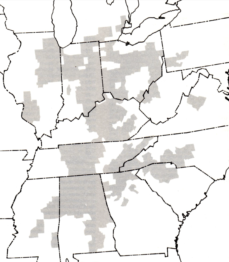
Detailed Super Outbreak tornado path and intensity analysis, hand drawn by Dr. T. Theodore Fujita of University of Chicago. (click for high-res version)
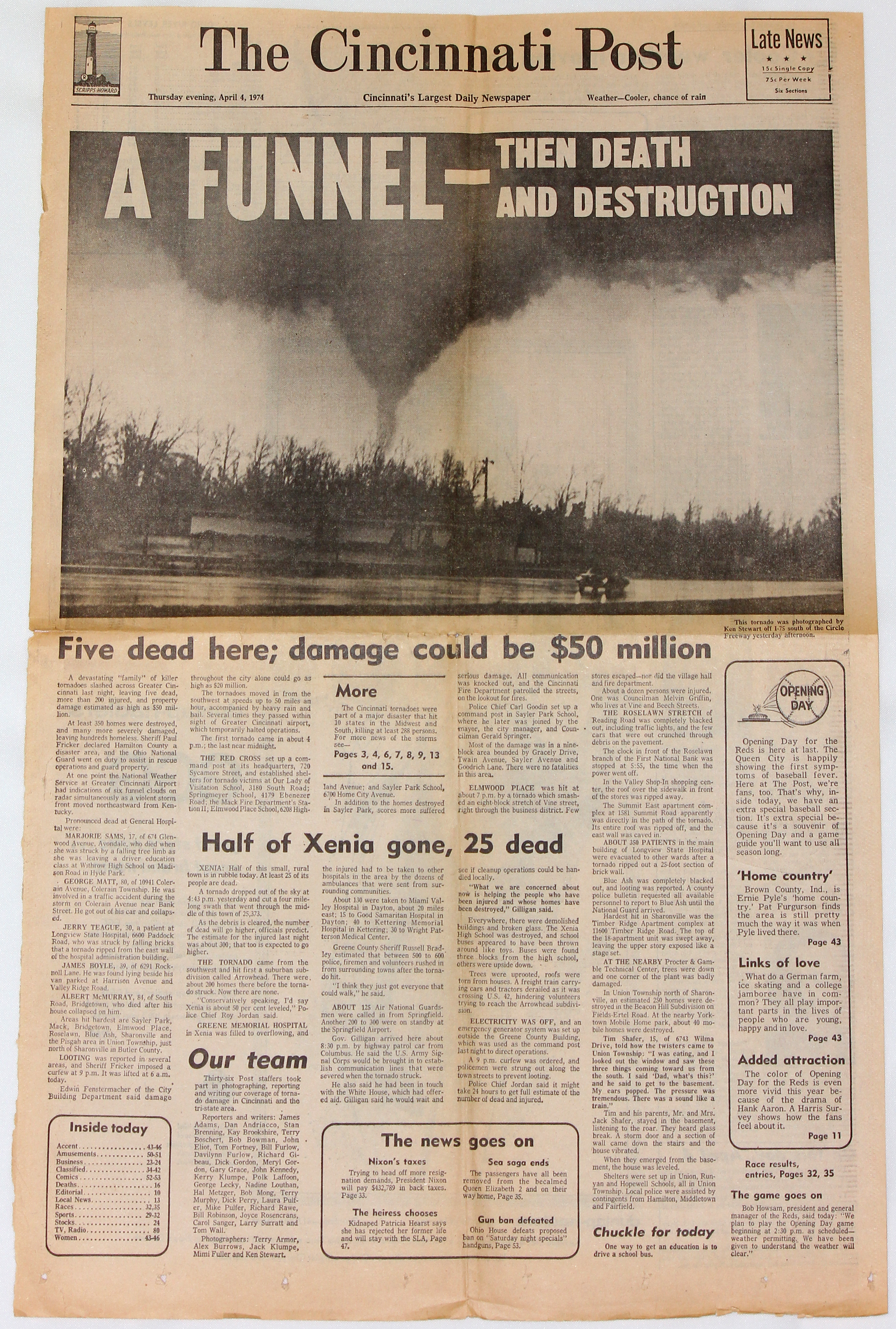
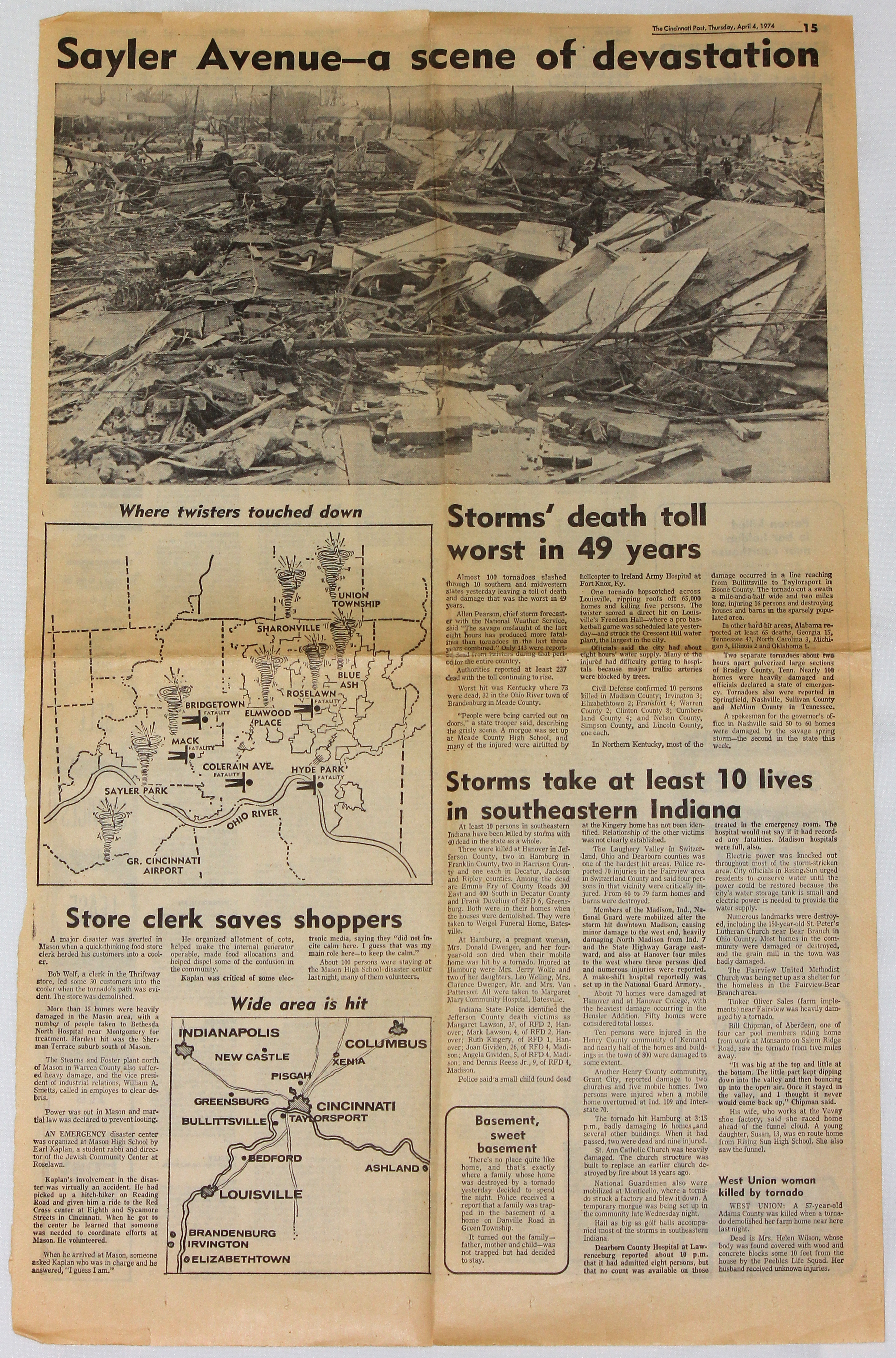
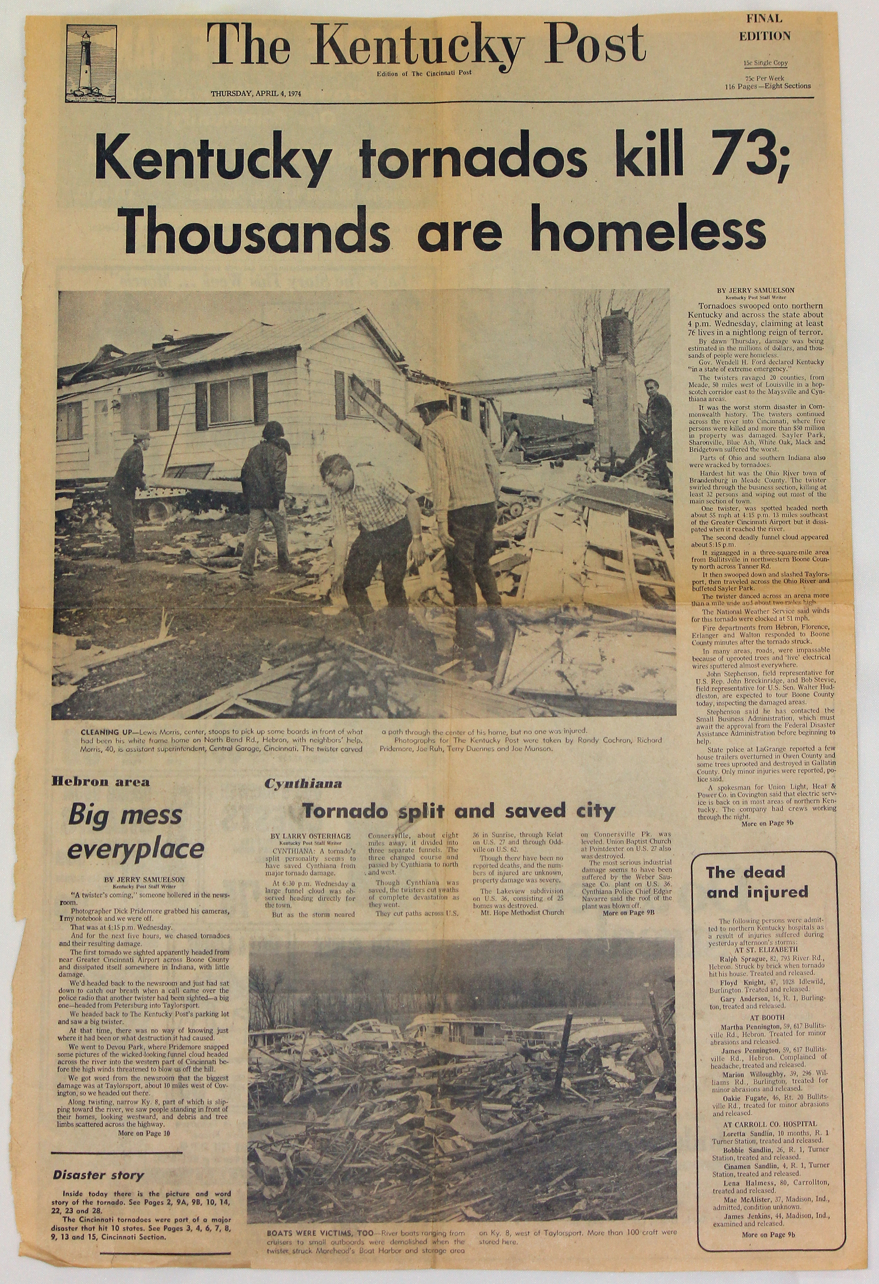
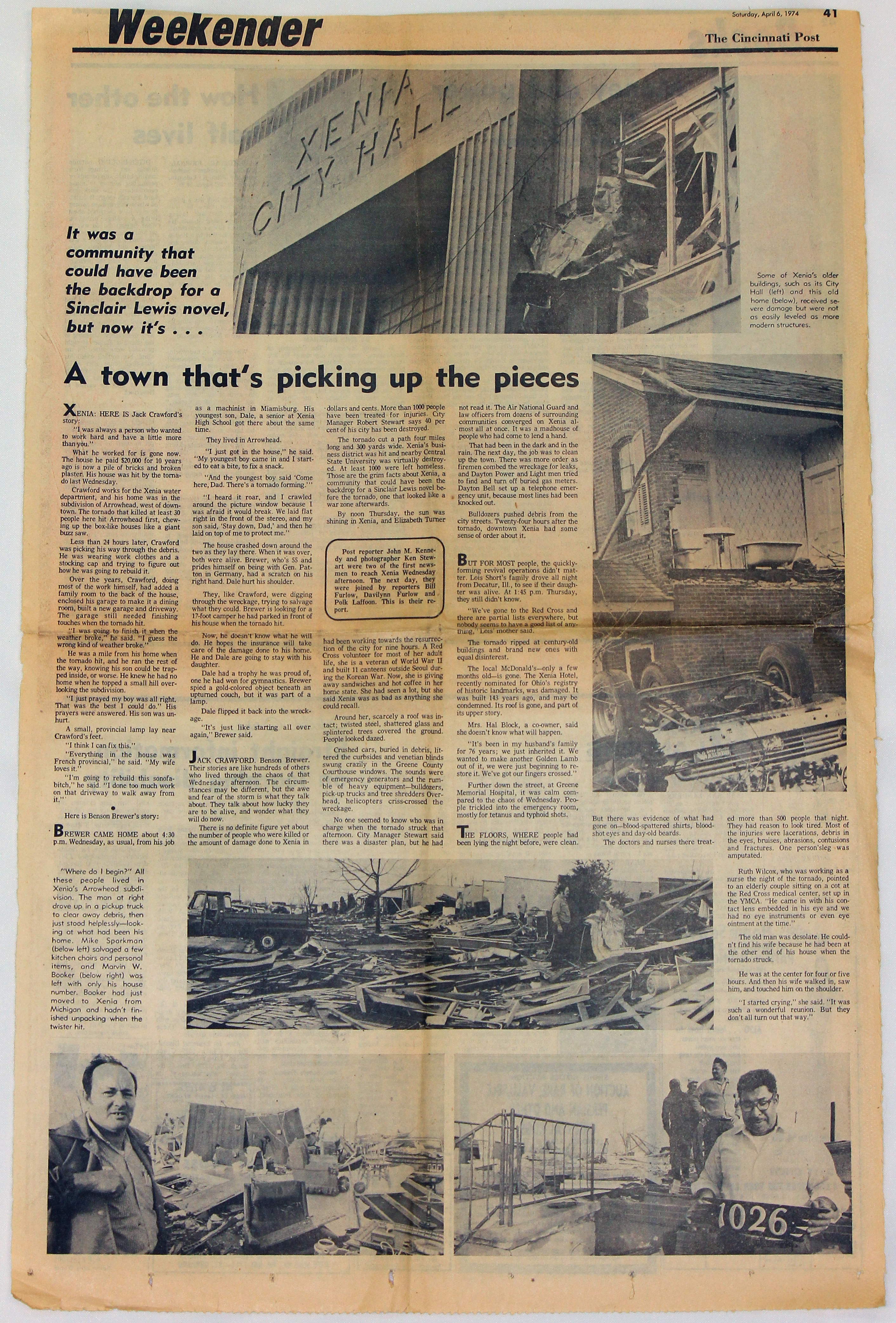
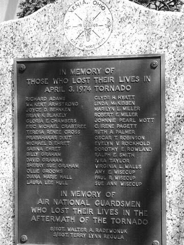
Some of the strongest tornadoes from this outbreak occurred right here in the Ohio Valley. Dozens of tornadoes struck Ohio, Indiana, and Kentucky, resulting in 159 deaths, over 4000 injuries, and hundreds of millions of dollars in property damage. Two violent F5 tornadoes destroyed much of Xenia and Sayler Park (a western suburb of Cincinnati) in Ohio. Resulting in 34 deaths, the Xenia tornado was the deadliest of all tornadoes from this outbreak and remains among the top 10 costliest U.S. tornadoes on record (approximately $250 million in 1974). Several other strong F2 to F4 tornadoes also touched down during the Super Outbreak across southeast Indiana, northern Kentucky, and southwest Ohio, an area that today encompasses NWS Wilmington, Ohio's warning area. National Weather Service office boundaries and technology were quite different back in 1974. The Weather Service Office (WSO) in Cincinnati served the greater Cincinnati Tri-State area while WSO Dayton was responsible for the Miami Valley and west-central Ohio. In those days, not every NWS office was equipped with a radar. A WSR-57 (Weather Surveillance Radar - 1957) was installed at WSO Cincinnati in 1960, giving NWS meteorologists coarse reflectivity data but no velocity data, which made it extremely difficult to detect tornadoes. Storms on the radar screen were traced onto thin paper maps, and meteorologists heavily relied on the manifestation of hook echoes as well as spotter reports when issuing tornado warnings. WSO Dayton did not have a radar of its own but utilized a facsimile machine tied into Cincinnati's WSR-57 (also known by its identifier, CVG) display. When the CVG radar displayed hook echoes and other impressive storm features outside WSO Cincinnati's warning area on April 3, meteorologists there made calls to the appropriate neighboring offices. At one point, the CVG radar screen displayed five distinct hook echoes--more than 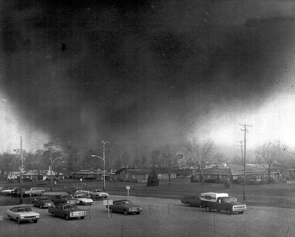
A massive F5 tornado bears down on Xenia. Photo taken from the Greene Memorial Hospital by Fred Stewart.
About an hour after the Xenia tornado, another violent F5 tornado took aim at the western suburbs of Cincinnati. The only tri-state twister of the Super Outbreak, this tornado originated near Rising Sun in Indiana around 5:30 PM, passed through Kentucky, and then crossed the Ohio River 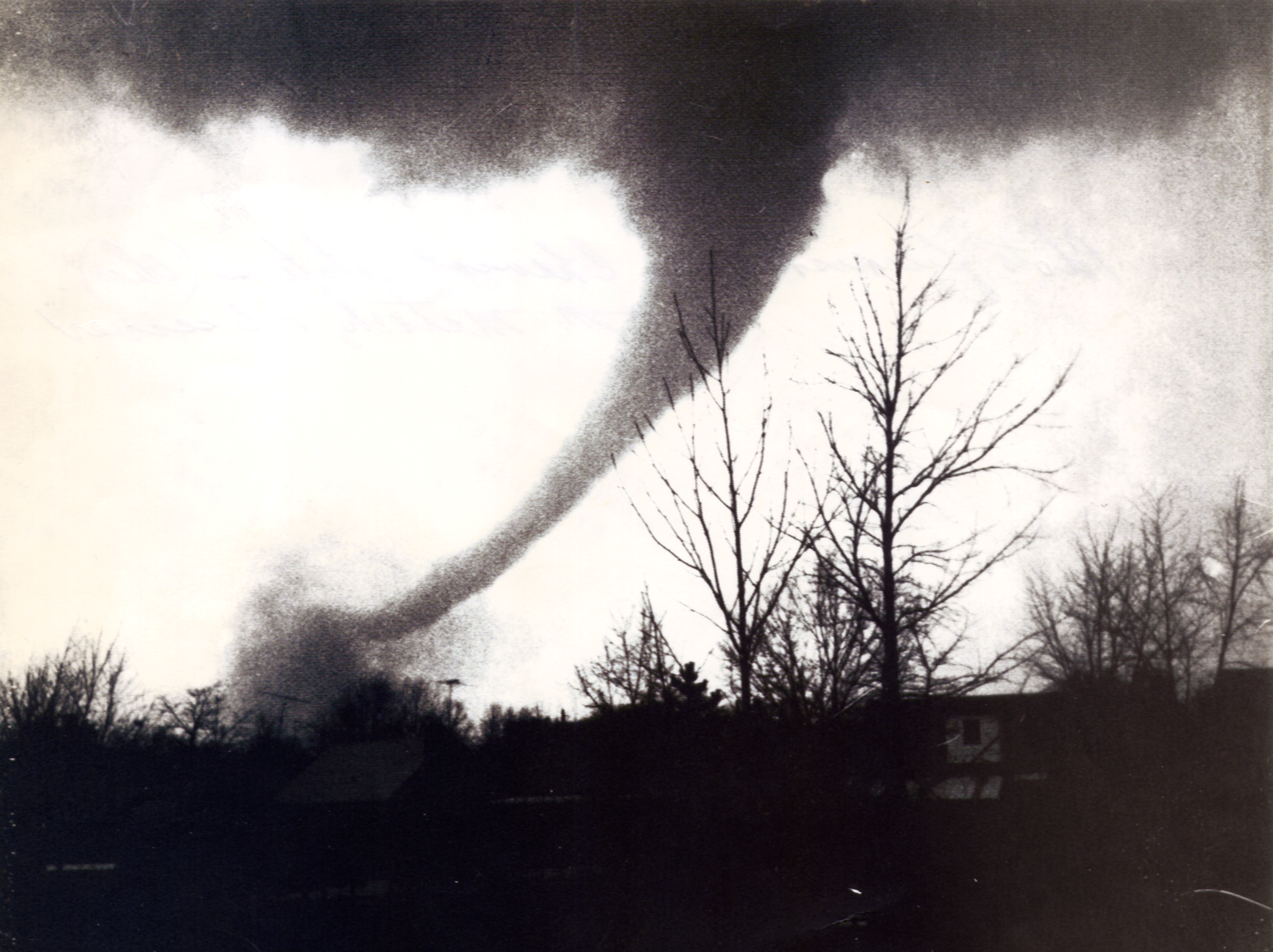
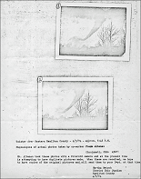
A view of the Sayler Park tornado as it moved through the Bridgetown area. Photo taken by Frank Altenau.
In the aftermath of this horrific event, many lessons were learned that have since been applied by various government agencies to mitigate hazards in subsequent severe weather outbreaks. Improvements in communications, warning systems, emergency preparedness, and forecast techniques and equipment have been implemented since the Super Outbreak, with the end result being increased lead times for warnings, more accurate forecasts of events, greater public awareness, and more reliable communications.
A 1978 documentary of the Super Outbreak, showing actual footage of tornadoes as they
struck Xenia, Cincinnati, and Louisville, causing massive damage and numerous deaths. Includes discussion of advance tornado preparation and emergency coordination. Courtesy of the National Archives. |
||||||||||||||||||||||||||||