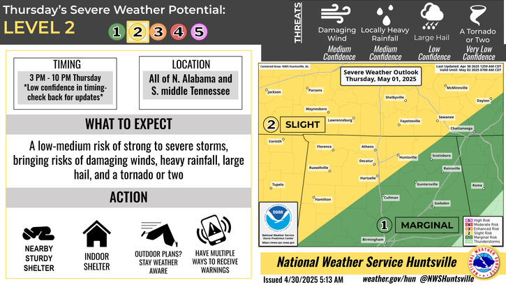
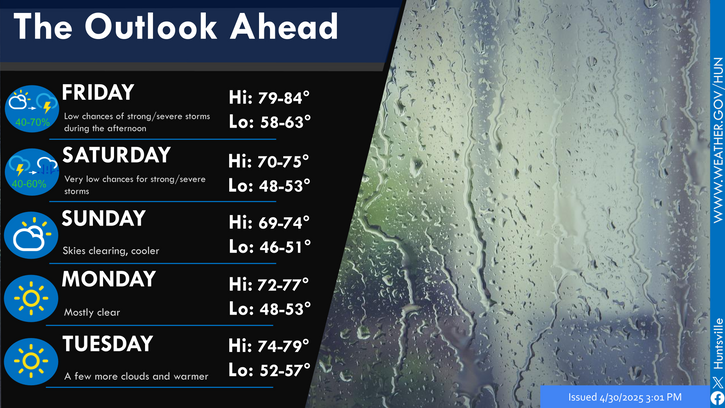
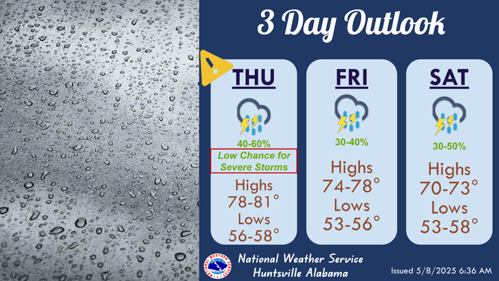
A low chance of strong to severe storms is forecast Wednesday evening into Thursday morning. Confidence remains low in hazards and exact timing due to low confidence in storm formation as the cold front (the force causing the storms) will most likely stall (or slow down) to our NW. This would decrease our rain and severe chances significantly. Be sure to remain updated throughout the day tomorrow and always be sure to have multiple ways to get warnings.


