|
A weak tornado touched down in the Martling/Asbury community just west of Martling Road around 538 AM. It tracked east across Martling Road, Bell Orr Drive, and Claude Hill Road before weakening and lifting near Asbury Church Road. Along the path, several trees were uprooted, and a few were snapped. The tornado peeled much of a metal roof off a barn along Martling road, scattering the metal several yards away into the nearby field. Along Claude Hill road, a few homes received minor roof damage. At least two small sheds were heaviley damaged in the same area.
Pictures
Below are some pictures that were taken during our damage surveys. Click any image for the a larger resolution version.
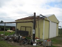
The roof of this barn off Martling Road was damaged near the beginning of the tornado path.
|
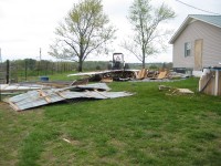
Damage was sustained by an outbuilding at this house off Claude Hill Road.
|
|
Radar Data
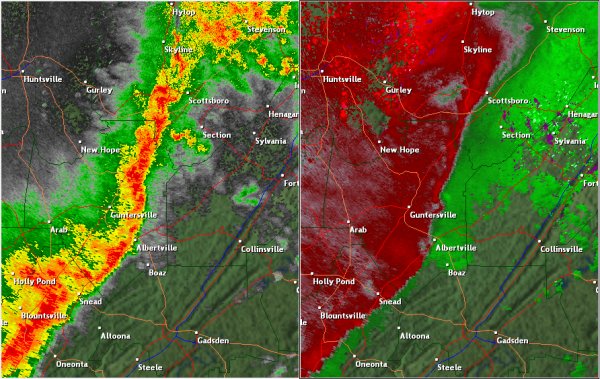
This National Weather Service radar image from 5:38am shows an area of rotation east-northeast of Guntersville, near the Martling/Asbury community. The base reflectivity product in the left panel, which shows rainfall intensity, shows a line of showers and thunderstorms moving across northeast Alabama. The storm relative velocity product in the right panel shows winds toward (in green) and away (in red) from the radar at Hytop.
|


 Local Radar
 Weather Map