|
Survey Summary
| EF-Scale Rating |
EF-4 |
| Est. Peak Wind |
170 MPH |
| Est. Path Length |
16.7 miles (14.0 in Lawrence, 2.7 in Morgan) |
| Maximum Path Width |
1/2 mile |
Representatives from the National Weather Service and the Lawrence County Emergency Management Agency conducted an storm survey of damage that occurred in Lawrence County and Morgan County, Alabama early in the morning of February 6, 2008.
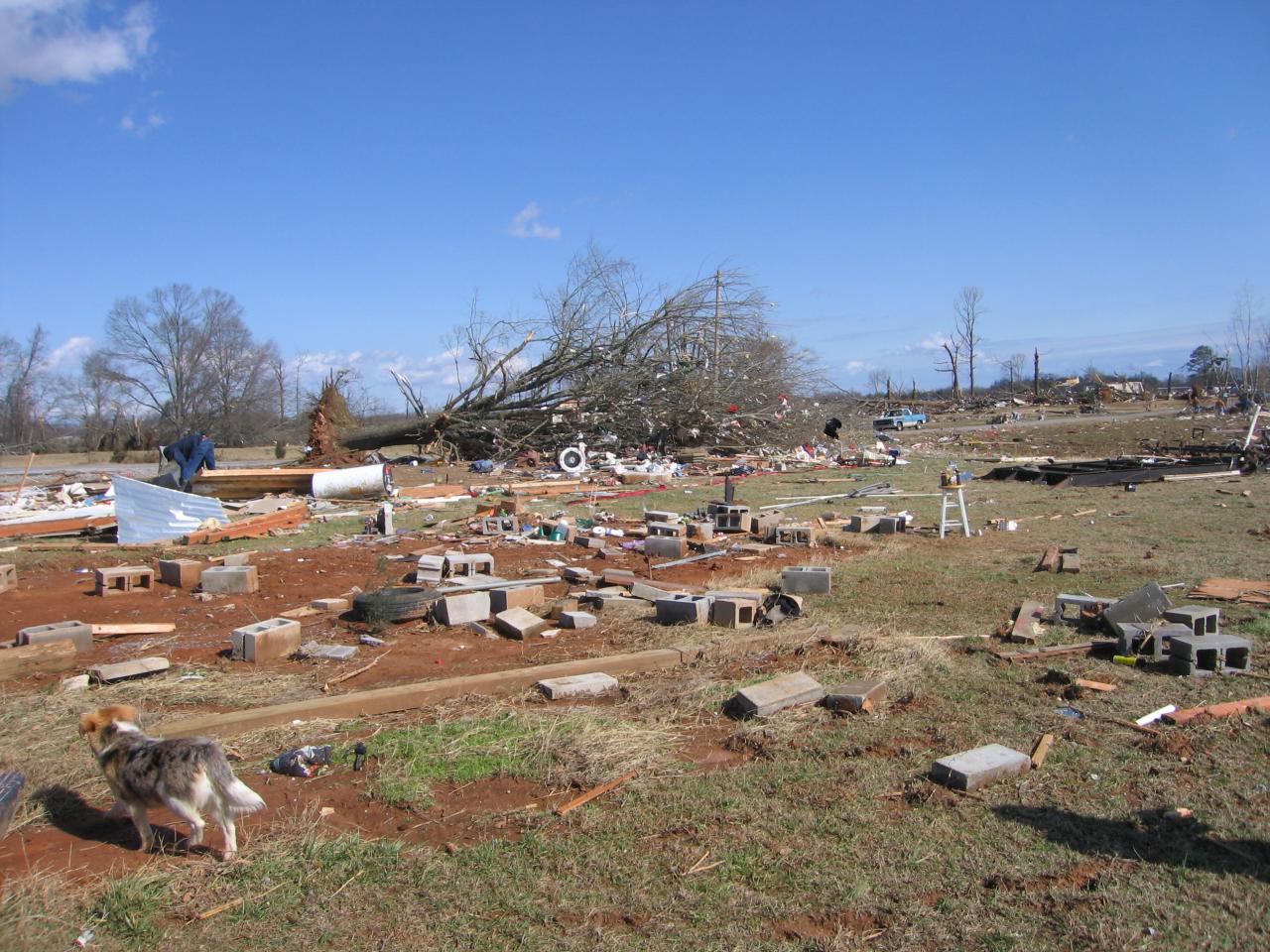
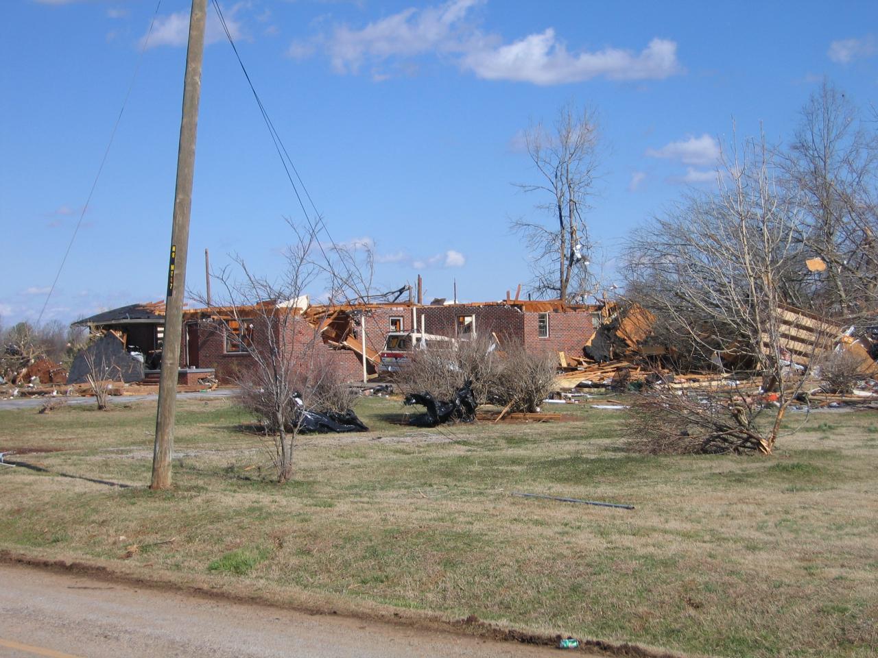
The damage was determined to originate from a strong tornado, which at its peak had winds of approximately 170 MPH, giving it a rating of EF-4 on the Enhanced Fujita Scale. Based on reports and an aerial survey conducted by the Lawrence County EMA, the tornado is believed to have originally touched down near the Pinhook community in south-central Lawrence County (just north of the Bankhead National Forest) around 3:00 AM CST. The tornado remained on the ground for approximately 16.7 miles; the first 14 miles of the track occurred in Lawrence County, tracking through the Aldridge Grove, Fairfield, Five Points, Midway, and Caddo communities, and it continued into Morgan County for 2.7 miles, lifting near the Trinity community west of Decatur around 3:20 AM CST.
The most significant damage occurred in two main areas. The first occurred just south of the Pinhook community, near the intersection of County Road 92 and 188. The second occurred north of Aldridge Grove near the intersection of County Road 94 and 183, where three fatalities occurred. Numerous homes received significant structural damage, including a 2300 square foot/2-story brick house that was nearly leveled off its foundation. Large trees, with diameters up to 4 feet, were completely snapped, with many uprooted. Fence posts embedded in concrete were ripped out of the ground and vaulted 50 to 100 feet in several different directions. A truck was thrown over a distance of more than 100 yards into an open field.
Tornado watch #41 had been issued for all of north Alabama at 10 PM CST, and was in effect until 5 AM CST (it was later extended until 7 AM CST). A tornado warning for Lawrence County was issued at 2:40 AM CST, and a follow-up warning for northwestern Morgan and southeastern Limestone was issued at 3:08 AM.
|


 Local Radar
 Weather Map