|
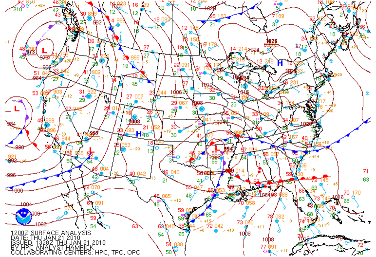
On Thursday (January 21, 2010) morning at 7 am, a complex and potent weather system was beginning to take shape over the southeastern US. A strong occluded (denoted by the purple frontal symbol) area of low pressure with a central pressure near 994 mb was situated over northern Akansas. Several boundaries intersected with this area of low pressure. However, the most important ones were the cold front extending south through central Louisiana and the warm front extending east into southern Alabama. These later pushed into northern Alabama as the occluded low pushed east northeast into southwestern Kentucky by late Thursday afternoon. |
|
Figure 1. January 21, 2010 - 6 am Surface Analysis |
|
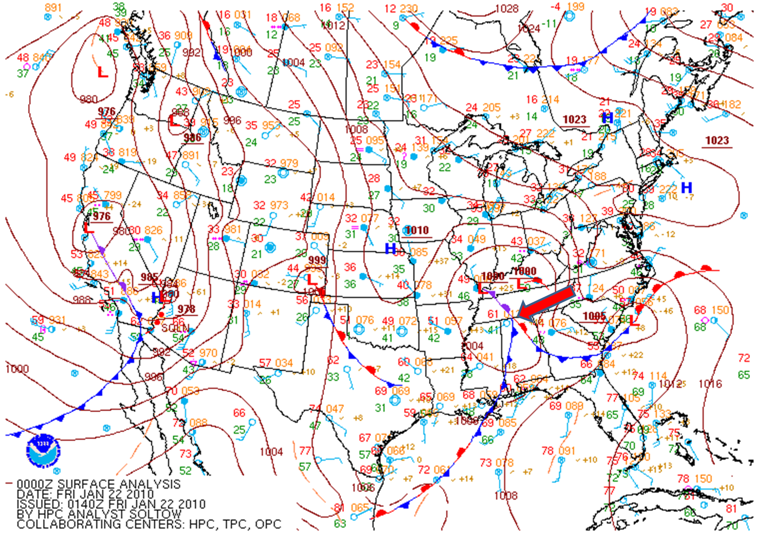
Figure 2. January 21, 2010 - 6 pm Surface Analysis
|
|
Two Main Ingredients were in place by the late afternoon hours for scattered severe thunderstorm development capable of producing large hail and isolated tornadoes across the Huntsville Forecast Area. 1. A triple point (location near a occluded surface low where the cold front and warm front intersect) is notated by the red arrow in Figure 2. This helped to provide enhanced shear for low level rotation. Although wind speeds aloft were generally just around 30 to 40 kts, and surface winds only around 10 kts, deep layer shear was sufficient for the development of supercellular storm structures, as long as instability was sufficient. 2. During the day on Thursday, mostly clear skies and strong southerly flow lead to significant daytime heating, which caused high temperatures to climb into the upper 60s. This was only 4-5 degrees away from all-time record highs at both the Muscle Shoals Airport and the Huntsville International Airport. Dew point temperatures rose to relatively high values for late January, into the mid to upper 50s. The movement of a deep short wave trough into the region lead to the development of steep low level lapse rates by the late afternoon hours. The combined effect of warm, moist air in the lower-levels, and cold air aloft, produced high instability with CAPE values around 1000 - 1500 J/kg. This allowed for relatively rapid updrafts in convective storms, and aided in the initiation of storm rotation. |


 Local Radar
 Weather Map