
A slow moving weather disturbance will continue to bring periodic rain showers, a few isolated thunderstorms, and a localized flash flooding across the Southwest. The threat will expand into the Southern Plains Wednesday night. Moderate to heavy snow across the Sierra Nevada and southern Utah Ranges will continue into the overnight period. Read More >
|
||||||||||||||||||||||||||||||||||||||||||||||||||||||||


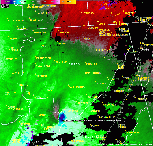


 Local Radar
 Weather Map