|
Weather Synopsis:
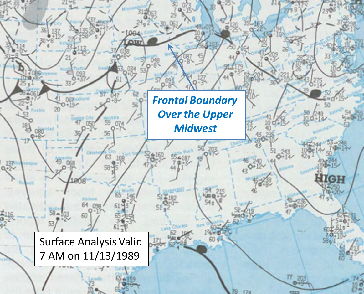
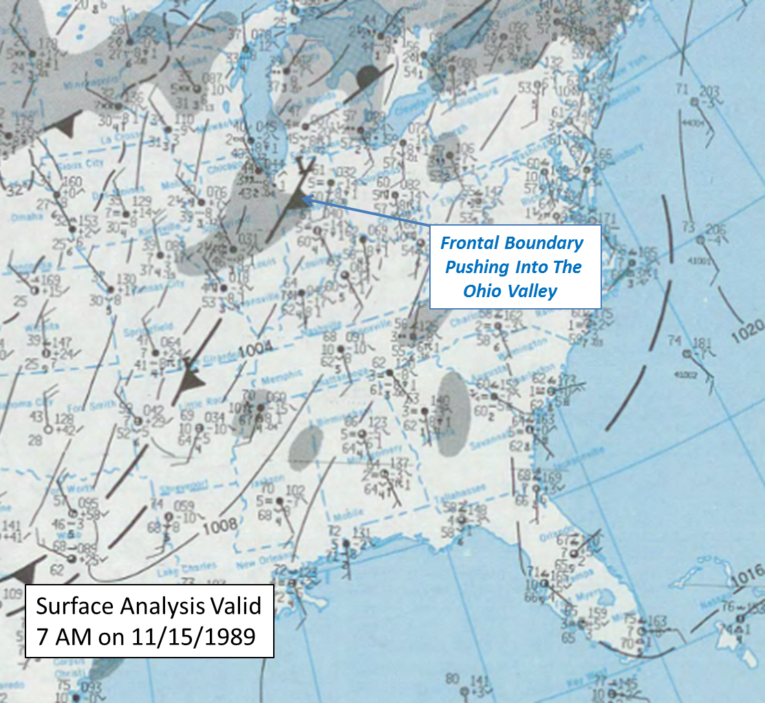
On November 13th, 1989 persistent southerly to southwesterly flow was in place over much of the southeastern United States. This was south of a cold front located over the Upper Midwest and Great Lakes Region at 7 AM, as seen in Figure 1 below. This moist, southerly boundary layer flow continued and strengthened through November 15 as this front pushed southeast toward the Tennessee Valley over the next few days. By November 15th, the front had pushed southeast and was approaching the Ohio Valley, as can be seen in Figure 2. |
 |
 |
|
Figure 1: 7 AM Surface Analysis 11/13/1989
|
Figure 2: 7 AM Surface Analysis 11/15/1989
|
|
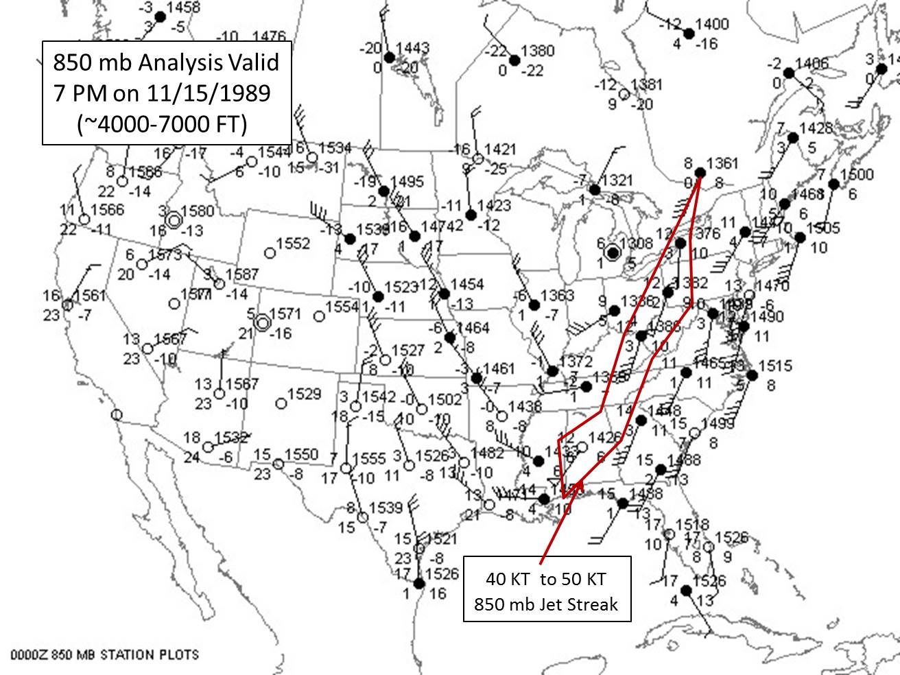
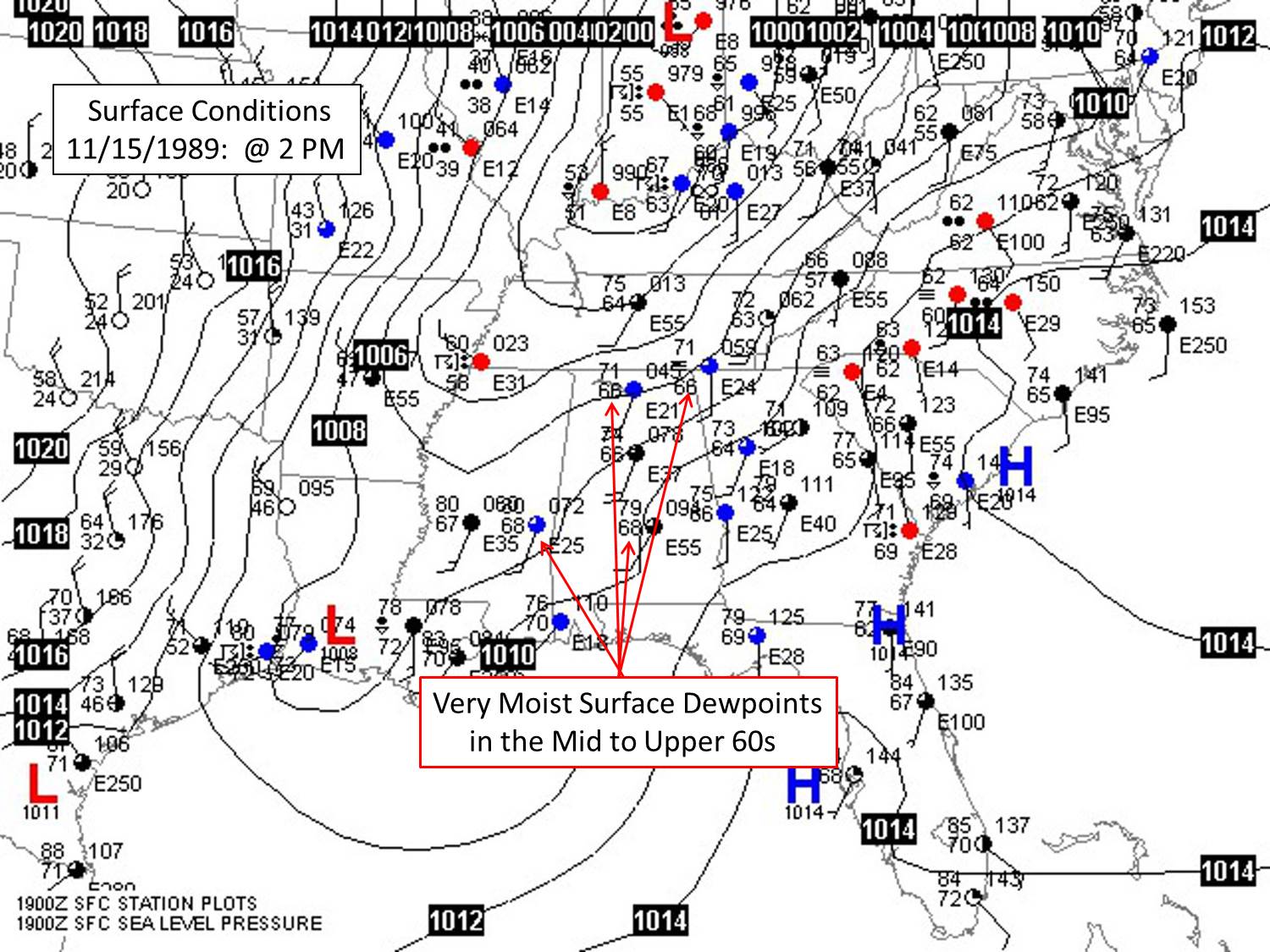
| Across the Tennessee Valley, southerly winds around 25 kts (29 mph) were in place at lower levels of the atmosphere near 850 mb (~4000 to 7000 ft) as early as November 13th. These low level winds steadily increased to near 45 kts or 52 mph (as can be seen in Figure 3 below) prior to the frontal passage during the afternoon/evening hours on November 15, 1989. This brought ample moisture into the Tennessee Valley ahead of the cold front, as dewpoints climbed into the mid to upper 60s (seen in Figure 4 below). |
 |
 |
|
Figure 3: 7 AM 850 mb Analysis at 7 PM at 11/15/1989
|
Figure 4: Surface Analysis at 2 PM at 11/15/1989
|
|
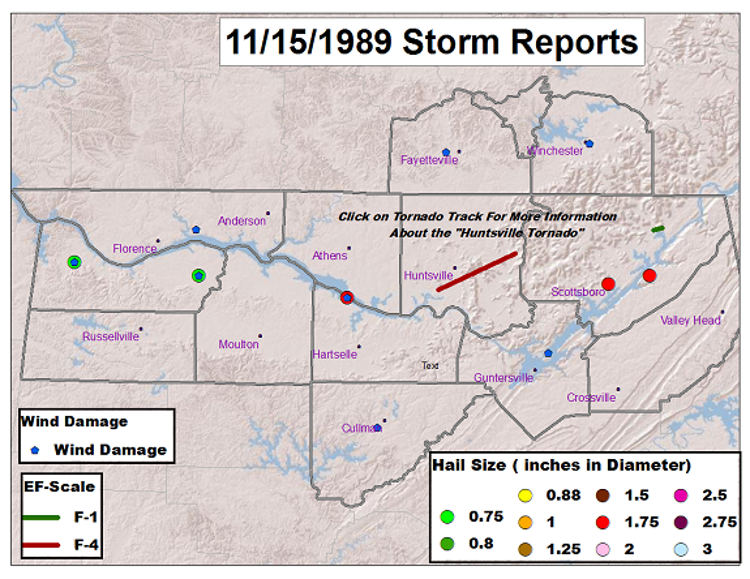
| As a result, moderate levels of instability were in place over the Tennessee Valley ahead of the cold front on November 15th. As the storm system moved across the Tennessee Valley and into eastern Georgia/South Carolina from 7 am on November 15th into the morning hours on November 16th, this storm system underwent rapid and robust strengthening as its central pressure dropped 19 mb in 24 hours. This strengthening markedly increased the dynamics and winds aloft associated with this storm system, as 850 mb winds increased to around 45 kts (52 mph)and 500 mb winds increased to between 70 kts (81 mph) and 90 kts (104 mph) ahead and along the sharp cold front. The moderate instability coupled with the strong dynamics and strong wind/wind shear aloft set the stage for a notable severe weather outbreak including: large hail, damaging winds, and tornadoes (some possibly long tracked and violent). Tragically, the tornado threat materialized as a devastating F4 tornado tore through southeastern parts of Madison County into far eastern Madison county (east of Hurricane Creek). All told, the November 15, 1989 tornado killed 21 people and injured 463 and inflicted approximately $250 million in damage across southeast portions of Madison county. |
 |
 |
| Photographs of the wrath of an F-4 tornado, taken November 16, 1989 by the NWS Birmingham Storm Survey team. At left, portions of the Waterford Square Apartment complex were completely destroyed. At right, an aerial photograph of the damage: for reference, the road going diagonally from lower right to top middle is Airport Road. (Click for a larger image) More pictures are available from the Birmingham storm survey link below. |
|
