|
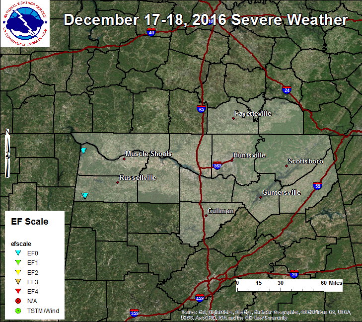
ESRI Shapefiles: All Survey Shapefiles - Zipped folder contains line, path, survey point, and select estimated damage swath shapefiles of all tornado tracks that occurred in the Huntsville County Warning Area. Attribute information includes: Tornado Name, EF-Scale, Peak Wind, Start Time, Beginning and Ending Latitudes and Longitudes, End Time, and maximum width in yards. Jump to: |
|||
|
.Colbert County EF0 Tornado...
|
|||
 |
|||
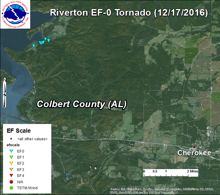
.Riverton Tornado (Colbert)
Rating: EF-0
Estimated Peak Wind: 85 MPH
Path length /Statute/: 0.62 Miles
Path width /Maximum/: 87 Yards
Fatalities: 0
Injuries: 0
Start date: Dec. 17 2016
Start time: 1137 PM CST
Start location: 4 SSW Waterloo
Start Lat/Lon: 34.82 / -88.08
End date: Dec. 17 2016
End time: 1138 PM CST
End location: 3 SSW Waterloo
End_lat/lon: 34.83 / -88.07
Survey Summary:
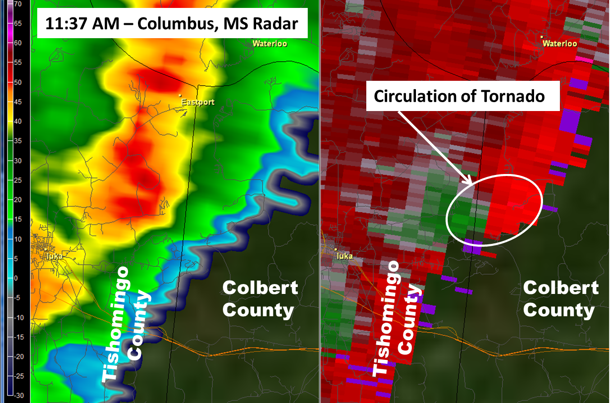
A NWS and Colbert County survey team investigated significant tree damage
in the Riverton area. The damage was associated with a weak tornado
embedded in a line of thunderstorms along a cold front. The damage
occurred at 537 UTC, as estimated on radar.
The survey team determined a tornado touched down at 537 UTC in the
Riverton, AL area. Numerous softwood trees were either uprooted or
snapped just east of Bear Creek along Riverton Rose Trail. Damage
was conducive to an EF-0 tornado with maximum winds speeds of
85 MPH.
The weak tornado produced a swath of damage approx. 0.62 miles long and
87 yards wide. Damage indicators in this region were sparse, other than
the tree damage along Riverton Rose Trail. The tornado was likely only briefly
on the ground (1 min or less) given the a storm motion nearly of 50 mph.
EF Scale: The Enhanced Fujita Scale Classifies Tornadoes into
the following categories.
EF0...Weak......65 to 85 MPH
EF1...Weak......86 to 110 MPH
EF2...Strong....111 to 135 MPH
EF3...Strong....136 to 165 MPH
EF4...Violent...166 To 200 MPH
EF5...Violent...Over 200 MPH
|
|||
|
|||
| Return to Top of Page |
|||
|
.Franklin County (AL) EF0 Tornado...
|
|||
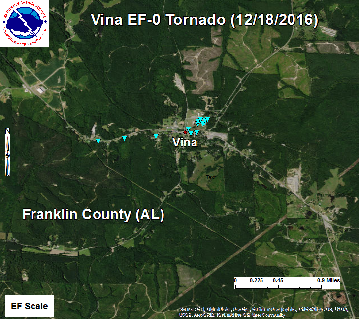
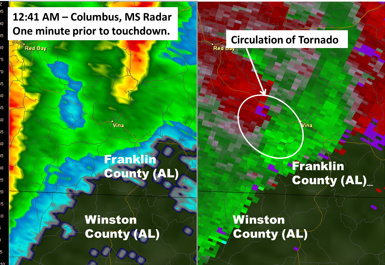
.Vina Tornado (Franklin AL)...

Rating:                   EF-0
Estimated Peak Wind:      80 MPH
Path length /Statute/:    0.97 Miles
Path width /Maximum/:     75 Yards
Fatalities:               0
Injuries:                  0

Start date:               DEC 18 2016
Start time:               1242 AM CST
Start location:           Hwy 9 just west of Maple Street
Start Lat/Lon:           34.37510/-88.07190

End date:                 DEC 18 2016
End time:                 1246 AM CST
End location:             Near intersection of Maple St/Old Cotton Gin Rd
End_lat/lon:              34.37845/-88.05529

Survey Summary: The NWS in conjunction with Franklin Alabama EMA
conducted a ground survey of damage in Vina. The findings are
as follows.

An initially very weak and narrow tornado touched down in the
Vina community along Highway 19 just west of Maple Street. Here
some limbs were snapped off of a stand of trees on the south side of
the road. Additional very minor tree damage was noted south of
Highway 19. A tree was uprooted near a home along Cedar street south
of Highway 19.

The tornado then likely crossed Highway 19 very near two community
storm shelters and the local fire department. No discernible damage was
identifiable here, but it should be noted that the shelters were open
and occupied due to watches and warnings being in effect. Damage was once
again noted on the south and west side of the Vina High School.

On the south side, a large tree was snapped and a home sustained roof
damage. The athletic fields sustained damage to the fences and a baseball
dugout was destroyed. Several large unanchored objects here were thrown
large distances.

The school sustained roof damage in several locations including uplift of
the roof on the main building. Windows were also blown out here by the wind
with other damage due to the flying debris. Awnings were also destroyed
connecting different portions of the school. The tornado was rated EF-0 here
with maximum winds of 80 mph due to the damage to the roof in several different
locations. The width was estimated to be around 75 yards.

The tornado lifted up and blew away shingles on another building here before
lifting in the wooded area east northeast of the school.

EF Scale:  The Enhanced Fujita Scale Classifies Tornadoes into
the following categories.

EF0...Weak......65 to 85 MPH
EF1...Weak......86 to 110 MPH
EF2...Strong....111 to 135 MPH
EF3...Strong....136 to 165 MPH
EF4...Violent...166 To 200 MPH
EF5...Violent...>200 MPH
|
|||
|
|||


 Local Radar
 Weather Map