|
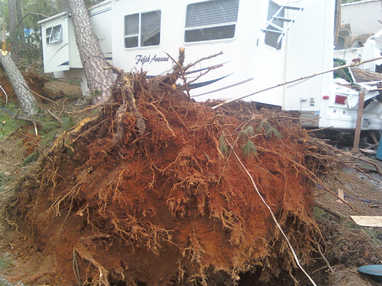
On the evening of Sunday, April 12 and into the early morning hours of the 13th, strong winds developed behind a large area of stratiform rain as it moved eastward across the central Tennessee Valley. These strong winds were induced by the development of a phenomenon known as a wake low. A wake low will often form along the backside of large areas of rain or large complexes of showers and thunderstorms, sometimes known as mesoscale convective complexes (MCS). If conditions aloft are just right, downward motion following the area of precipitation will result in strong warming at the surface, which will further strengthen the development of the wake low. The strong winds develop as the pressure difference grows between this small, but relatively strong area of low pressure and an adjacent area of high pressure. Such was the case late on that Sunday eveninig, as the low developed in northern Alabama, and an area of high pressure was present in Georgia. During this particular wake low event, high winds lasted for several hours, which resulted in a considerable amount of damage, even though peak winds at the surface generally did not exceed 60 miles per hour. The most concentrated area of damage in the National Weather Service Huntsville County Warning Area was along a swath from southern Franklin County (Alabama), through Lawrence, Cullman, Morgan, Madison, Marshall, Jackson, and DeKalb counties. Numerous trees and power lines were downed in these areas, with many trees and power poles falling on houses and blocking roadways. In Guntersville, several boats were blown ashore and damaged. Some areas in Jackson County remained without electricity as late as Thursday, April 16th.
Note: Previously this was summarized as a gravity wave event. However, some further investigation has revealed that the strong winds across the area were likely the result of the wake low alone. An analysis of the surface pressure and wind speed trends at some observation sites reveals that the highest wind speeds occurred before the lowest pressure readings. This would indicate that the winds were primarily the result of the pressure gradient alone, and not necessarily due to the additional effects of a potential gravity wave. The graphs below, taken from the Mobile Integrated Profiling System (MIPS) located on the campus of the Univeristy of Alabama at Huntsville, show that indeed the strongest winds occurred mainly before the pressure bottomed out around 0700 UTC (2:00 AM CDT).
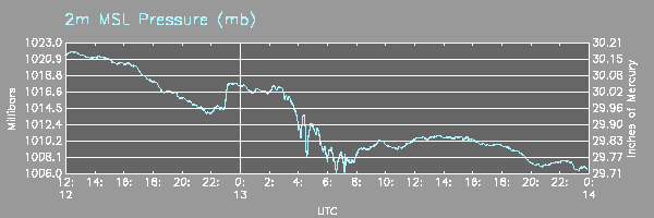
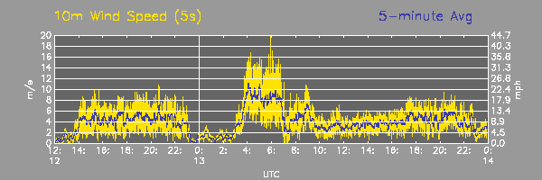
Notice that the wind speeds in the graph above are five-minute averages, and that values around 30 mph were common for a three-hour period beginning at 0400 UTC (11:00 PM CDT) and lasting through 0700 UTC.
|


 Local Radar
 Weather Map