| May 10, 2008 Severe Weather |
|
 |
| Southern Cullman County |
| Rating |
EF-2 |
Peak Wind |
120 mph |
| Path Length |
13.3 miles |
Peak Path Width |
1/4 mile |
|
|
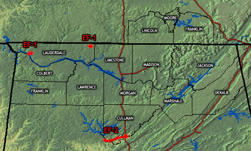
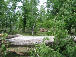
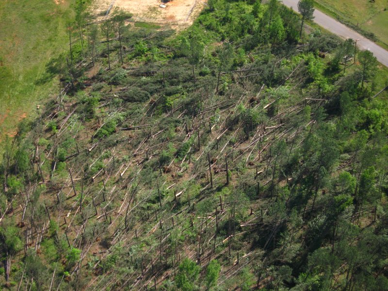
Several debris paths were seen across southern Cullman county. The most significant damage occurred along Highway 91, in the vicinity of the town of Colony. Several chicken houses were destroyed and numerous large trees were snapped and uprooted. Elsewhere, significant tree damage was seen around Arkadelphia, along county roads 8 and 35. Spotty damage was also seen in extreme northeast Walker County and just east of Interstate 65, near Black Bottom, in association with this tornado.
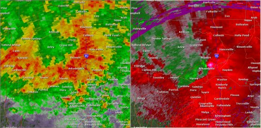
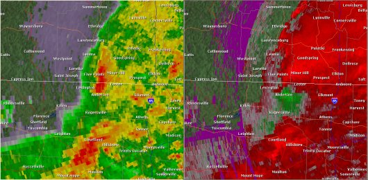
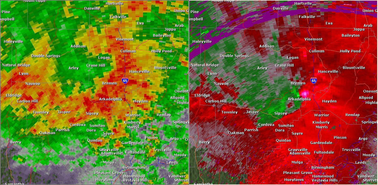
This National Weather Service radar image from 12:48am shows a tight velocity couplet near Arkadelphia in southern Cullman County. The base reflectivity product in the left panel shows rainfall intensity. The storm relative velocity product in the right panel shows winds toward (in green) and away (in red) from the radar in Shelby County, AL.
|

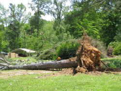
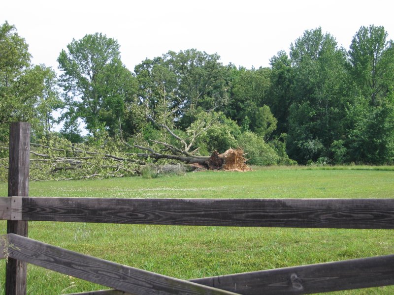
This is an aerial photograph of tree damage along the tornado path. The convergent pattern of the fallen trees is a tell-tale sign the damage was caused by a tornado and not straight line winds. |

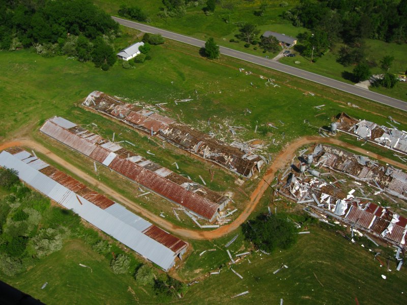
The tornado demolished these chicken houses along Alabama Highway 91 between Arkadelphia and Colony. |
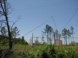
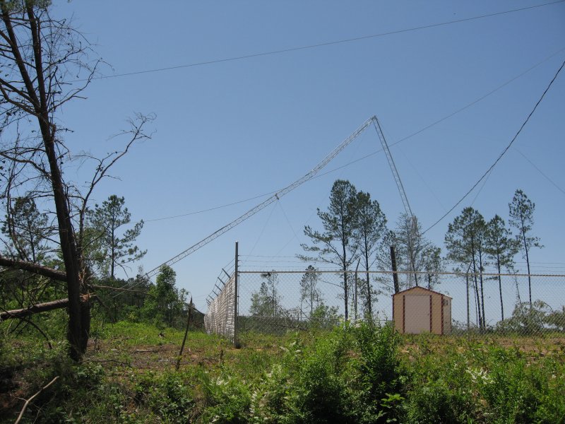
This radio tower was no match for the tornado's violent winds. |
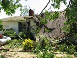
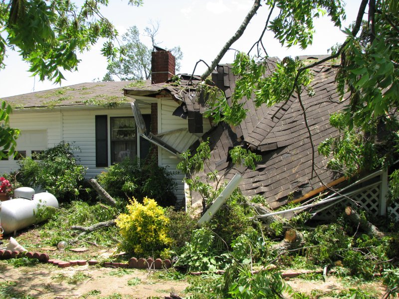
A tree fell on this home, causing considerable damage to the roof. Several other homes in the area experienced relatively minor structural damage. |
|
| |
Western Lauderdale County |
| Rating |
EF-1 |
Peak Wind |
100 mph |
| Path Length |
1.6 miles |
Peak Path Width |
250 yards |
|
|
The tornado touched down near a cove along the Tennessee River and moved east northeast, nearly paralleling County Road 14 halfway between the Wright and Rhodesville communities. Extensive tree damage was observed with multiple large trees uprooted and many medium size tree trunks snapped. The heaviest damage occurred to a farm where an all metal barn was completely destroyed and an awning adjacent to another outbuilding was ripped off. The metal roofing was catapulted approximately 1/2 of a mile by the tornado.

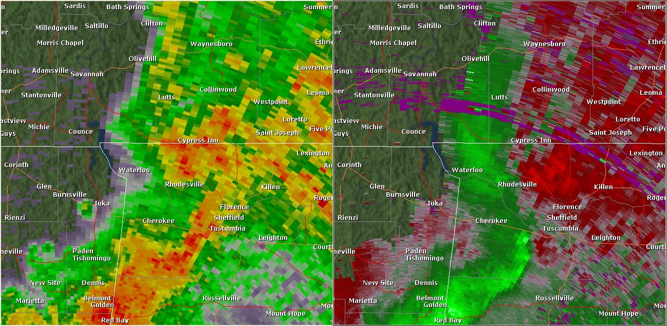
This National Weather Service radar image from 11:14pm shows a mesocyclone, which was producing a tornado at the time, moving over the Rhodesville area. Another mesocyclone can be seen just west of Tuscumbia. Though no tornado damage was found in association with this feature, a funnel cloud was reported over Tuscumbia. The base reflectivity product in the left panel shows rainfall intensity. The storm relative velocity product in the right panel shows winds toward (in green) and away (in red) from the radar at Columbus AFB, MS.
|

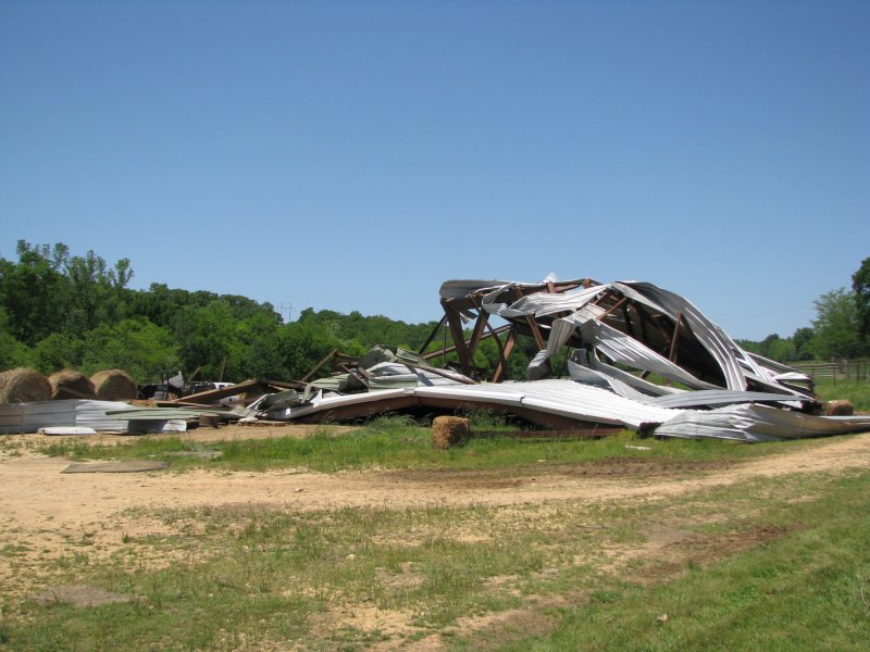
This metal barn was completely destroyed by the tornado. Scrap metal from the structure was blown as far as a half a mile away. |
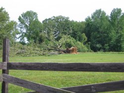
This is one of several large trees that were uprooted or snapped along the tornado's 1.6 mile long path. |
|
| |
Northeastern Lauderdale County |
| Rating |
EF-1 |
Peak Wind |
95 mph |
| Path Length |
1.5 miles |
Peak Path Width |
250 yards |
|
|
The tornado touched down along County Roads 181 and 515 at approximately midnight, and uprooted and snapped several trees in its path. The tornado also produced minor structural damage to an outbuilding.
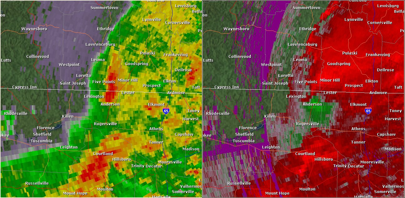
This National Weather Service radar image from midnight on the 11th shows a velocity couplet just north of Anderson at the time this tornado was occurring. The base reflectivity product in the left panel shows rainfall intensity. The storm relative velocity product in the right panel shows winds toward (in green) and away (in red) from the radar at Hytop, AL.
|
Several large trees were downed along CR 181 and CR 515. |
Several large trees were downed along the path of the tornado. There was also minor structural damage to an outbuilding in the area. |
|
| |


 Local Radar
 Weather Map