|
Visible satellite imagery shows Hurricane Dennis bearing down on the Gulf Coast at 11:15am Sunday, just 3 hours prior to landfall. (Click to enlarge the image in a new window).
|
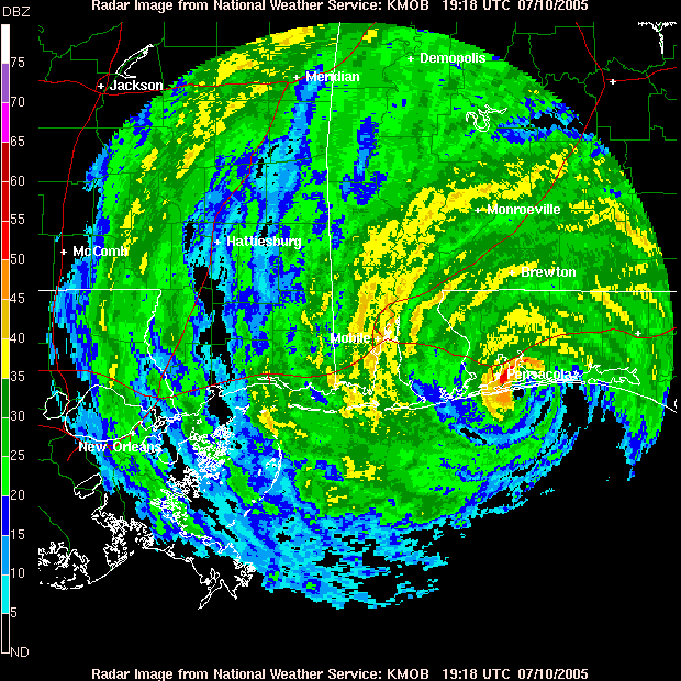
Mobile, Alabama's radar shows the eye of Hurricane Dennis just poised to make landfall near Pensacola, Florida, at 2:18pm. (Click to enlarge the image in a new window.)
|
Hurricane Dennis made landfall on Sunday, July 10, at 2:24pm CDT, as a Category 3 hurricane on the Saffir-Simpson scale with sustained winds of 120 mph. The storm made landfall near Pensacola Beach, Florida, before proceeding inland across southern and western Alabama, then into northeast Mississippi.
Dennis began weakening almost immediately after landfall, and weakened at an unusually fast pace before reaching the Tennessee Valley. This rapid collapse of the storm helped keep the area from experiencing more severe impacts. |


 Local Radar
 Weather Map