National Weather Service United States Department of Commerce

Severe Thunderstorms and Heavy Rainfall Today from the Central Plains into the Tennessee Valley

Severe thunderstorms capable of damaging winds will be possible from the Ozark Plateau east into portions of the Southeast today. Rounds of heavy thunderstorms ahead of a slow moving front will continue locally heavy rainfall and scattered flash flooding potential from the Ozarks to the Ohio and Tennessee Valleys today. Read More >

Tropical Storm/Depression Ivan - Recap

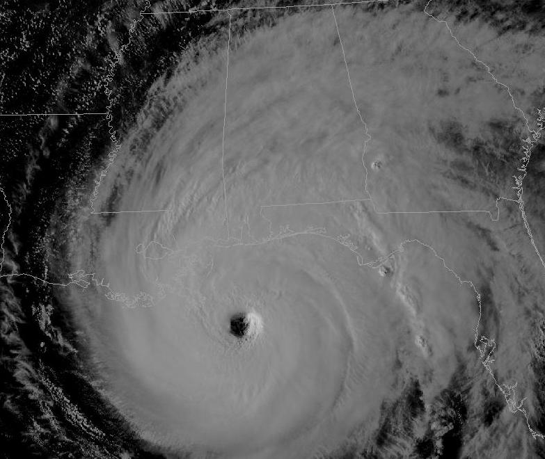
Visible satellite imagery shows Hurricane Ivan bearing down on the Gulf Coast at 5pm Wednesday (click to enlarge the image in a new window).
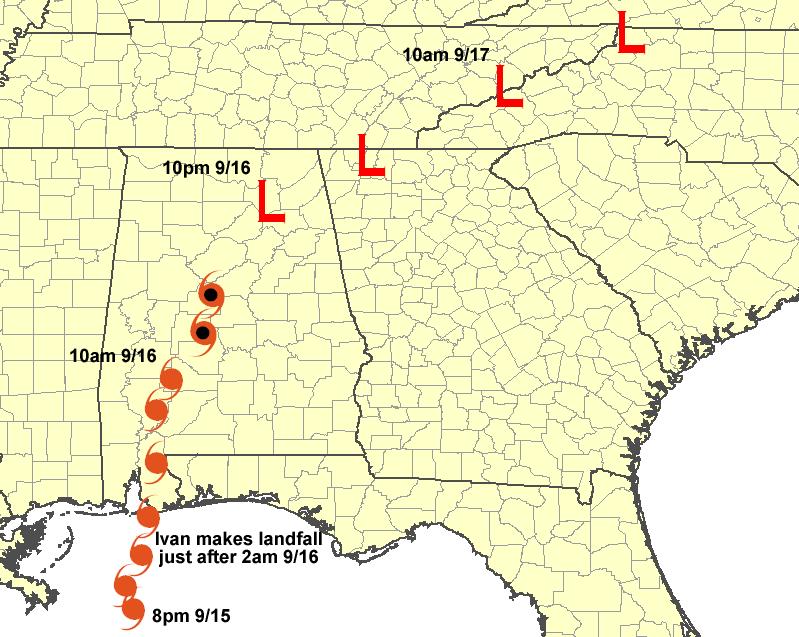
Ivan's track through Alabama and the southern Appalachians. Click to see a larger image along with more information on the storm.
Stage IV radar and rain gauge Rainfall Analysis from the Ivan event. Click the graphic to enlarge the image and for more information (will open in its own window).
Mobile, Alabama's radar shows the eye of Hurricane Ivan just miles away from making landfall in Baldwin County. Click the image to see a few radar images from the event.
 

24-Hour Rainfall Totals
(as of 9/17)

Precipitation Report
(as of 3am 9/17; contains automated 6 and 24-hourly rainfall totals)

Local Storm Report Summary
(as of 9/17)

Wind Gust Reports from Automated Observation Sites