|
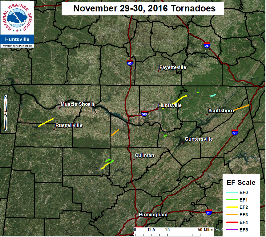
A tornado outbreak occurred during the evening hours of the 29th into the early morning hours of the 30th. A very mild and unstable air mass was in place along with a strong southwesterly upper level jet. These ingredients combined with a cold front and pre-frontal
trough sweeping from west to east across the area sparked scattered supercell thunderstorms during the evening, a few of which were tornadic. This was followed by a quasi-linear convective system (QLCS) that occurred with the trough, which also was responsible for severe weather.

ESRI Shapefiles: 
All Survey Shapefiles - Zipped folder contains line, path, survey point, and select estimated damage swath shapefiles of all tornado tracks
that occurred in the Huntsville County Warning Area. Attribute information includes: Tornado Name, EF-Scale, Peak Wind, Start Time,
Beginning and Ending Latitudes and Longitudes, End Time, and maximum width in yards.
|