|
||||||||||||||||
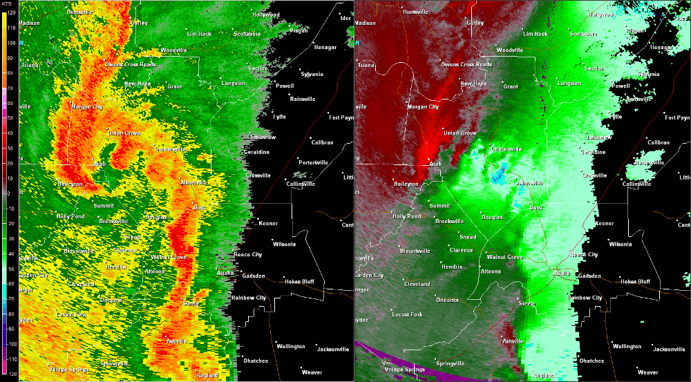
| The third of three tornadoes found just south of Guntersville in central Marshall County initially touched down near the intersection of Highway 325 and Max Graben Circle southwest of Albertville. From there, the tornado moved northeast across Section Line Road and Highway 205. Numerous hardwood and softwood trees were snapped and uprooted along the path, and several residences sustained damage due to fallen trees. At this point, the tornado was about 50 yards in width. The tornado crossed Highway 431 north of Albertville near Highway 426. As it crossed George Wallace Drive north of Highway 431, a chicken house was completely destroyed on Arbor Acres Road. Other chicken houses on the same property sustained roof damage and lost tin from the sides of the structures. No further damage was found northeast of Wyeth Mountain Road southeast of Guntersville where the tornado lifted. | ||||||||||||||||
Radar Data |
||||||||||||||||
|
||||||||||||||||


 Local Radar
 Weather Map