National Weather Service United States Department of Commerce

Tracking a Couple of Storm Systems Across the Country

Showers, along with a few strong to severe thunderstorms, are expected from the Great Lakes, New England and southward into the Ohio and Tennessee Valleys. In the wake of this system, a stronger storm is expected to track from the Pacific Northwest, Plains and through the Eastern U.S. this weekend. Strong winds, showers and a larger drop in temperatures are expected this weekend into Monday. Read More >

Rating EF-1 Peak Wind 105 mph
Path Length 1.55 miles Peak Path Width 100 yards
Beginning Point 34.5018, -86.1911 End Point 34.5162, -86.1702
Start Time 6:49 AM End Time  6:52 AM

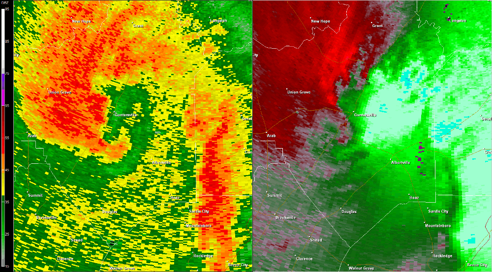
The tornado initially touched down between Buck Island and Pine Island on Guntersville Lake in northeast Marshall County.  Numerous hardwood and softwood trees were snapped along Highway 79 as the tornado skipped northeast.  The tornado touched down again on Pine Island and remained on the ground for several miles approaching the Jackson County line. Numerous homes sustained damage from trees falling on them in a convergent pattern as the tornado moved along the shore of the lake on Preston Island.  At this point in the tornado path, width was estimated at 50 yards, but additional surveys are needed to determine both the entire path length and width of this tornado.

Radar Data

Hytop, AL Radar (HTX) radar loop of the EF-1 tornado track from 6 :40 - 6:50 am CDT.  The imagery on the left is reflectivity, while the imagery on the right is storm-relative velocity.  Click on the image to loop.
Hytop, AL Radar (HTX) radar loop of the EF-2 tornado track.  The imagery on the left is reflectivity, while the imagery on the right is storm-relative velocity.  Click on the image to loop.

Back to April 27 Survey Info