|
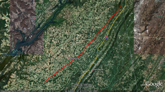
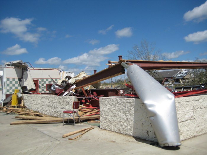
The tornado path is likely to have begun in the Lakeview community northeast of Geraldine before tracking northeastward, generally parallel to and just east of State Route 75. Along this line, the tornado passed through Fyffe, Rainsville, Sylvania, and eventually into northern DeKalb County south of the Cartersville community. On the first day of surveys, the survey team noticed intial damage in the Lakeview community where the path width was generally around 50 yards. This initial damage included mostly felled and snapped trees and structural damage to small buildings. Extensive damage was noted especially in the Rainsvile and Sylvania communities where the path width was estimated to be up to 1/2 mile wide. Damage in Rainsville included houses that were completely removed from foundations, with debris scattered for about one mile. Near this location, trees were debarked and a few mobile homes were completely destroyed, with debris strewn for about a mile downstream. In the Sylvania community, a similar situation occurred with houses completely removed from foundations and debris blown far downstream. Some of these houses were connected to their foundations with anchor bolts and foundation straps, indicating a stronger construction of the homes.
On the second day of surveys, information was received from DeKalb County EMA, who conducted several areal surveys and determined that the tornado damage path was indeed continuous from the Lakeview community through Rainsville, Sylvania, and then to south of the Cartersville area in northeastern DeKalb County. Further damage was observed to the north of Cartersville and into Northwest Georgia, but this was later determined to be another tornado track from earlier in the day. Ground surveys were conducted from the Blake community into southeast Sylvania, then through Henagar, Ider, and to the Cartersville area. The tornado damage continued along the path from the Blake community, intersecting County Road 27 and continuing to the northeast, running parellel between Hwy 75 and Interstate 59 through Henagar, Ider and then to south of Cartersville. In the Blake community, the tornado damage width was estimated to be one half to as much as three-quarters of a mile wide. Along County Road 27 just southeast of the Sylvania community, significant damage was observed. All exterior and interior walls of several homes were completely destroyed with partial block and mortar foundations remaining. In one instance, a concrete slab that served as a porch was displaced a few feet and broken in half. Some hardwood trees in the area were stripped with no stubs of any branches remaining and were partially debarked. The Mountain View Baptist Church, which was just inside the Sylvania community also sustained significant damage. An old, one-story portion of the church dating to 1902 and constructed of a brick and mortar exterior on wood frame walls was completely destroyed. A recent two-story addition to the church constructed in 2004 and consisting of similar building materials was partially destroyed, with most exterior walls and nearly all interior walls fallen. A concrete block and mortar foundation was all that remained of a hallway adjoining the two buildings.
|
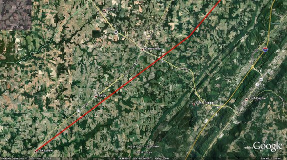
Zoomed in Image of Track From:
Northeast of Rainsville to Rising Fawn Georgia
|
|
|
|
|
|
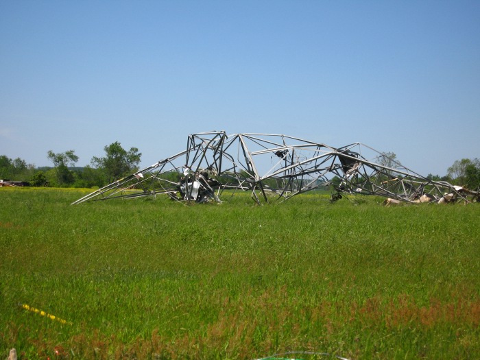
Farther to the northeast along County Road 112 just east of Sylvania and near the High Point community, a couple of electrical transmission metal truss towers were completely bent over and partially twisted. Several homes along County Road 112 were also completely destroyed with interior and exterior walls all collapsed, but portions of large debris remained nearby. Farther to the northeast, just south of the Ider community along County Road 17, the tornado width was estimated to be about one half mile. In this location, several homes were destroyed with exterior and interior walls all blown away while block and mortar foundations remained. Most hardwood trees were completely stripped and debarked in this area of damage. South of Cartersville and near the Blevins Mill community, trees were snapped and felled, but the damage path here was reduced to about 50 yards as the tornado appeared to weaken. The National Weather Service in Huntsville would like to extend thanks to the Emergency Management of DeKalb County, the state and county police, and other citizens, whom volunteered time and information during their cleanup efforts to help in conducting this storm survey.
* UPDATED SURVEY INFORMATION GATHERED ON JUNE 15TH:
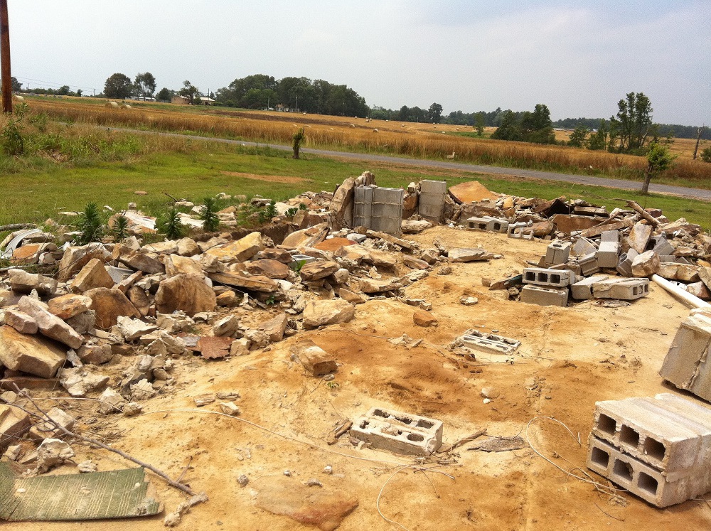
For the purposes of further study, the National Weather service focused primarily on a narrow corridor of intense damage extending from Skaggs road to Lingerfeldt Road (also known as County Road 180) extending toward County Road 514. Along Skaggs Road, a stone house was completely obliterated with much of the interior debris strewn well away from the structure. A supporting large cement and stone pillar was ripped completely out of the ground. Another home along Skaggs Road was also leveled completely to the ground. The NOAA overflight showed significant ground scarring in this area and a walk through the nearby fields showed large pot marks and other sections of disturbed ground.
Slightly northeast along Lingerfeldt Road, numerous homes were leveled completely to their foundation with vehicles and debris strewn for hundreds of feet. Overhead photos and follow-up visual confirmation revealed a mangled vehicle tossed well into a ravine and resting up in the remainder of trees. At 1608 Lingerfeldt Road/CR 180 a large two story brick home was completely obliterated with several of the supporting anchors ripped out of the ground. A concrete porch was ripped off with pieces strewn up to 150 yards. A section of the asphalt driveway was pulled up. In addition, an anchored liberty safe weighing 800 pounds was pulled off its anchorage and thrown into a wooded area 600 feet away. When found, the safe`s door had been ripped open and completely off. A large pick-up truck at this residence was found mangled in pieces over 250 yards away in the same wooded area. The residents of the home survived in a nearby storm pit. Of note the storm pit was partially exposed by the tornado with dirt being sucked up and pulled away around the opening. Next door a mobile home was completely disintegrated. The residents of the mobile there also survived in a storm pit. This section of damage from Skaggs Road to Lingerfelt road near the intersection with Crow Lane was deemed to be EF-5 in intensity. It should also be noted that severe damage, near EF-5 in intensity was noted in a corridor from CR 515 through a neighborhood along County Road 441. In the east and south ends of the neighborhood, many one and two story homes were leveled to their foundation with debris scattered some distance. Several cars were thrown a large distance in this area. There was evidence of ground scarring as well as some sidewalk pavement pulled up in this location. However, some of the homes in this area appeared to be pushed off their foundation initially with limited anchorage. Thus, the damage was deemed high end EF-4 in this area.
These findings are still preliminary and are subject to adjustment before a final report is completed. Also note that the final report may include a slight adjustment to the beginning point of the track.
|
|


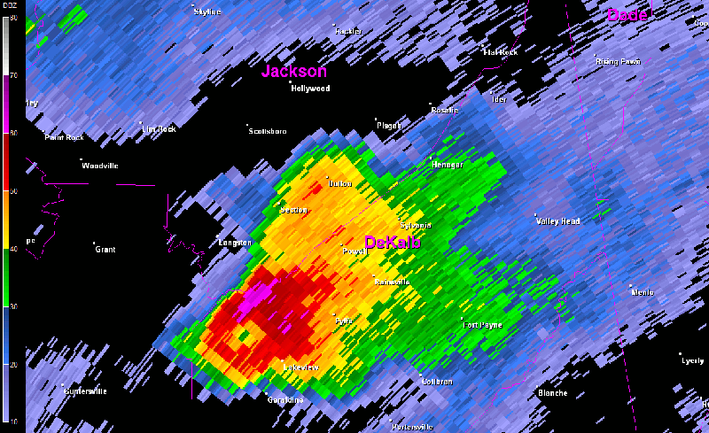
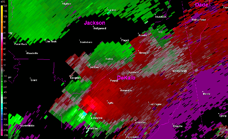


 Local Radar
 Weather Map