| Complete Tornado Track Map |
 |
|
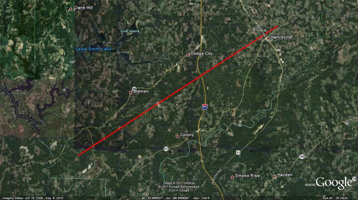
Click on the image above to display an experimental contoured map created by Suheiley Lopez (UPRM) dipicting the strength of damage indicators seen along the track during NWS storm surveys.
|
A weak tornado touched down east of Cold Springs, toppling and snapping numerous trees. Several sheds sustained minor damage in this early part of the track. The storm crossed Highway 69 where it damaged a large shed. Additional damage was noted as the tornado tracked northeast across County Road 46, where trees continued to be snapped and damage sustained to many chicken coops, some of which collapsed. After crossing Interstate 65 just south of Dodge City, additional chicken coops and trees were damaged along the path of the storm. The tornado then increased in strength as it approached Wallace State College in Hanceville, where winds were estimated to peak at 120 mph (EF-2 intensity). Eight large metal power poles were bent over just above the base and several campus buildings had significant portions of metal roofing torn off. A mid-rise under construction had its windows blown out, while the high-rise building sustained additional minor damage. The connected construction crane remained standing. To the south of the main track, in Hanceville proper, significant numbers of large pine, poplar and other hardwood trees were toppled onto houses. The roof of the high school gym in town was partly destroyed and additional small buildings near downtown Hanceville sustained damage.. The tornado continued its track northeast from Hanceville, nearly paralleling Highway 91. Between Center Hill and Walter, large hardwood trees were found snapped and twisted. In addition along County Road 645, a barn was nearly destroyed. Continuing northeast along a path, just south of Holly Pond along Highway 91, a portion (1/3 to 1/2) of a residential shelter or shed was destroyed and a portion of a chicken house was badly damaged. Additional damage was seen along County Road 1742 and 1753, several miles northeast of Holly Pond, and along Highway 231 in extreme northeast Cullman county. This damage is considered to be with the same complex of storms that rolled across the area during the early morning hours April 27th, however there is too much distance between damage points to be considered one long track tornado. |
Radar Data
|
|


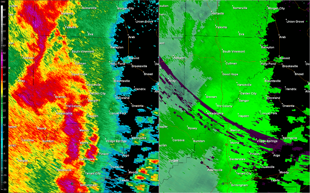


 Local Radar
 Weather Map