STORM SIGNALS
Spring 2000, Vol. 54
CONTENTS

This edition of Storm Signals was printed by Union Carbide, as a service to the citizens of Southeast Texas and the upper Texas coastal area.
1999 Year In Review
By Charles Roeseler
1999 started out with a bang! Several supercells roared across southeast Texas on New Years Day producing tornadoes across Walker and Trinity counties. Later New Years Night, a squall line moved across the area producing another round of gusty winds and very heavy rain. The remainder of the month was much warmer than normal averaging six to seven degrees above normal. The region was slightly drier than usual with rainfall totals about an inch below normal.
February was much warmer than normal with temperatures averaging eight to nine degrees above normal. Rainfall was one to two inches below normal. The only significant weather to occur during the month was a round of severe thunderstorms which developed on the 27th and produced pockets of large hail from Apple Springs to Edna.
The warmer than normal temperature trend continued in March as temperatures averaged around a degree warmer than normal. Rainfall was near or slightly above normal over the northern half of the area, but around a half inch below normal over the south. A series of thunderstorms moved across the northern half of the region through the 8th, 12th and 19th. These storms produced gusty winds which blew trees down near Livingston, Magnolia and Sebastopol. Flooding occurred in southwest Houston on the 19th as four to five inches of rain fell in that area in a four hour period.
April was another in a string of unusually warm months. Stormy weather started and ended the month with a severe weather outbreak on both the 3rd and 26th. Severe flooding occurred in Polk county on the 3rd with as much as three feet of water covering parts of US Highway 59. Temperatures averaged two to five degrees above normal for the month.
May was again slightly warmer than normal and rainfall was very close to normal. The month was punctuated by several episodes of severe weather. On May 10th, an early morning squall line ripped through southeast Texas. These storms produced wind gusts in excess of 60 mph and blew down trees, power lines and billboards. On May 30th, a cluster of severe thunderstorms developed just south of Houston. These storms dumped very heavy rain and golf ball to baseball sized hail from the Houston area westward to Columbus. Temperatures averaged 0.5 to 2.0 degrees above normal across the region.
A surge of tropical moisture affected southeast Texas in June. Scattered showers and thunderstorms affected the region almost daily through the middle of the month. Some locally heavy rainfall totals were reported on the 15th including 4.50 inches in Dickinson and 4.14 inches in Pearland. More heavy rain fell on the 25th, especially over the eastern half of the region. Eight to ten inches of rain fell over parts of Polk and Trinity counties and flooding was reported from Livingston to Galveston. The monthly rain total in Pearland was in excess of 13 inches. Despite the rainfall and increased cloud cover, monthly temperatures across the region were still averaging one to two degrees above normal.
July started out rainy but ended hot and dry. Once the rain ended, temperatures soared! 95 degrees was not reached until July 23 at Houston and College Station. This was the latestdate in recorded history for this temperature to be reached. Temperatures were within a degree of normal area wide. The rain which occurred early in the month was heavy enough to produce above normal totals for the month. On the 12th, a waterspout developed over Galveston Bay and moved inland over Texas City and damaged an apartment complex.
August can be described in two words, VERY HOT! Temperatures were three to five degrees above normal area wide. Numerous heat advisories were in effect as heat index values rose to very dangerous levels. The hottest day of the year was August 20. College Station reached a high temperature of 107 degrees while Houston reached a high temperature of 105 degrees. On August 31, a cluster of severe thunderstorms which developed around Galveston Bay moved southwest across southeast Texas. Extremely gusty winds produced damage from Houston to Wharton. One person was killed when a motel under construction collapsed during the storm. During the month, another six deaths were attributed to the heat. There were twelve heat related deaths for the year. Rainfall was paltry, under an inch in most locations.
September remained dry. Area rainfall was 2.5 to 4.0 inches below normal. Since the air mass was so dry, afternoon high temperatures were above normal while night time lows were below normal. Average temperatures were near normal. The only significant weather event occurred on the 8th when a few severe storms developed near Galveston Bay.
October was a benign month with near normal temperatures and below normal rainfall. No severe weather warnings were issued for the month.
November was another month with above normal temperatures and below normal rainfall. Temperatures across the area were one to two degrees above normal while rainfall totals were about two inches below normal. August through November rainfall in Houston totaled 3.96 inches. This was the second driest August through November period in recorded history. Only 1924 was drier when rainfall totaled 3.68 inches.
Rainy periods increased in frequency during the early part of December but dry conditions prevailed over the latter half of the month. Rainfall was heaviest near the coast with coastal locations receiving above normal rainfall. Inland areas remained dry and received below normal rainfall totals.
Looking back at 1999, what really stands out as unique was the relative tranquility the year possessed. Severe weather such as flooding, large hail, gusty winds and tornadoes were not as common as in past years. The latter half of 1999 was especially calm. Only nine severe thunderstorm warnings and one flash flood watch were issued between September and December. The only tropical system to affect the state was Hurricane Bret and this system stayed well south of Southeast Texas. Ice storms and snow did not affect the region either. All in all, another very warm year with below normal rainfall.
 The above chart shows rainfall totals across Southeast Texas for 1999. This chart includes many of the volunteer co-op stations which contribute temperature and rainfall data to the National Weather Service.
The greatest 1999 rainfall total was at Corrigan which is located in northern Polk county. Rainfall in Corrigan was 50.61 inches. The lowest rainfall across the region was 23.37 inches which was reported at Matagorda. Most reporting stations were around 15 inches below normal for the year.
The last half of 1999 was very dry. Houston had the second driest period in city history. Rainfall between August 1 and December 31 was only 6.16 inches, normal rainfall for this period is 19.89 inches. The picture becomes more bleak if you include rainfall totals for January 2000. The rainfall for this period was only 7.41 inches, normal rainfall is 23.18 inches. The rainfall deficit for the period January 1 1999 through January 31 2000 is now a staggering 20.03 inches below normal. Historically, only 1917 was drier. The six month total for 1917-18 was only 6.48 inches.
The College Station area endured a similar fate. The August through December rainfall was only 5.71 inches which makes it the fifth driest period in history. Although most coastal stations fared somewhat better than inland locations, coastal stations from Palacios to Freeport did not have rainfall totals exceeding 30 inches.
As stated earlier, it was another hot year. The average temperature in Houston was 70.6 degrees. This ties 1953 as the eighth warmest year in city history. The warmest year occurred in 1933 when the average temperature was 71.6 degrees. In 1998, the average temperature was 70.7 degrees. College Station was very warm with the 1999 average temperature at 69.6 degrees (tied for 9th all-time). The warmest year in College Station was also 1933 when the average temperature was 71.0 degrees.
Here is a monthly breakdown of climate data for Houston, Galveston and College Station. Temperature is in degrees Fahrenheit and rainfall is measured in inches.
|
|
| Month | Avg High | Avg Low | Daily | Temperature Departure | Rainfall | Rainfall Departure |
|---|---|---|---|---|---|---|
| January | 65.6 | 42.8 | 54.2 | +5.7 | 0.95 | -1.70 |
| February | 73.1 | 49.7 | 61.4 | +9.0 | 0.14 | -2.48 |
| March | 71.5 | 51.3 | 61.4 | +1.1 | 4.13 | +1.55 |
| April | 81.0 | 59.7 | 70.4 | +2.2 | 2.54 | -0.84 |
| May | 85.3 | 64.5 | 74.9 | +0.4 | 4.16 | -0.64 |
| June | 90.3 | 72.6 | 81.5 | +0.8 | 4.61 | +0.93 |
| July | 92.9 | 72.4 | 82.7 | -0.9 | 2.38 | +0.09 |
| August | 100.3 | 73.3 | 86.8 | +2.8 | 0.77 | -1.65 |
| September | 92.9 | 65.4 | 79.2 | +0.6 | 0.73 | -4.14 |
| October | 83.1 | 54.5 | 68.8 | -0.6 | 1.58 | -2.23 |
| November | 76.2 | 47.2 | 61.7 | +1.9 | 1.09 | -2.06 |
| December | 66.5 | 38.2 | 52.4 | +1.0 | 1.54 | -1.29 |
| 1999 | 81.6 | 57.6 | 69.6 | +2.0 | 24.62 | -14.46 |
| Normals | 77.8 | 57.4 | 67.6 | - | 39.08 | - |
Weather Forecast for

By Lance Wood
Considering southeast Texas is currently experiencing a moderate to severe drought, many are interested in the region's weather for the upcoming year. Long range forecasting (beyond one month) centers on the state of the El Nino/Southern Oscillation cycle and its known link to weather patterns affecting southeast Texas.
El Nino is named after the Christ child (in Spanish) because of its December occurrence off the coast of Peru, where abnormally warm sea surface temperatures signal the beginnings of warm anomalies over a much larger area (the eastern half of the equatorial Pacific). La Nina is the opposite phenomenon, referring to cold sea surface temperatures in the eastern half of the equatorial Pacific. The Southern Oscillation, consists of an east-west atmospheric pressure see-saw that directly affects tropical weather around the globe. Both El Nino/La Nina and swings of the Southern Oscillation typically occur in conjunction.
The current state of the cycle is one of cold episode conditions, or La Nina. Cold sea surface temperatures have persisted since August 1998 making this La Nina the longest period of cold episode conditions since the mid 1980s. The Climate Prediction Center is forecasting La Nina conditions to continue through the spring and into the summer. Near neutral conditions are expected during the second half of the year as La Nina diminishes.
The result of this forecast for southeast Texas is near normal temperatures this spring followed by above normal temperatures during the summer and early fall. During the remainder of the year, temperatures are expected to be near normal. Unfortunately, rainfall amounts are expected to be below normal through the spring, with drought conditions continuing. Near normal rainfall is predicted this summer, when we normally receive less rainfall, and for the remainder of the year.
The La Nina/El Nino condition also affects hurricane activity in the Atlantic basin. The Colorado State hurricane forecast team, headed by Dr. William Gray, issued their first forecast for the 2000 season last December. They are expecting slightly above average hurricane activity, but less active than the recent years of 1995, 1996, 1998 and 1999. The forecast is for 11 named storms (avg. = 9), 7 hurricanes (avg. = 6), and 3 intense hurricanes (avg. = 2). As a reference, last year there were 12 named storms, 8 hurricanes, 5 of which were intense (category 3,4,5). Their forecast will be updated on April 7. NOAA's Climate Prediction Center will issue a hurricane activity forecast in May.

2000 Houston Boat Show
By Brian Kyle
The 2000 Houston International Boat Show was held at the Astrohall and Astroarena from January 7th through January 16th. Over 170,000 people attended the 10 day event, and similar to previous years, this was a great opportunity for the Houston staff to meet with the marine community as they passed by the NWS booth.
Positive comments regarding the NWS marine forecasts were received from most of those that stopped by to chat. One gentleman even stopped by to thank the staff because of a special "marine warning that saved not only my life, but my family's as well." Numerous people also commented how much they liked the digital NOAA Weather Radio voice. It is always good for our forecasters to hear your feedback - it shows that the products we issue are used and are an important tool for local mariners.
A variety of handouts were available to the public. The most popular brochures included those about hurricanes, severe weather, safe boating, and tide tables for January and February.
Those not able to attend this years show are also encouraged to provide feedback regarding our local marine program by e-mailing brian.kyle@noaa.gov

Houston/Galveston Hurricane Workshop
May 10, 2000
Work is already underway planning this year's annual Houston/Galveston Hurricane Workshop. The theme of this year's workshop will be "1900 STORM: CAN IT HAPPEN AGAIN?"The workshop will take place on May 10th at the Pasadena Convention Center beginning at 8:00 AM. This year's workshop is again being sponsored by the East Harris County Manufacturers Association (EHCMA).
We will be looking at what would realistically happen in 2000 if a storm similar to the 1900 Storm would make landfall along the upper Texas coast. We will look at how the changes in the landscape will affect the impact of the storm and of course the enormous growth in the population. In addition, we will discuss the continuing improvement in forecasting these storms but emphasize, the major difficulties in forecasting the impact a particular storm will have. This year we are also planning on having two breakout sessions to educate people on what they can do to protect the physical structures along the coast whether it be a home...small business or a large Petro-Chemical Plant along the ship channel.
Please mark your calenders so you can attend this important workshop. It is open to everyone and there is no charge due to the great sponsorship we continue to have.

2000 Gulf Coast Hurricane Awareness Tour
and the NOAA P-3 Aircraft
May 2, 2000
On May 2nd the National Hurricane Center's (NHC) 2000 Gulf Coast Hurricane Awareness Tour will be in Galveston Texas. NOAA's P-3 research aircraft will be at Galveston Scholes Field for tours by the public along with school children from around the area. Hurricane experts from the National Hurricane Center will be available during the day to brief Emergency Management Officials on Hurricane Forecasting. These same experts will also be available during the day for media interviews.
On the evening of May 2nd the annual Galveston Town Meeting will be held at the Moody Gardens Convention Center. This meeting will focus on the 1900 Storm and how Galveston will cope with a similar storm in 2000.
Additional information about the Houston/Galveston Hurricane Workshop, the 2000 Gulf Coast Hurricane Awareness Tour and the Galveston Town Meeting will be sent in a special Storm Signals in mid April. You may also call the Houston/Galveston NWS Office at 281-337-5074 for further details.

SKYWARN 2000
It is not too late to schedule your Skywarn Meeting to prepare for the severe weather season this Spring. Just pick up the phone and contact Gene Hafele at 281-337-5074 x223 to schedule your class today. Programs can be scheduled during the evening or during the day to maximize your attendance.
What is Skywarn? Skywarn is a program sponsored by your National Weather Service Office in conjunction with your local Emergency Management Organization. It is a group of trained volunteers that watch the skies during severe weather and relay reports back to the local Emergency Management Official, the local law enforcement agency, and /or the National Weather Service. These volunteers provide valuable information to their local community and to the National Weather Service which helps improve the warning program, thus possibly saving lives and reducing property damage in the community.
This year's Skywarn program will emphasize the dangers of heavy rain and the eventual floods and flash floods produced by these rains. Floods and flash floods continue to be the number one producer of weather related deaths. With your help we will try to identify flash flood prone areas and also develop a better rainfall reporting network.

Southeast Texas Severe Weather Awareness Week
March 5 - 11, 2000
Governor George Bush has proclaimed the week of March 5-11 as Severe Weather Awareness Week for the state of Texas. In an official memorandum, he reminded Texans of the devastation and loss of life in the May 1999 tornado outbreak in Oklahoma, and the fact that no part of Texas is immune to severe weather.
During Severe Weather Awareness Week, the National Weather Service in coordination with the Texas Division of Emergency Management and the Insurance Information Institute will highlight various aspects of severe weather through press releases and Public Information Statements. Newspapers, broadcast media, safety organizations and other local government officials are encouraged to work with their communities to disseminate severe weather awareness information to prepare them for the upcoming severe weather season.
During each day of Severe Weather Awareness Week, special releases will be made by the National Weather Service to further emphasize important information about severe weather and the National Weather Service's job in warning the public.
| Date/Time | Release |
|---|---|
| Sunday, March 5 AM | Introduction to Severe Weather Awareness Week |
| Sunday, March 5 PM | EMWIN Program |
| Monday, March 6 AM | Severe Weather Preparedness |
| Monday, March 6 PM | Severe Weather Watch/Warning System |
| Tuesday, March 7 AM | Tornadoes |
| Tuesday, March 7 PM | Severe Thunderstorms |
| Wed, March 8 AM | NOAA Weather Radio/SAME |
| Wed, March 8 at 11 AM | Tornado Drill for Southeast Texas |
| Wed, March 8 PM | Flooding and Flash Flooding> |
| Thursday, March 9 AM | Lightning |
| Thursday, March 9 PM | Drought and Fire Weather Forecasts |
| Friday, March 10 AM | Important Phone numbers and Internet Web Sites |
| Friday, March 10 PM | Severe Thunderstorm/Tornado Safety Tips |

The Spring Storm Season
Often in Southeast Texas, the most active season for severe weather is the collection of spring months of March, April, and May.
With warm, moist air returning from the Gulf of America and active frontal systems from the north and west, the Upper Texas Coast and Southeast Texas often experience numerous showers and thunderstorms.
There are mainly two big weather phenomena during the spring-thunderstorms and tornadoes. Tornadoes are associated with thunderstorms, but not every thunderstorm is capable of producing a tornado. However thunderstorms can still produce significant damage without the presence of tornadoes. By definition, a thunderstorm produces lightning which is the number two weather related killer in the United States. The number one killer is flash floods which are also associated with thunderstorms. Despite the popularity, or notoriety, of hurricane and tornadoes, the two main weather related killers can occur on a frequent basis. There are ways to help reduce the chances of suffering injury or damage during thunderstorms.
The best defense for spring thunderstorms is preparation. Try to keep updated to forecasts that might suggest severe weather. There are several signs that suggest a thunderstorm approaching. Thunder is often the best warning signal. Temperature changes and breezy winds also offer a clue to approaching weather. If you can hear thunder or feel cool breezes, you are close enough to the thunderstorm to be affected. If at all possible, take shelter in a sturdy building away from windows. Use phones only in case of an emergency. If a shelter is not available, find a hard top automobile and keep the windows up. A common myth about automobiles is that the rubber tires insulate the car. This is false as lightning can still strike the vehicle. But the vehicle will provide significantly more protection than the open ground. Stay away from towers, hills, and tall trees as objects protruding into the air are the ones most likely to be struck. The only time to move to higher ground is if flood waters have been seen or reported in your area. If at the lake or on the coast, get off and away from water. If caught in the open ground, find a low spot in the terrain away from trees and fences. Squat low to the ground and lean on the balls of your feet. As lightning strikes the ground, it often spreads in several directions and can strike any object in the vicinity. By eliminating the area of ground that your are in contact with, you minimize your chance of being struck. If at all possible, stay informed by listening to advisories from commercial radio and television or to the National Weather Service weather radio. With proper information and preparation, you can reduce the damage of severe thunderstorms to you, your family, and your property.
Tornadoes offer different problems, but many safety rules from thunderstorms apply. The best defense is again preparation. Practice tornado drills so that all members of the family or employees of business know the appropriate locations of tornado shelters. Don't panic. Move to an interior room away from windows. If at all possible cover yourself with blankets, pillows, or other soft objects. If driving, find a suitable low spot on the ground as quick as possible and abandon your vehicle. Do not try to outrun a tornado. If you reside in a mobile home, leave and find appropriate shelter as mobile homes offer little, if any, protection from tornadoes. Stay informed with the changing weather conditions.
By following these basic rules one can minimize the risk, and thus the damage, posed by the variety of spring severe weather over Southeast Texas.
DEFINITIONS:
Tornado Watch - Conditions are favorable for the development of tornadoes (tornadoes are possible in the area).
Severe Thunderstorm Watch - Conditions are favorable for the development of severe thunderstorms (severe thunderstorms are possible in the area).
Tornado Warning - Tornadoes are imminent or are occurring in the area.
Severe Thunderstorm Warning - Severe thunderstorms are imminent or are occurring in the area.
Coop Corner
By Don Oettinger
As of this writing, the January forms have been received from ALL 50 of our Coop sites! Congratulations and thanks for your cooperation! It has been a long time since we have received 100% of our data. Timely receipt of weather data is very helpful for the folks at the National Climatic Data Center who publish, and make available to the public, data from over 3,000 Cooperative Observer sites nationwide.
There is a fairly large supply of WS Form B-91 booklets in the Weather Service supply system. All of these booklets have "19__" printed in the upper left hand corner of the station information block. The next printing will be "Y2K compliant" but, in the meantime, we will have to use our supply of the older booklets. Either write over the 19 or cross it out and put "2000" in its place. Your data will not be mistaken as having been recorded in the year 1900!
Congratulations to Mr. Melton West of Dacus and T.C. Koester of Houston Heights. They recently received ten and fifteen year awards respectively. They've done a great job for the Coop program. Ms. Lillie Fry, of the Houston Barker station, has received the Benjamin Franklin Award. This award was created to recognize observers who have 55 years of service as Cooperative Observers. The Benjamin Franklin award is brand new, its creation was authorized in late 1999. Ms. Fry's is the first or second to be awarded in the entire nation. Congratulations!
I would like to remind sites that have a Fischer-Porter recording raingage to please try to change the tape monthly, on or about the first of the month. Also, it is very important to put your station name, number, and the data and time on the tape at the beginning and end, whenever you remove it. Without a reference for the beginning and ending times, the data is useless. Rainfall data is published in 15 minute increments from these tapes and it is important that the National Climatic Data Center knows when the rain occurred. Thanks for your timely and accurate data. Remember, if you have a question or a problem, please call us. Either Tom, Bill, or Don will be able to help.
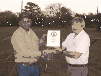 Milton West(left) of the Dacus Station receiving a Ten Year Service Award from Tom Fountain. The West Family have taken observations at Dacus for over 30 years. |
 T. C. Koester(left) of the Houston-Heights Station receiving a Fifteen Year Service Award from Tom Fountain. A retired mailman, T. C. likes to keep track of the weather and woodworking. |
 Lillie Fry(sitting) of the Houston-Barker Station receiving the Benjamin Franklin Award from Bill Read. Ms. Fry took over the Barker Station when husband Glen (center) went off to the war 55 years ago and according to Glen "wouldn't have it back when he returned". |
|

Staff Spotlight
...Chuck Roeseler...
Name: Chuck Roeseler
Position: Forecaster
Favorite Song: "American Pie" by Don McLean
PERSONAL INFO
Hometown: Milwaukee, WI
Birthday: 10/27 (Scorpio)
NWS BACKGROUND
1992-1995......... Meteorological Intern, NWSO Galveston, TX
1995-1998......... Meteorological Intern, NWSO Houston/Galveston, TX
1998 to present...Forecaster, NWSO Houston/Galveston, TX
HIGHLIGHTS/DUTIES/OTHER TIDBITS
How was your first week with the Weather Service in Galveston?
Well, I started on a Monday...on both Wednesday and Thursday we had a severe thunderstorm watch and on Saturday we had a tornado watch. I happened to have started my NWS career the week of the Channelview tornado outbreak!
What got you interested in weather?
Snow. Particularly the winter of 1977-78. Over 100 inches of snow fell in Milwaukee that winter and at one point, there was over 40 inches of snow on the ground. On New Year's Eve (1978), the storm produced so much snow and wind, I could not even open the front door.
What is your tennis record against the other office staff?
Probably 30 wins with 1 loss.

