Synopsis
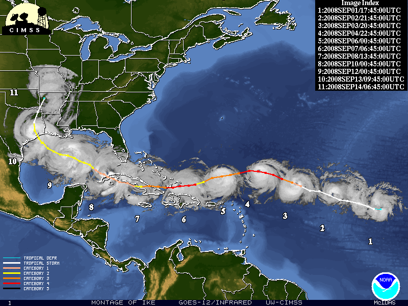
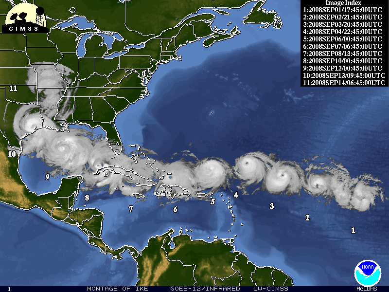
Ike evolved from a tropical disturbance that moved off the west coast of Africa at the end of August. On the morning of September 1st, a tropical depression formed approximately 1750 miles east of Puerto Rico. The depression quickly strengthened into a tropical storm later that afternoon. Moving west-northwest, Ike strengthened into a hurricane on the afternoon of September 3rd, and was located approximately 885 miles east-northeast of Puerto Rico. Ike rapidly intensified into a major hurricane late that afternoon and into the evening hours, reaching a maximum intensity of 145 mph during the early morning hours on Thursday, September 4th.
Continuing to move west and then west-southwest, Ike began to impact the Turks and Caicos Islands on Saturday, September 6th. On Sunday, September 7th, as a category 4 hurricane, Ike slammed into the island of Great Inagua. By Sunday night, Ike moved to the Cuban coast and made another landfall as a major hurricane near the province of Holguin near Punto de Sama with maximum winds around 125 mph. Ike moved west across Cuba and eventually exited the southwest Cuban coastline near Camaguey on Monday afternoon, September 8th. Ike moved northwest that night just off the coast with a track that paralleled the Cuban coastline before making a second Cuban landfall across near the town of Puerto Padre on Tuesday afternoon September 9th. Just prior to crossing the northwest tip of Cuba as a category 1 hurricane with winds close to 80 mph that morning, Ike began producing tropical storm force winds across portions of the Florida Keys. Fortunately for the Keys, Ike would only deliver a glancing blow, as the hurricane continued to move west-northwest toward the US. Gulf coast as it crossed the southeast Gulf of America on Tuesday night and early Wednesday,September 10th.
Over the warm waters of the Gulf of America, Ike grew in size and intensified to a category two hurricane with maximum winds of 100 mph by that evening. Ike continued to move northwest toward the Texas coast as the hurricane crossed the central and northwest Gulf of America. Although Ike's intensity remained in the category 2 range, the cyclone continued to grow and became a very large hurricane. The diameter of tropical storm force winds covering a total of 425 miles from the northwest to southeast as Ike approached the upper Texas coast on Friday, September 12th. Ike made landfall at 2:10 am CDT Saturday, September 13th near Galveston, Texas. Ike was a category 2 hurricane at landfall with maximum sustained winds of 110 mph.
Hurricane Ike produced a damaging, destructive and deadly storm surge across the upper Texas and southwest Louisiana coasts, and will likely end up being the third costliest natural disaster in the United States behind Hurricane Katrina and Hurricane Andrew.
 |
 |
Post Storm Analyses
Post Tropical Cyclone Reports
Satellite Imagery
Radar Imagery
Other Links
Survey Pictures (caution: some of these images are very large and may have long download times)
| Bolivar | ||
|---|---|---|
.JPG) |
.JPG) |
.JPG) |
| more damage pictures from Bolivar >>>> | ||
NWS Houston/Galveston Products
| Hazardous Weather Outlook | ||
|---|---|---|
| 10 Sept 08 / 1049Z | 11 Sept 08 / 0357Z | 11 Sept 08 / 1047Z |
| 12 Sept 08 / 0409Z | 12 Sept 08 / 1138Z | 13 Sept 08 / 0955Z |
| 14 Sept 08 / 1111Z | - | 14 Sept 08 / 2011Z |
National Hurricane Center Products