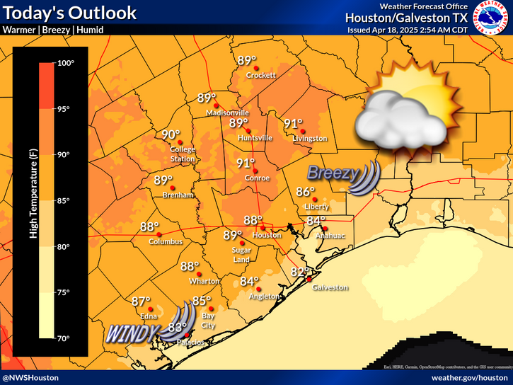
Today's outlook. Warm and humid conditions are expected with highs in the upper 70s to low 80s. Areas of patchy fog could affect the coastal locations, particularly during the morning and late afternoon to evening hours.
Tonight's outlook. Expect areas of patchy to dense sea fog Monday night into Tuesday morning. If you experience fog during your commute, reduce your speed and only use your low-beam lights.


 Local Radar
 Weather Map
 TX Satellite Imagery
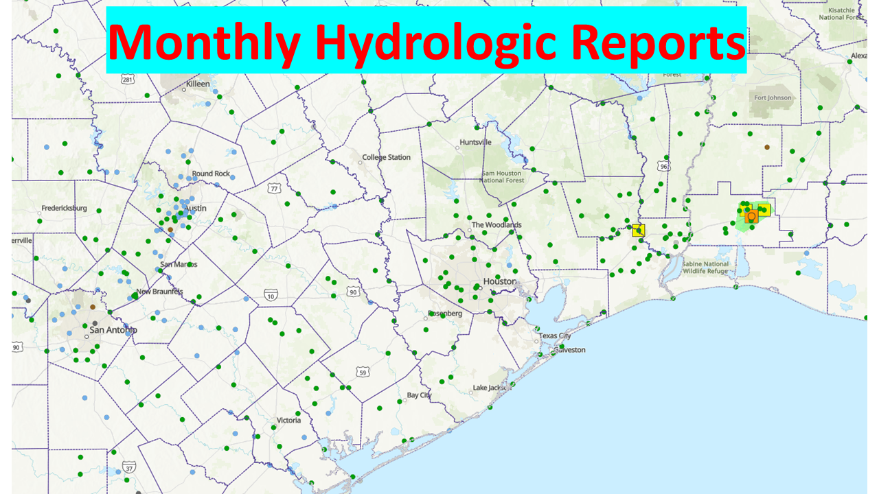 Monthly Hydrologic Reports
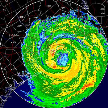 Hurricane Preparedness
 CONUS Satellite Imagery
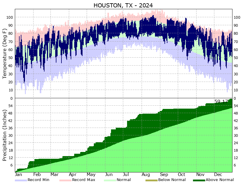 Climate Graphs
 Climate Summaries