¡Comparta con nosotros y aprenda sobre condiciones de tiempo severo! Aproveche esta oportunidad y participe de uno de nuestros seminarios en línea completamente gratuitos. Los mismos serán impartidos por meteorólogos del NWS. Regístrese: weather.gov/crp/skywarnSPA


 Local Radar
 Weather Map
 TX Satellite Imagery
 Monthly Hydrologic Reports
 Hurricane Preparedness
 CONUS Satellite Imagery
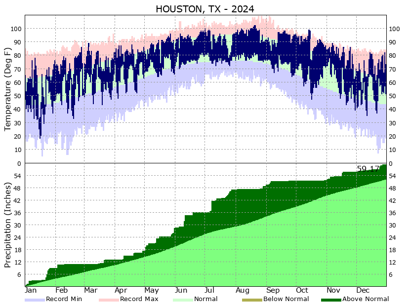 Climate Graphs
 Climate Summaries