Fort Worth/Dallas, TX
Weather Forecast Office
ENSO Teleconnections


What Are the Impacts of El Niño/La Niña?
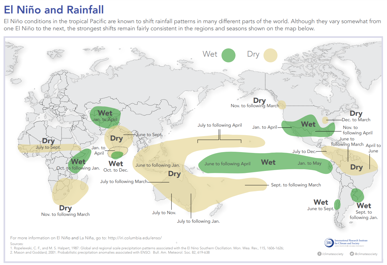
 Global Precipitation Impacts During El Niño and La Niña
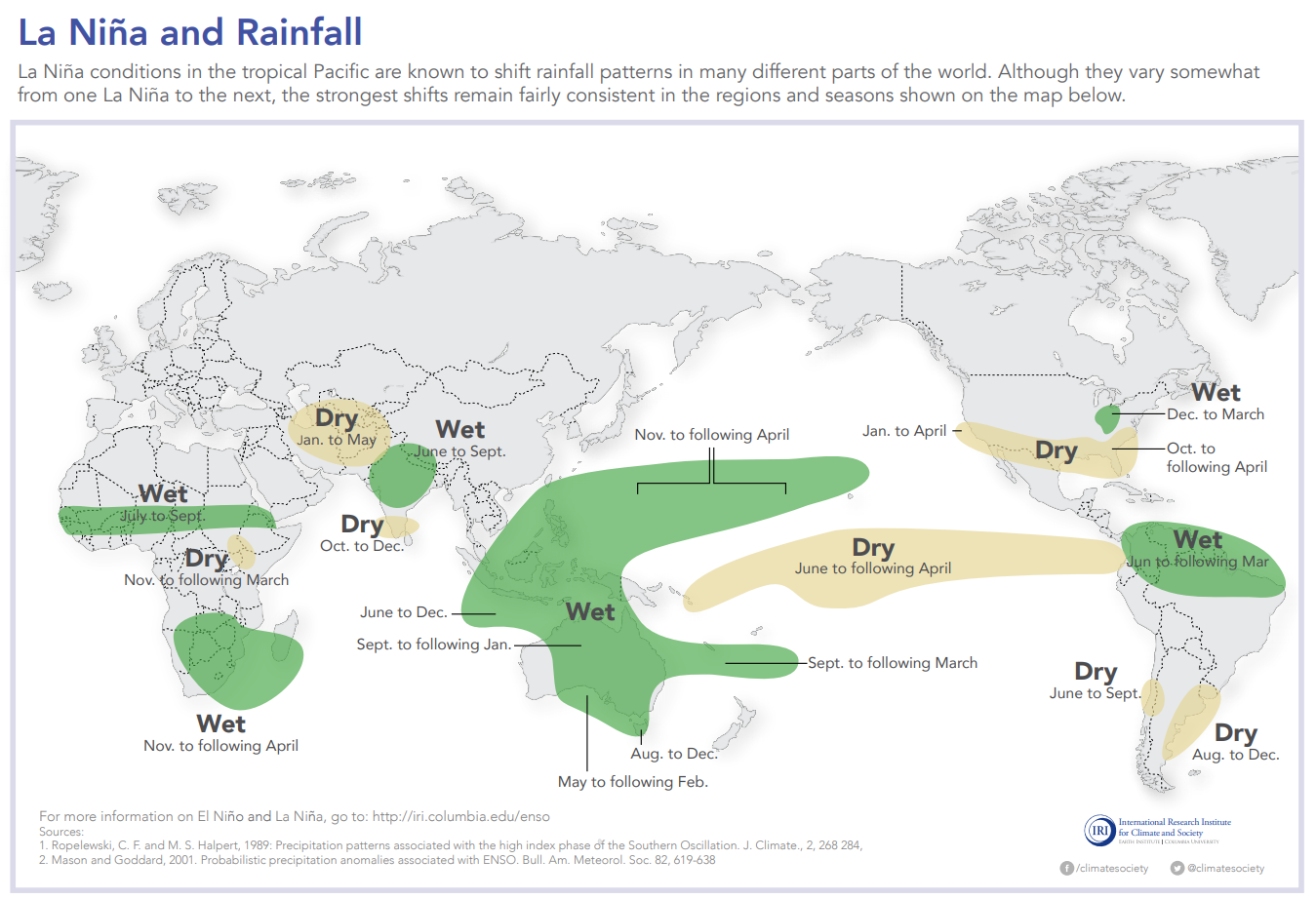
The effects of ENSO are often called teleconnections, emphasizing that changing conditions in one part of the world can affect areas far from the source.

The impacts of ENSO on the United States are most noticeable in the cold season.
.GIF)
Narratives About El Niño and La Niña Impacts (from CPC)
The Climate Prediction Center discusses how weather patterns are affected by ENSO.
Will your area have an increased or decreased risk of temperature or precipitation extremes?
Composites - Local Impacts
Temperature/Precipitation Impacts by ENSO Phase
Temperature/Precipitation Probabilities During La Niña
Box and Whiskers Analysis by Climate Division
Selectable ENSO Response (from PSL)
Other Impact/Teleconnection Links
Climate Prediction Center (CPC) - ENSO Impacts Page
Physical Sciences Laboratory (PSL) - Global Composites and Extremes
Current Hazards
National Outlooks
Tropical
Local Storm Reports
Storm Reports (Graphical)
Submit Storm Report
Tornado Warnings
Severe Thunderstorm Warnings
Flash Flood Warnings
Forecasts
Forecast Discussion
Graphical Forecast
Aviation Forecasts
Fire Weather
Hazard Planner
N. Texas Convective Parameters
US Dept of Commerce
National Oceanic and Atmospheric Administration
National Weather Service
Fort Worth/Dallas, TX
3401 Northern Cross Blvd.
Fort Worth, TX 76137
817.429.2631
Comments? Questions? Please Contact Us.


.GIF)
.GIF)