|
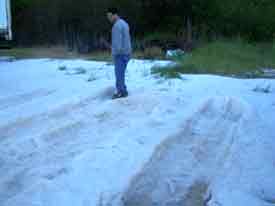
Around 3 PM, strong thunderstorms began forming in southern Parker and northern Erath counties. These storms quickly became supercellular and split into several individual storms. This activity generally moved east at around 35 mph. The strongest storms of the afternoon occurred over Dallas, Johnson, and Ellis counties. Quarter size hail was reported at 3:20 PM in Weatherford. Hail reports continued as the storms moved across the Dallas Fort Worth metroplex, ranging from marble to quarter size. Most impressive was not the size of the hail, but the quantity that fell! Drifts of hail up to 1 foot deep were common just south of the metroplex. A second tornado occurred west of Alvarado, in Johnson County, at approximately 4:25 PM. Brief tornadoes were reported near Mansfield; between Cedar Hill and Midlothian; and near Maypearl in Ellis county at 5:00. Damage to tree limbs, television antennas, and outbuildings resulted from this activity. |
|
|
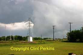
Supercell in Ellis County at 5:02 pm CDT |
|
|
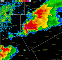
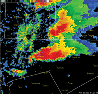 Supercells in Tarrant/Johnson counties at 4:32 pm CDT |
|
|
|
|
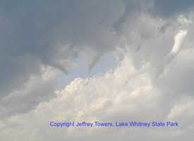
Wall Cloud near Miller Brewery |
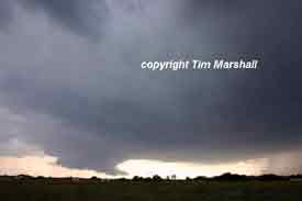
Wall Cloud in Southwest Ft. Worth |