Below are some images from our storm surveys of wind and tornado damage.
The radar images come in pairs:
Click here for a map of damage paths and ratings polygons.
Most Tornadoes in January by Year for Our North and Central Texas Counties:

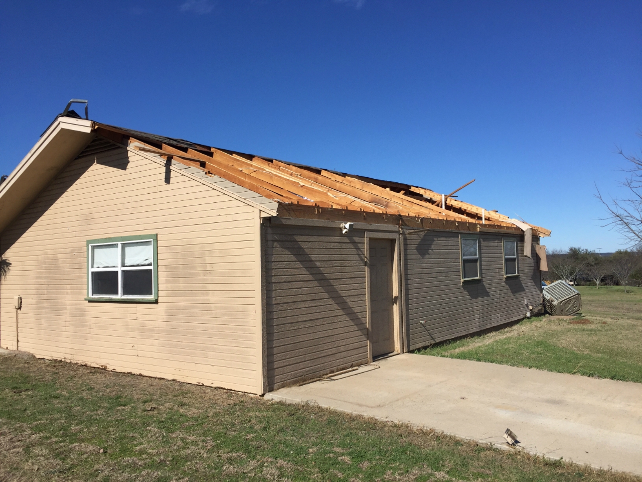
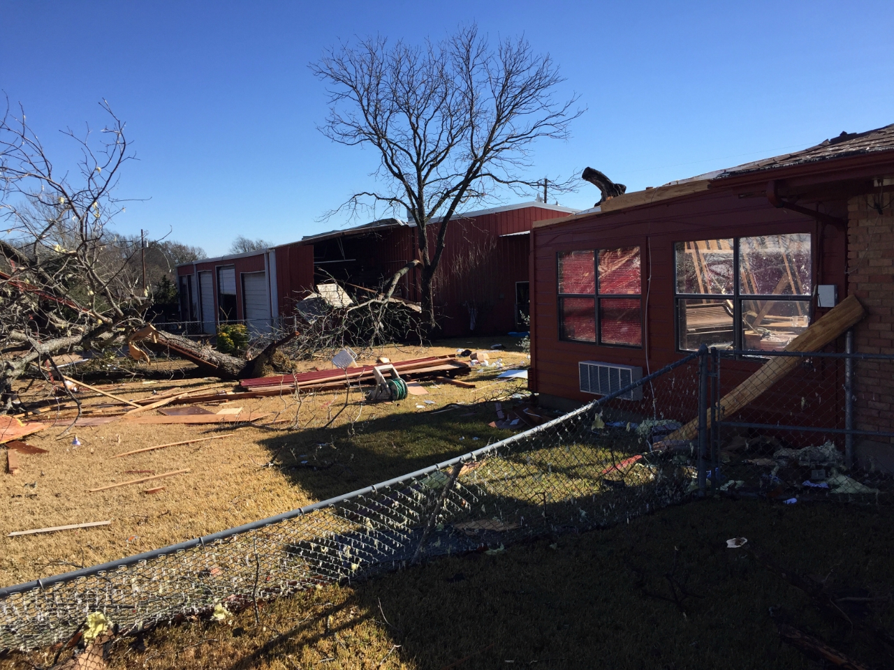
Confirmed tornado: EF-2 (115-120 mph)
Radar images from the Central Texas NWS radar at 5:41 pm CST. The radar is located beyond the bottom of the images.
This tornado damaged a few houses in the Coryell City area along CR 273 and CR 262. The heaviest damage was near CR 273, where two houses lost most of their roofs. Several barns, storage sheds, and farm machinery was damaged as well. The debris field extended to the north and northwest, where several power poles were broken. The tornado continued over ranch land in Coryell County before dissipating near Mosheim in Bosque County.

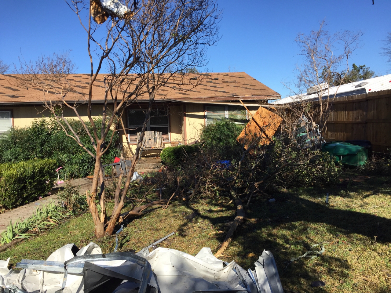
Confirmed tornado: EF-1 (90-95 mph)
Radar images from the NWS radar in Fort worth at 6:03 pm CST. The radar is located at the top of the image. In the reflectivity image the surface circulation was not well defined but in the SRM image the two opposing wind flows were evident.
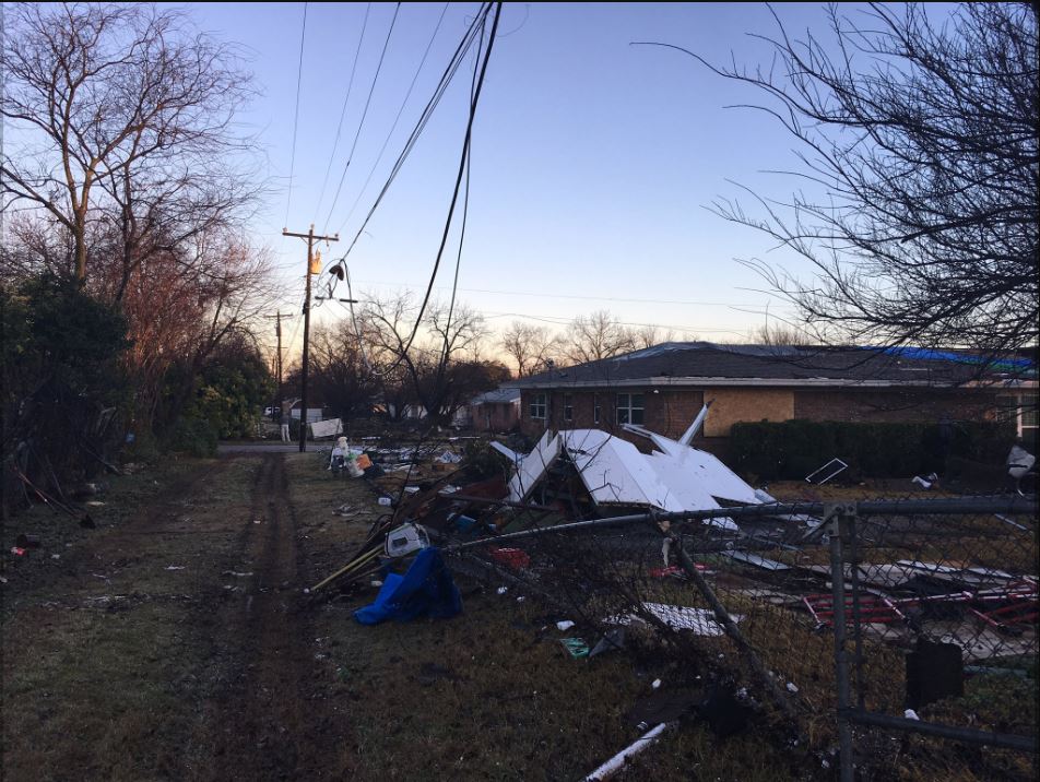
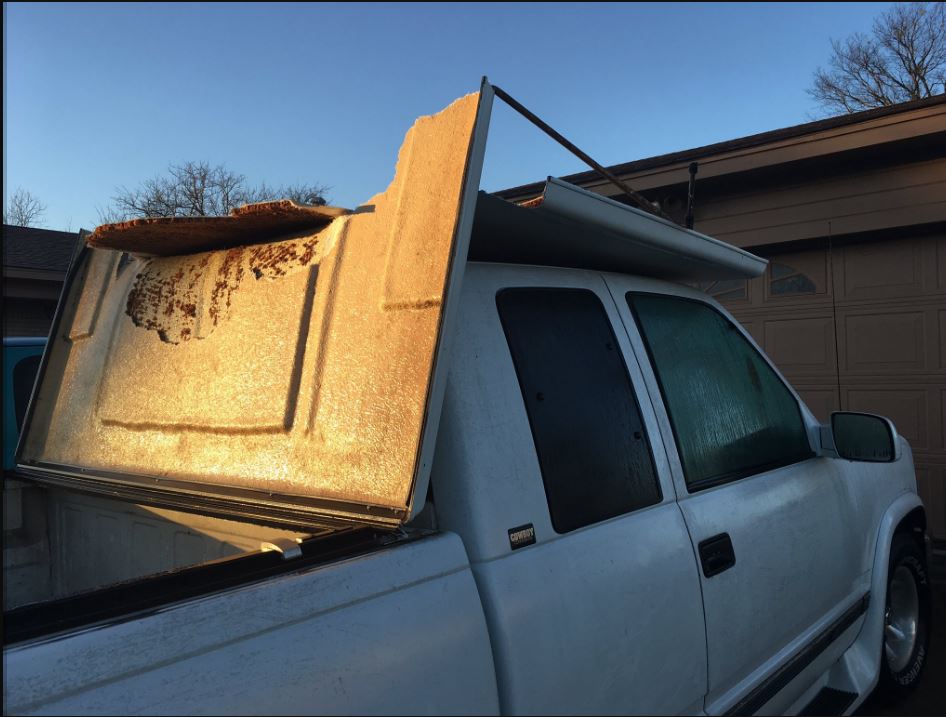
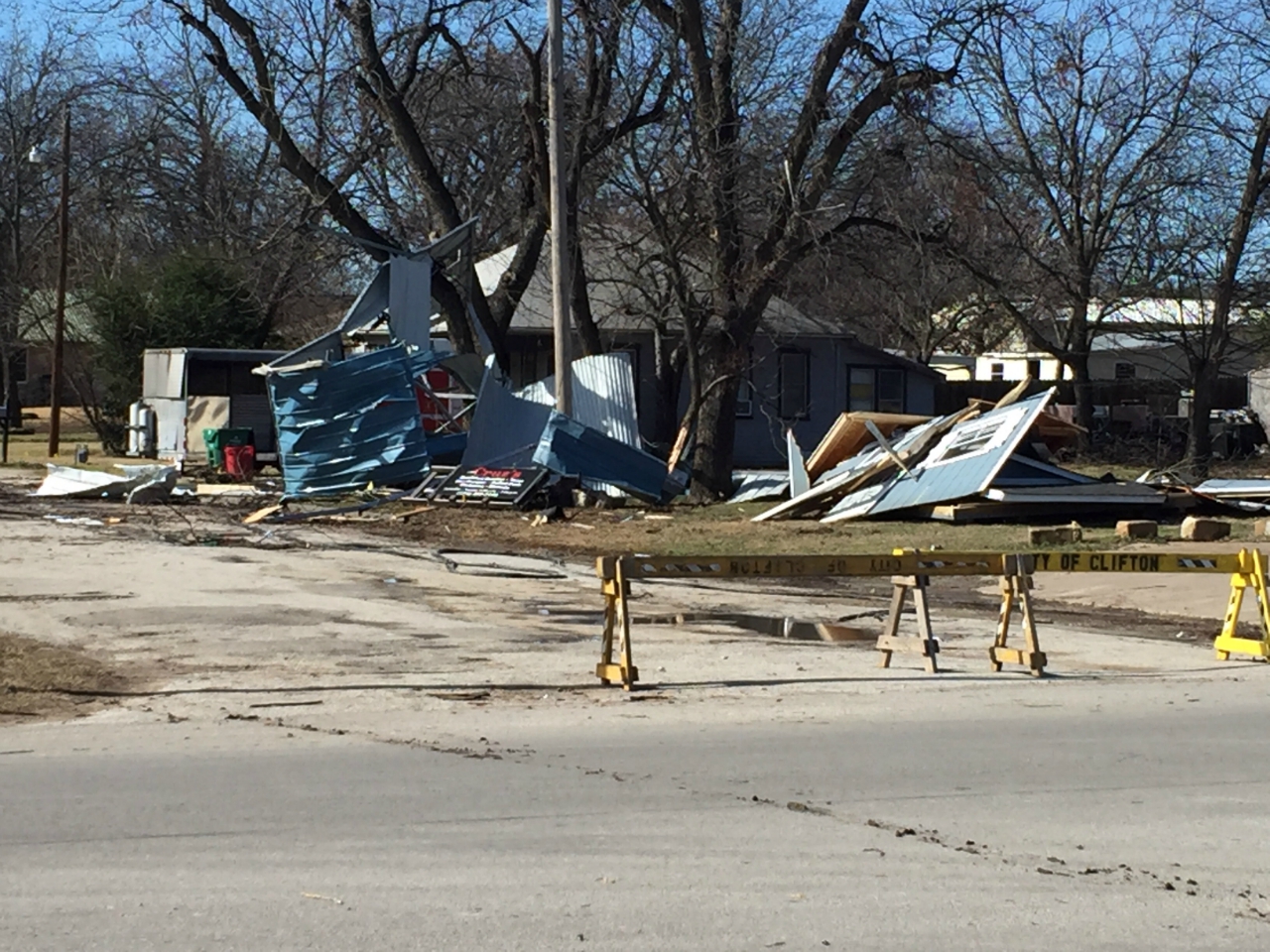
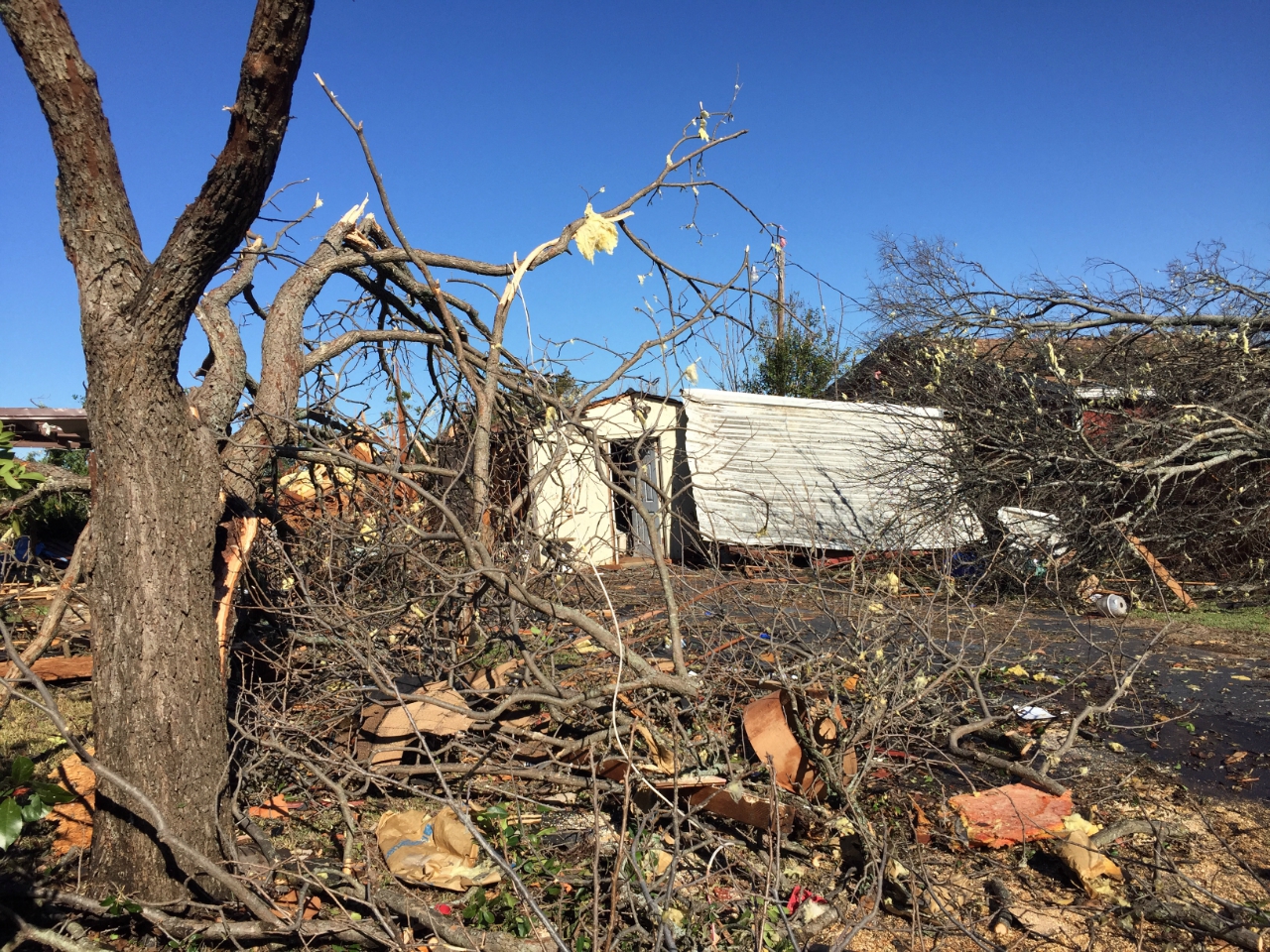
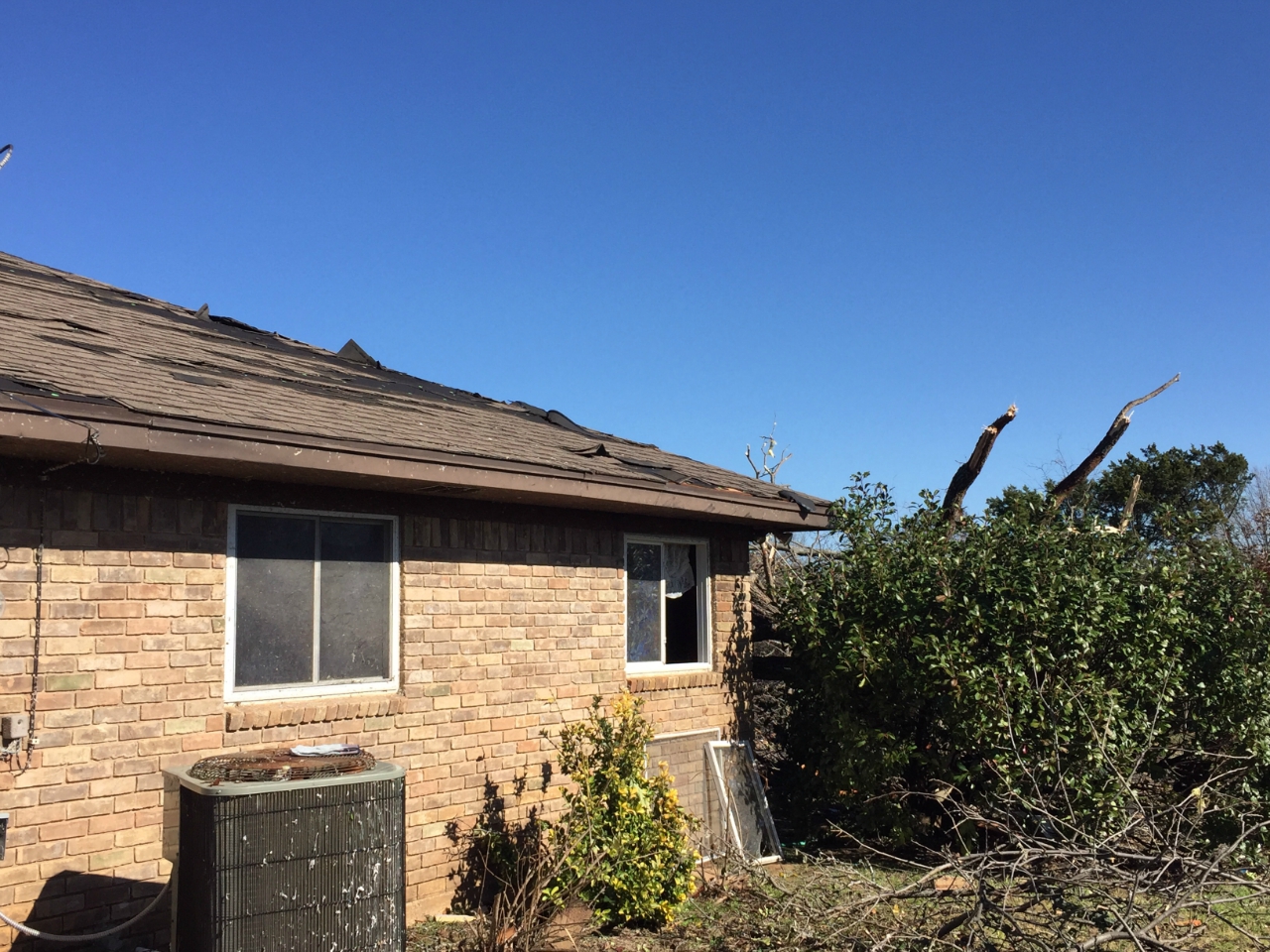
The tornado began on the south side of Clifton, just off of 23rd Street, where several trees were uprooted and several homes suffered roof damage. This tornado produced a narrow path of damage to the north side of town, either roof damage from the tornado or from tree or other debris hitting the houses.
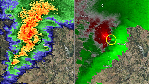
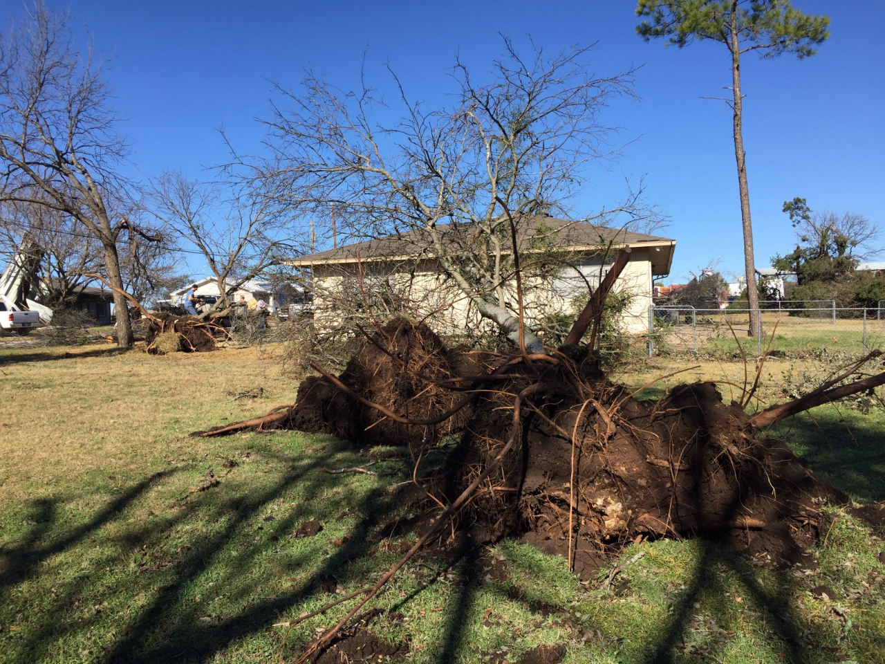
Confirmed tornado: EF-1 (90-95 mph)
Radar images from the NWS radar in Fort Worth at 6:48 pm CST. The radar is located at the top of the image. In the reflectivity image the tornado is on the leading edge of the parent thunderstorm. The SRM image clearly indicated rotation.
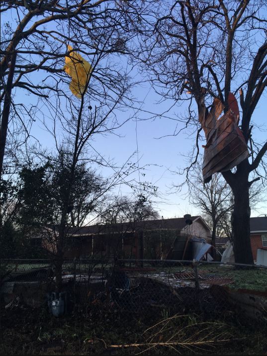
The tornado started on the far eastern side of Bosque County, near Laguna Park. The tornado then crossed over Lake Whitney before damaging several homes on the east side of the lake in far western Hill County. The heaviest damage was concentrated in Hill County, along both sides of FM 1713 near CR 1236. Numerous homes were damaged by the tornado, as were a church and a marina. Most homes in this area suffered roof and shingle damage, with at least 10 homes suffering major damage.
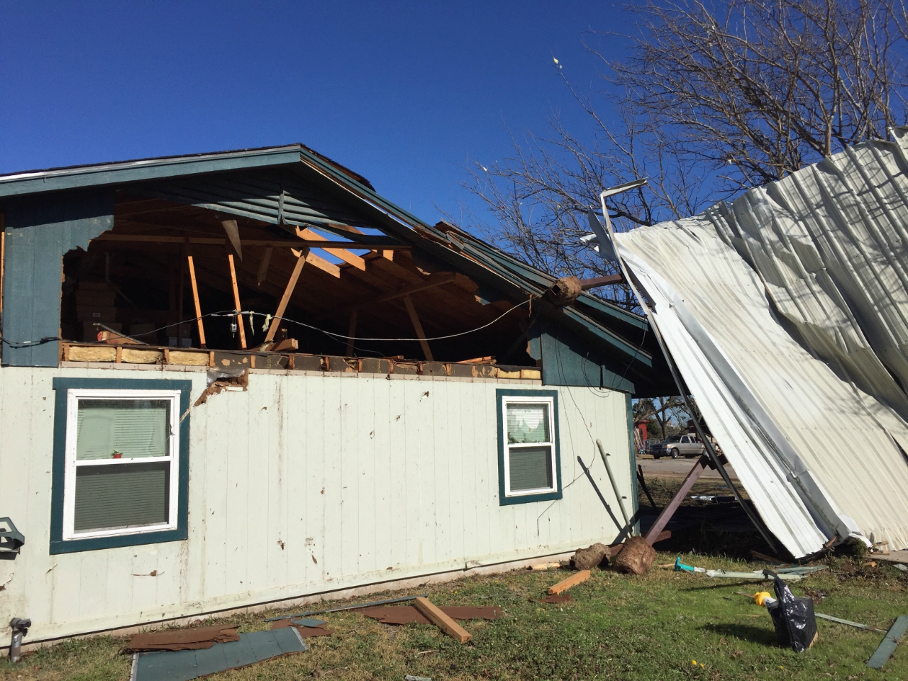
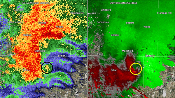
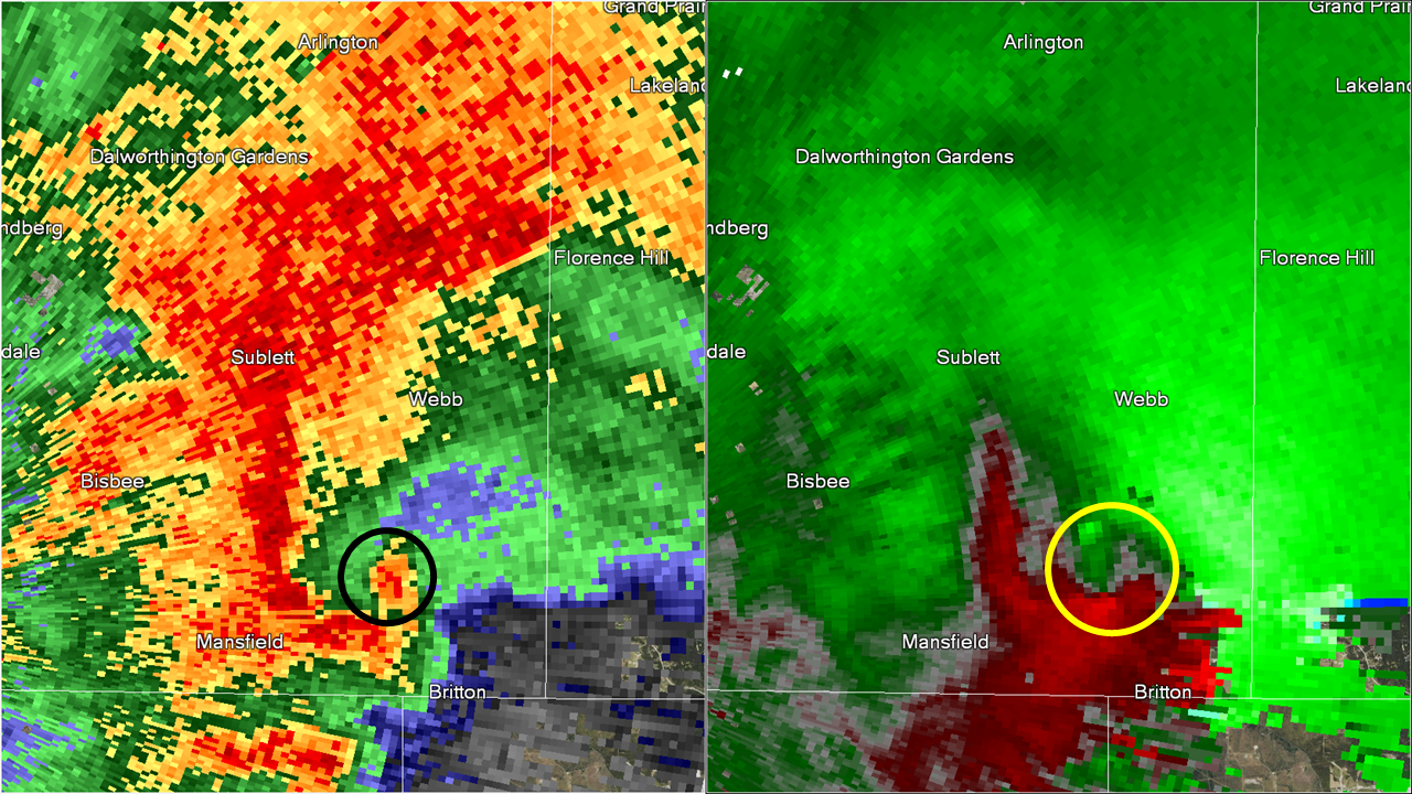
Confirmed tornado: EF-0 (70-75 mph)
Radar images from the NWS radar in Fort Worth at 8:11 pm CST (Johnson County) and at 8:20 pm CST (Tarrant County). The radar is located near the left edge of the images.
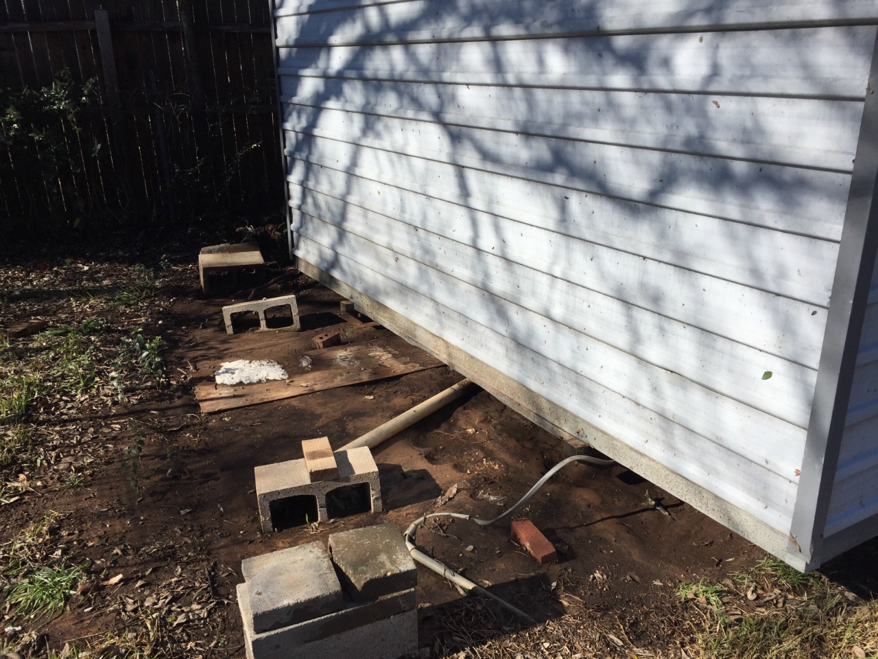
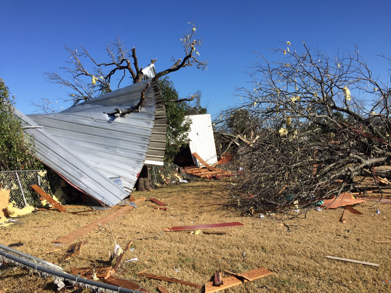
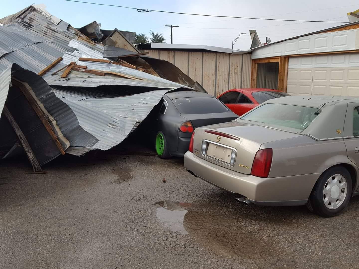
A weak tornado occurred in the far northeastern corner of Johnson County, beginning just west of Lone Star Road and Main Street in far southern Mansfield. The tornado damaged metal buildings on the south side of Lone Star Road as well as one house. The storm then moved northeast across Highway 287, damaging one barn just over the county line off of Mitchell Road.

Confirmed tornado: EF-0 (80-85 mph)
Radar images from the NWS radar in Fort Worth at 8:40 pm CST. The radar is located beyond the bottom left corner of the images.
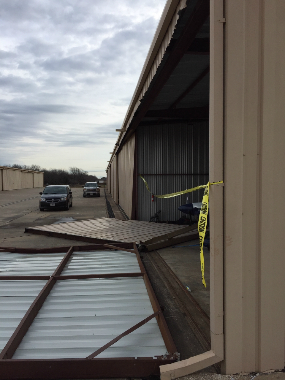
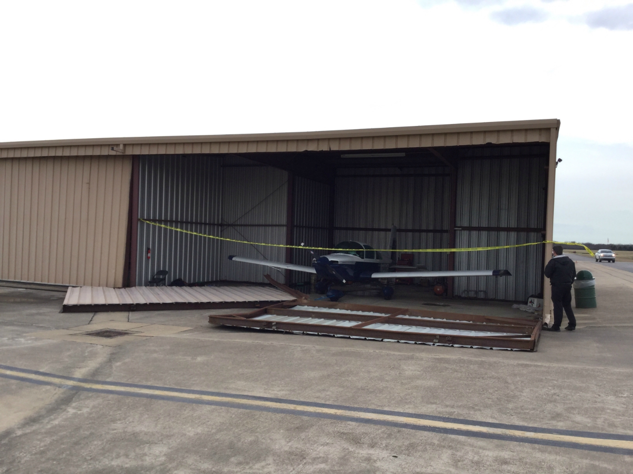
Weather equipment at Grand Prairie Municipal Airport (Tarrant County) measured a wind gust of 63 mph. Based on wind damage surveyed at the airport, the peak winds were estimated at 80 mph.
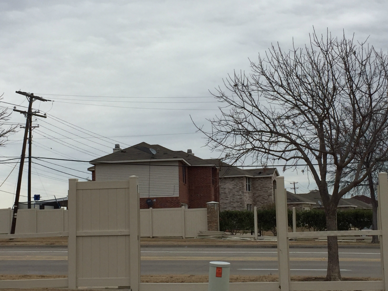
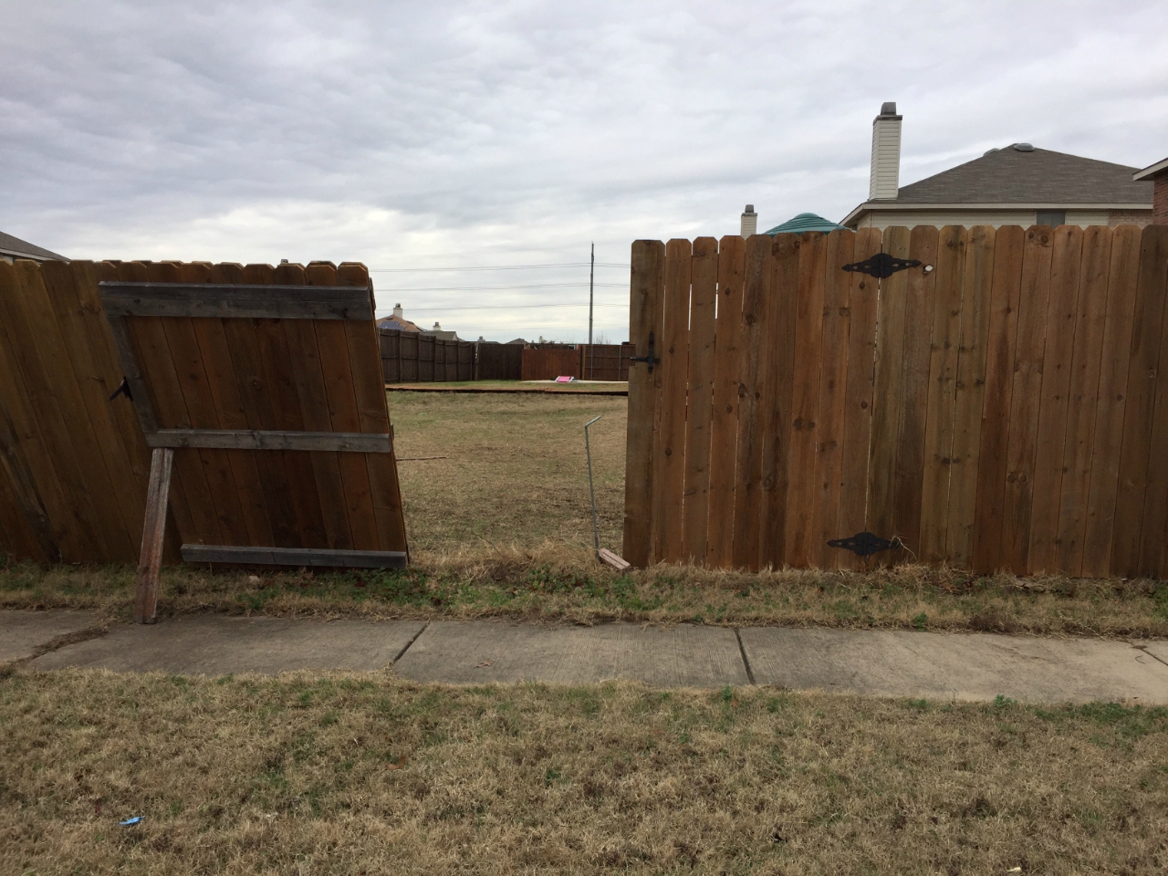
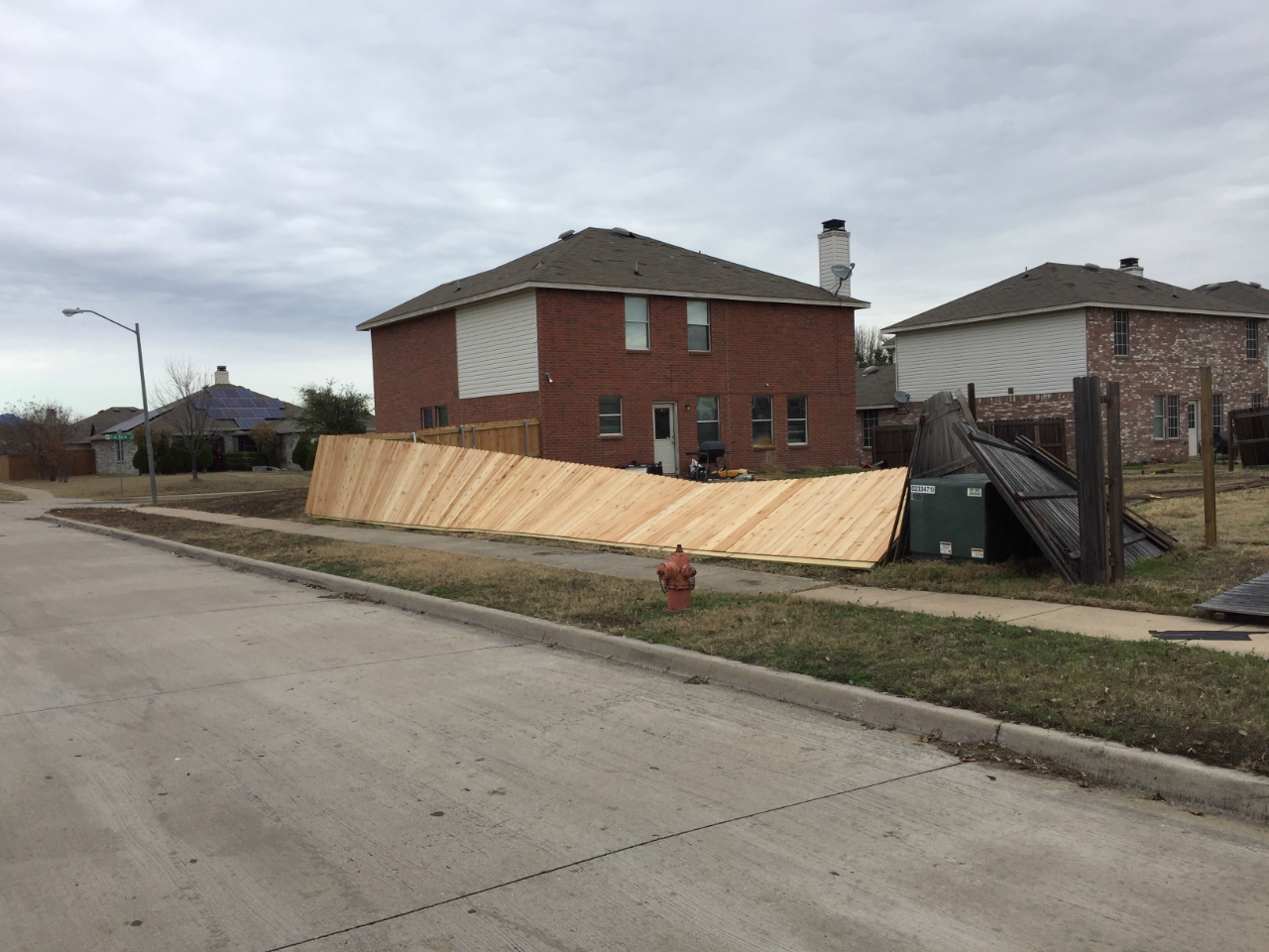
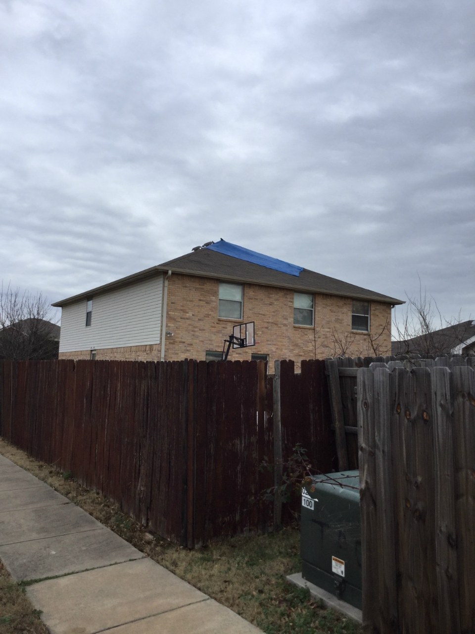
Storm spotters and airport observers reported a tornado near the airport. Damage to homes east of the airport (in Dallas County) was indicative of EF-0 tornado damage, estimated at 65 to 85 mph.
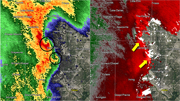
Confirmed tornado? No
Another example of why we have storm spotters. The reflectivity image indicated a "hook" shape, which can indicate a tornado. However, the SRM image did not indicate rotation.
At 9:20 pm CST, the two "hooks" were on the leading edge of straight line winds associated with the line of thunderstorms. Damage occurred along 635 in north Dallas.

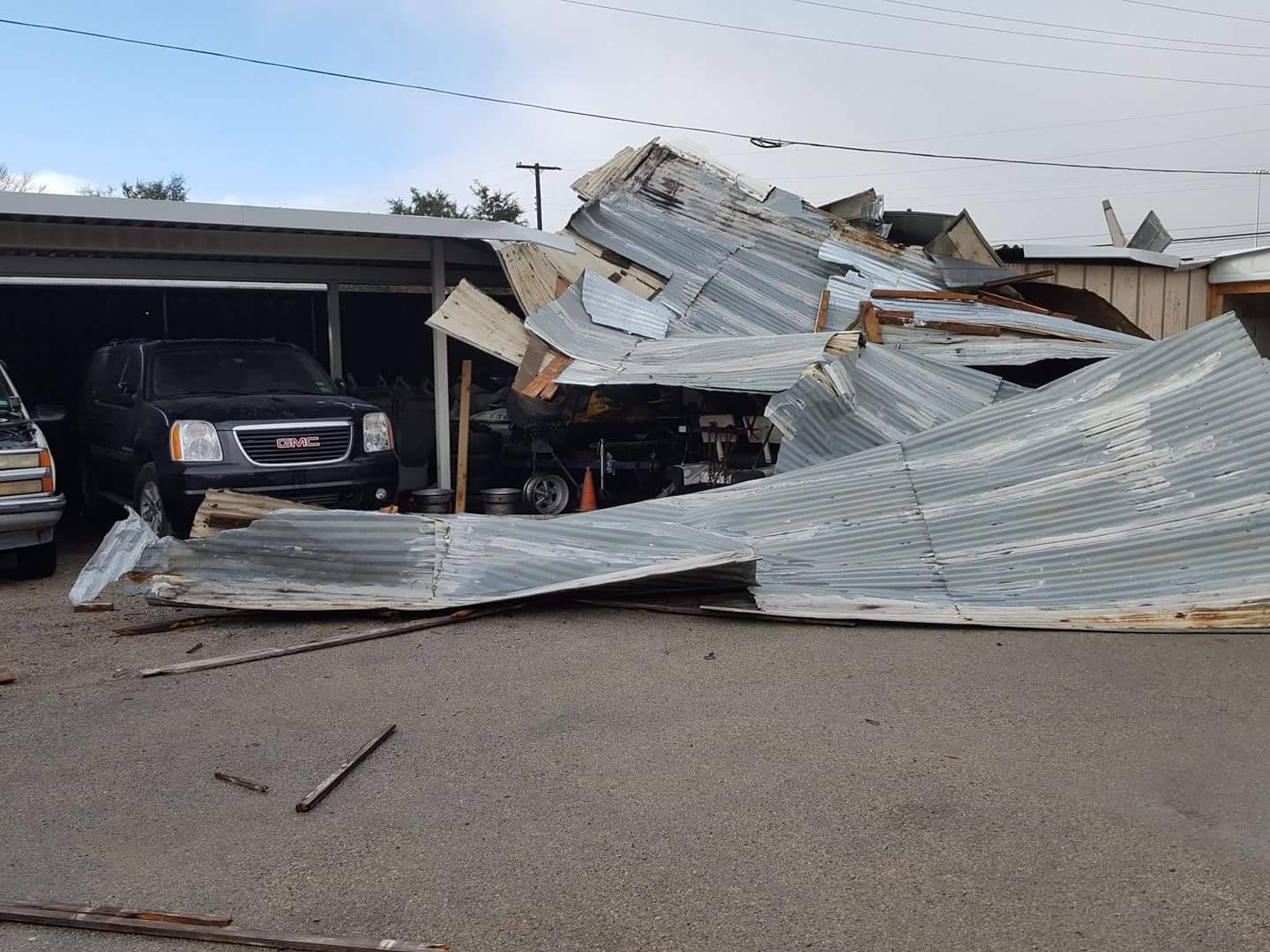

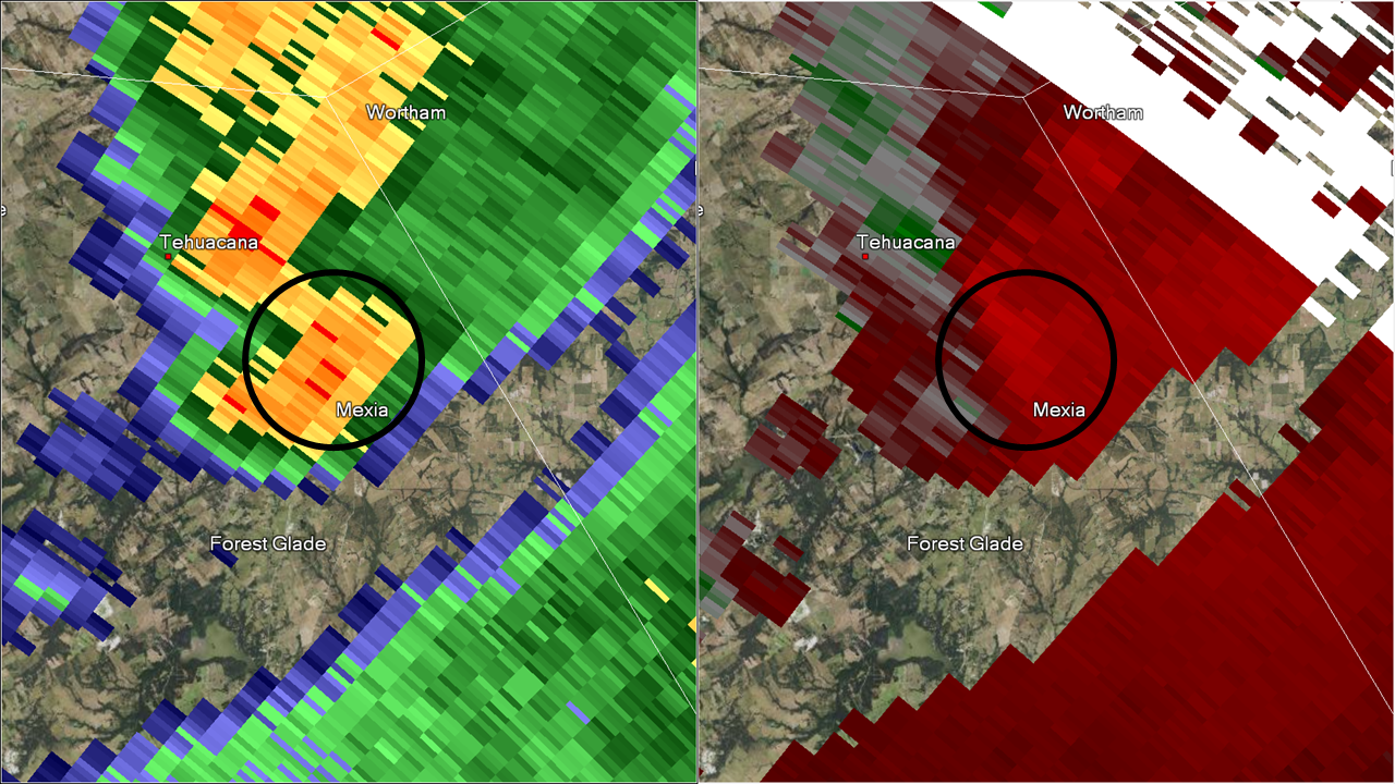
Confirmed tornado: EF-1 (90-95 mph)
Radar images from the Central Texas NWS radar at 2:44 am CST. The radar is located beyond the bottom left corner of the images.
Damage consistent with EF-1 winds occurred to the Mexia State Supported Living Center (MSSLC) along Highway 171 and FM 2838 during the early morning hours of January 16. At least 6 buildings were damaged, with one likely destroyed. The tornado began at 2:43 am CST south of the center of town at a tree farm. It then moved through the southeastern side of the MSSLC campus before dissipating a few miles to the north at 2:48 am CST.

