|
Widespread Severe Weather Including Isolated Tornadoes Strike North and Central Georgia
March 18th, 2013
|
A strong upper level system combined with a moist south to southeast flow to result in widespread severe weather including damaging winds, large hail, and isolated tornadoes. As is usually the case this time of year, all of the ingredients came together with moderate instability, a cold pool aloft, and enhanced surface convergence along and ahead of a cold front moving through the Deep South. Initial storm development was delayed from earlier model projections which allowed instability values to build through the early afternoon hours. This allowed for more robust updrafts which were able to transport the strong low level wind core to the surface and produce widespread wind damage to property, trees, and powerlines. Although the low level turning of the winds was not quite as impressive as in previous systems, it was sufficient to produce an isolated tornado. Perhaps the most impressive part of this system was the incredible amount of hail it produced with several reports of baseball sized hail and lasting images of hail covered roadways resembling more of a winter time scene. Lets take a quick look at the setup for the event.
Surface analysis showing a strong cold front moving through the Deep South. Also note the retreating wedge front which acted to keep northeast Georgia shielded from the most substantial activity.
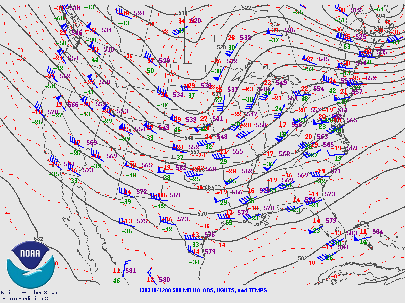
500MB map on the morning of the 18th showing large scale trough digging from the Central Plains into the Deep South.

850MB map which shows the strong winds over Mississippi and Alabama in the morning which would move into the area for the afternoon.

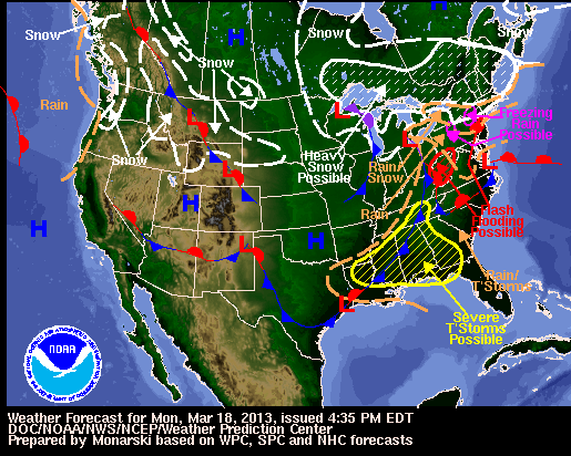
Severe thunderstorms were in the forecast including large hail, damaging winds and isolated tornadoes.

Severe thunderstorm reports from March 18th showing all but northeast Georgia affected by this storm system.
Results from the NWS Survey Teams:
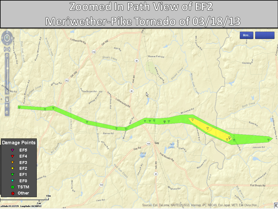
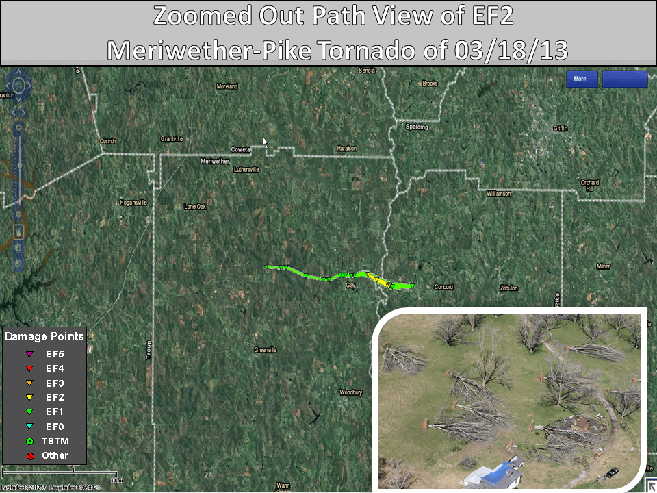
Meriwether and Pike County Tornado
Rating: EF-2
Max wind speed: 120 mph
Path length: 13.35 miles
Path width: 300 yards
Injuries: 0
Deaths: 0
Start time: 6:10 PM
End time: 6:30 PM
Begin point: 33.143743N/-84.676504W
End point: 33.089763N/-84.454884W
Movement of the tornado was east-southeast. Two out-buildings and one barn were destroyed. There were thousands of trees blown over or snapped. A few of the trees fell on homes.
|