As was the case for many parts of the country, north and central Georgia experienced its share of extreme weather in 2011. From a crippling snow/sleet storm in early January to a historic tornado outbreak in late April, to one of the hottest summers on record, the region was certainly subjected to a variety of extraordinary conditions.
January began on a mild note, but this was abruptly reversed by an arctic outbreak on the 8th, followed by a record setting winter storm on the 9th-10th. An upper level disturbance tracked across the northern Gulf of America dumping 8.8” of snow on Athens, while Atlanta received a snow and sleet mix totaling 4.4”. This was the most snow from a single storm in Athens on record, and the greatest storm total in the capital city since January 2nd-3rd, 2002. Colder than normal temperatures lingered through much of the month until unseasonably mild conditions arrived for the final 4 days. On the 29th, Columbus and Macon soared to high temperatures of 73°F and 72°F, respectively, followed the next day by Atlanta reaching 70°F and Athens 73°F. Although not records, the warmth was a welcomed relief from a colder than average month. Monthly averages ranged from 39.7°F in Athens to 43.6°F in Columbus which were -2.5°F and -3.2°F from the normal, respectively. Consequently, the abundance of dry, cool air masses for much of the month led to precipitation deficits in all four cities. Departures from normal ranged from -1.37” in Athens to -2.40” in Atlanta.
|

|

|
|
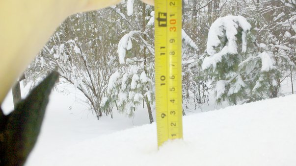
January Snow Storm
Crawford, GA
|
January Snow Storm
Dalton, GA
|
The late January thaw was short-lived, as colder than normal temperatures returned on February 2
nd-3
rd, then persisted into mid-month. However, the second half of February experienced a remarkable rebound in temperature as daily averages climbed to as much as 14-18 degrees above normal. This was in response to a strong southwesterly low-level flow which pushed high temperatures into the mid and upper 70s, and to as high as 80°F on the 19
th. In fact, Macon recorded 80°F on the 19
th, 22
nd, and 27
th. Columbus also reached 80°F on the 19
th, and 79°F on the 22
nd and 28
th. Among these temperatures were record highs in Columbus on the 19
th (previous 79°F, 1956), and 79°F on the 22
nd tying the old record set in 2005. Unseasonably mild conditions persisted through the remainder of February pushing monthly averages well above normal. Departures from normal were +3.3°F in Atlanta, +2.6°F in both Athens and Columbus, and +2.2°F in Macon. With regard to precipitation, only Atlanta posted a rainfall deficit for the month, registering a departure from normal of -0.43”. On the 4
th, a stalled front across Georgia, combined with a surge of moisture ahead of a second system over southeast Texas produced daily rainfall totals of 1.38”, 1.55”, 2.09”, and 2.54” in Atlanta, Athens, Columbus, and Macon, respectively. These set new records for both Columbus and Macon, breaking the previous mark of 1.76” and 2.21” from 1959.
Even though, Columbus and Macon fell short of their average rainfall in March by 0.45” and 0.87”, respectively. Abundant rainfall accumulated in Atlanta and Athens, as both recorded totals well above average. An inch or more fell on 5 separate days in the capital, along with 3 occurrences in Athens. Monthly totals of 9.06” and 6.65” in Atlanta and Athens, respectively, were 3.68” and 1.66” above their averages. The mild temperatures also persisted with Atlanta failing to record a freezing temperature during the entire month. This was the first March since 1989 in which Atlanta didn’t record a temperature of 32°F or below. In fact, February 12
th would be the capital city’s last freeze date of the season, and the earliest since 1945. Monthly departures from normal ranged from +1.2°F in Athens to +2.7°F in Columbus. In addition, Macon tied a record high on the 19
th from 1963 when the mercury reached 88°F.
In April, a fading tropical Pacific La Nina episode contributed to conditions remaining mild and dry. The increased warmth produced record and near record high temperatures on the 9
th and 10
th. Atlanta tied a record from 1995 with 86°F on the 9
th, while Columbus missed theirs by 1 degree with 88°F. The next day, Athens fell short of their record by one degree while also reaching 88°F. Remarkably, this unusually warm April also witnessed high temperatures of 90°F and 91°F on the 27
th in Columbus and Macon, respectively. Furthermore, three days earlier Columbus had already achieved a high of 90°F. By month’s end, all four locations posted well above normal monthly averages. Departures from normal were +3.7°F in Atlanta, +3.2°F in Athens, +4.7°F in Columbus, and +4.0°F degrees in Macon. This excessive warmth helped fuel three severe weather events occurring on the 4-5
th, 15-16
th, and 27-28
th. All 3 produced tornadoes in Georgia with the 27-28
th April outbreak being of historic proportion. In fact, this 13 state tornado outbreak produced nearly 300 tornadoes and was the most extensive since the “Super Outbreak” of April 3-4, 1974. However, the additional warmth and severe weather wasn’t accompanied by sufficient enough precipitation to offset a drier than average month in all four locations. Rainfall deficits ranged from -0.56” in Atlanta to -2.17” inches in Columbus. Consequently, by the end of April, moderate drought conditions were creeping northward and into northern Georgia.
|

|

|
|
April Tornado Outbreak
Damage in Catoosa County, GA
|
April Tornado Outbreak
Damage in Catoosa County, GA
|
The drought intensified in May, as Athens, Columbus, and Macon all received less than an inch of rainfall. Monthly totals were 0.82”, 0.65”, and 0.66”, respectively. These sparse amounts represented deficits of 3.04”, 2.97”, and 2.32” in each of the 3 cities, while Atlanta too recorded a deficit of 1.02”. On the other hand, temperatures during the month experienced two swings between much below and much above average readings. For example, high temperatures ranged between the mid 60s and low 70s in the middle of the month to the lower and upper 90s by the end of the month. The warmer than normal final 11 days dominated, however, as all four cities again posted above average monthly readings. Departures from normal ranged from +1.1°F in Atlanta to +1.3°F in both Athens and Macon to +1.7°F in Columbus. The 90°F plus high temperatures along with little or no rainfall brought the return of severe to extreme drought conditions to much of Georgia by the 1
st of June. The early heat wave during the end of May was only a hint of things to come. A large persistent upper level ridge of high pressure became entrenched over the south-central U.S. for the next 3 months, resulting in the 2
nd hottest summer on record for Georgia. In the first 6 days of June, Columbus and Macon recorded high temperatures which reached or exceeded the century mark 4 and 3 times, respectively. Of these, 3 broke records in Columbus on the 1
st-3
rd, and one set the new mark in Macon on the 3
rd. Macon also tied their record from 1953 and 1945 on the 1
st when the mercury reached 100°F. June also tallied the 2
nd most 90°F or above maximum temperatures in the capital city with 24. With a monthly average of 81.2°F, Atlanta also tied 1981 and 1943 for their 3
rd warmest June on record. In Columbus, a sultry 84.4°F monthly average dwarfed their previous warmest June of 1998 by 0.8°F. Following this trend, Macon with a monthly average of 82.9°F had its 2
nd warmest June, eclipsed only by 1952. As a result, monthly departures were rather astounding with +4.4°F, +4.7°F, +5.2°F, and +4.9°F in Atlanta, Athens, Columbus, and Macon, respectively. Unlike the heat, rainfall was somewhat in short supply for June. All four cities recorded deficits ranging between 1.50” in Athens and 0.78” in Macon.
July and August too, posted rainfall deficits 7 out of 8 times in the 4 cities, and generally on a grander scale. Only Columbus, with 5.05” of precipitation in August received a surplus (+1.28”) in these two months. In fact, July rainfall of 1.46” in Athens, followed in August by 1.51” in Atlanta and 1.41” in Macon, represented totals well below half of their respective averages. The heat was also unrelenting as monthly average temperatures remained well above normal in all 4 locations through August. All were warmer than average by 2 degrees or more through the period, with Athens leading the way in July at +3.2°F, proceeded in August by Atlanta and Columbus at +3.6°F. June through August would prove to be the warmest summer on record for Athens and Columbus, while Macon experienced their 2
nd warmest and Atlanta tied 2010 for 3
rd warmest. By the end of August most of Georgia was under a severe to extreme drought. Highs in the mid to upper 90s persisted into the first 3 days of September, but then welcomed relief arrived. A series of early polar fronts sweeping through on the 4
th and 15
th cooled daytime highs to the upper 60s and 70s, while providing overnight lows in mid and upper 50s to low 60s. The fronts, while stalling across south Georgia did help to provide above average monthly rainfall for Columbus (+0.50”) and Macon (+0.37”). However, the beneficial rain occurred mostly to the south of Atlanta and Athens, as both cities again recorded substantial deficits. Atlanta’s monthly rainfall of 2.30” was -2.17” below normal while Athens with just 1.55” recorded a deficit of -2.39”. However, the arrival of the first polar air masses of the season cooled temperatures enough to result in monthly averages below normal in Atlanta (-0.3°F), Columbus (-1.0°F), and Macon (-0.2°F). This was the first cooler than normal month since January in any of these 3 cities.
By the onset of September, La Nina conditions had re-emerged in the tropical Pacific. Characteristically, this resulted in an overall warmer and drier October through December period. However, the onslaught of cool air masses persisted through October providing another rare month with a below average temperature. Departures from normal were all below average in Atlanta (-1.2°F), Athens (-2.7°F), Columbus (-2.5°F), and Macon (-3.6°F). As far as precipitation was concerned, an isolated record rainfall in Athens on the 11
th drenched the city with 2.46”. This surpassed the previous record for the date of 2.03”, set in 1934. It also contributed to a monthly total of 4.35”, which represented a surplus of 0.80”. Whereas, Atlanta, Columbus, and Macon didn’t share in Athens’ fortune, their rainfall totals were rather paltry, resulting in huge monthly deficits of -1.71”, -1.86”, and -1.57”, respectively. In line with La Nina, a record high of 85°F was set in the capital city on the 18
th, breaking the old record from 1920 of 84°F. Record warmth was also achieved in November as two more records fell in Atlanta. With daily averages running 10 to 17 degrees above normal during the 2
nd half of the month, the mercury climbed to 77°F on the 21
st and 22
nd. This eclipsed the previous records of 76°F (1942) and 74°F (1979), respectively. November ended with monthly averages at or near normal in Macon (0.0°F) and Athens (+0.1°F) and 1.7°F and 1.3°F above in Atlanta and Columbus, respectively. The warmth though was mostly accompanied by drier than average conditions, as the 4 cities once again recorded monthly deficits. Departures from normal ranged from -1.61” in Atlanta to -0.19” in Macon.
In December, a moderate strength La Nina lived up to its expectations, as milder than normal conditions prevailed throughout the month. High temperatures in the 60s were frequent along with an occasional reading in the low to mid 70s. Amazingly, record high minimum temperatures were set in Athens, Columbus, and Macon on the 23
rd when lows were held to 61°F, 62°F, and 62°F, respectively. All these balmy readings contributed to monthly averages well above normal. Departures from normal were +5.1°F in Atlanta, +4.1°F in Athens, +4.5°F in Columbus, and +3.0°F in Macon. Precipitation for the month did end the year on a positive note, however, as Atlanta and Columbus received rainfall surpluses of 0.53” and 0.75”, respectively. Athens was extremely close to normal with only a -0.05” deficit, followed by Macon at just over an inch (-1.01”) below average.