| Previous Month | Next Month |
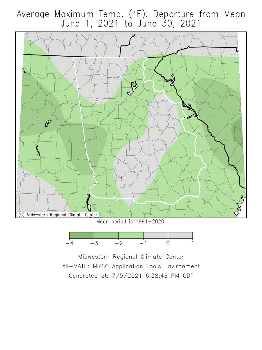
Temperatures through the month of June were near normal. Precipitation through the month of June was around 0 to 3 inches above normal.
Atlanta set a daily rainfall total record during the month of June.
|
June 2021 Climate Averages
|
|||
| Climate Site | June Temp (°F) |
Average Temp
|
Departure from normal
|
|
78.6
|
77.7
|
+0.9
|
|
|
77.6
|
77.9
|
-0.3
|
|
|
78.8
|
80.5
|
-1.7
|
|
|
78.8
|
79.5
|
-0.7
|
|
|
75.6
|
75.6
|
0.0
|
|
|
76.3
|
76.2
|
+0.1
|
|
|
76.6
|
76.9
|
-0.3
|
|
|
76.0
|
75.7
|
+0.3
|
|
|
76.0
|
77.5
|
-1.5
|
|
|
77.2
|
77.5
|
-0.3
|
|
|
June 2021 Temperature Climate Statistics
|
||||
| Climate Site | Maximum Temperature | Max T Date |
Minimum Temperature
|
Min T Date
|
|
Athens
|
96
|
6/14, 6/18
|
56
|
6/1
|
|
Atlanta
|
92
|
6/14
|
61
|
6/1
|
|
Columbus
|
96
|
6/15
|
61
|
6/1
|
|
Macon
|
97
|
6/15
|
54
|
6/1
|
|
Cartersville
|
91
|
6/14
|
57
|
6/17, 6/23
|
|
Dekalb Peachtree Arpt
|
94
|
6/14
|
56
|
6/1
|
|
Fulton Co Arpt
|
94
|
6/14
|
56
|
6/1
|
|
Gainesville
|
90
|
6/12, 6/14
|
56
|
6/1
|
|
Peachtree City
|
92
|
6/14
|
54
|
6/1
|
|
Rome
|
95
|
6/14
|
58
|
6/17
|
|
June 2021 Precipitation Climate Statistics
|
|||
| Climate Site |
Total Precipitation (inches) |
Normal Precipitation
|
Departure
From Normal
|
|
3.97
|
4.88
|
-0.91
|
|
|
6.36
|
4.54
|
+1.82
|
|
|
4.01
|
4.03
|
-0.02
|
|
|
4.43
|
4.44
|
-0.01
|
|
|
3.99
|
3.79
|
+0.20
|
|
|
4.80
|
4.69
|
+0.11
|
|
|
3.00
|
3.84
|
-0.84
|
|
|
3.91
|
4.23
|
-0.32
|
|
|
8.32
|
4.45
|
+3.87
|
|
|
7.00
|
3.80
|
+3.20
|
|
|
June 2021 Precipitation Climate Statistics
|
||||
| Climate Site | Maximum Daily Precip. | Max Precip. Date | ||
|
Athens
|
1.60
|
6/20
|
||
|
Atlanta
|
2.66*
|
6/20*
|
||
|
Columbus
|
1.72
|
6/20
|
||
|
Macon
|
1.96
|
6/20
|
||
|
Cartersville
|
1.06
|
6/5
|
||
|
Dekalb Peachtree Arpt
|
1.97
|
6/20
|
||
|
Fulton Co Arpt
|
1.30
|
6/20
|
||
|
Gainesville
|
1.72
|
6/20
|
||
|
Peachtree City
|
2.78
|
6/20
|
||
|
Rome
|
3.32
|
6/20
|
||
* indicates a daily record was set
Temperature Maps |
Precipitation Maps
|
Temperature Graphs
|
Precipitation Graphs |


|
June 2021 Climate Records
|
|||
|
An all time daily precipitation record was set at ATL on 6/20 with 2.66 inches. This breaks the old record of 1.42 set in 1972
|
June 6th: Oconee/Clarke Storm
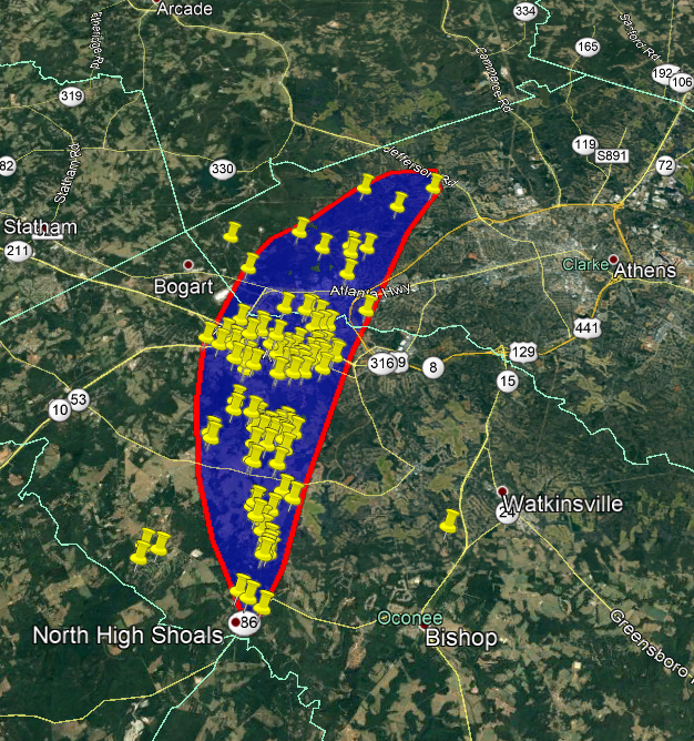
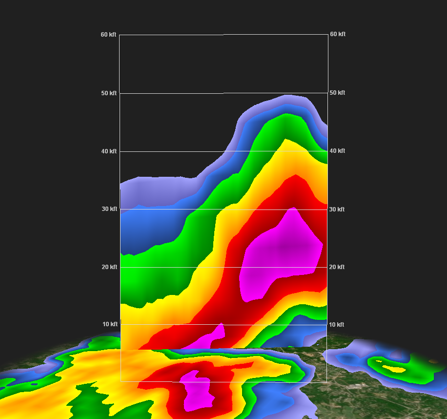
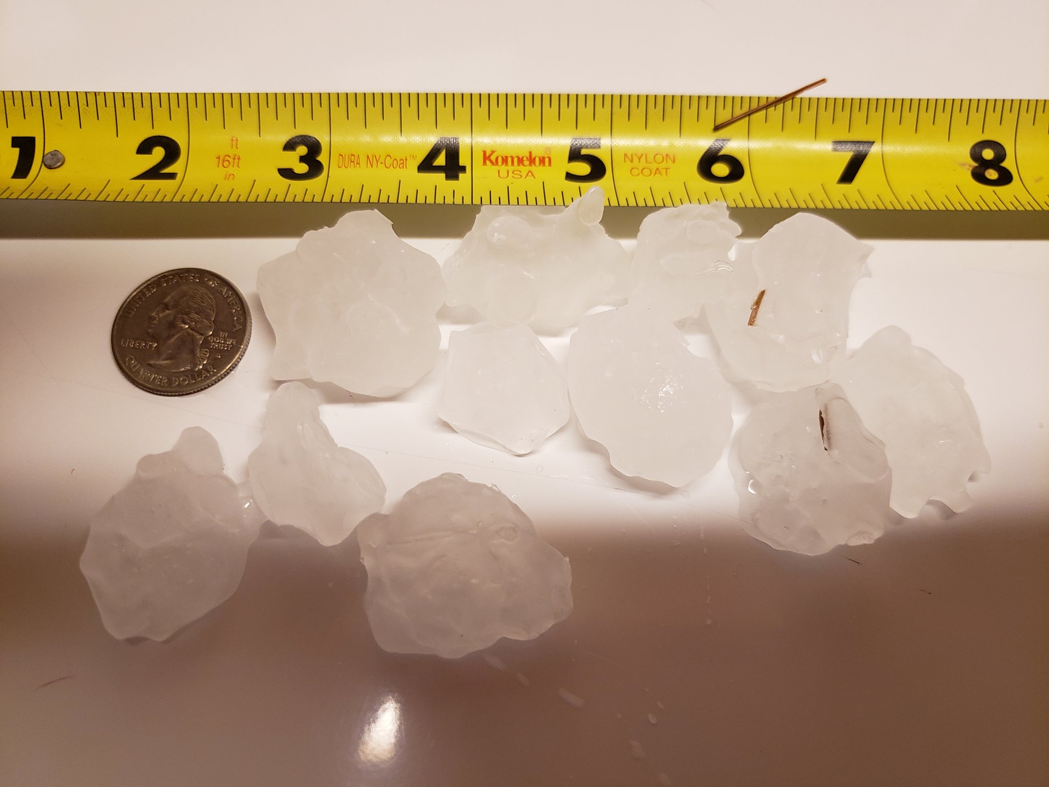
Wind damage occurred with an intense thunderstorm on Sunday, June 6th with winds estimated between 70-80 mph. Numerous damage reports provided by local emergency management (which are mapped below) combined with radar data indicating 60 dBZ above 30 kft indicates that this was a straight line wind event. This storm also produced golf ball sized (1.75") hail in numerous locations.
| Damage Reports | Radar | Hail |
 |
 |
 |
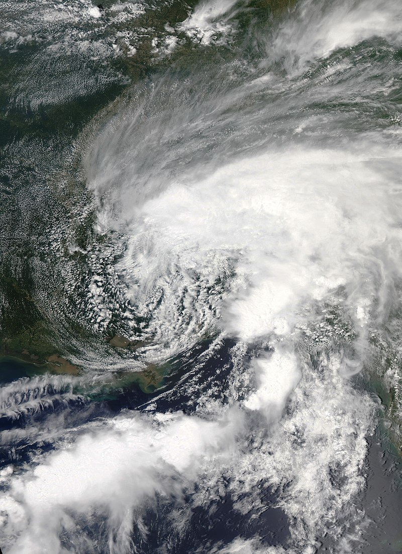
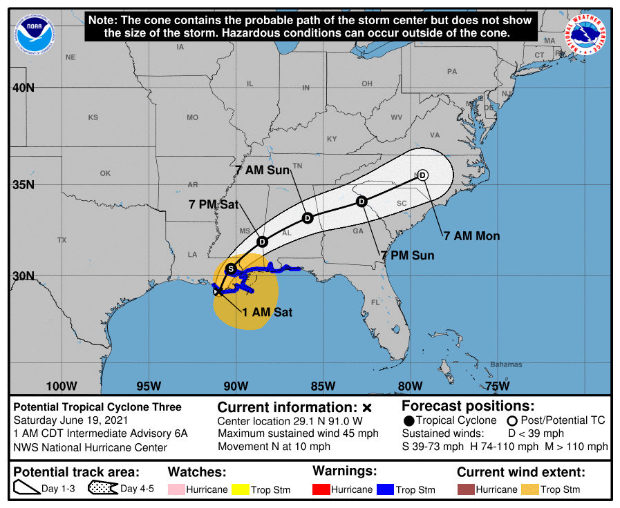
June 19 - 20th:Tropical Storm Claudette
On June 19th and 20th, Tropical Storm Claudette brought heavy rain and tropical tornadoes to the region after making landfall along the north-central Gulf Coast. Significant flash flooding was recorded in Chattooga County near Summerville with multiple roads being reported under water. Brief spin-up tornadoes were identified on radar across parts of central and southern Georgia, and a number of reports of trees down from tropical depression winds between 35 and 40 mph came in from Gwinnett County. For more information on the history and products from Tropical Storm Claudette visit the National Hurricane Center's Archive. For more information on rainfall totals for this storm, please visit the Weather Prediction Center's summary page.
| Satellite Imagery | Storm Path |
 |
 |
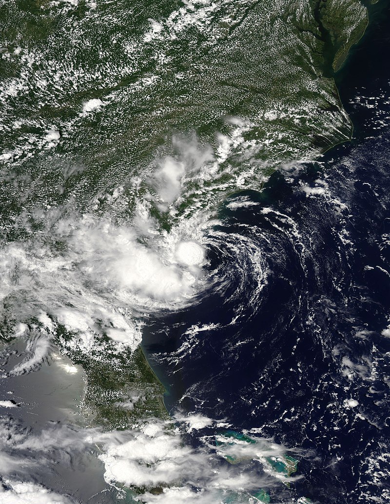
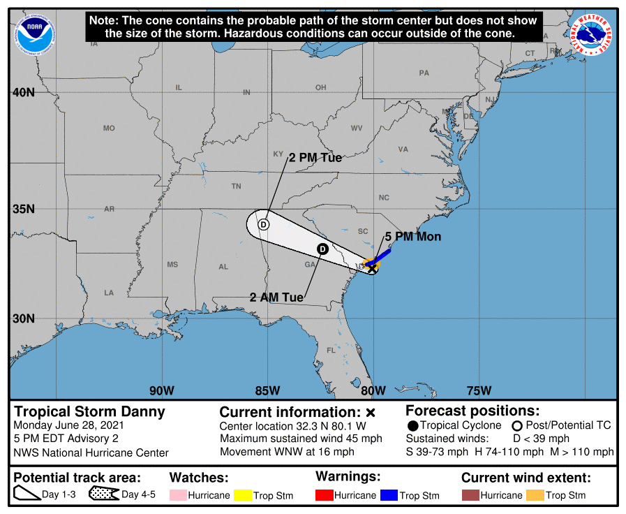
June 28 - 29th: Tropical Storm Danny
Tropical Storm Danny formed quickly off the South Carolina coast and only obtained Tropical Storm status just before making landfall. As a Tropical Depression, it moved into Georgia and brought 1 to 3 inches of rain and winds around 25 mph. Widespread impacts from Danny were minor and no warnings were needed during its brief existence over land.. For more information on Tropical Storm Danny, visit the National Hurricane Center's Archive page.
| Satellite Imagery | Storm Path |
 |
 |
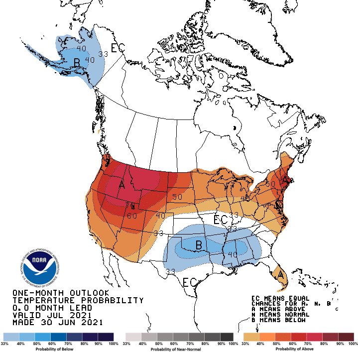
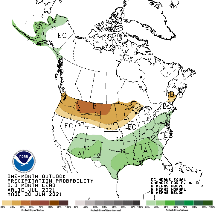
Based on the Climate Prediction Center's outlook for July, western Georgia has a 30% to 40% chance of below normal temperatures while eastern Georgia has an Equal Chance for above, below or near normal temperatures. For precipitation, most of Georgia has a 40% to 50% chance of above normal precipitation while southeast Georgia has a 30% to 40% chance of above normal precipitation.
 |
 |

