| Previous Month | Next Month |
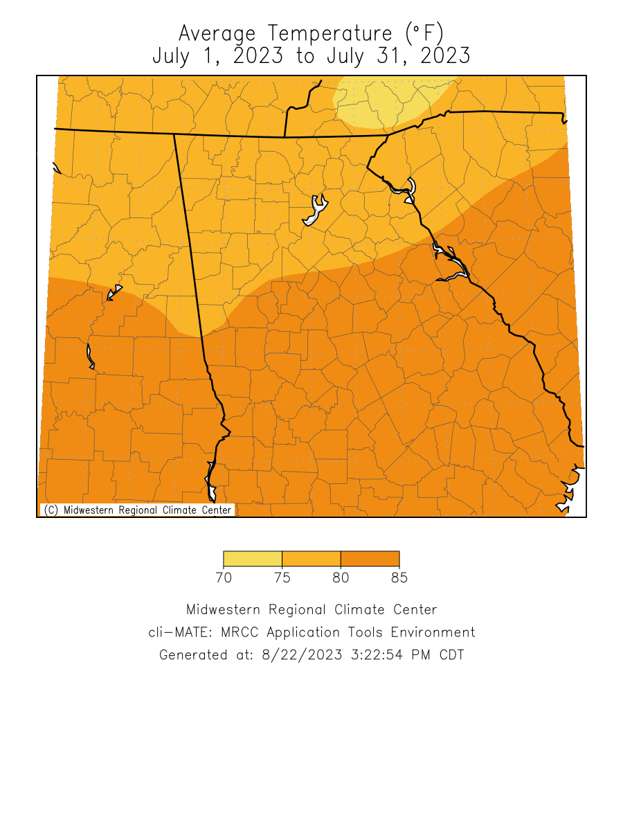
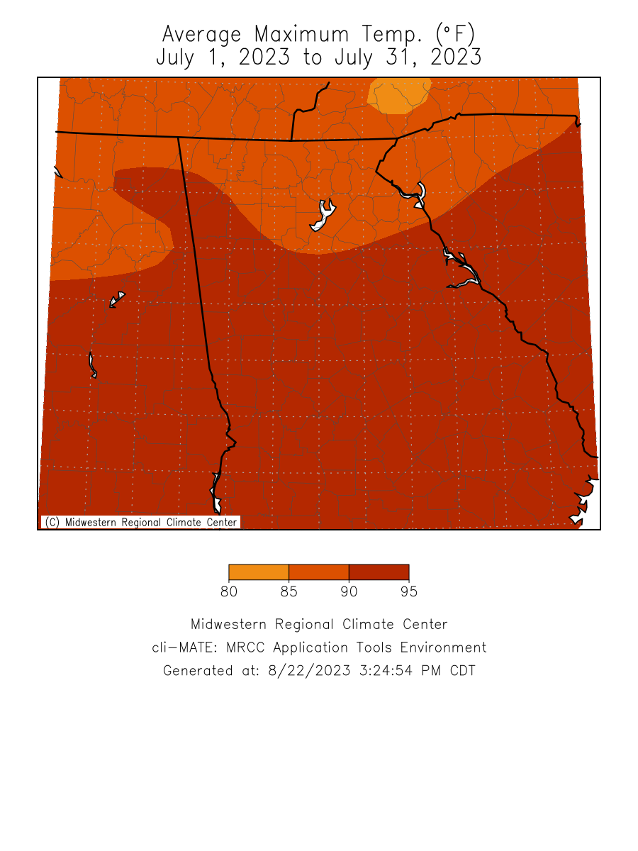
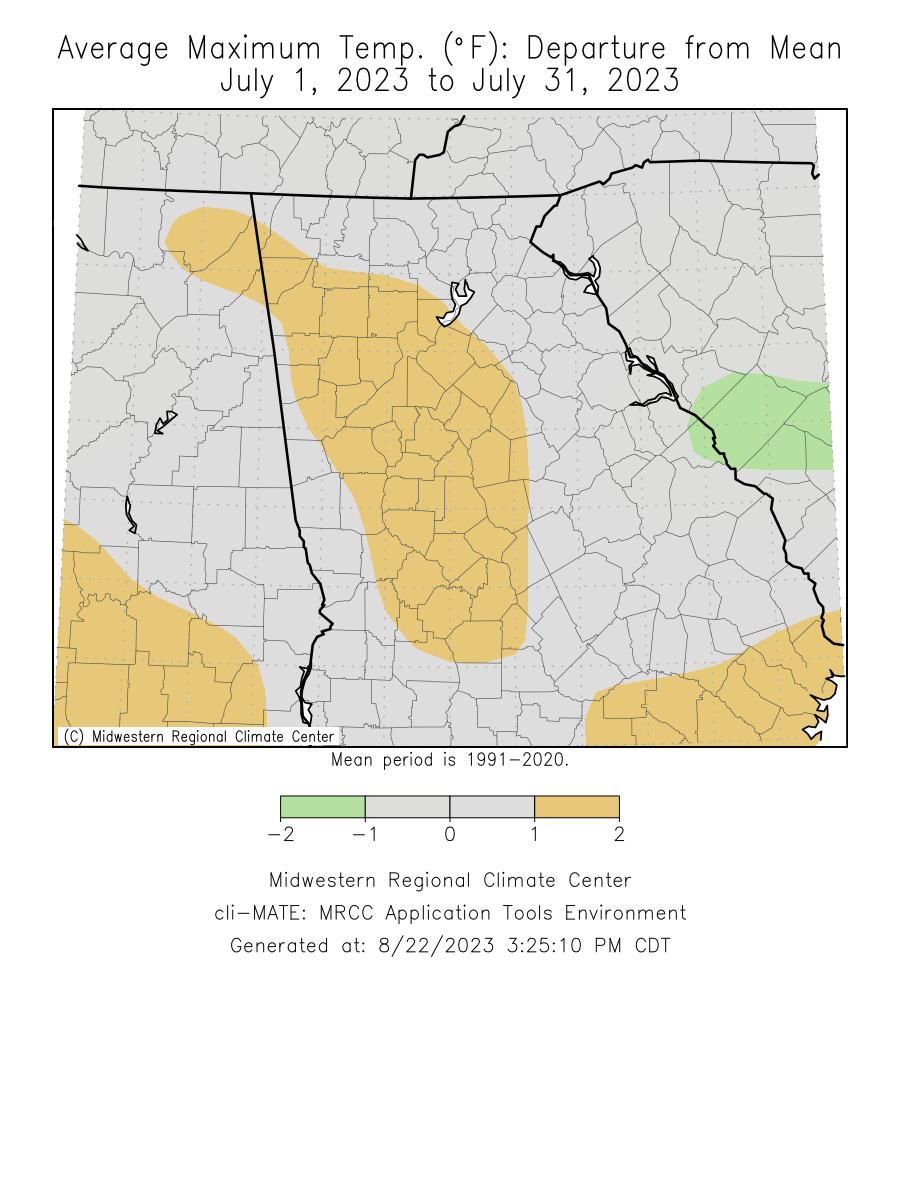
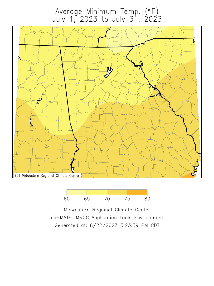
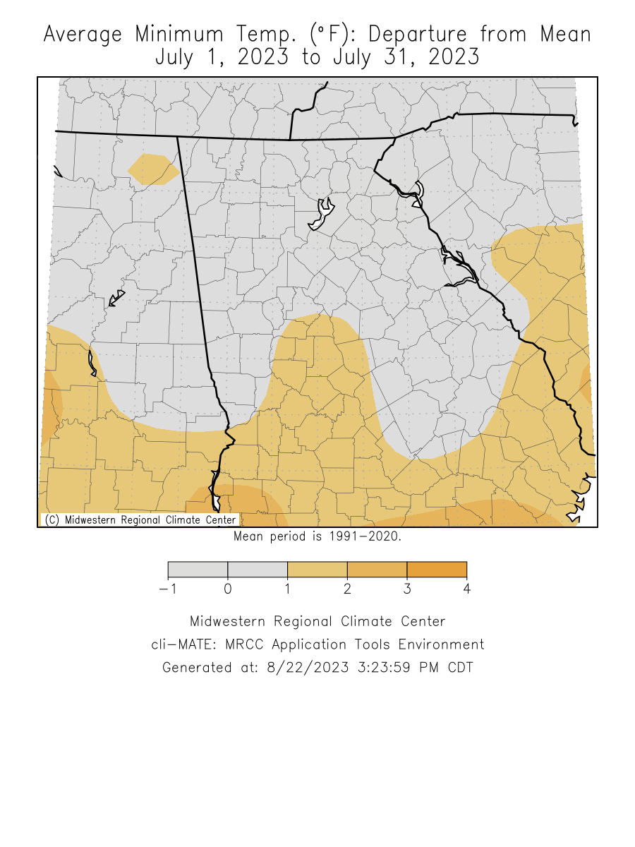
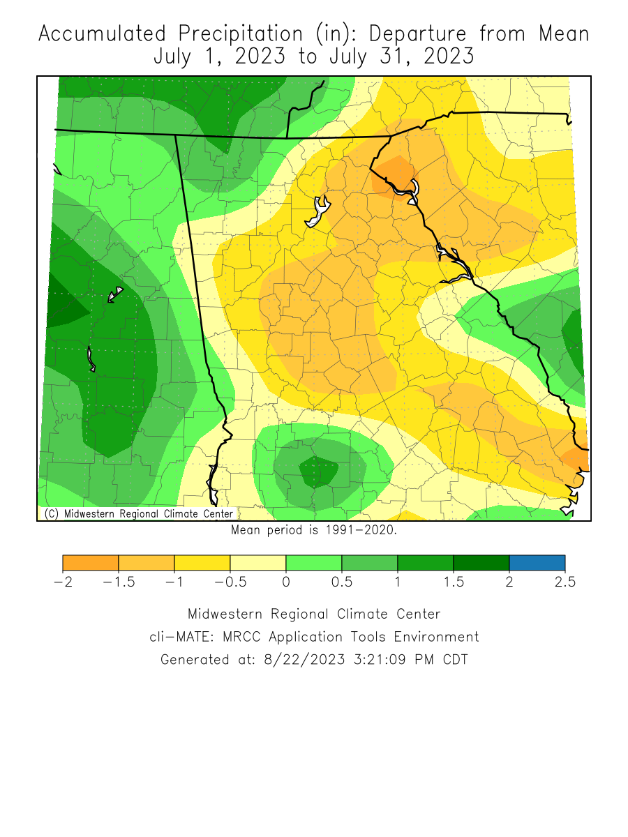
Temperatures through the month of July were around a degree above normal. Precipitation through the month of July was around an inch above normal.
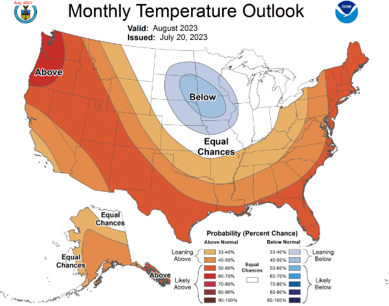
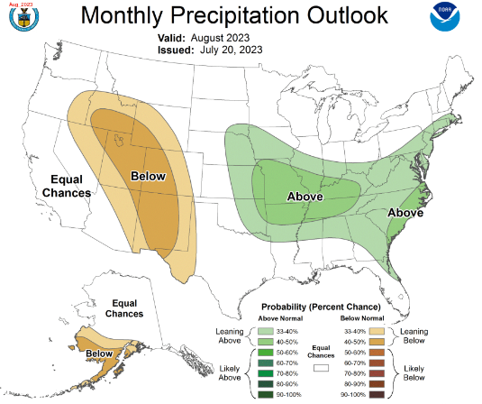
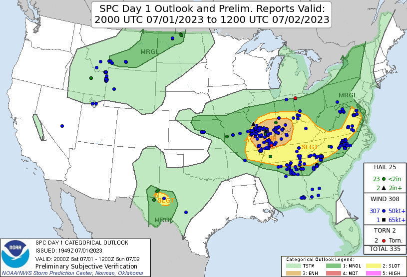
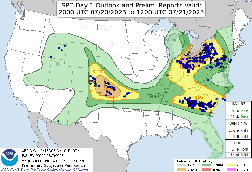
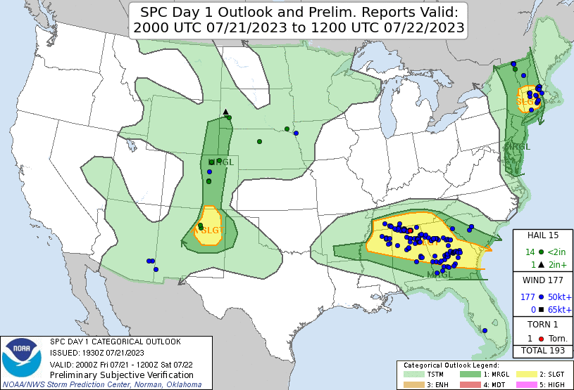
Climate Site Temperatures Precipitation Climate Site Maximum Temperature Max T Date *Indicates a daily record was set Climate Site Total Precipitation DFN (Departure Climate Site Maximum Daily Precip (in inches) Max P Date *Indicates a daily record was set Data prepared by NWS Peachtree City/Atlanta July 1st thunderstorms: DISCUSSION...Clusters of strong to severe thunderstorms will continue to shift east across parts of Middle and southeast TN, northern AL/GA and far western NC the next few hours. This activity is occurring in a moderately unstable environment characterized by weak effective shear. Nevertheless, steep low-level lapse rates, high PW, and a corridor of 1000+ J/kg DCAPE exist downstream of ongoing convection. Several measured severe gusts have been noted, along with wind damage, over the past 1-2 hours. Expect sporadic/locally damaging wind potential to persist across eastern portions of Severe Thunderstorm Watch 428. July 2nd Thunderstorms: A band of thunderstorms is ongoing late this morning across parts of northern MS. This activity is expected to gradually increase in coverage as convection spreads east/northeast through midday. Mostly clear skies downstream from current convection is allowing for rapid warming, with temperatures already in the 80s. Surface dewpoints mostly in the low/mid 70s beneath modest midlevel lapse rates (near 7 C/km) are aiding in moderate destabilization, with MLCAPE values around 2500-3500 J/kg expected to develop eastward across the MCD area by early afternoon. Vertical shear decreases with southward extent over the region, but effective shear magnitudes around 25-35 kt will be more than sufficient for organized bands/clusters of storms. Steepening low-level lapse rates and high PW values amid strong instability will support damaging wind potential. Additionally, 30-40 kt southwesterly flow in the 3-6 km layer, coupled with large instability/steep midlevel lapse rates suggest at least an isolated large hail threat will accompany more intense semi-discrete convection. A severe thunderstorm watch will likely be needed for portions of the area in the next 1-2 hours. Additionally, a small southward expansion of the Slight risk area will be included with the 1630z Day 1 Convective Outlook.. July 20th Thunderstorms: DISCUSSION...A bowing storm cluster with a history of damaging wind is moving southeastward east of Nashville, with recent vigorous development noted southeast of this cluster into southern middle and eastern TN, and increasing cumulus noted along the southwest flank. The background environment remains supportive of organized convection near and to the warm side of an outflow-reinforced surface boundary, with rich low-level moisture, MLCAPE in excess of 2000 J/kg, and sufficient deep-layer shear. Isolated hail and maybe a brief tornado cannot be ruled out with any stronger discrete cell, but the damaging winds are expected to remain the primary threat. The ongoing bowing segment may continue to move southeastward near the surface boundary, with additional damaging-wind producing clusters possible as new development matures this afternoon. As a result, downstream watch issuance may be needed across parts of northern AL/GA and potentially into upstate SC.. July 21st Thunderstorms: DISCUSSION...Several clusters of thunderstorms have developed and continue to move east-southeast across northern Alabama and northern Georgia. These storms are moving through an airmass with 1500 to 2500 J/kg MLCAPE (per SPC mesoanalysis) and effective shear around 25 knots (per FFC VWP). This should continue to support multicell organization. The threat should start to wane after sunset once the boundary layer starts to cool, but a moist boundary layer, with mid 70s dewpoints, may be sufficient for some threat to linger after dark. The warm airmass and only marginal shear should keep the large-hail threat muted, with damaging wind gusts as the primary threat. Based on the Climate Prediction Center's outlook for August, Georgia has a 40% to 50% chance for above normal temperatures. North and central Georgia have a 33% to 40% chance of above normal precipitation. Data prepared by NWS Peachtree City/Atlanta.
Overview
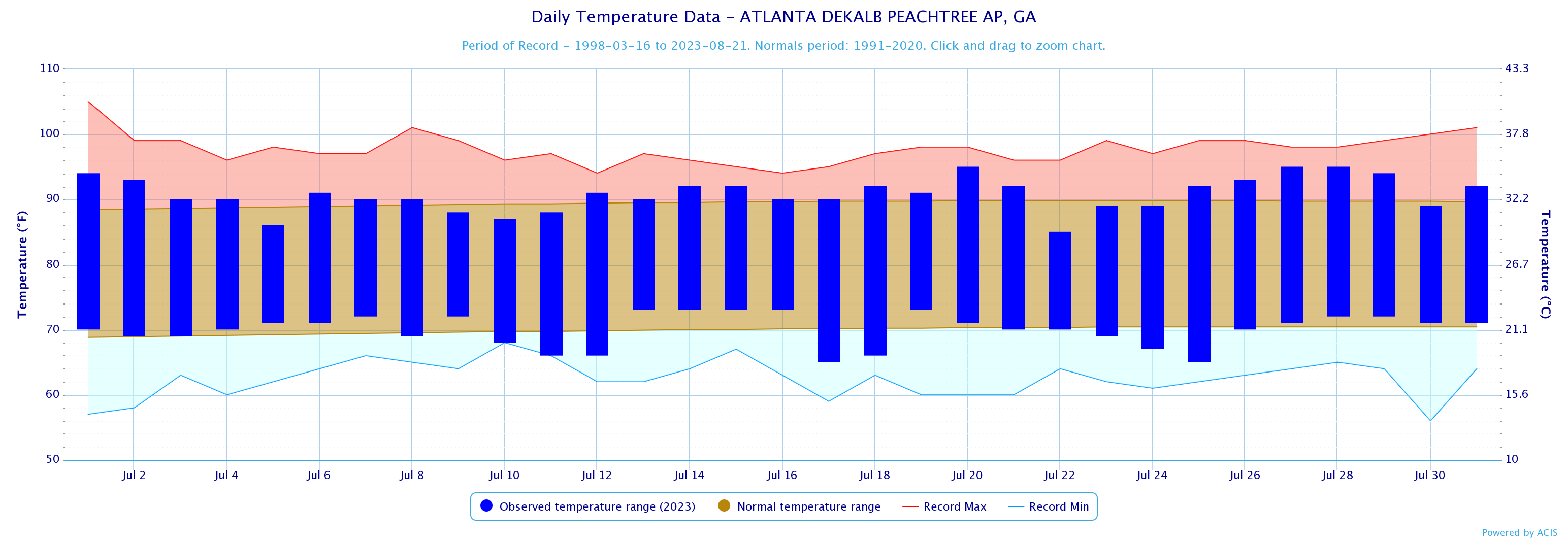
Climate Graphics
Records
Events
August Outlook
Below are the overview stats for July 2023 for our 10 climate sites.
July 2023 Monthly Rankings
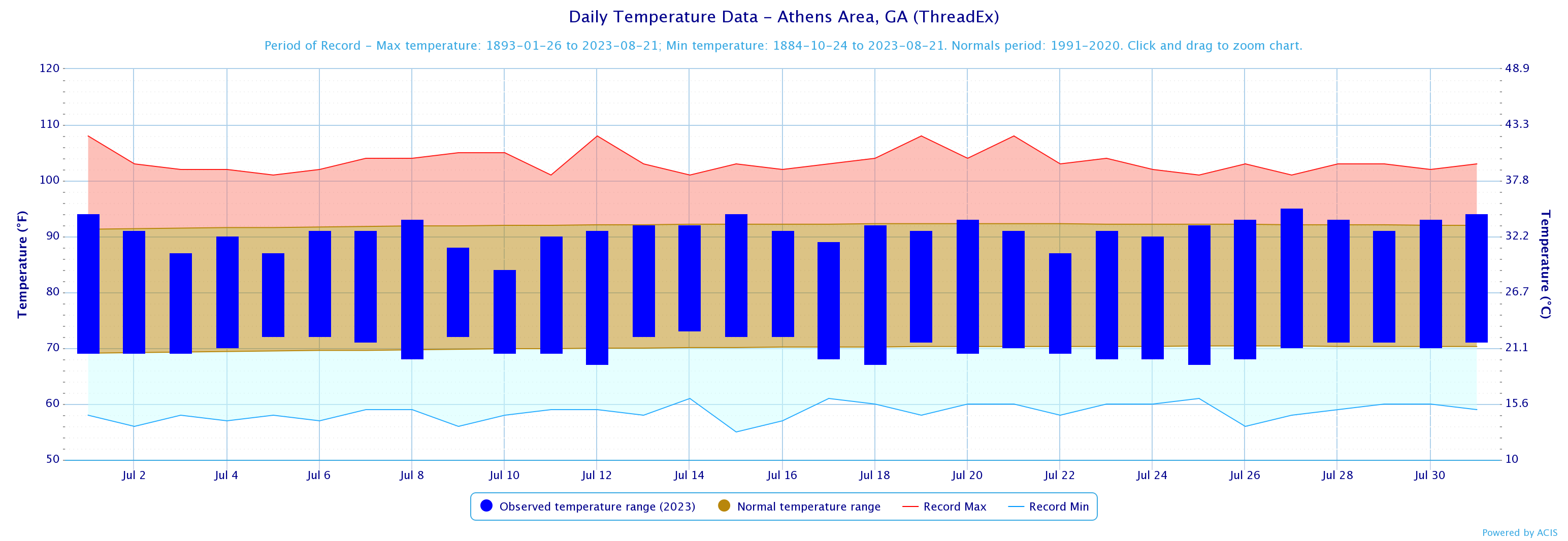
Athens
42nd Warmest
53rd Driest
Atlanta
7th Warmest
9th Driest
Columbus
29th Warmest
53rd Wettest
Macon
22nd Warmest
11th Driest
July 2023 Climate Averages
Climate Site
Month Temp (°F)
Average Temp
Departure from normal
Athens
80.4
81
-0.6
Atlanta
83.1
80.9
2.2
Columbus
83.4
83.2
0.2
Macon
83.3
82.5
0.8
Dekalb Peachtree Arpt
80.4
79.6
0.8
Fulton Co Arpt
80.9
80.1
0.8
Gainesville
80.6
78.8
1.8
Peachtree City
80.2
80.8
-0.6
Rome
80.7
80.2
0.5
July 2023 Temperature Climate Statistics
Minimum Temperature
Min T Date
Athens
95
7/27
67
7/12, 7/18, 7/25
Atlanta
98
7/29
70
7/10
Columbus
98
7/7, 7/8
70
7/22
Macon
97
7/20, 7/21, 7/27, 7/28
70
7/24
Dekalb Peachtree Arpt
95
7/20, 7/27, 7/29
65
7/17, 7/25
Fulton Co Arpt
97
7/27
66
7/24
Gainesville
95
7/27
66
7/11
Peachtree City
96
7/27
63
7/25
Rome
97
7/27
65
7/24
July 2023 Precipitation Climate Statistics
Average Precipitation
From Normal)
Athens
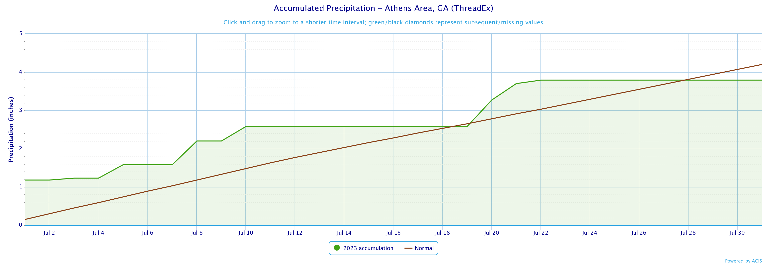
3.79
4.2
-0.41
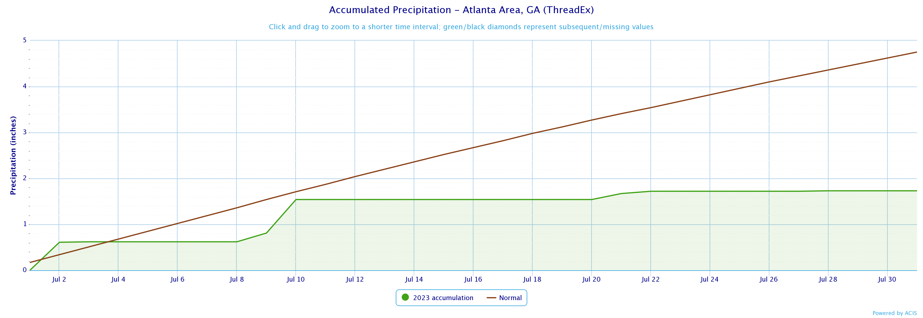
Atlanta
1.73
4.75
-3.02
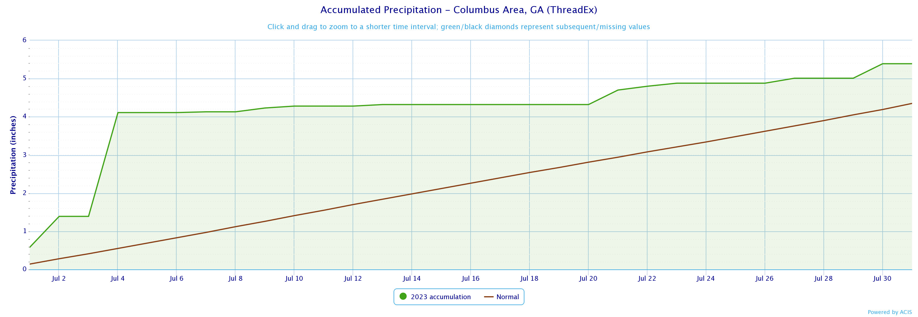
Columbus
5.39
4.35
1.04
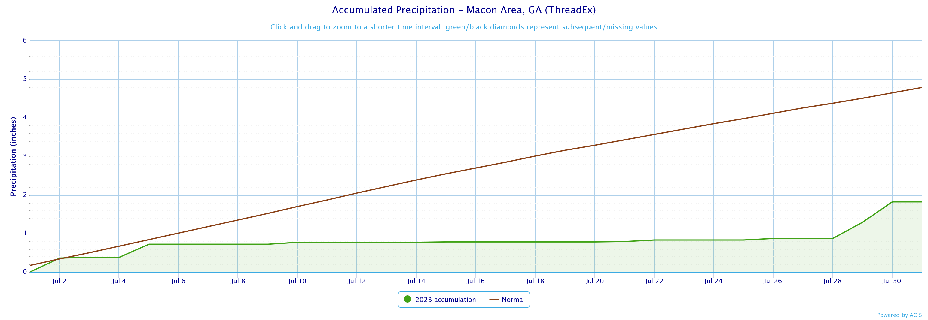
Macon
1.82
4.79
-2.97
Dekalb Peachtree Arpt
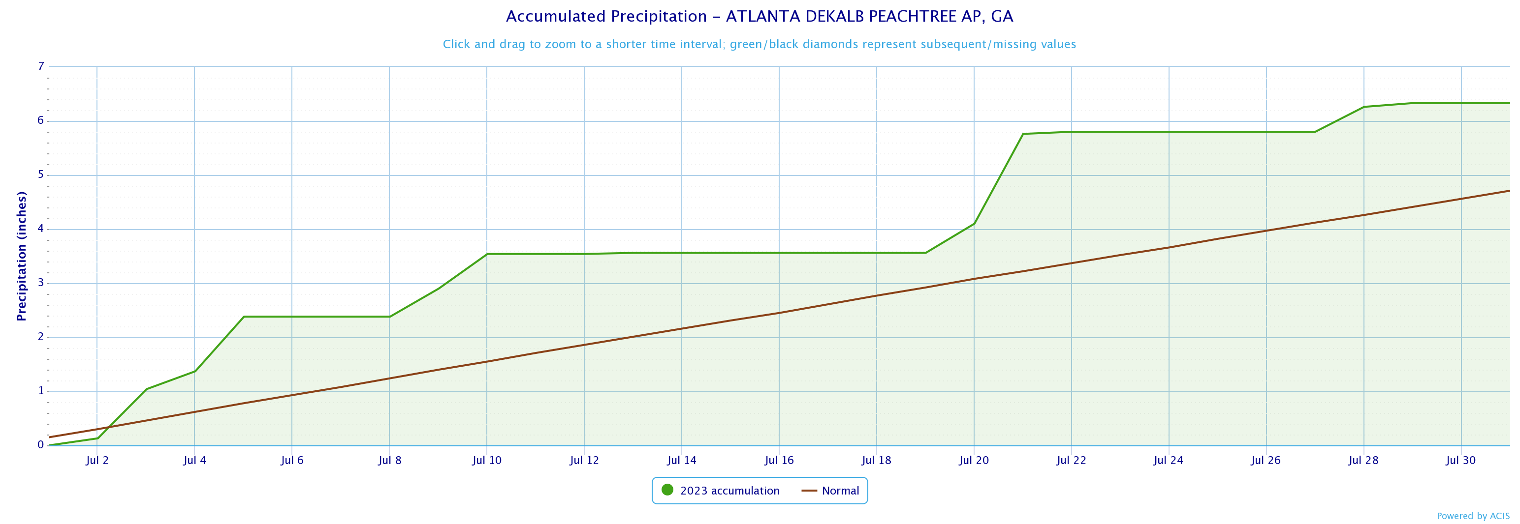
6.33
4.71
1.62
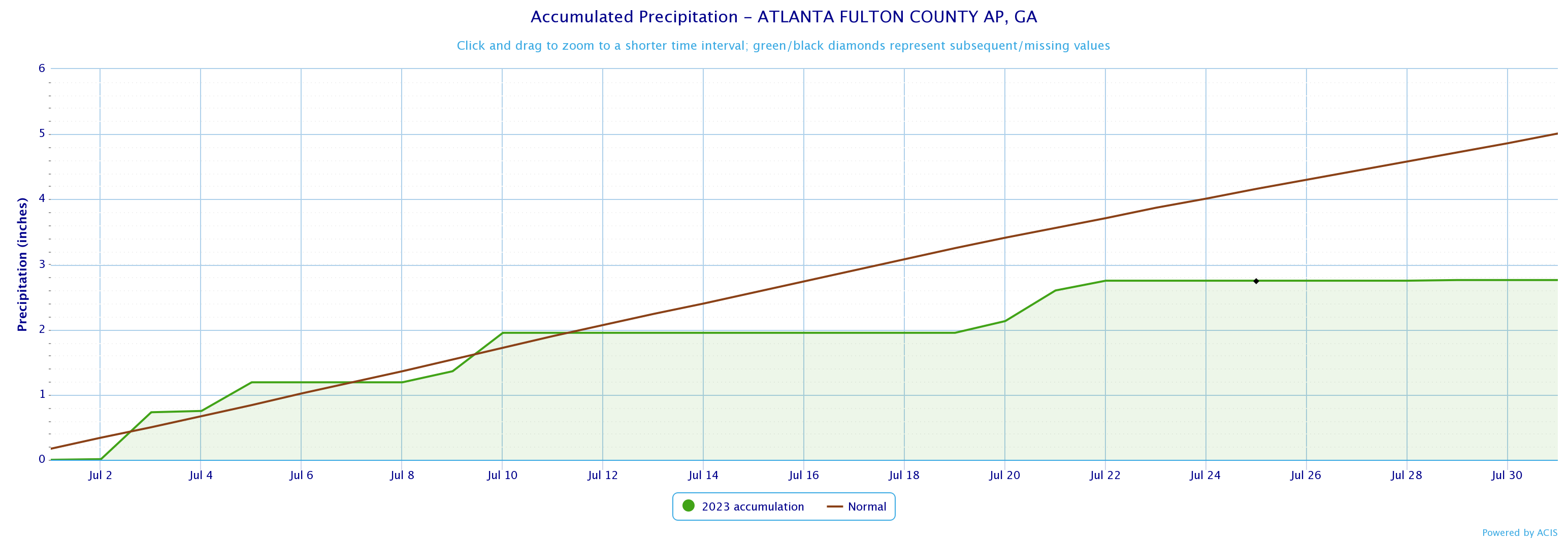
Fulton County Arpt
2.76
5.01
-2.25
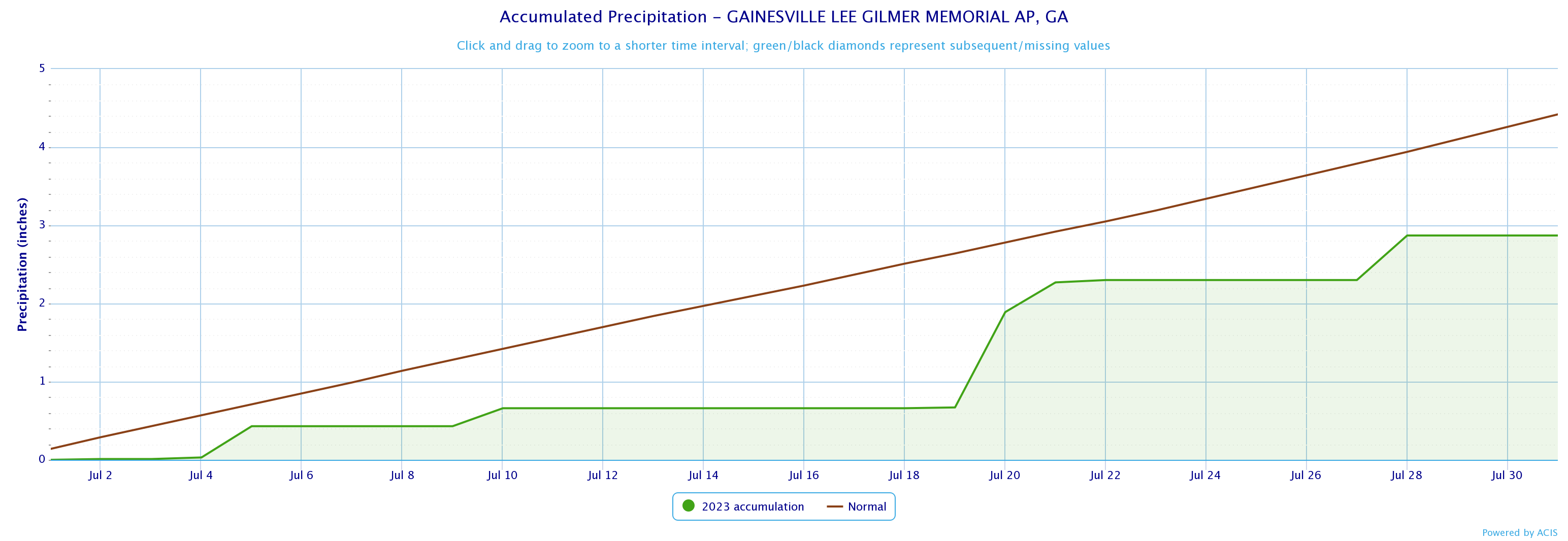
Gainesville
2.87
4.42
-1.55
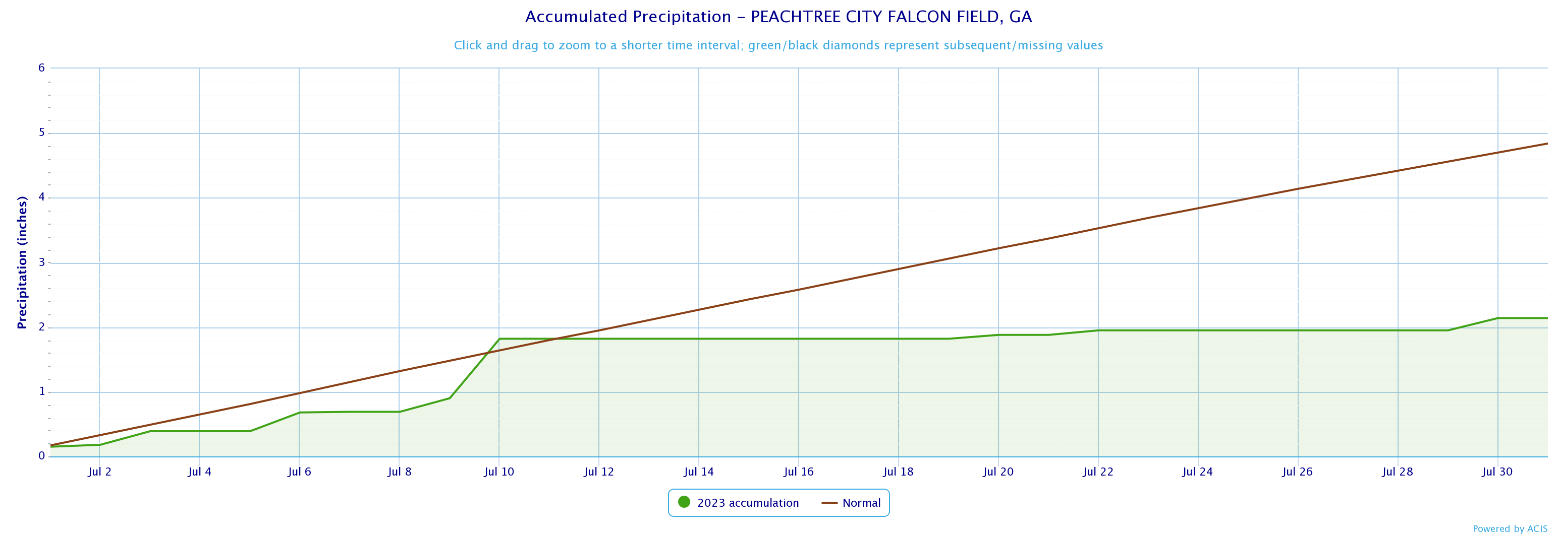
Peachtree City
2.87
4.42
-1.55
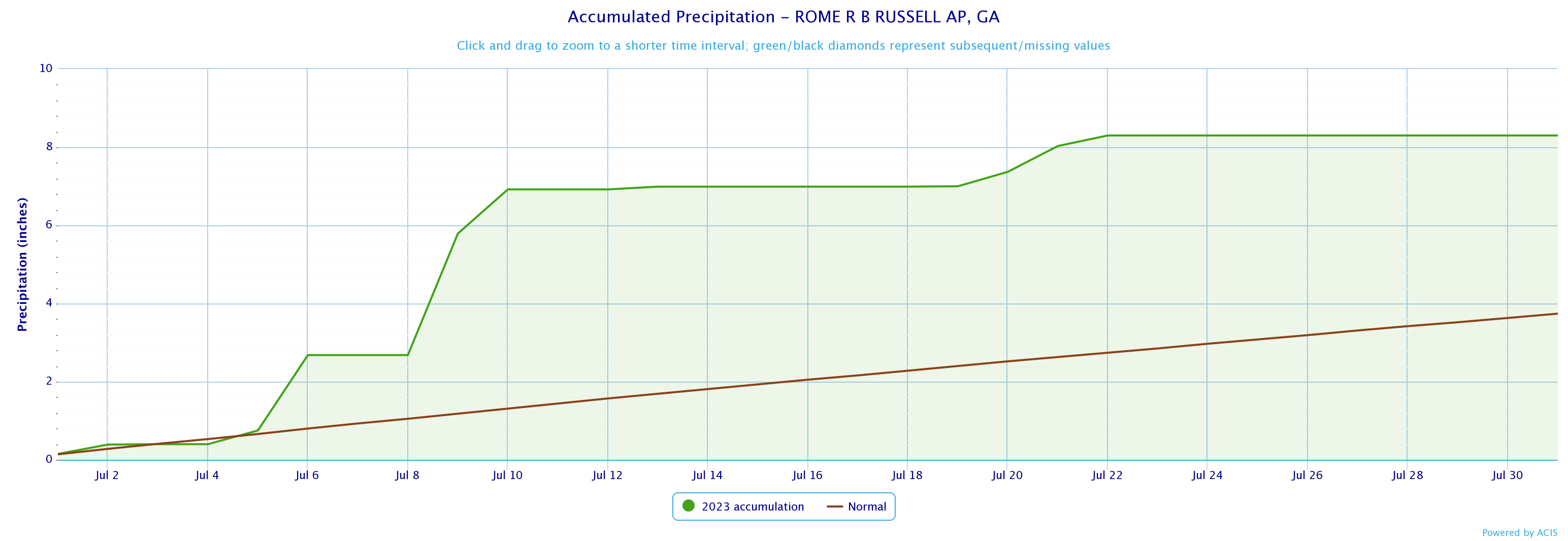
Rome
8.3
3.74
4.56
July 2023 Precipitation Climate Statistics
Athens
1.18
7/1
Atlanta
0.73
7/10
Columbus
2.72
7/4
Macon
0.53
7/30
Dekalb Peachtree Arpt
1.66
7/21
Fulton Co Arpt
0.72
7/3
Gainesville
1.22
7/20
Peachtree City
0.92
7/10
Rome
3.11
7/9
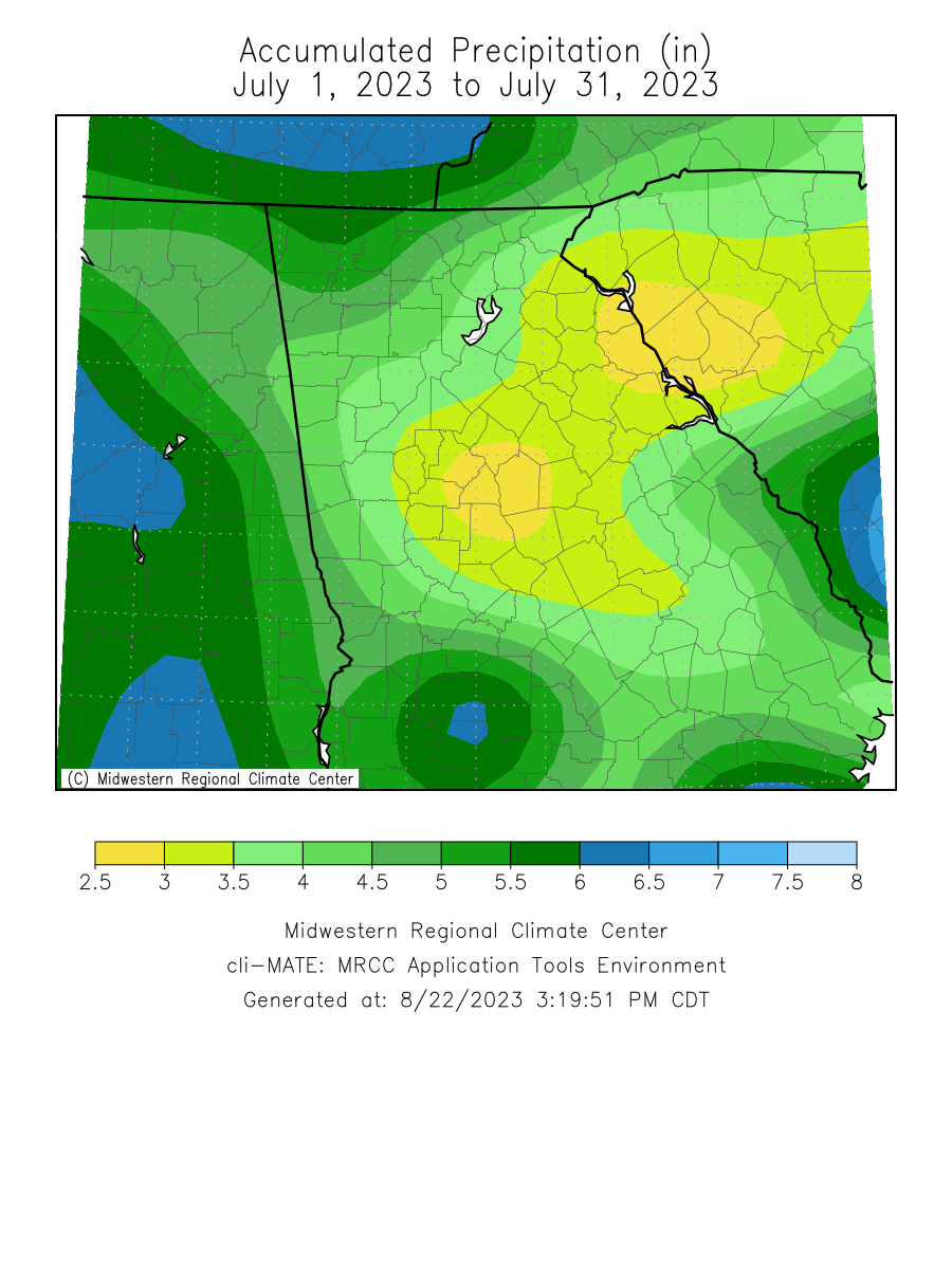
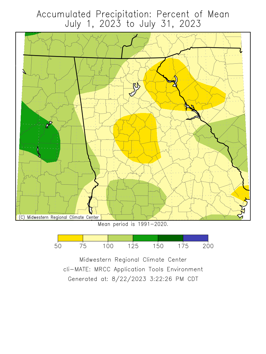
Click the links below to explore the temperature and precipitation data across north and central Georgia for the month of July 2023.
Temperature Maps
Precipitation Maps
Temperature Graphs
Precipitation Graphs
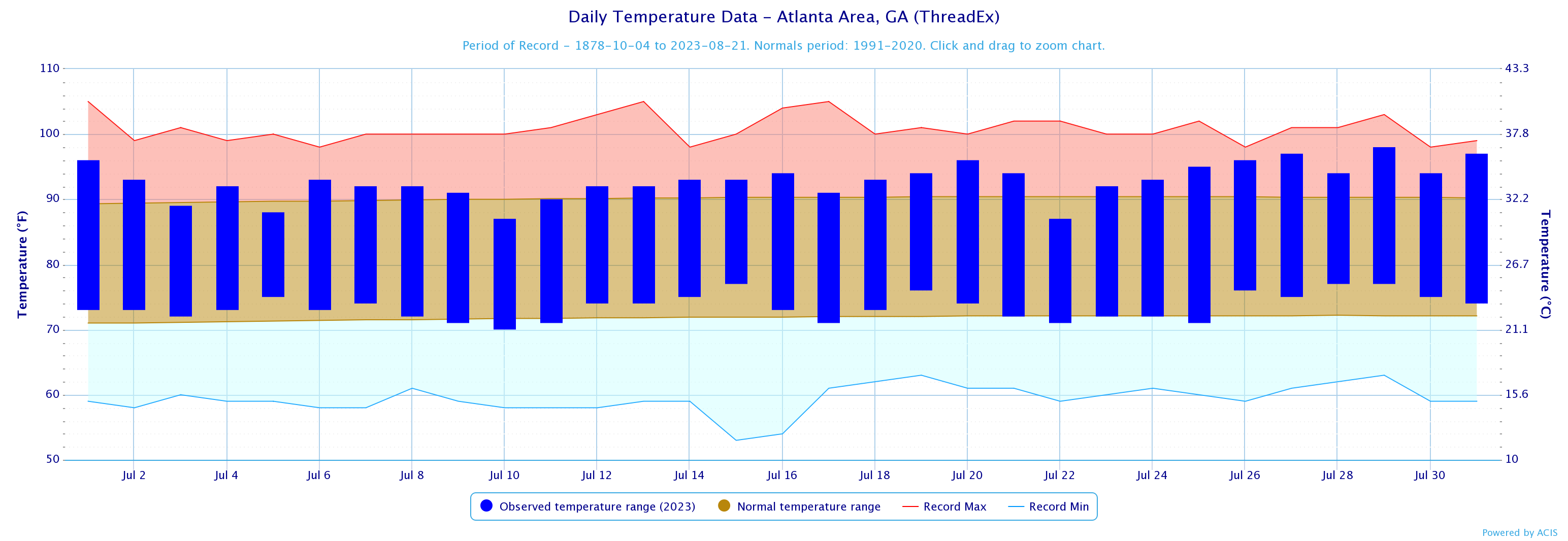
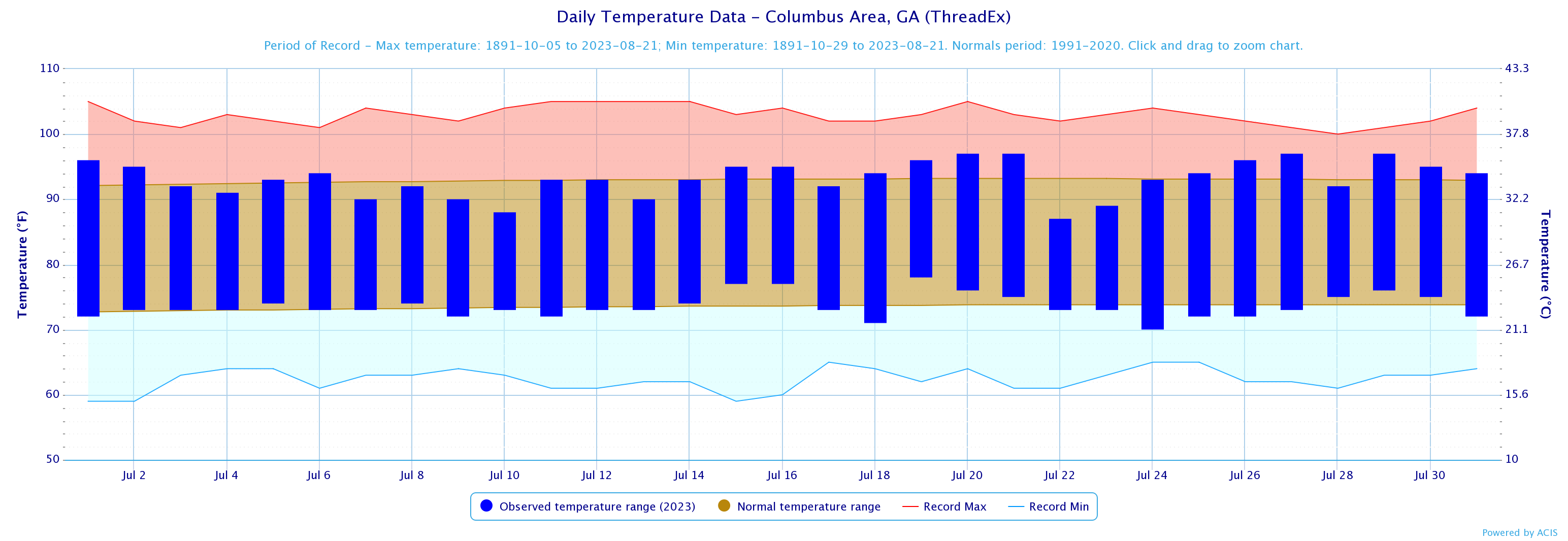
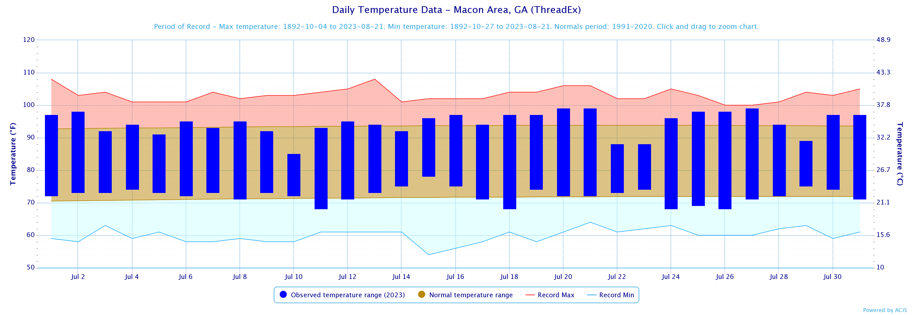
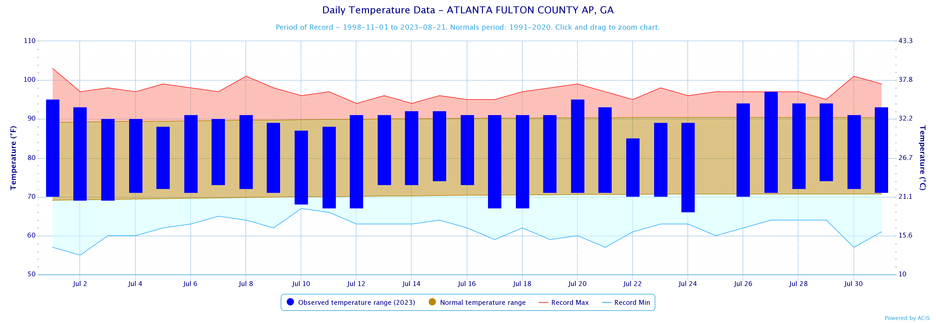
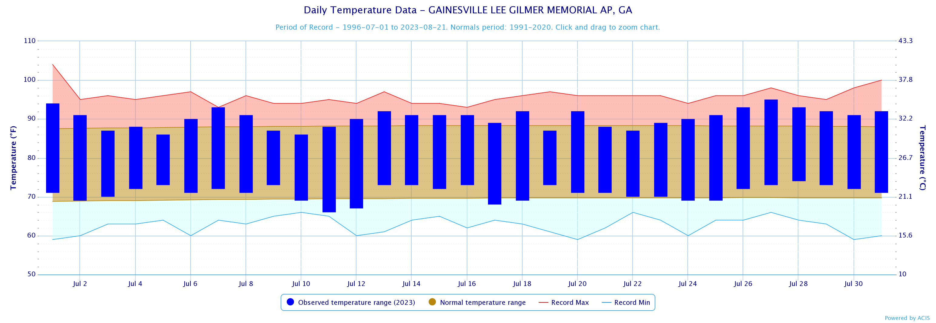
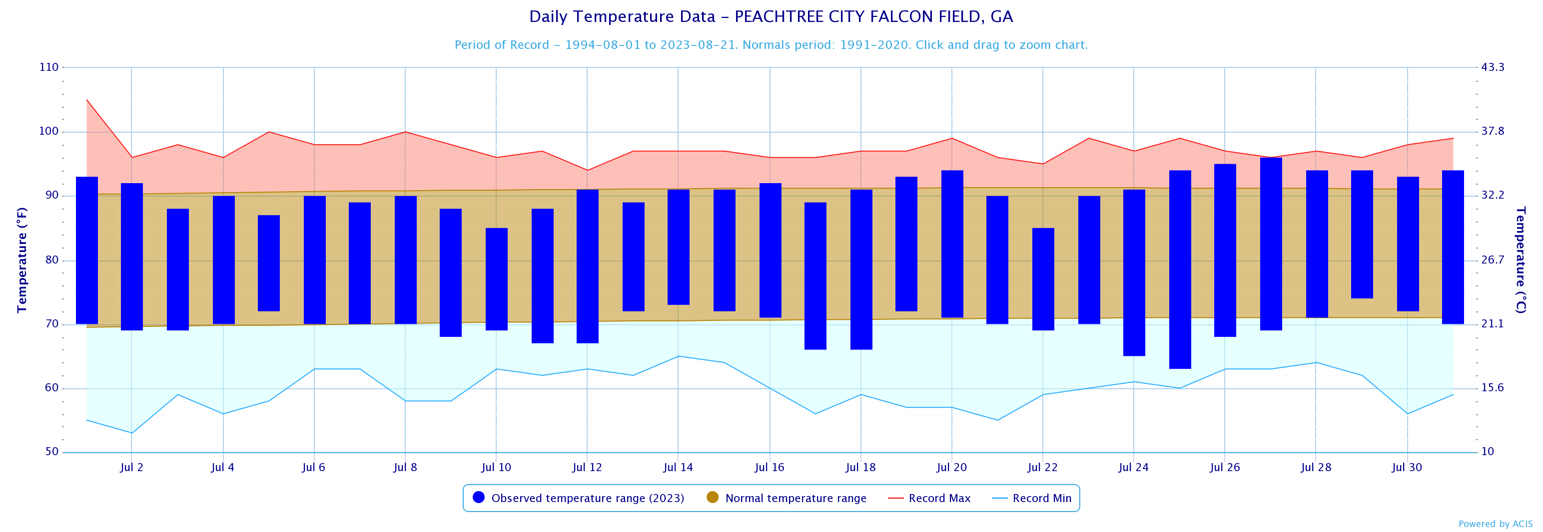
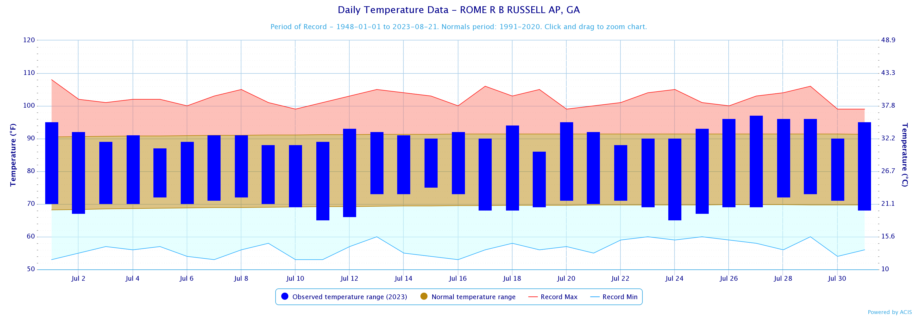
Temperature and precipitation records at our 4 main climate sites are located below.
July 2023 Climate Records
No Records were broken during the month of April
Larger events that occurred across north and central Georgia this past July can be found here.

The August climate outlook is below.
August Outlook