Meriwether County EF-0 Tornado
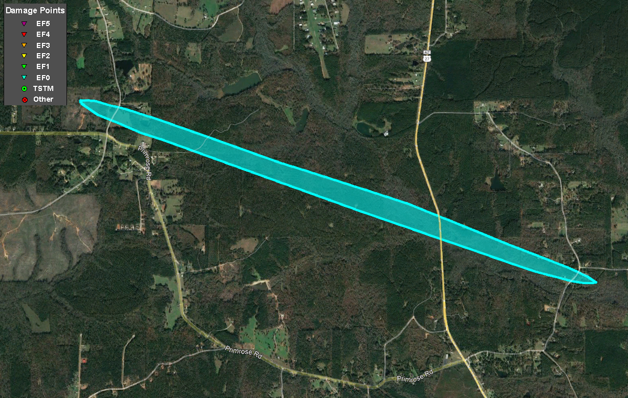 |
| Damage Path - Meriwether County |
|
| County |
Rating |
# of Fatalities/Injuries |
KML |
| Meriwether |
EF-0 |
0 Fatalities /
0 Injuries
|
 |
| Rating: |
EF-0 |
| Peak Wind: |
85 mph |
| Path Length: |
3.36 miles |
| Path Width: |
150 yards |
| Fatalities: |
0 |
| Injuries: |
0 |
| Start Date: |
August 17, 2021 |
| Start Time: |
4:34 AM EDT |
| Start Location: |
3 WSW Rocky Mount |
| Start Lat/Lon: |
33.1523 / -84.7178 |
| End Date: |
August 17, 2021 |
| End Time: |
4:39 AM EDT |
| End Location: |
2 E Lone Oak |
| End Lat/Lon: |
33.1688 / -84.7724 |
|
|
Based on the combination of a radar confirmed debris signature and ground-truth damage, a brief tornado touched down near Coleman Creek Circle just east of Highway 27/41 (Roosevelt Hwy) in northwest Meriwether County. After snapping several larger trees along Coleman Creek Circle, the tornado tracked west-northwest with additional damage (downed trees) reported between Sawmill Road and Charlie Fuller Road. No additional damage was seen downstream from this location, and radar supports these findings that the tornado likely lifted somewhere northwest of the Primrose Rd/Charlie Fuller Rd intersection. Based on the size and number of trees snapped and the height of the Tornado Debris Signature (TDS), maximum winds were estimated to be around 85 mph, a high-end EF-0.
|
|
 |
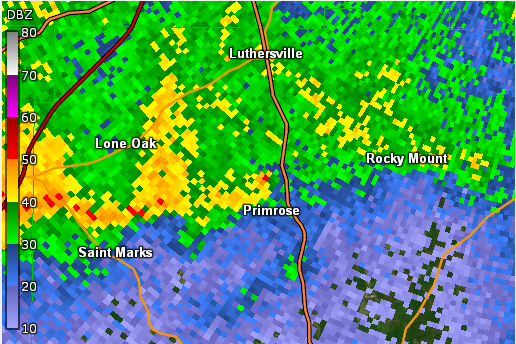
| KFFC Reflectivity (4:37 AM EDT) |
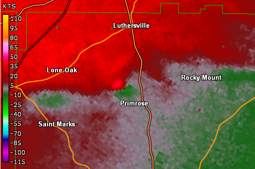
KFFC base velocity (4:38 AM EDT) |
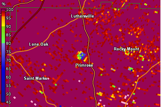 |
| KFFC Correlation Coefficient (4:37 AM EDT) |

