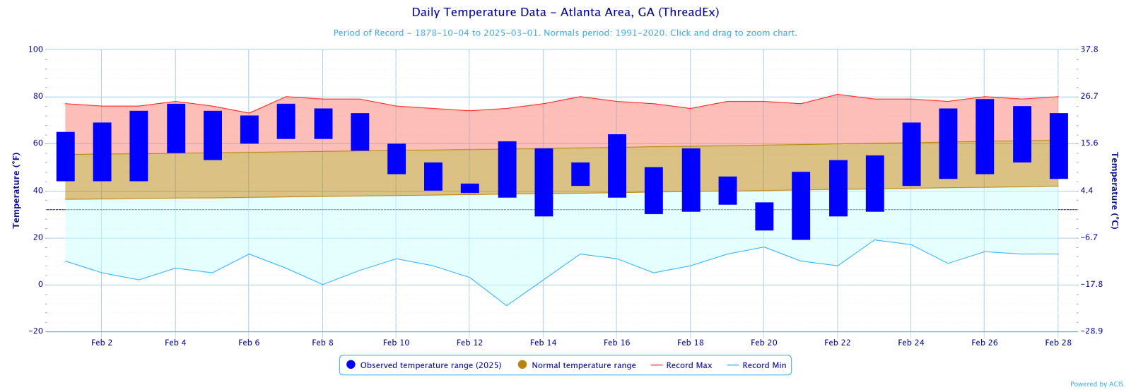
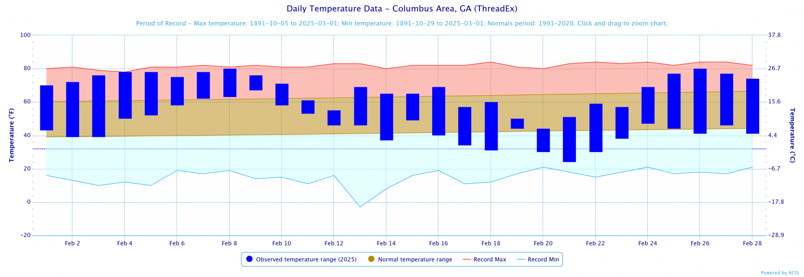
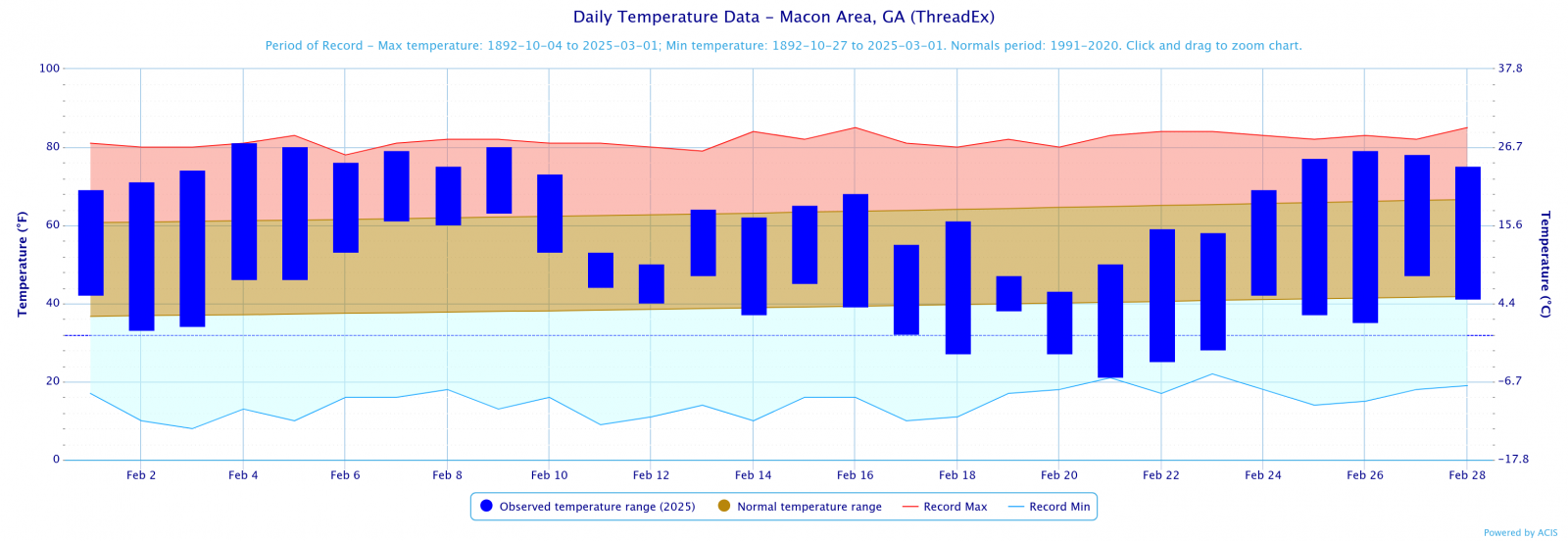
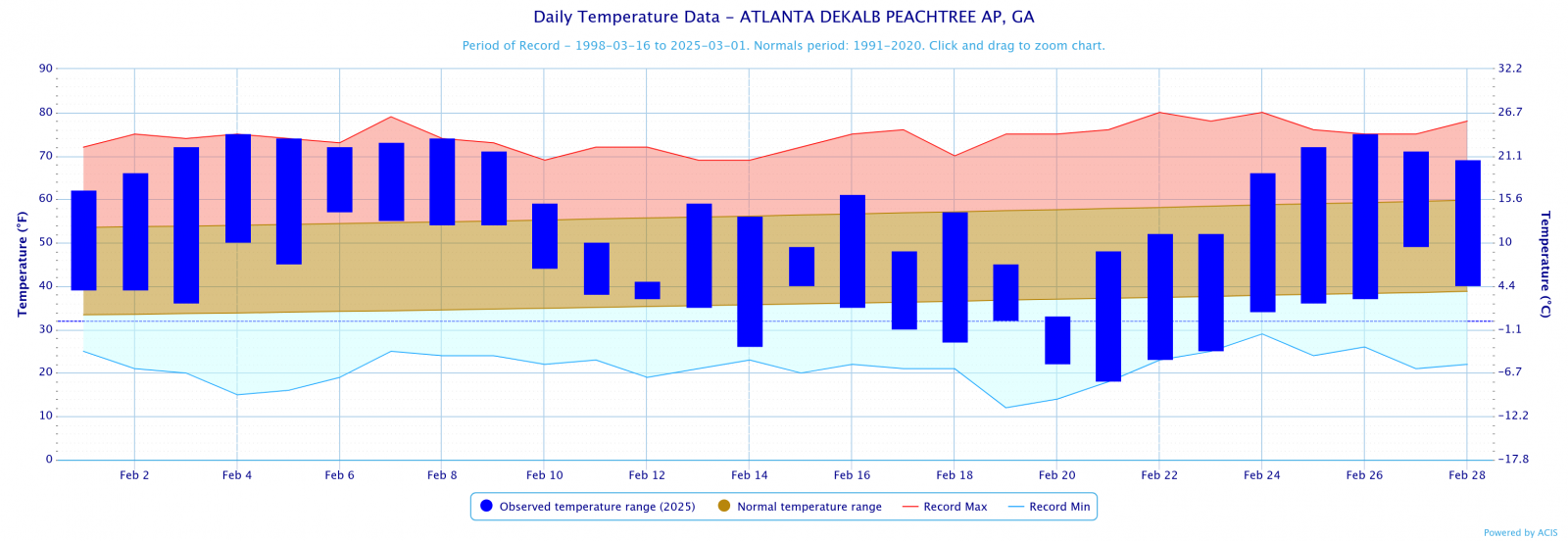
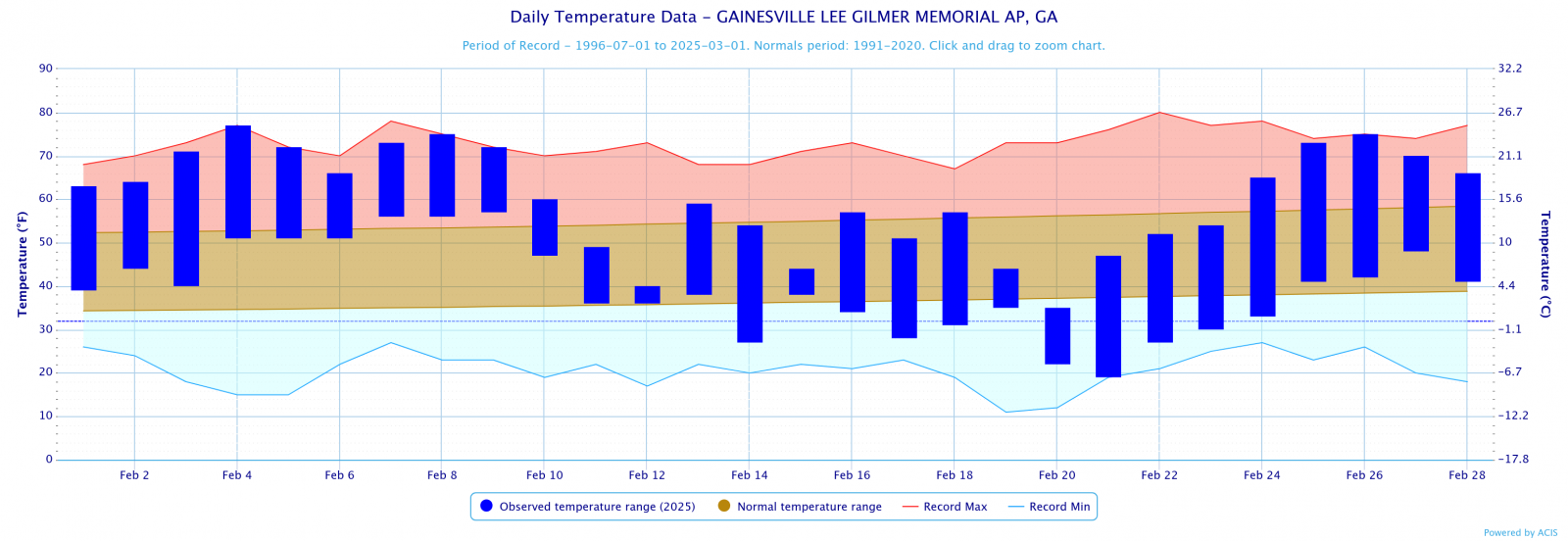
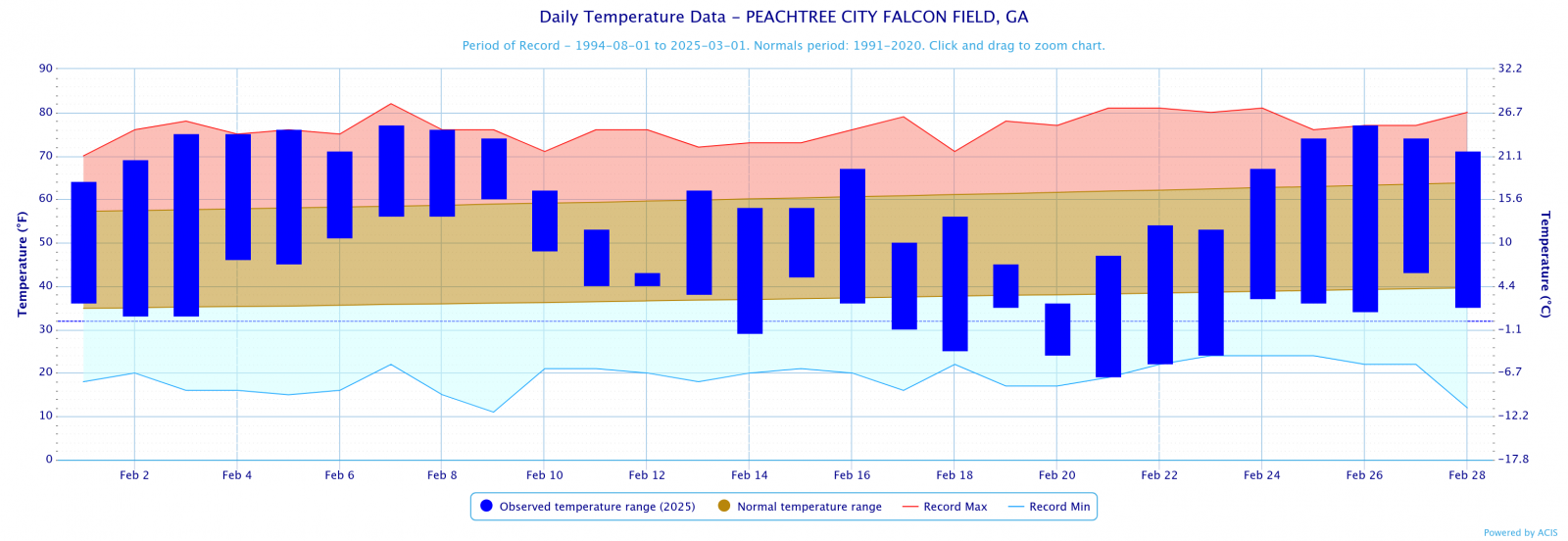
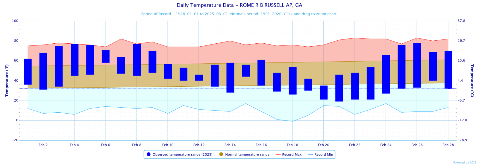
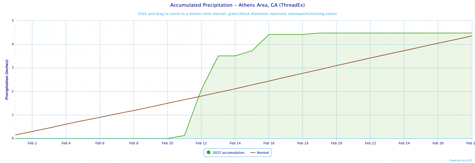
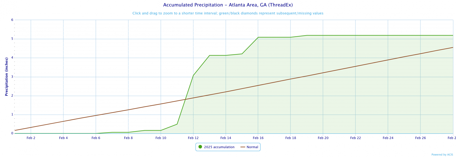
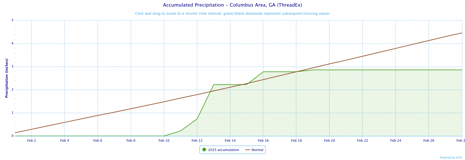
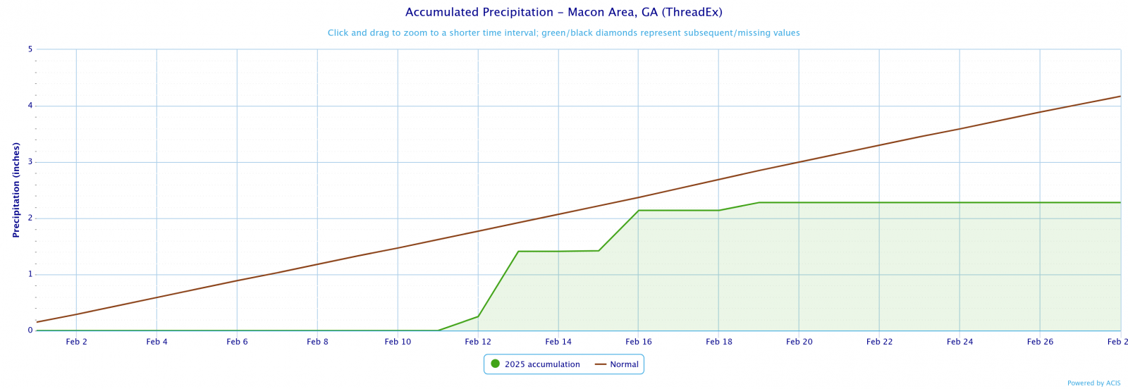
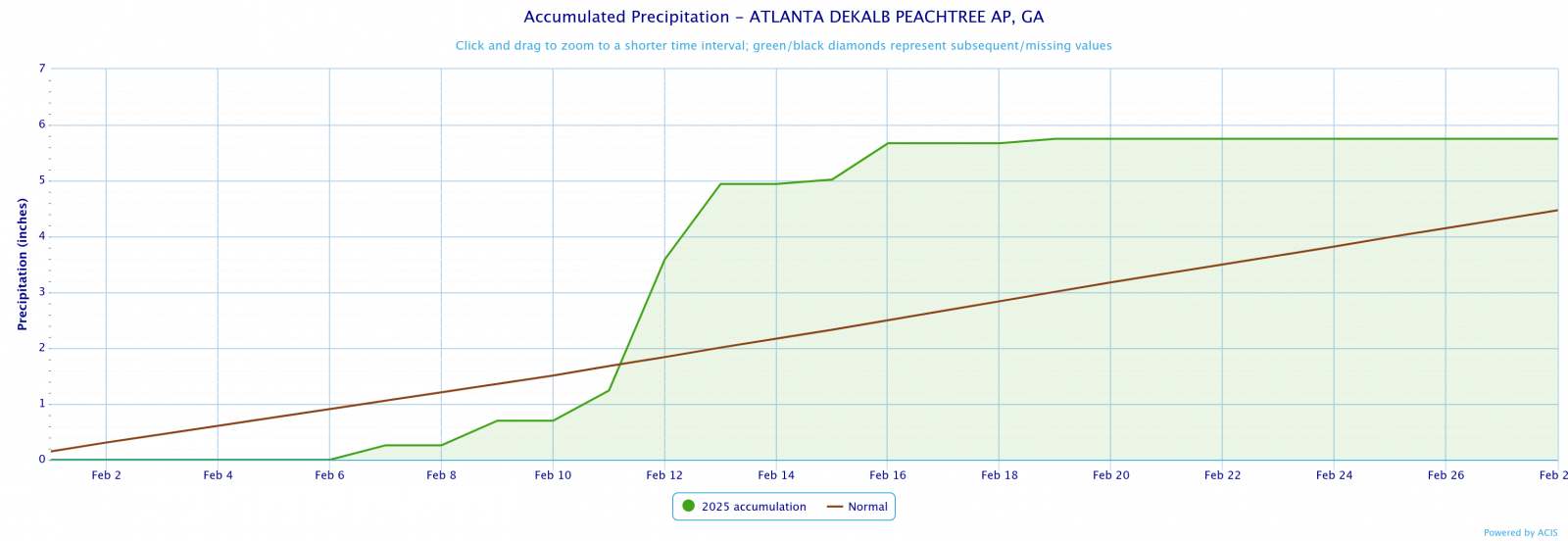
Temperature and precipitation records at our 4 main climate sites are located below.
February 2025 Climate Records
Date
Type
Location
Records set over a 24 hour period
2/12
Precip
Atlanta
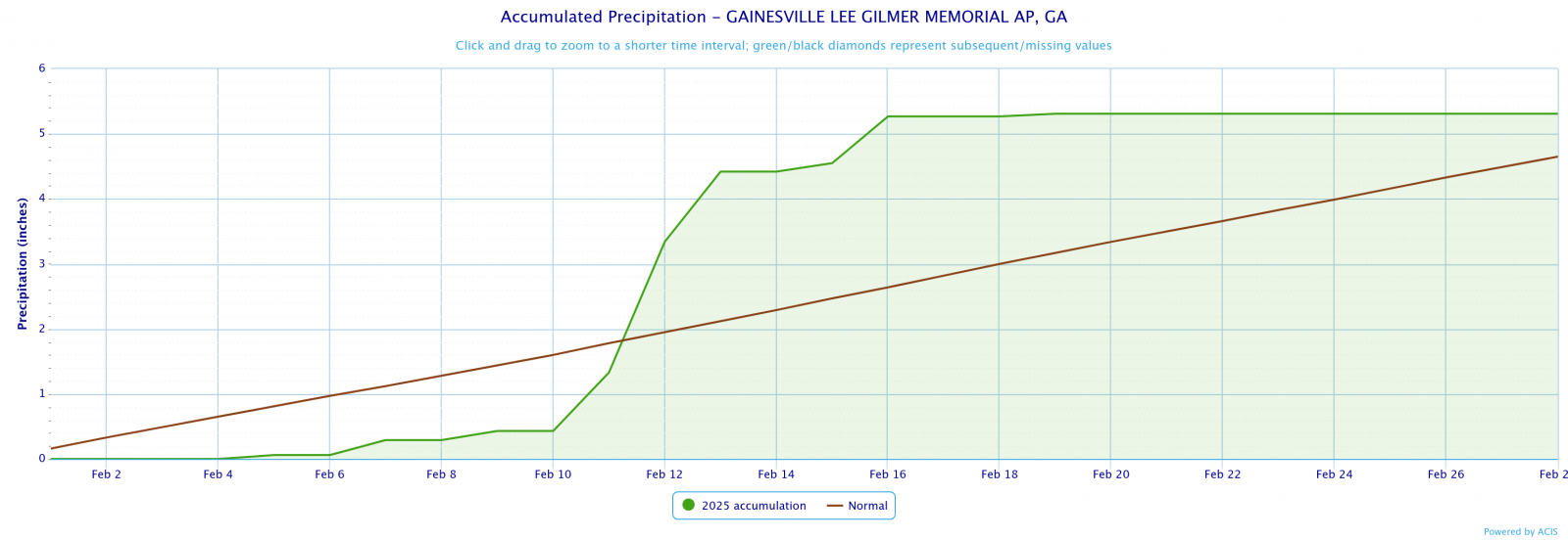
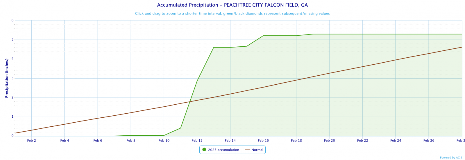
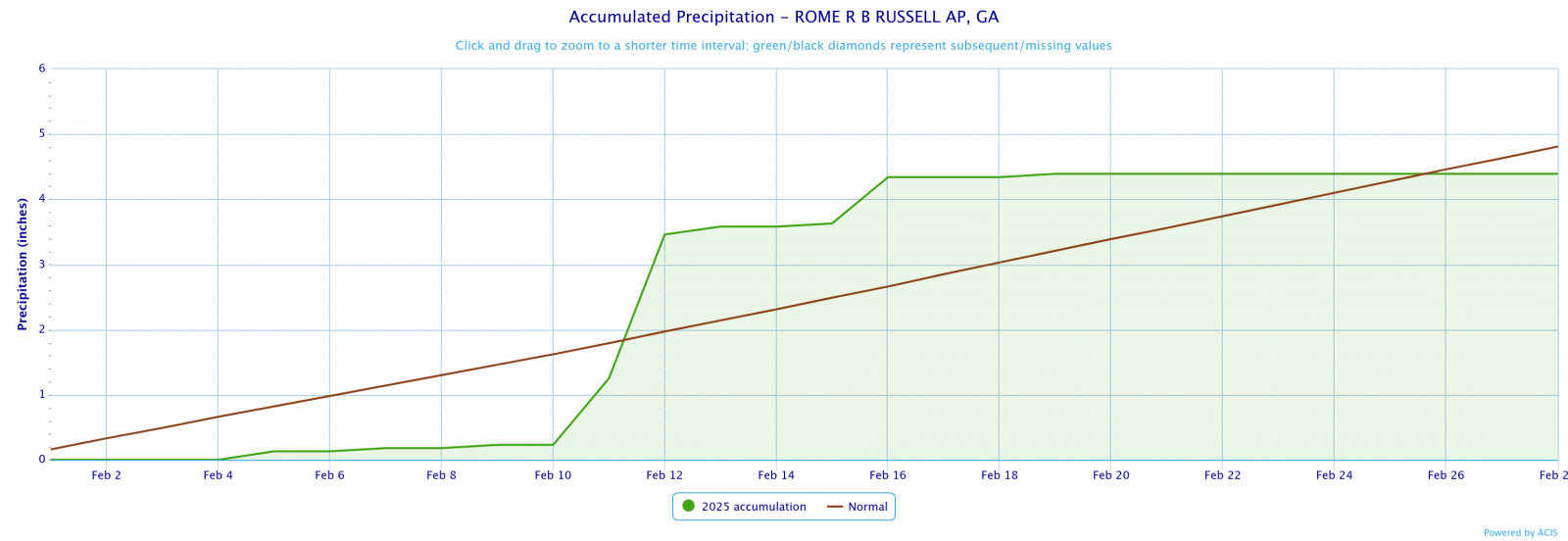
A record 24 hour rainfall total was set at 2.58". This breaks the old record of 2.42" set in 1900.
2/21
Min Temp
Macon
Macon fell to 21°F which breaks the old record of 23°F set in 1958.
Larger events that occurred across north and central Georgia this past February can be found here.
February 15-16, 2024 Severe Weather Outbreak: The following Public Information Statements were the result of the storm surveys that took place after a line of severe thunderstorms moved through the County Warning Area on February 16th.
..Northern Butts/Southern Newton/Jasper County Tornado...

Rating:                 EF1
Estimated Peak Wind:    105 mph
Path Length /statute/:  7.10 miles
Path Width /maximum/:   200 yards
Fatalities:             0
Injuries:               0

Start Date:             02/16/2025
Start Time:             5:16 AM EST
Start Location:         1 SSW Worthville / Butts County / GA
Start Lat/Lon:          33.3814 / -83.9301

End Date:               02/16/2025
End Time:               5:23 AM EST
End Location:           2 NE Turtle Cove / Jasper County / GA
End Lat/Lon:            33.3872 / -83.822

Survey Summary:
An EF1 tornado with maximum winds of 100 to 105 mph touched down
in northeastern Butts County February 15, 2025 at 5:16AM EST.
The tornado spun up within a strong line of storms moving rapidly
eastward across northern GA early in the morning hours.  The
Tornado first touched down in a wooded region west of Winding Way
road located west of Hwy 36.  The tornado crossed Winding Way
snapping and uprooting trees including one onto a home causing
severe damage to the home.  The tornado continued ENE reaching
maximum intensity as it crossed Keys Ferry Road snapping and
uprooting numerous trees.  Additionally, approximately a dozen
homes along Keys Ferry road sustained damage either directly from
the wind or from falling trees consistent with mid and high end
EF1 winds.  Several homes had portions of the roof blown off
while others were missing shingles.  Several homes with trees on
them sustained more significant damage.   The tornado continued
ENE crossing Walthall Road snapping and uprooting trees before
reaching HWY 36 where one business sustained roof damage. The
tornado continued eastward crossing Martin Road snapping trees
and through an uninhabited area north of Haley Road snapping
trees.  Coincidentally, the area along Hwy 36 eastward through
Martin road to the edge of Lake Jackson is the same area hit by
the January 2023 tornado and damage from that tornado was still
very evident among the new tornado damage.  The tornado began to
weaken as it crossed Henry Higgins Road and Haley road while
still snapping and uprooting some trees.  A home was damaged
along Henry Higgins road from a tree.   The tornado damage became
more sporadic as it crossed Jackson Lake into Newton County where
trees were downed in a wooded region along Mitchell Road. The
tornado crossed the lake again knocking over a few trees near hwy
212 before lifting as it reached Blue Herron Dr.
..Northeastern Troup County Tornado...

Rating:                 EF0
Estimated Peak Wind:    85 mph
Path Length /statute/:  1.5 miles
Path Width /maximum/:   75 yards
Fatalities:             0
Injuries:               0

Start Date:             02/15/2025
Start Time:             11:25 PM EST
Start Location:         3 NNE Hogansville / Troup County / GA
Start Lat/Lon:          33.215 / -84.8888

End Date:               02/19/2025
End Time:               11:27 PM EST
End Location:           2 SW Grantville / Troup County / GA
End Lat/Lon:            33.2168 / -84.8634

Survey Summary:
An EF0 tornado with maximum winds of 85 mph touched down in
northeastern Troup County February 15, 2025 at 4:25AM EST.  The
tornado spun up within a strong line of storms moving rapidly
eastward through Alabama and into Western Georgia in the early in
the morning hours Sunday Feb 15.  The tornado first touched down
on private property in the 9000 block of Hogansville Road or Hwy
29. Numerous trees were snapped or uprooted on the property
approximately 1/3 of a mile north of Hwy 29.  Additionally, a
weak Tornado Debris Signature (TDS) briefly appeared on KFFC in
this location around 4:26 AM further confirming the presence of a
weak tornado.  The tornado continued east through mainly a
heavily wooded area north of Hwy 29 and crossing Hwy 29 near the
intersection of Buck Smith Road where mostly minor tree damage
occurred.  The tornado did impact 1 structure however, a
Barndominium, just west of Minnie Sewell Road where much of the
metal roof was torn off and tossed into nearby trees.  The
tornado lifted as it approached Minnie Sewell Road.
More information on this storm system can be found on our story maps, that document significant events that happen over north and central Georgia.
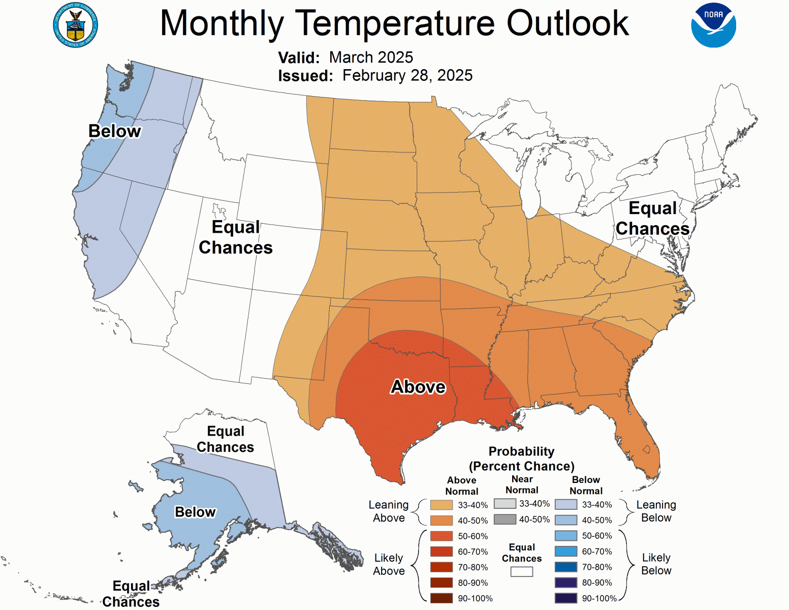
March Outlook
Based on the Climate Prediction Center's outlook for March, Georgia has an 40% to 50% chance of seeing above normal temperatures. For precipitation, Georgia has an equal chance of above or below normal precipitation.