October 10-11, 2020
Hurricane Delta made landfall early on the morning of October 9, 2020 along the Louisiana coast, bringing widespread damage to that portion of the coast. After landfall, Delta moved northeastward before picking up speed and moving just north of Georgia as it quickly weakened.
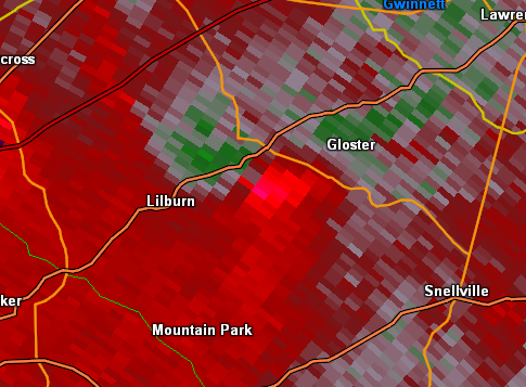
As the remnants of Delta passed northeast of Georgia on Saturday, October 10th, moisture off the Gulf of Mexico spread across the area due to Delta, bringing multiple weak tornadoes to the area in addition to pockets of heavy rainfall and flooding across the Atlanta metro area and portions of northeast Georgia. Periods of heavy rain and localized flooding led to many flooded or washed out roads and strong winds within tornadoes downed trees and power lines and damaged several buildings.
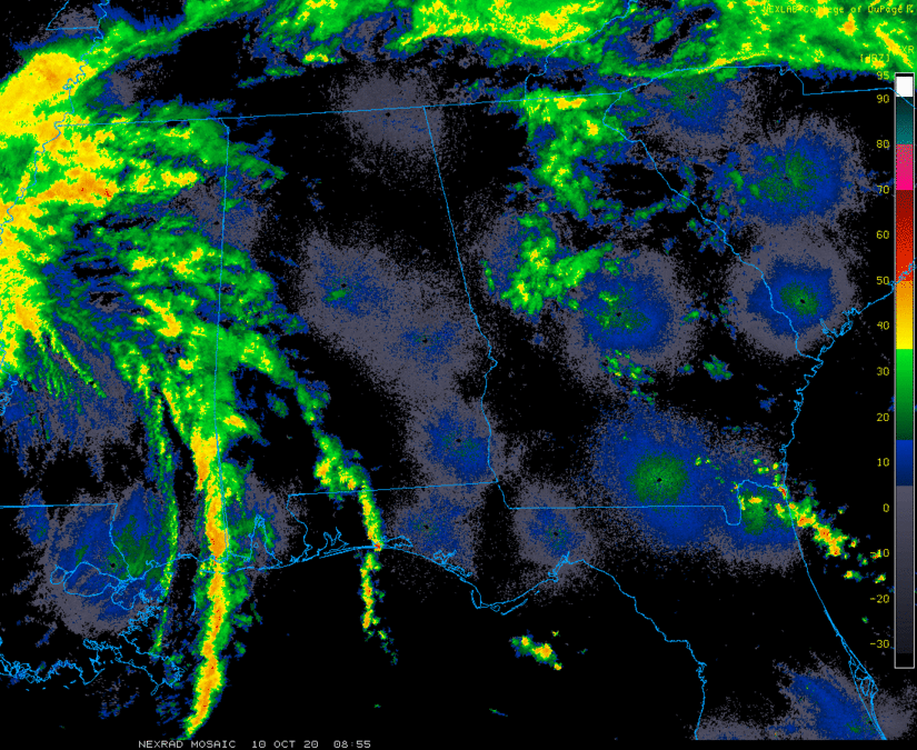
Radar Loop of Delta from October 10-11, 2020:
Local Warnings Issued October 10-11, 2020:

Periods of heavy rainfall late in the evening and overnight on Saturday October 10, 2020 led to many instances of flash flooding and river flooding across portions of north and central Georgia. Across the Atlanta metro area, 2 to 5 inches of rain fell, causing extensive flooding that led to multiple water rescues and also caused extensive river flooding around the city. Some gauges even reported their highest gauge readings over the past several years. Across northeastern Georgia, 4 to 8 inches of rainfall were reported, leading to additional flash flooding issues and numerous washed out roadways. Lingering flooding of some streams and rivers occurred for several days after the rain had ended.
|
|
| Rainfall totals reach 4-6" in some locations, particularly across the heart of metro Atlanta and into northeast Georgia. |
 |
|
| Many roadways were flooded like this one in Morrow in Clayton County at Reagan Chase. | Uncle Shuck's Corn Maze in Dawson County was flooded. |
Notable Hydrographs:
These hydrographs show several of the local waterways that reached flood stage during and after the heavy rainfall event. Some of the gauges reached as high as Moderate to Major flood stage.
Click the images to enlarge.
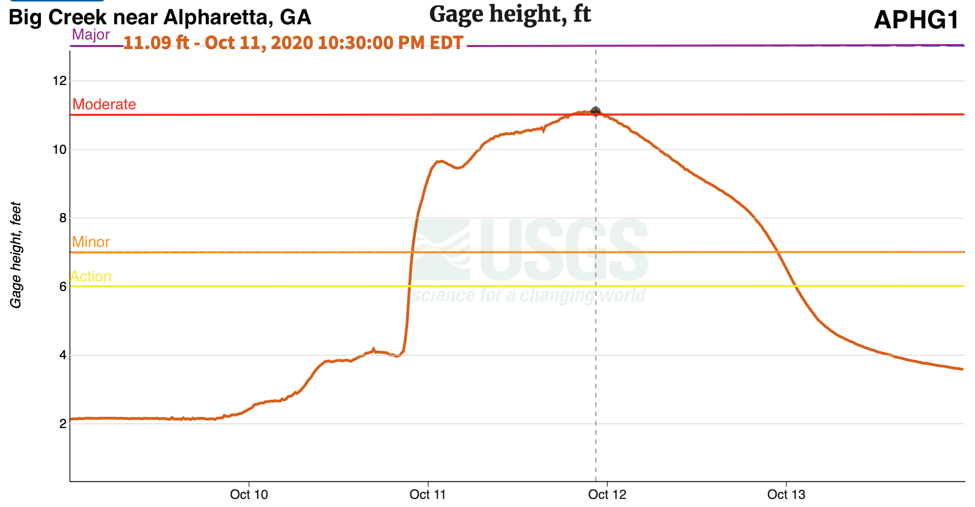


Charts courtesy of USGS.
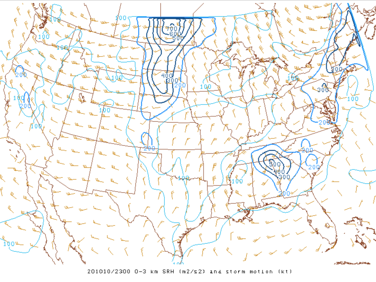
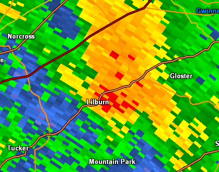
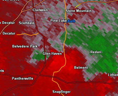
Shear and instability increased as the remnants of Delta approached the area, setting the stage for several weak tornadoes during the afternoon and evening.
|
|
 |
|
|
0-3 km storm relative helicity (Oct. 10, 7 pm) As the remnant low center of Delta passed northwest of the area, attendant shear led to favorable conditions for rotating storm cells. |
Surface CAPE (Oct. 10, 5 pm) Instability also surged northward ahead of the remnants of Delta as increased shear moved into the area. |
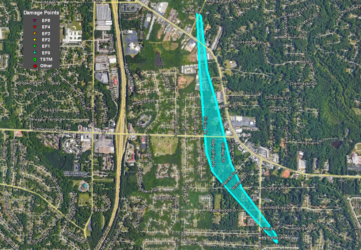
Delta Tornadoes:
| (1) Newton | (2) Coweta #1 | (3) Coweta #2 |
| (4) Pike | (5) Clayton | (6) DeKalb |
| (7) Gwinnett |
An EF-1 tornado with a path length of 1.43 miles tracked through Covington, GA. The tornado first touched down near the intersection of Washington Street and Walker Bend Parkway at 4:34 PM. It continued to move NW, ending just south of Interstate 20 along Woodhaven Drive at 4:44 PM. This tornado created some tree and structural damage with most occurring along Turner Lake Circle at a homeless shelter where portions of the roof and walls of the building were damaged. No fatalities occurred, but 2 people received minor injuries and were treated.
|
|
|
|
|
| This building suffered major structural damage from the tornado near Turner Lake Circle. | The tornado also caused minor damage to this home near Holmes Court. |
|
|
 |
 |
| Reflectivity (4:39 PM EDT). | Velocity (4:39 PM EDT). | Correlation Coefficient (4:39 PM EDT). |
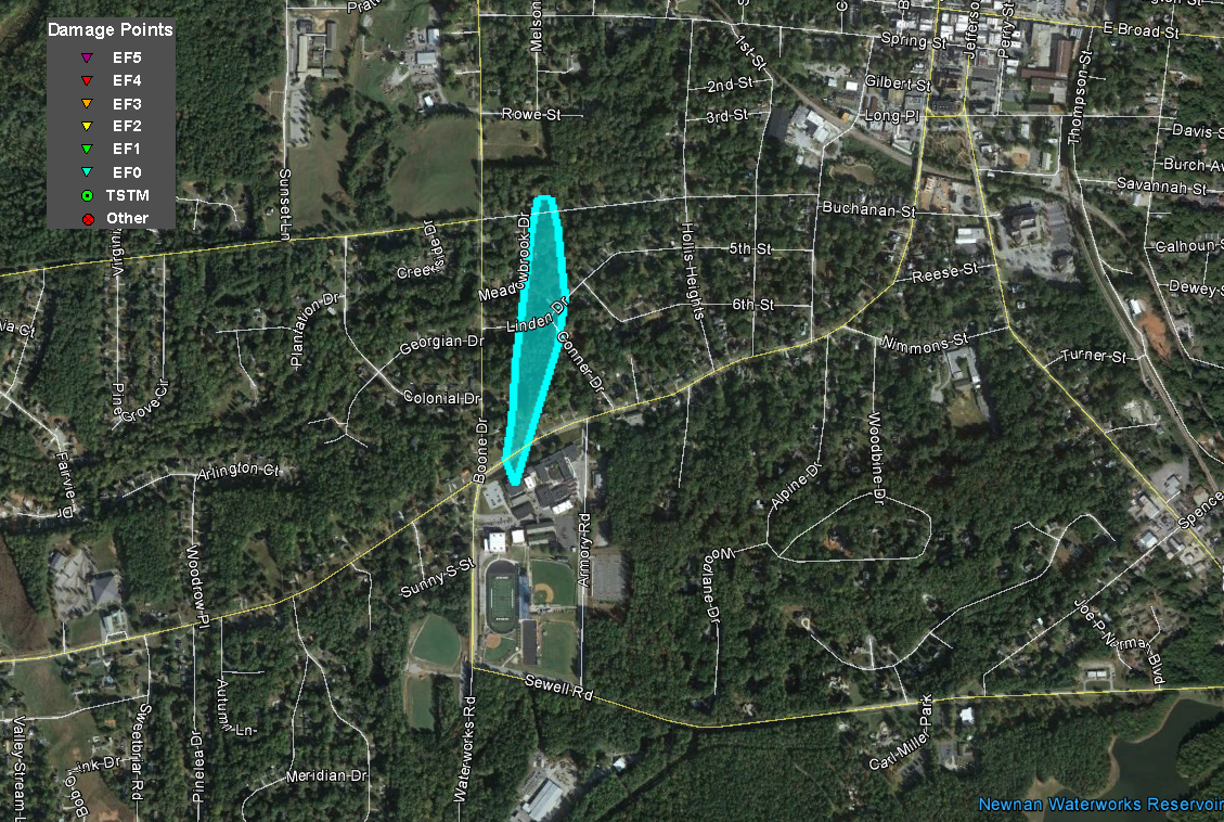
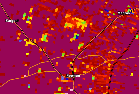
An EF-0 tornado with a path length of 0.37 miles affected the southwestern side of Newnan. The tornado first touched down on the north side of Newnan High School at 6:12 PM. It continued to move north, ending just south of Westview Cemetery at 6:13 PM. This tornado caused some tree and structural damage with most occurring at Newnan High School where a portion of the roof was damaged.
|
|
|
|
|
| Portions of Newnan High School sustained minor roof damage in the tornado. | This tree was downed in Newnan. |
|
|
 |
 |
| Reflectivity (6:13 PM EDT). | Velocity (6:14 PM EDT). | Correlation Coefficient (6:13 PM EDT). |
An EF-0 tornado with a path length of 0.83 miles tracked through the northern side of Newnan, GA. The tornado first touched down near The Village Center along Highway 29 at 6:18 PM. It continued to move north, ending in a residential area along Howard Hughes Road at 6:21 PM. This tornado caused some tree damage with the most occurring in the residential area along Howard Hughes Road where some softwood trees were uprooted.
|
|
|
|
| Several trees were downed along Highway 29 in Newnan. |
|
|
 |
 |
| Reflectivity (6:18 PM EDT). | Velocity (6:18 PM EDT). | Correlation Coefficient (6:20 PM EDT). |
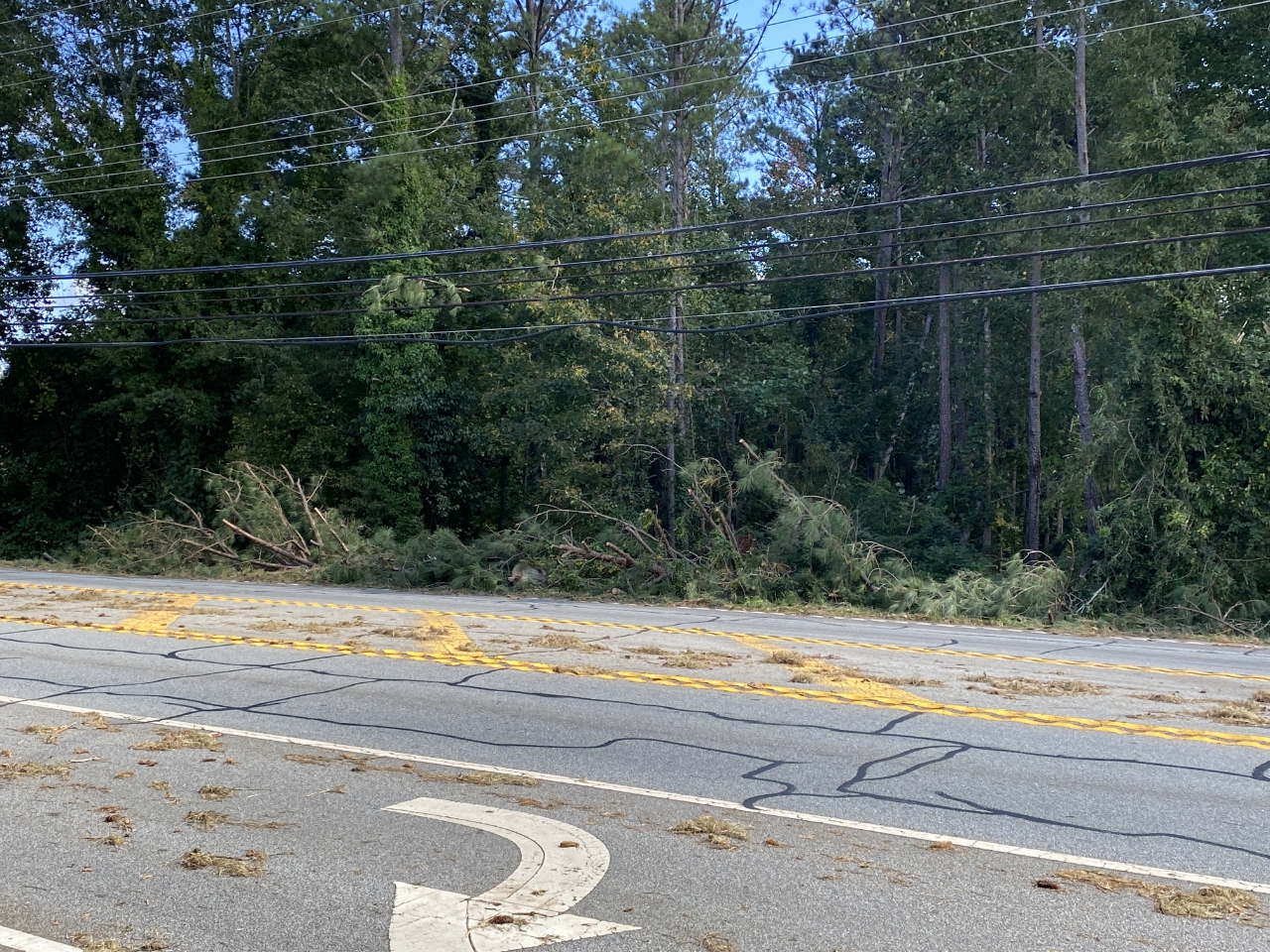
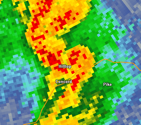
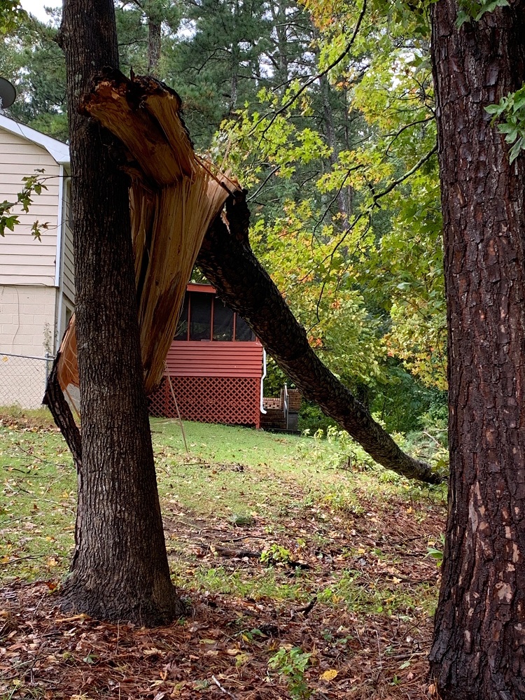
A tornado touched down just northeast of Concord in west-central Pike County, snapping or uprooting multiple trees along its path before lifting near the intersection of West Road and Hollonville Road. Based on radar and ground surveys, the tornado appeared to cause most of its damage to a number of pine trees along West Road near Bottoms Road.
|
|
|
|
| Multiple trees were snapped and uprooted by the tornado. |
|
|
 |
 |
| Reflectivity (6:28 PM EDT). | Velocity (6:28 PM EDT). | Correlation Coefficient (6:28 PM EDT). |
|
|
|
|
 |
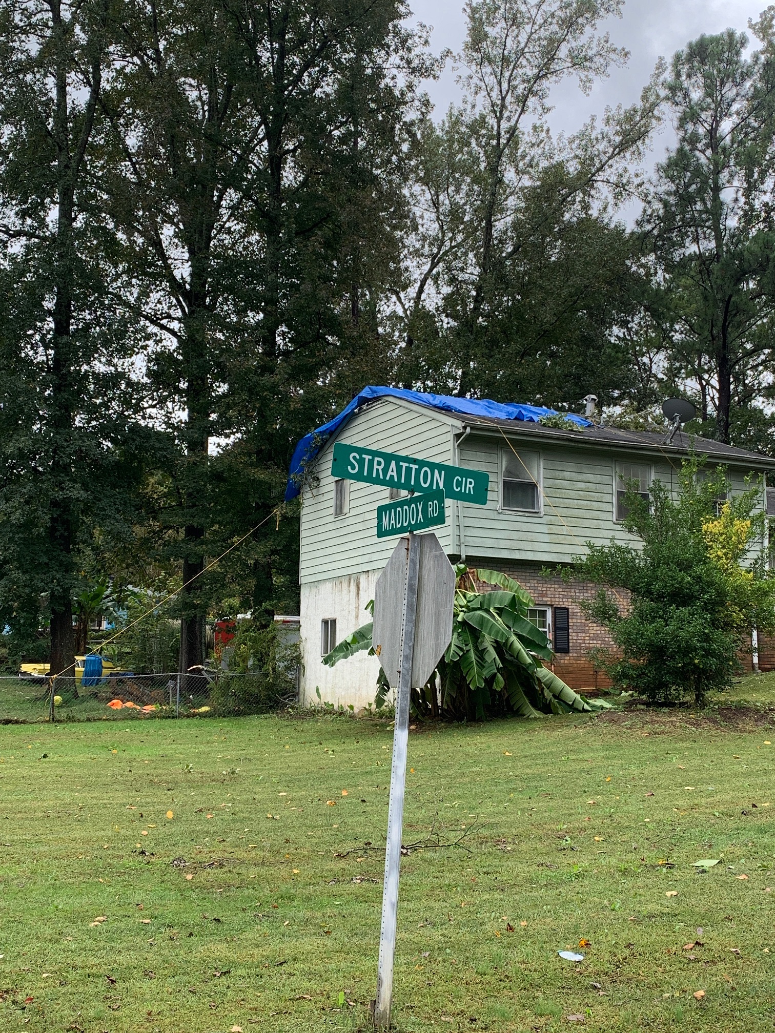
| This home at the corner of Stratton and Maddox received roof damage in the tornado. | This tree, along with several others, was snapped by the tornado. |
|
|
 |
 |
| Reflectivity (7:45 PM EDT). | Velocity (7:45 PM EDT). | Correlation Coefficient (7:45 PM EDT). |
|
|
|
|
 |
| Several large trees were downed, including this one that unfortunately crushed a vehicle. | This tree was downed onto a home. |
|
|
 |
 |
| Reflectivity (8:17 PM EDT). | Velocity (8:17 PM EDT). | Correlation Coefficient (8:17 PM EDT). |
|
|
|
|
 |
| The tornado snapped and uprooted a number of trees, including several in this backyard. | More trees damage was observed at this home. |
|
|
 |
| Reflectivity (8:42 PM EDT). | Velocity (8:43 PM EDT). |