May 3 - 4, 2021 Severe Thunderstorms
May 3rd and 4th brought two main rounds of strong and severe thunderstorms. Five tornadoes were spawned on May 3rd with additional numerous reports of damaging winds and one tornado on May 4th. In addition, due to multiple rounds of thunderstorms, heavy rainfall totals brought localized flooding to some areas of north Georgia both days.
 |
 |
|
Rainfall Totals, May 3-4 Widespread rainfall totals of 2-4" with locally higher totals over 5" led to localized flooding across north Georgia. |
Warnings Issued, May 3-4 Numerous convective warnings were issued on May 3rd and 4th. |
Preliminary Survey Information:
(click Location for Detailed Survey)
| Location of Tornado |
EF-Scale Rating |
Fatalities/ Injuries |
Damage Path Length/Max Width | Start Point/ Time |
End Point/ Time |
|
May 3 |
EF-1 90 mph |
0 |
1.5 miles long 250 yards wide |
1 E Bill Arp 33.6681 / -84.7821 10:00 AM EDT |
2 WSW Chapel Hill 33.6717 / -84.7572 10:03 AM EDT |
|
May 3 |
EF-1 110 mph |
0 (no known injuries) |
5.8 miles long 400 yards wide |
3 WSW Sandtown 33.6974 / -84.6206 10:22 AM EDT |
3 E Cassville 34.2397 / -84.7971 10:34 AM EDT |
|
May 3 |
EF-0 85 mph |
0 |
1.4 miles long 200 yards wide |
2 SSW Gratis 33.8501 / -83.6841 12:39 PM EDT |
1 SSE Gratis 33.8607 / -83.6634 12:42 PM EDT |
|
May 3 |
EF-1 90 mph |
0 |
5.6 miles long 250 yards wide |
1 SSE Neese 34.0672 / -83.315 12:54 PM EDT |
2 S Danielsville 34.0865 / -83.2213 1:32 PM EDT |
|
May 3 |
EF-0 80 mph |
0 |
2.0 miles long 200 yards wide |
1 S Winterville 33.9543 / -83.2791 1:29 PM EDT |
Dunlap 33.9544 / -83.2464 1:32 PM EDT |
|
May 4 |
EF-0 85 mph |
0 |
4.8 miles long 350 yards wide |
3 ENE Auraria 34.4797/ -83.9624 1:24 PM EDT |
3 SE Garland 34.4785/ -83.8799 1:32 PM EDT |
Storm Prediction Center (SPC) Convective Outlooks
May 3rd:
 |
|
| Initial Day 1 Convective Outlook | Day 1 Outlook Report Verification |
|
|
 |
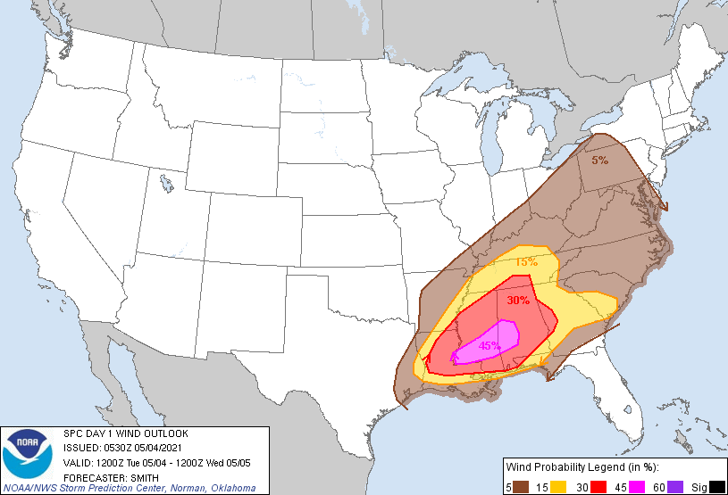
| Initial Day 1 Tornado Probabilities | Initial Day 1 Wind Probabilities |
|
|
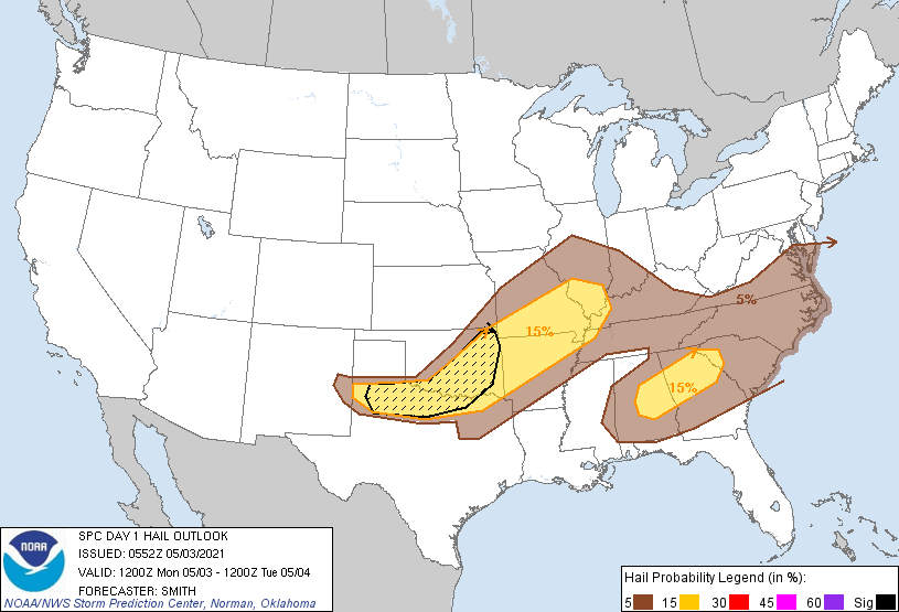
| Initial Day 1 Hail Probabilities |
|
|
|
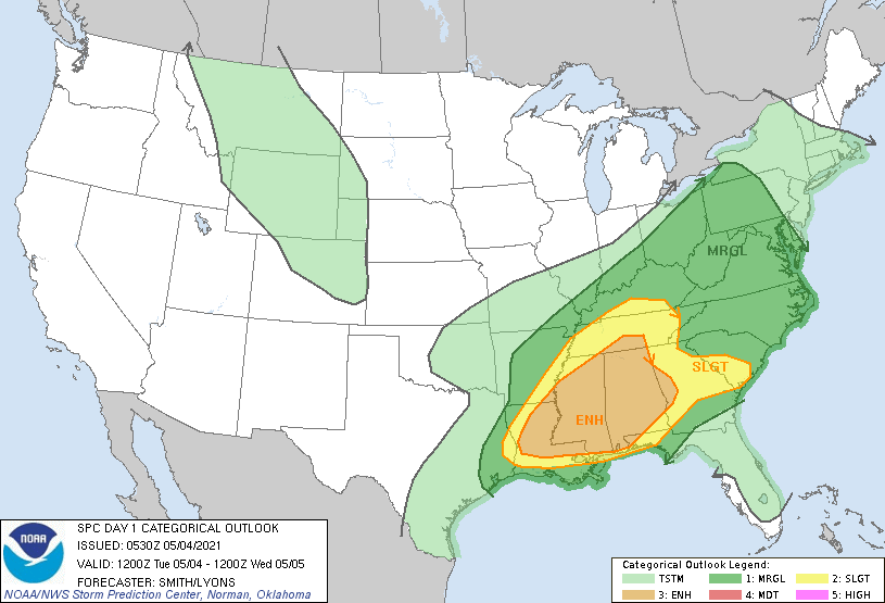
| Initial Day 1 Convective Outlook | Day 1 Outlook Verification |
|
|
 |
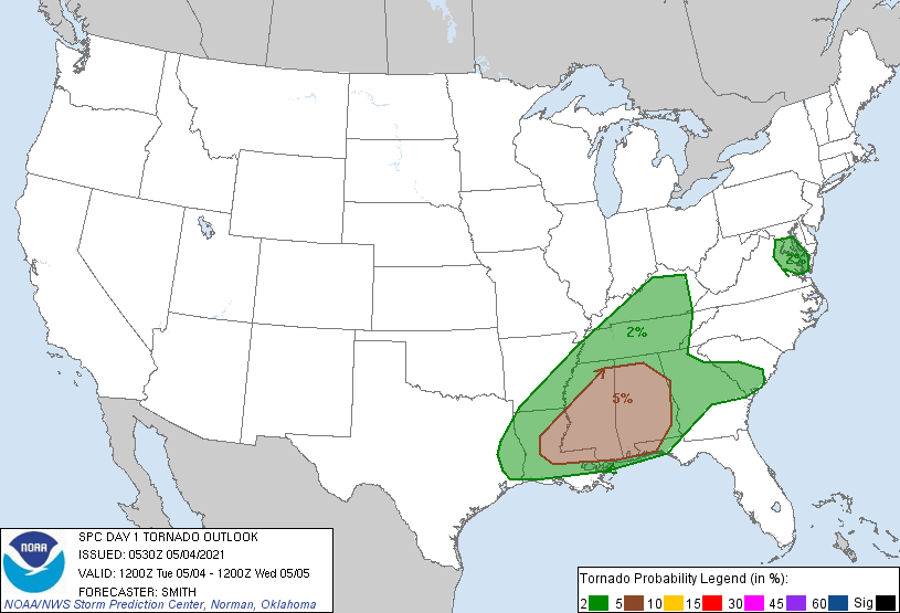
| Initial Day 1 Tornado Probabilities | Initial Day 1 Wind Probabilities |
|
|
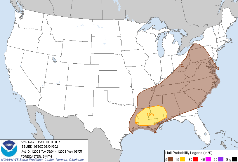
| Initial Day 1 Hail Probabilities |
|
|
Surface Analysis:
May 3
 |
|
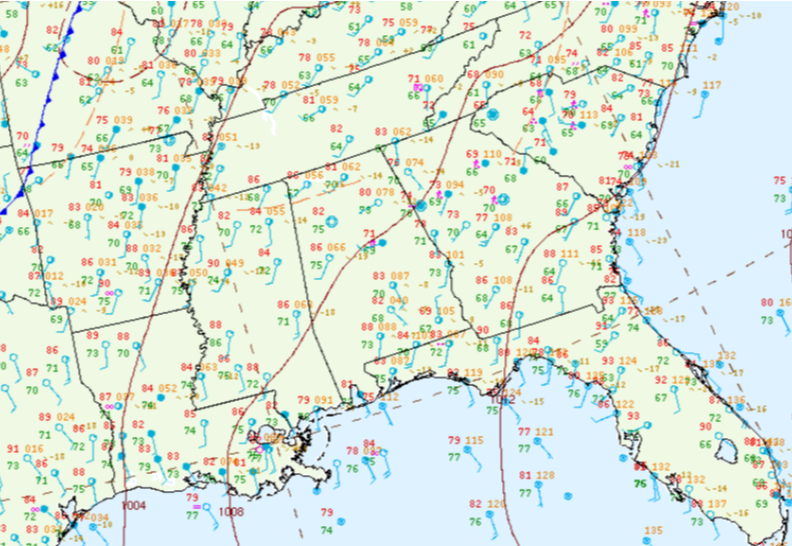
| 8 AM EDT, May 3 | 11 AM EDT, May 3 |
|
|
|
| 2 PM EDT, May 3 | 5 PM EDT, May 3 |
|
|
|
| 8 AM EDT, May 4 | 11 AM EDT, May 4 |
|
|
|
| 2 PM EDT, May 4 | 5 PM EDT, May 4 |
|
|
| 8 PM EDT, May 4 |
 |
|
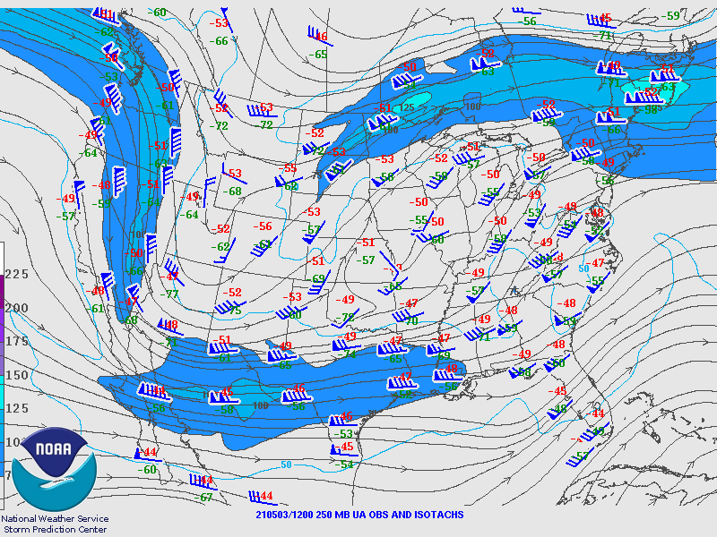
| 250 mb analysis, 8 AM | 500 mb analysis, 8 AM |
|
|
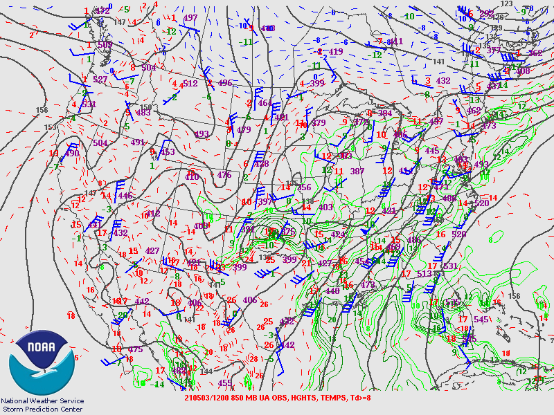
| 850 mb analysis, 8 AM |
|
|
|
| 250 mb analysis, 8 AM | 500 mb analysis, 8 AM |
|
|
| 850 mb analysis, 8 PM |