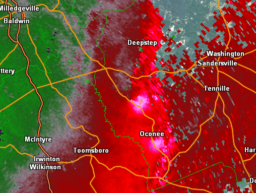
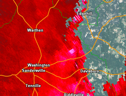
April 3, 2017 Tornado Outbreak:
[Overview]
Tornadoes of April 3, 2017:
(in chronological order of tornado occurrence by county)
Event Overview:
A line of severe thunderstorms developed ahead of an approaching storm system and rapidly raced across the area on April 3, 2017. With favorable shear in place ahead of the QLCS (quasi-linear convective system) a significant number of tornadoes formed along the leading edge of the line of thunderstorms. While all of the tornadoes were EF-2 or lower on the Enhanced Fujita scale, the large number of tornadoes in one severe weather event was very notable. Also notable is that this event was quickly followed up by another severe weather event on April 5, 2017 that added additional complexity to the surveys of tornadoes from the April 3rd event.
|

|
 |
|
|
Surface map (11 am, 04/03/2017)
A line of thunderstorms formed ahead of an approaching cold front an raced into Georgia by mid-morning on April 3rd.
|
0-1 km Storm Relative Helicity (SRH) (12 pm, 04/03/2017)
SRH helicity values were very supportive of QLCS tornadoes along the leading edge of the approaching line of storms.
|
|
|
|
|
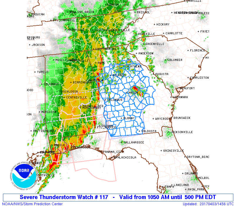
A Severe Thunderstorm Watch was initially issued ahead of the line of storms as it entered Georgia in the morning.
|
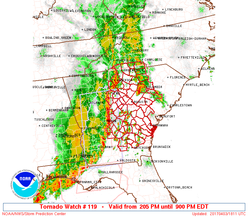
A Tornado Watch was later issued for the remainder of the area ahead of the line of thunderstorms during the afternoon. |
|

|
| Numerous Storm Reports were received across the area on April 3, 2017 |
Tornadoes:
1) Carroll County Tornado:
A brief tornado embedded within a line of strong to severe thunderstorms touched down over central Carroll County, very near the University of West Georgia. The tornado tracked tracked northeast then turned slightly east before dissipating near Highway 27 in Carrollton. Much of the tornado damage was snapped and uprooted trees; however, significant structural damage occurred to a fire station off Brumbelow Road. A styrofoam-metal roof was pulled off, and in the process, a portion of the concrete exterior wall was destroyed. Numerous large trees were snapped or uprooted across the street from this location. Based on this damage, estimated winds were around 90 mph, which resulted in an EF-1 rating for this tornado. Additional damage (mainly snapped trees) was seen in a north-south path between Cedar Street and Newnan Road but was likely caused by strong inflow/thunderstorm winds.
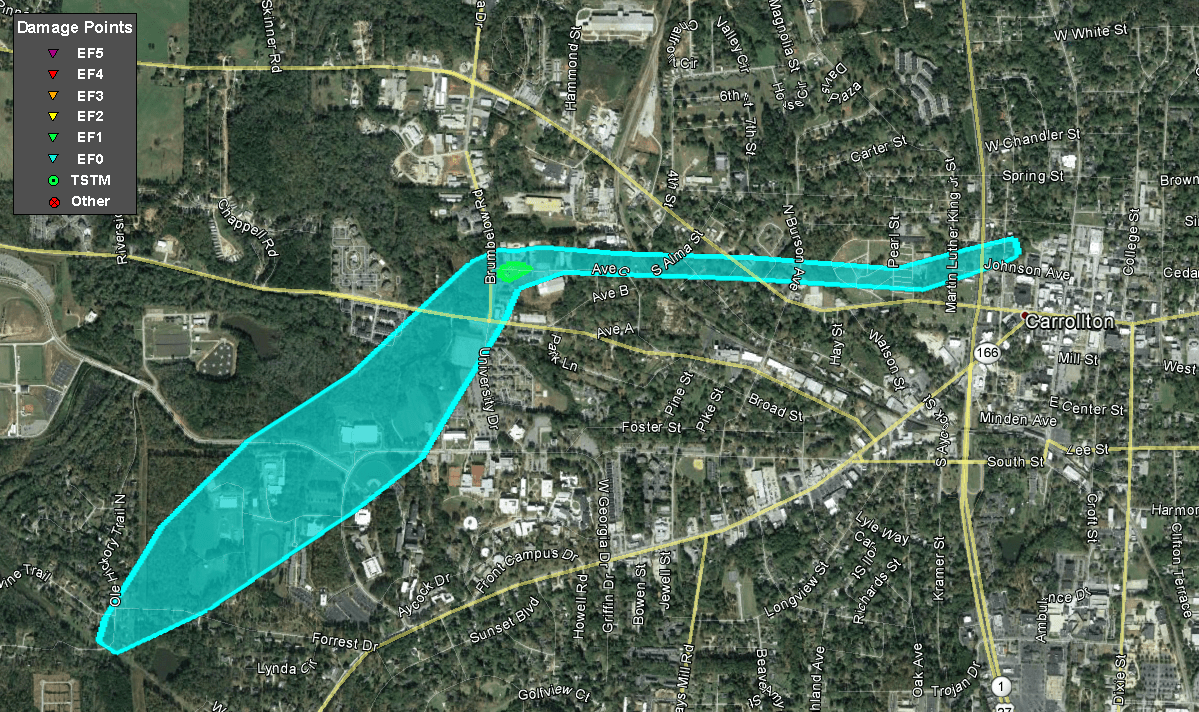 |
| Damage Path - Carroll County |
|
| County |
Rating |
# of Injuries |
KML |
| Carroll |
EF-1 |
0 |
 |
|
| Rating: |
EF-1 |
| Peak Wind: |
90 MPH |
| Path Length: |
2.5 miles |
| Path Width: |
300 yards |
| Fatalities: |
0 |
| Injuries: |
0 |
| Start Date: |
Apr. 3, 2017 |
| Start Time: |
10:58 AM EDT |
| Start Lat/Lon: |
33.5688 / -85.1141 |
| End Date: |
Apr. 3, 2017 |
| End Time: |
11:02 AM EDT |
| End Lat/Lon: |
33.5826 / -85.0765 |
|
|
|

|
 |
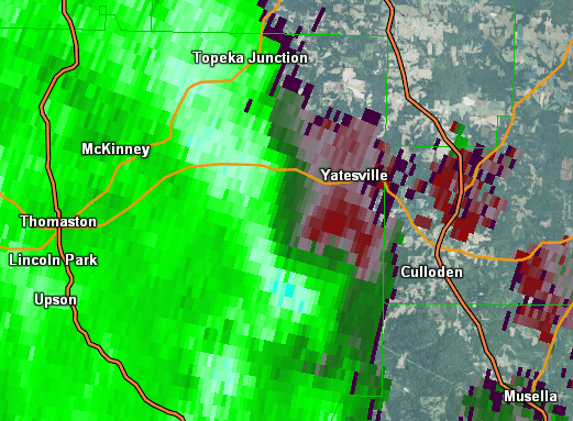
| This fire station on Brumbelow Road lost most of its roof as well as an exterior concrete wall. |
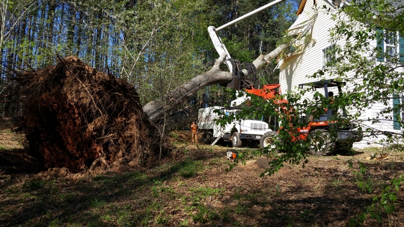
This home suffered major damage when a huge tree fell onto it. |
|

|
 |
| Reflectivity (10:59 AM EDT) |
Velocity (10:59 AM EDT) |
2) Fulton County Tornado:
An EF1 tornado touched down along Cambellton Redwine Road in a rural part of southwest Fulton County. A few trees were snapped onto the road and in an adjacent field. The tornado continued northeast Crossing Upper Wooten Rd and Rico Road snapping and uprooting trees before moving through a heavily wooded area north of Upper Wooten Road. A NWS meteorologist noted that the area is full of bike trails and biked the area noticing hundreds of trees down across paths throughout its path. NWS radar also confirmed a TDS signature when the tornado was passing through this region as well. The tornado crossed into Cochran Mill Park snapping a few trees…then across Cochran Mill Rd before lifting just south of Rivertown Rd.
 |
| Damage Path - Fulton County |
|
| County |
Rating |
# of Injuries |
KML |
| Fulton |
EF-1 |
0 |
 |
|
| Rating: |
EF-1 |
| Peak Wind: |
90 MPH |
| Path Length: |
4.6 miles |
| Path Width: |
150 yards |
| Fatalities: |
0 |
| Injuries: |
0 |
| Start Date: |
Apr. 3, 2017 |
| Start Time: |
11:28 AM EDT |
| Start Lat/Lon: |
33.5678 / -84.7811 |
| End Date: |
Apr. 3, 2017 |
| End Time: |
11:37 AM EST |
| End Lat/Lon: |
33.5773 / -84.7113 |
|
|
|

|
 |
| Numerous trees were downed in the vicinity of Cochran Mill Park. |
Numerous trees were downed in the vicinity of Cochran Mill Park. |
|

|
 |
| Reflectivity (11:32 AM EDT) |
Velocity (11:33 AM EDT) |
3) Muscogee County Tornado:
An EF-1 tornado touched down in Columbus along Cusseta Road and traveled ENE crossing Clover Lane, Brennan Road, and into a mobile home community south of St. Mary's Road. Numerous trees were downed and damage to homes consisted of roof damage, blown-away mobile home skirting, and in one case a roof was removed in the mobile home community. The tornado crossed St. Mary's Road into another neighborhood where numerous trees were snapped or uprooted along Vivian Lane, Hawaii Way, and North Oakley Drive. An apartment complex on North Oakley Drive had more than 20 percent of its roofing removed. The tornado crossed Interstate 185 a few hundred feet north of the St. Mary's Road exit into the Sunset Trace Neighborhood. Numerous trees were snapped or uprooted, including some onto homes and cars. The tornado continued east, crossing Wickham Drive and Mays Avenue onto Dorado Circle where the most extensive home damage occurred from falling trees. The tornado began to weaken as it crossed Northstar Drive, narrowly missing a school while snapping a few trees nearby. The tornado ended along RC Allen Drive prior to crossing into Fort Benning.
 |
| Damage Path - Muscogee County |
|
| County |
Rating |
# of Injuries |
KML |
| Muscogee |
EF-1 |
0 |
 |
|
| Rating: |
EF-1 |
| Peak Wind: |
90 MPH |
| Path Length: |
3.5 miles |
| Path Width: |
175 yards |
| Fatalities: |
0 |
| Injuries: |
0 |
| Start Date: |
Apr. 3, 2017 |
| Start Time: |
11:42 AM EDT |
| Start Lat/Lon: |
32.4443 / -84.9555 |
| End Date: |
Apr. 3, 2017 |
| End Time: |
11:48 AM EST |
| End Lat/Lon: |
32.4484 / -84.8996 |
|
|
|

|
 |
| This home on Dorado Circle was severely damaged by large falling trees. |
This type of tree damage was common along the tornado's path. |
|

|
 |
| Reflectivity (11:42 AM EDT) |
Velocity (11:42 AM EDT) |
4) Stewart County Tornado #1 (Lumpkin):
An EF-0 tornado touched down along Green Gove Road southwest of the town of Lumpkin in Stewart County. The tornado snapped a few trees west of the Bell Sister Road intersection and traveled ESE, hitting Stewart County High School. Several trees were snapped at the front of the school, and roofing material was torn from the school and spread several hundred yards eastward. Water damage inside the school resulted from the loss of the roofing material, primarily on the east side of the school. Bleachers on the adjacent baseball field were overturned and sections of fence along the field were blown down. A few more trees were blown down east of the high school before the tornado lifted just west of US Highway 27.
 |
| Damage Path - Stewart County |
|
| County |
Rating |
# of Injuries |
KML |
| Stewart |
EF-0 |
0 |
 |
|
| Rating: |
EF-0 |
| Peak Wind: |
85 MPH |
| Path Length: |
1.6 miles |
| Path Width: |
150 yards |
| Fatalities: |
0 |
| Injuries: |
0 |
| Start Date: |
Apr. 3, 2017 |
| Start Time: |
12:10 PM EDT |
| Start Lat/Lon: |
32.0336 / -84.8361 |
| End Date: |
Apr. 3, 2017 |
| End Time: |
12:12 PM EDT |
| End Lat/Lon: |
32.0306 / -84.8097 |
|
|
|

|
 |
| Stewart County High School suffered extensive roof damage in the tornado. |
These bleachers were tossed by the tornadic winds. |
|

|
 |
| Reflectivity (12:10 PM EDT) |
Velocity (12:10 PM EDT) |
5) Stewart County Tornado #2:
An EF-0 tornado recycled from the same storm that caused a tornado near Lumpkin, GA and touched down along US-27 southwest of Richland, snapping a few trees south of the highway. The tornado continued northeast, hitting a small shed on the north side of the highway and ripping off roof panels. The tornado knocked down a few trees near the intersection of Pleasant Valley Toad and US-27 before weakening prior to Highway 520.
 |
| Damage Path - Stewart County |
|
| County |
Rating |
# of Injuries |
KML |
| Stewart |
EF-0 |
0 |
 |
|
| Rating: |
EF-0 |
| Peak Wind: |
70 mph |
| Path Length: |
1.3 miles |
| Path Width: |
100 yards |
| Fatalities: |
0 |
| Injuries: |
0 |
| Start Date: |
Apr. 3, 2017 |
| Start Time: |
12:16 PM EDT |
| Start Lat/Lon: |
32.0692 / -84.7015 |
| End Date: |
Apr. 3, 2017 |
| End Time: |
12:18 PM EDT |
| End Lat/Lon: |
32.081 / -84.6832 |
|
|
|

|
 |
| Reflectivity (12:16 PM EDT) |
Velocity (12:17 PM EDT) |
6) Lumpkin County Tornado:
A brief tornado developed along a line of thunderstorms shortly after noon just east of Highway 19 and Georgia 400 North. EF-0 damage in the form of numerous uprooted trees were found along the majority of Red Oak Flats Road. Shortly thereafter, the tornado strengthened to an EF-1 along a ridgetop northeast of Red Oak Flats Road where significant damage to barns and sheds was found. In addition, damage to a home was found on Dunagan Drive along with numerous large trees uprooted in a local pasture behind the road. The tornado continued along Cleveland Highway for several miles but weakened to an EF-0 at which point it caused damage to numerous trees and the collapse of a large local chicken coop on Francis Smith Road. The tornado lifted quickly after moving east of Francis Smith Road.
 |
| Damage Path - Lumpkin County |
|
| County |
Rating |
# of Injuries |
KML |
| Lumpkin |
EF-1 |
0 |
 |
|
| Rating: |
EF-1 |
| Peak Wind: |
100 |
| Path Length: |
4.6 miles |
| Path Width: |
350 yards |
| Fatalities: |
0 |
| Injuries: |
0 |
| Start Date: |
Apr. 3, 2017 |
| Start Time: |
12:18 PM EDT |
| Start Lat/Lon: |
34.4858 / -83.9252 |
| End Date: |
Apr. 3, 2017 |
| End Time: |
12:26 PM EDT |
| End Lat/Lon: |
34.5356 / -83.8714 |
|
|
|

|
 |
| This barn on Dunagan Road suffered significant roof damage. |
Numerous trees were uprooted by the tornado in this pasture. |
|

|
 |
| Reflectivity (12:23 PM EDT) |
Velocity (12:24 PM EDT) |
7) Talbot County Tornado #1:
An EF-0 tornado touched down northeast of Talbotton along Boot Kelly Road. The tornado snapped a few trees and tossed several trampolines near the beginning of the track where a few homes were located. As the tornado traveled northeast, the area became more forested, and damage was limited to trees snapped on either side of Boot Kelly Road. The tornado lifted briefly before crossing PoBiddy Road and recycling another tornado farther northeast.
 |
| Damage Path - Talbot County |
|
| County |
Rating |
# of Injuries |
KML |
| Talbot |
EF-0 |
0 |
 |
|
| Rating: |
EF-0 |
| Peak Wind: |
70 MPH |
| Path Length: |
2.2 miles |
| Path Width: |
75 yards |
| Fatalities: |
0 |
| Injuries: |
0 |
| Start Date: |
Apr. 3, 2017 |
| Start Time: |
12:18 PM EDT |
| Start Lat/Lon: |
32.6956 / -84.5267 |
| End Date: |
Apr. 3, 2017 |
| End Time: |
12:22 PM EDT |
| End Lat/Lon: |
32.7069 / -84.4908 |
|
|
|

|
 |
| This large tree was snapped by the tornado. |
This picture illustrates more of the tree damage the tornado caused. |
|

|
 |
| Reflectivity (12:19 PM EDT) |
Velocity (12:19 PM EDT) |
8) Talbot County Tornado #2:
A high-end EF-1 tornado touched down south of PoBiddy Road and Jeff Hendricks Road and traveled eastward, snapping a few trees before crossing Poplar Cross Road where several trees were snapped or uprooted onto the road. The tornado continued eastward north of Carl Mathis Road in a largely wooded area, damaging trees before reaching an unoccupied home along Carl Mathis Road. A nearly 100-year-old barn was completely destroyed along with a small shed. Numerous pecan and hardwood trees 200 feet north of the home were snapped and uprooted. The tornado crossed Carl Mathis Road and George Smith Road, continuing to cause damage to trees before weakening in a wooded area east of George Smith Road.
 |
| Damage Path - Talbot County |
|
| County |
Rating |
# of Injuries |
KML |
| Talbot |
EF-1 |
0 |
 |
|
| Rating: |
EF-1 |
| Peak Wind: |
105 MPH |
| Path Length: |
4.6 miles |
| Path Width: |
200 yards |
| Fatalities: |
0 |
| Injuries: |
0 |
| Start Date: |
Apr. 3, 2017 |
| Start Time: |
12:26 PM EDT |
| Start Lat/Lon: |
32.7393 / -84.434 |
| End Date: |
Apr. 3, 2017 |
| End Time: |
12:32 PM EDT |
| End Lat/Lon: |
32.7531 / -84.3606 |
|
|
|

|
 |
| This large barn was destroyed by the tornado. |
Many trees were snapped or uprooted along the tornado's path. |
|

|
 |
| Reflectivity (12:28 PM EDT) |
Velocity (12:28 PM EDT) |
9) Webster County Tornado:
An EF-0 tornado touched down just west of Seminole Road in Webster County, snapping several trees onto Seminole Road. The tornado continued east, snapping trees as it crossed County Road 8 and County Road 123 before lifting prior to crossing Highway 41. Winds associated with inflow into the storm as well as the rear flank caused damage farther south along Churchill and Harry Roads, snapping and uprooting trees. A large tree fell onto a car along US-280 near the Webster/Stewart County line, trapping a man inside.
 |
| Damage Path - Webster County |
|
| County |
Rating |
# of Injuries |
KML |
| Webster |
EF-0 |
0 |
 |
|
| Rating: |
EF-0 |
| Peak Wind: |
75 MPH |
| Path Length: |
3.9 miles |
| Path Width: |
150 yards |
| Fatalities: |
0 |
| Injuries: |
0 |
| Start Date: |
Apr. 3, 2017 |
| Start Time: |
12:29 PM EDT |
| Start Lat/Lon: |
32.1409 / -84.6112 |
| End Date: |
Apr. 3, 2017 |
| End Time: |
12:31 PM EDT |
| End Lat/Lon: |
32.1492 / -84.5456 |
|
|
|

|
 |
| These trees were snapped near the beginning of the tornado track. |
The top of this tree was snapped off by the tornado. |
|

|
 |
| Reflectivity (12:29 PM EDT) |
Velocity (12:29 PM EDT) |
10) Spalding County Tornado:
A very brief tornado touched down just northwest of the city of Griffin, near the University of Georgia - Griffin campus. In just over 1/2 mile, numerous trees were snapped or uprooted, some of them falling on several homes and causing more extensive structural damage. The damage occurred in a narrow path between Melrose Avenue and Cedar Avenue, along and just south of Ellis Road. Based on the larger trees that were uprooted or snapped near their bases, maximum winds of 85 mph were determined, which is a high-end EF-0 tornado.
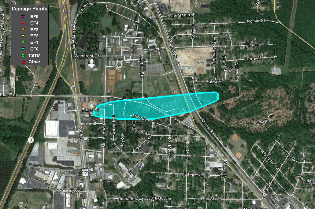 |
| Damage Path - Spalding County |
|
| County |
Rating |
# of Injuries |
KML |
| Spalding |
EF-0 |
0 |
 |
|
| Rating: |
EF-0 |
| Peak Wind: |
85 MPH |
| Path Length: |
0.6 miles |
| Path Width: |
150 yards |
| Fatalities: |
0 |
| Injuries: |
0 |
| Start Date: |
Apr. 3, 2017 |
| Start Time: |
12:35 PM EDT |
| Start Lat/Lon |
32.2599 / -84.2874 |
| End Date: |
Apr. 3, 2017 |
| End Time: |
12:37 PM EDT |
| End Lat/Lon: |
33.2613 / -84.2773 |
|
|
|

|
 |
| Several very large trees were downed by the tornado. |
Several very large trees were downed by the tornado. |
|

|
 |
| Reflectivity (12:36 PM EDT) |
Velocity (12:36 PM EDT) |
11) Upson County Tornado #1:
An EF-0 tornado briefly touched down south of Thomaston along John B. Gordon Road, snapping a few trees. The tornado tracked northeast, crossing US-19 and then followed along New Harmony Church Road where several trees were snapped or uprooted. Minor roof damage was noted to some homes along Samuel Atwater Road. The tornado lifted before crossing Wolf Creek.
 |
| Damage Path - Upson County |
|
| County |
Rating |
# of Injuries |
KML |
|
Upson
|
EF-0 |
0 |
 |
|
| Rating: |
EF-0 |
| Peak Wind: |
70 mph |
| Path Length: |
1.7 miles |
| Path Width: |
75 yards |
| Fatalities: |
0 |
| Injuries: |
0 |
| Start Date: |
Apr. 3, 2017 |
| Start Time: |
12:36 PM EDT |
| Start Lat/Lon: |
32.8198 / -84.3151 |
| End Date: |
Apr. 3, 2017 |
| End Time: |
12:39 PM EDT |
| End Lat/Lon: |
32.8296 / -84.2875 |
|
|
|

|
 |
| Reflectivity (12:36 PM EDT) |
Velocity (12:36 PM EDT) |
12) Upson County Tornado #2:
An EF-0 tornado developed out of the same storm that produced a short tornado track south of Thomaston 6 minutes earlier. The tornado first touched down west of Birdsong Road, snapping a few trees. The tornado then continued east along Waymanville Road where numerous trees were snapped and uprooted. The tornado shifted slightly to a ENE path and crossed Kendall Drive, uprooting several trees before crossing the intersection of Log-Town and Traylor Driver where several trees were snapped or uprooted. Minor damage occurred to a church at the intersection. The tornado continued ENE, crossing Kendall Road several times as it traveled nearly parallel to it, snapping a few trees along the way. The tornado crossed Pleasant Grove Road where several trees were snapped or uprooted. The tornado then lifted in a wooded area east of this location before crossing into Monroe County. There were reports of trees downed in the town of Culloden east of this location. This damage was determined to be caused by thunderstorm wind associated with this storm as outflow winds took over and dissipated the tornado.
 |
| Damage Path - Upson County |
|
| County |
Rating |
# of Injuries |
KML |
| Upson |
EF-0 |
0 |
 |
|
| Rating: |
EF-0 |
| Peak Wind: |
85 MPH |
| Path Length: |
6.9 miles |
| Path Width: |
150 yards |
| Fatalities: |
0 |
| Injuries: |
0 |
| Start Date: |
Apr. 3, 2017 |
| Start Time: |
12:44 PM EDT |
| Start Lat/Lon: |
32.843 / -84.2483 |
| End Date: |
Apr. 3, 2017 |
| End Time: |
12:52 PM EDT |
| End Lat/Lon: |
32.8724 / -84.1389 |
|
|
|
|
 |
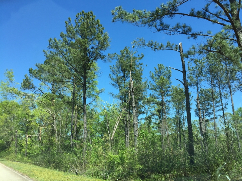
| This type of tree damage was typical along the tornado's track. |
More tree damage along the track of the tornado. |
|

|
 |
| Reflectivity (12:47 PM EDT) |
Velocity (12:47 PM EDT) |
13) Schley County Tornado:
An EF-1 tornado touched down west of Ellaville near a small farm south of Chancey Drive and moved east. The tornado snapped and uprooted trees along its path south of Chancey Drive into the southwestern portion of Ellaville. The tornado snapped and uprooted dozens of trees as it crossed Pinefield and Ridgewood Drives. Several homes along those streets were impacted. The tornado continued east, crossing Ebenezer Road. It followed east along Pine Circle where trees were snapped and roof damage to homes occurred. The tornado crossed South Calloway Drive and Broad Street where a large metal building collapsed onto peanut storage bins. The tornado then turned southeast, hitting a large warehouse and mobile home manufacturer, caving in the front of the metal building and overturning several mobile homes in the lot. The tornado then turned east, crossing US-19 and paralleling Highway 228, where a few trees were snapped before the tornado lifted west of Lacross Road. In total, 40+ homes were damaged, 3 homes were destroyed by trees, and 12 businesses sustained damage of varying severity. The entire town of Ellaville was without power for more than 24 hours.
 |
| Damage Path - Schley County |
|
| County |
Rating |
# of Injuries |
KML |
| Schley |
EF-1 |
0 |
 |
|
| Rating: |
EF-1 |
| Peak Wind: |
105 mph |
| Path Length: |
5.6 miles |
| Path Width: |
200 yards |
| Fatalities: |
0 |
| Injuries: |
0 |
| Start Date: |
Apr. 3, 2017 |
| Start Time: |
12:46 PM EDT |
| Start Lat/Lon: |
32.2295 / -84.3569 |
| End Date: |
Apr. 3, 2017 |
| End Time: |
12:56 PM EDT |
| End Lat/Lon: |
32.2272 / -84.2632 |
|
|
 |
 |
| The tornado collapsed this metal building onto peanut storage bins. |
Many trees were snapped in Ellaville like the ones in this picture. A number of homes were impacted by these falling trees.
|
|

|
 |
| Reflectivity (12:51 PM EDT) |
Velocity (12:51 PM EDT) |
14) Henry County Tornado:
A brief tornado touched down in southern Henry County, just south of the Locust Grove community. The tornado traveled in a nearly due-east path for less than 2 miles and mainly snapped or uprooted trees. In a neighborhood off Jayley Parkway, numerous shingles were pulled off a roof of one residence. Just south of this location, a large tree fell on one corner of a house resulting in significant roof and exterior wall damage. Maximum winds were determined to be around 85 mph based on the numerous uprooted and snapped trees. The tornado lifted along Grove Pointe Circle just east of Locust Road. Note: This tornado was associated with the same storm that produced the Griffin EF-0 tornado about 20 minutes earlier.
 |
| Damage Path - Henry County |
|
| County |
Rating |
# of Injuries |
KML |
| Henry |
EF-0 |
0 |
 |
|
| Rating: |
EF-0 |
| Peak Wind: |
85 MPH |
| Path Length: |
1.8 miles |
| Path Width: |
250 yards |
| Fatalities: |
0 |
| Injuries: |
0 |
| Start Date: |
Apr. 3, 2017 |
| Start Time: |
12:52 PM EDT |
| Start Lat/Lon: |
33.3184 / -84.1156 |
| End Date: |
Apr. 3, 2017 |
| End Time: |
12:55 PM EDT |
| End Lat/Lon: |
33.3181 / -84.085 |
|
|
|

|
 |
| This home sustained roof damage from the tornado. |
This home sustained significant damage when a massive tree fell onto it. |
|

|
 |
| Reflectivity (12:48 PM EDT) |
Velocity (12:49 PM EDT) |
15) Monroe County Tornado:
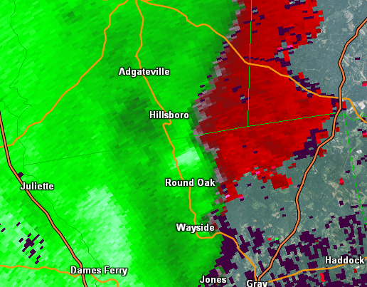
A high end EF-1 tornado touched down west of US-41 near Montpelier Road and traveled northeast crossing US-41 near Old Rumble Road. Numerous trees were snapped or uprooted in this area. The tornado widened, possible the result of a downburst, as it approached Gose Road west of I-75. More than a hundred trees were snapped or uprooted in a wooded area west of Gose Road. Along Gose Road, numerous homes sustained roof damage form the wind or from falling trees. The tornado continued east, crossing I-75 where several trees fell onto cars on I-75 and blocked the highway. The interstate was shut down for several hours sue to debris and flooding. The tornado continued east and crossed Lee King Road, damaging a small garage roof and snapping dozens of trees before crossing Abares Road and Jenkins Road where trees were snapped and uprooted. The tornado began to weaken as it continued ENE, crossing Dames Ferry Road and snapping a few trees. The tornado dissipated shortly before crossing over Lake Juliette north of GA-18. in total, several thousand were without power and 30 homes sustained damage with 9 sustaining major and 1 destroyed. One family was trapped in their home along Music Row.
 |
| Damage Path - Monroe County |
|
| County |
Rating |
# of Injuries |
KML |
| Monroe |
EF-1 |
3 |
 |
|
| Rating: |
EF-1 |
| Peak Wind: |
110 MPH |
| Path Length: |
8.3 miles |
| Path Width: |
300 yards |
| Fatalities: |
0 |
| Injuries: |
3 |
| Start Date: |
Apr. 3, 2017 |
| Start Time: |
1:06 PM EDT |
| Start Lat/Lon: |
32.9899 / -83.9028 |
| End Date: |
Apr. 3, 2017 |
| End Time: |
1:22 PM EDT |
| End Lat/Lon: |
33.0316 / -83.7716 |
|
|
|

|
 |
| This garage on Lee King Road was heavily damaged by the tornado. |
This home sustained roof damage from the tornado's winds. |
|

|
 |
| Reflectivity (1:14 PM EDT) |
Velocity (1:14 PM EDT) |
16) Peach and Houston County Tornado:
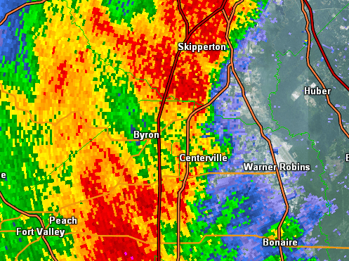
A low end EF-1 tornado touched down in west Byron in northern Peach County and traveled east across the northern portions of Centerville and Warner Robins in northern Houston County. The primary damage was mainly hardwood trees being either uprooted or snapped along this path. A few trees north of Centerville caused some roof damage when they fell onto homes.
 |
| Damage Path - Peach and Houston Counties |
|
| County |
Rating |
# of Injuries |
KML |
| Peach & Houston |
EF-1 |
0 |
 |
|
| Rating: |
EF-1 |
| Peak Wind: |
93 MPH |
| Path Length: |
9.4 miles |
| Path Width: |
630 yards |
| Fatalities: |
0 |
| Injuries: |
0 |
| Start Date: |
Apr. 3, 2017 |
| Start Time: |
1:30 PM EDT |
| Start Lat/Lon: |
32.6576 / -83.7657 |
| End Date: |
Apr. 3, 2017 |
| End Time: |
1:45 PM EDT |
| End Lat/Lon: |
32.6545 / -83.6079 |
|
|
|

|
 |
| Most damage consisted of snapped or uprooted trees such as this one in Peach County. |
This large tree fell onto a home in Houston County. |
|
|
 |
| Reflectivity (1:40 PM EDT) |
Velocity (1:40 PM EDT) |
17) Jones County Tornado:
An EF-0 tornado touched down west of Hadaway Road in Jones County and traveled eastward, crossing Hillsboro Lake Road, Hadaway Road as second time south of where Dumas Road connects with Hadaway. Trees were snapped and uprooted along the path. Minor structure damage occured to one home on Hillsboro Lake Road when a tree was uprooted next to the home. Otherwise the area impacted by the tornado is largely wooded.
 |
| Damage Path - Jones County |
|
| County |
Rating |
# of Injuries |
KML |
| Jones |
EF-0 |
0 |
 |
|
| Rating: |
EF-0 |
| Peak Wind: |
70 MPH |
| Path Length: |
3.0 miles |
| Path Width: |
100 yards |
| Fatalities: |
0 |
| Injuries: |
0 |
| Start Date: |
Apr. 3, 2017 |
| Start Time: |
1:40 PM EDT |
| Start Lat/Lon: |
33.146 / -83.6046 |
| End Date: |
Apr. 3, 2017 |
| End Time: |
1:46 PM EDT |
| End Lat/Lon: |
33.1538 / -83.5546 |
|
|
|

|
 |
| Most of the damage along this tornado's path was to trees. |
This picture shows more trees that were snapped or uprooted by the tornado. |
|

|
 |
| Reflectivity (1:40 PM EDT) |
Velocity (1:40 PM EDT) |
18) Twiggs County Tornado #1:
A low end EF-1 tornado touched down in central Twiggs County about 3.5 miles northeast of Robins AFB. The damage consisted of snapped and uprooted hardwood and softwood trees. The tornado lifted just east of Highway 404.
 |
| Damage Path - Twiggs County |
|
| County |
Rating |
# of Injuries |
KML |
| Twiggs |
EF-1 |
0 |
 |
|
| Rating: |
EF-1 |
| Peak Wind: |
93 MPH |
| Path Length: |
6.3 miles |
| Path Width: |
440 yards |
| Fatalities: |
0 |
| Injuries: |
0 |
| Start Date: |
Apr. 3, 2017 |
| Start Time: |
1:56 PM EDT |
| Start Lat/Lon: |
32.6682 / -83.4567 |
| End Date: |
Apr. 3, 2017 |
| End Time: |
2:04 PM EDT |
| End Lat/Lon: |
32.6682 / -83.4267 |
|
|
|

|
 |
| Tree damage was the most notable damage with this tornado. |
A number of trees were downed in the vicinity of I-16 in Twiggs County. |
|

|
 |
| Reflectivity (2:00 PM) EDT |
Velocity (2:01 PM EDT) |
19) Wilkinson County Tornado #1:
A brief tornado developed southwest of the town of Gordon. The tornado quickly strengthened to an EF-2 as it moved through the Gordon community. Several small business structures were severely damaged and large trees within a local community park were uprooted as the tornado quickly moved east. Based on the condition of the damaged structures, maximum winds were determined to be around 115 mph. The tornado quickly lifted after moving through the local park. This storm would later produce an EF-0 tornado several miles east as it moved north of McIntyre.
 |
| Damage Path - Wilkinson County |
|
| County |
Rating |
# of Injuries |
KML |
| Wilkinson |
EF-2 |
0 |
 |
|
| Rating: |
EF-2 |
| Peak Wind: |
115 MPH |
| Path Length: |
3.3 miles |
| Path Width: |
200 yards |
| Fatalities: |
0 |
| Injuries: |
0 |
| Start Date: |
Apr. 3, 2017 |
| Start Time: |
2:03 PM EDT |
| Start Lat/Lon: |
32.8592 / -83.3733 |
| End Date: |
Apr. 3, 2017 |
| End Time: |
2:13 PM EDT |
| End Lat/Lon: |
33.8822 / -83.3242 |
|
|
|

|
 |
| Several businesses in Gordon sustained significant damage when the tornado was at it's strongest intensity. |
This view shows several of the businesses that were impacted by the EF-2 tornado in Gordon. |
|

|
 |
| Reflectivity (2:05 PM EDT) |
Velocity (2:05 PM EDT) |
20) Twiggs and Wilkinson County Tornado:
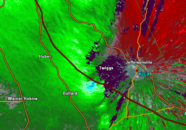
Another squall-line induced tornado touched down just south of Jeffersonville in far eastern Twiggs County, along Highway 96. It proceeded to move eastward directly across the KJGX (Warner Robbins) radar location, snapping a few softwood trees, though thankfully not doing any damage to the actual radar tower. The tornado continued its track east-southeast where it did its greatest damage, including roof damage to Reece Funeral Home where several AC untis on the main roof where moved several feet. In addition, a few metal support cables to power line poles were also broken. A nearby residence was also damaged with the majority of the shingles blown off. Another part of a barn metal roof was blown off as well. Multiple large mature oak trees were uprooted on the property. It was around this location that the tornado briefly strengthened to low-end EF-1 with maximum winds around 90 mph.
 |
| Damage Path - Twiggs & Wilkinson Counties |
|
| County |
Rating |
# of Injuries |
KML |
| Twiggs/Wilkinson |
EF-1 |
0 |
 |
|
| Rating: |
EF-1 |
| Peak Wind: |
90 MPH |
| Path Length: |
8.0 miles |
| Path Width: |
350 yards |
| Fatalities: |
0 |
| Injuries: |
0 |
| Start Date: |
Apr. 3, 2017 |
| Start Time: |
2:06 PM EDT |
| Start Lat/Lon: |
32.67581 / -83.35284 |
| End Date: |
Apr. 3, 2017 |
| End Time: |
2:18 PM EDT |
| End Lat/Lon: |
32.68751 / -83.22109 |
|
|
|

|
 |
| This home sustained roof damage. |
A number of trees were downed by the tornado. |
|

|
 |
| Reflectivity (2:15 PM EDT) |
Velocity (2:15 PM EDT) |
21) Wilkinson and Laurens County Tornado:
This tornado was nearly a continuation from the previous Twiggs/Wilkinson EF-1 tornado. It touched down in southern Wilkinson County, along Quinn Williams Road just north of Highway 112 (about 7 miles northeast of Allentown). This weak tornado mainly snapped or uprooted several trees along a path from this initial location, east across Highway 331, to Old Toomsboro Road, before lifting in Laurens County, just east of the county line.
 |
| Damage Path - Wilkinson & Laurens Counties |
|
| County |
Rating |
# of Injuries |
KML |
| Wilkinson/Laurens |
EF-0 |
0 |
 |
|
| Rating: |
EF-0 |
| Peak Wind: |
80 MPH |
| Path Length: |
6.8 miles |
| Path Width: |
150 yards |
| Fatalities: |
0 |
| Injuries: |
0 |
| Start Date: |
Apr. 3, 2017 |
| Start Time: |
2:26 PM EDT |
| Start Lat/Lon: |
32.667032 / -83.124043 |
| End Date: |
Apr. 3, 2017 |
| End Time: |
2:39 PM EDT |
| End Lat/Lon: |
32.68223 / -83.015251 |
|
|
|

|
 |
| Tree damage was apparent in this tornado. |
This tree was uprooted in the weak tornado. |
|

|
 |
| Reflectivity (2:33 PM EDT) |
Velocity (2:33 PM EDT) |
22) Wilkinson County Tornado #3:
The storm responsible for the EF-2 tornado in Gordon would produce an EF-0 tornado between the towns of Ivey and McIntyre. Although most of the path consisted of snapped trees as it moved east between these two towns the tornado caused roof damage to a local residence at the intersection of Napier Pond-Wriley Road and Parker Hill Road norhteast of McIntyre. No damage was found beyond this residence as the storm began to quickly dissipate and continue east into Washington County.
 |
| Damage Path - Wilkinson County |
|
| County |
Rating |
# of Injuries |
KML |
| Wilkinson |
EF-0 |
0 |
 |
|
| Rating: |
EF-0 |
| Peak Wind: |
85 MPH |
| Path Length: |
4.5 miles |
| Path Width: |
90 yards |
| Fatalities: |
0 |
| Injuries: |
0 |
| Start Date: |
Apr. 3, 2017 |
| Start Time: |
2:16 PM EDT |
| Start Lat/Lon: |
32.8899 / -83.2291 |
| End Date: |
Apr. 3, 2017 |
| End Time: |
2:23 PM EDT |
| End Lat/Lon: |
32.9033 / -83.1600 |
|
|
|

|
 |
| A number of trees were snapped or uprooted by the this tornado. |
This mobile home sustained roof damage in the tornado. |
|

|
 |
| Reflectivity (2:19 PM EDT) |
Velocity (2:19 PM EDT) |
23) Hancock County Tornado:
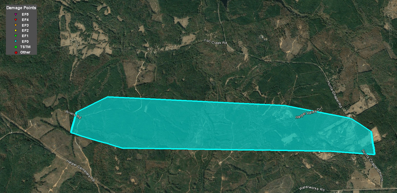
An EF-0 tornado moved across the western portion of Hancock County shortly before 2:30 PM. Numerous trees were uprooted and snapped west of Sparta near the Rivers Road and Fort Creek Road intersection. The tornado tracked east for several miles where numerous trees were found snapped along with the demolition of a small shed along Hunts Chapel Church Road near the intersection of Pumping Station Road. The tornado lifted shortly after this location as the storms tracked east.
 |
| Damage Path - Hancock County |
|
| County |
Rating |
# of Injuries |
KML |
| Hancock |
EF-0 |
0 |
 |
|
| Rating: |
EF-0 |
| Peak Wind: |
80 MPH |
| Path Length: |
3.2 miles |
| Path Width: |
200 yards |
| Fatalities: |
0 |
| Injuries: |
0 |
| Start Date: |
Apr. 3, 2017 |
| Start Time: |
2:21 PM EDT |
| Start Lat/Lon: |
33.2938 / -83.1208 |
| End Date: |
Apr. 3, 2017 |
| End Time: |
2:25 PM EDT |
| End Lat/Lon: |
33.2877 / -83.0648 |
|
|
|

|
 |
| This weak tornado produced primarily tree damage in Hancock County. |
Multiple trees were uprooted by the tornado in this location along Hunts Chapel Church Road. |
|

|
 |
| Reflectivity (2:23 PM EDT) |
Velocity (2:23 PM EDT) |
24) Wilkinson County Tornado #4:
A low-end EF-1 tornado touched down briefly in east central Wilkinson County near the intersections of Poplar Springs Church Road, At Land Senior Highway, and Club Drive. The worst damage was where a single wide trailer was shifted off the foundation. There were two people home at the time, though no injuries. Another trailer had some loss of shingles and a collapsed carport. There were also nearby trees snapped.
.png) |
| Damage Path - Wilkinson County |
|
| County |
Rating |
# of Injuries |
KML |
| Wilkinson |
EF-1 |
0 |
 |
|
| Rating: |
EF-1 |
| Peak Wind: |
87 MPH |
| Path Length: |
0.2 miles |
| Path Width: |
350 yards |
| Fatalities: |
0 |
| Injuries: |
0 |
| Start Date: |
Apr. 3, 2017 |
| Start Time: |
2:28 PM EDT |
| Start Lat/Lon: |
32.7750 / -83.0829 |
| End Date: |
Apr. 3, 2017 |
| End Time: |
2:30 PM EDT |
| End Lat/Lon: |
32.7745 / -83.0800 |
|
|
|

|
 |
| The attached carport of this mobile home collapsed in the tornado. |
This mobile home was moved off of its blocks in the tornadic winds. |
|

|
 |
| Reflectivity (2:29 PM EDT) |
Velocity (2:29 PM EDT) |
25) Washington County Tornado #1:
The strong storm that produced an EF-2 tornado in Wilkinson County moved into Washington County shortly after 2:30 PM. This storm produced a brief EF-1 tornado that caused roof damage to a local church and uprooted numerous large trees surrounding both the church and within a nearby cemetery. The tornado remained on the ground for several more miles as it moved east of the church but weakened to EF-0 intensity and caused minor roof damage to a local residence on Green Lane Road and uprooted numerous trees in the general vicinity. After moving through this location most of the EF-0 damage was found along uninhabited dirt roads, with damage limited to uprooted and snapped softwood trees. The tornado lifted approximately 6 miles southwest of Sandersville.
 |
| Damage Path - Washington County |
|
| County |
Rating |
# of Injuries |
KML |
| Washington |
EF-1 |
0 |
 |
|
| Rating: |
EF-1 |
| Peak Wind: |
95 mph |
| Path Length: |
6.1 miles |
| Path Width: |
250 yards |
| Fatalities: |
0 |
| Injuries: |
0 |
| Start Date: |
Apr. 3, 2017 |
| Start Time: |
2:36 PM EDT |
| Start Lat/Lon: |
32.9203 / -82.9996 |
| End Date: |
Apr. 3, 2017 |
| End Time: |
2:41 PM EDT |
| End Lat/Lon: |
32.9346 / -82.9024 |
|
|
 |
 |
| A number of trees were snapped by the tornado. |
This church sustained minor roof damage with surrounding trees unrooted. |
|
.png)
|
 |
| Reflectivity (2:37 PM EDT) |
Velocity (2:37 PM EDT) |
26) Washington County Tornado #2:
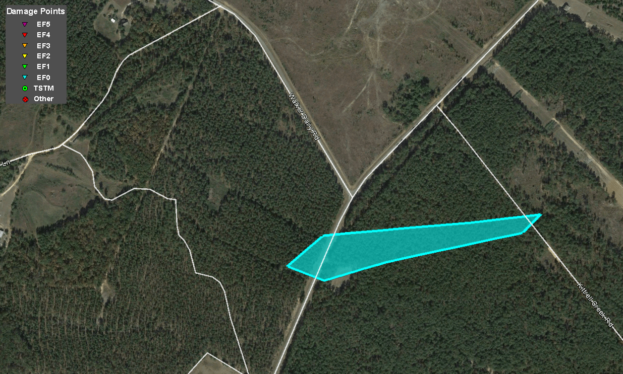
A tornadic storm developed approximately 5.5 miles northeast of Sandersville just before 3 PM. EF-0 tornado damage was found along a half mile path from Mayview Road and Kittrell Creek Road where numerous trees were uprooted and snapped. The tornado lifted for several miles before reaching the ground again toward the Washington and Jefferson county line.
 |
| Damage Path - Washington County |
|
| County |
Rating |
# of Injuries |
KML |
| Washington |
EF-0 |
0 |
 |
|
| Rating: |
EF-0 |
| Peak Wind: |
80 MPH |
| Path Length: |
0.4 miles |
| Path Width: |
150 yards |
| Fatalities: |
0 |
| Injuries: |
0 |
| Start Date: |
Apr. 3, 2017 |
| Start Time: |
2:56 PM EDT |
| Start Lat/Lon: |
33.0514​ / -82.7538​ |
| End Date: |
Apr. 3, 2017 |
| End Time: |
2:58 PM EDT |
| End Lat/Lon: |
33.0522 / -82.7471 |
|
|
|

|
 |
| This tornado primarily caused tree damage. |
This tornado primarily caused tree damage. |
|

|
 |
| Reflectivity (2:57 PM EDT) |
Velocity (2:58 PM EDT) |
27) Washington and Jefferson County Tornado:
A line of strong thunderstorms moved east in Jefferson County around 3 PM. A storm along the line produced an EF-1 tornado between Edgehill and Davisboro along the Washington and Jefferson county line. Damage to the metal roof of a large barn was found at a local residence on South Sparta Davisboro Road. South of this location, a barn was demolished along with numerous snapped and uprooted trees. As the tornado moved east, it weakened to an EF-0 where it caused minor roof damage to a home on Hardeman Road North, minor shed damage at the same home, and numerous uprooted trees.
 |
| Damage Path - Washington /Jefferson Counties |
|
| County |
Rating |
# of Injuries |
KML |
| Jefferson |
EF-1 |
0 |
 |
|
| Rating: |
EF-1 |
| Peak Wind: |
100 MPH |
| Path Length: |
7.8 miles |
| Path Width: |
300 yards |
| Fatalities: |
0 |
| Injuries: |
0 |
| Start Date: |
Apr. 3, 2017 |
| Start Time: |
3:00 PM EDT |
| Start Lat/Lon: |
33.0591 / -82.6704 |
| End Date: |
Apr. 3, 2017 |
| End Time: |
3:08 PM EDT |
| End Lat/Lon: |
33.0654 / -82.5377 |
|
|
|

|
 |
| This large barn had significant roof damage. |
This home experienced roof damage from the tornado. |
|

|
 |
| Reflectivity (3:00 PM EDT) |
Velocity (3:00 PM EDT) |


