Peachtree City, GA
Weather Forecast Office
Following record breaking cold temperatures, precipitation returned to north Georgia, bringing snow, sleet and freezing rain to portions of north Georgia. High pressure tracking from the Ohio Valley into the Carolinas set up a hybrid damming event with ridging down the Appalachians and helped to reinforce the cold temperatures across the area. Meanwhile aloft, a shortwave helped to draw gulf moisture into the Southern Plains and Lower Mississippi Valley that slowly spread into the southeast. Despite this, dew points were very low across the north and central Georgia, so the event was a battle between moisture, low level dry air and temperatures which makes for a difficult forecast situation!
In the end, despite the low level dry air, the column was able to saturate enough to produce snow and sleet initially across portions of north Georgia. Overnight, as temperatures warmed above the surface, the main concern became freezing rain although some snow and sleet continued into the morning. Overall the main impact from the event was felt on roadways Friday evening (February 20, 2015) into Saturday when snow that fell Friday evening, melted and then froze with the below freezing temperatures. Numerous accidents were reported across north Georgia and some roads became impassible. Luckily, with surface temperatures warming, these dangerous road conditions did not last long into Saturday, February 21, 2015.
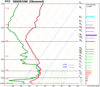
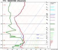
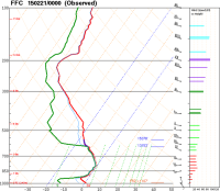
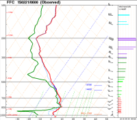
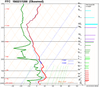
Although radiosondes are typically released twice a day, during this event, additional
weather balloons were released at 18z (February 20, 2015) and 06z (February 21, 2015)
to help forecasters better time the transition from snow to sleet to freezing
rain by capturing the warming of temperatures just above the surface.
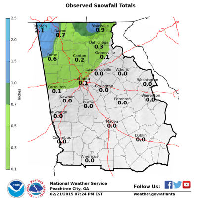
Snowfall totals for February 20-21, 2015.
 |
 |
| Gilmer County Courtesy of Chasity Matthews |
LaFayette, GA Courtesy of @MichelleWRCB |
 |
 |
| Gilmer County Courtesy of John W. Weathers |
Trenton, GA Courtesy of John Madewell (News Channel 9 Chattanooga) |
Current Hazards
Outlooks
Georgia Road Conditions
Nationwide
Local Storm Reports
Local
Submit Storm Report
Forecasts
Tropical Weather
Local
Computer Models
Graphical
Aviation Weather
Activity Planner
Recreational Forecast
Fire Weather
Forecast Discussion
Incident Support
Current Weather
Satellite Images
Observations
Maps
Rivers/Lakes
Radar Imagery
Regional Loop
Nationwide
Warner Robins
Peachtree City
US Dept of Commerce
National Oceanic and Atmospheric Administration
National Weather Service
Peachtree City, GA
4 Falcon Drive
Peachtree City, GA 30269
770.486.1133
Comments? Questions? Please Contact Us.


