Overview
|
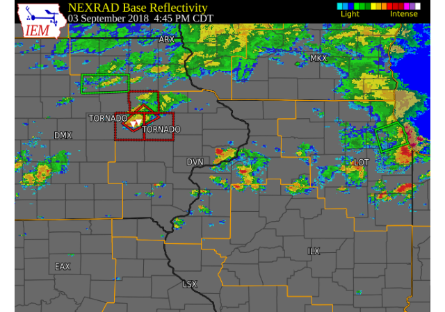
Scattered showers and thunderstorms developed across eastern Iowa, northwest Illinois, and northeast Missouri during the afternoon and evening of Monday, September 3, as an upper level disturbance tracked across the region. One thunderstorm intensified into a supercell, and produced a few tornados as it tracked across Benton and Linn counties during the late afternoon and early evening. Another storm produced a tornado on the west northwest side of Cedar Rapids shortly after 9 PM CDT. |
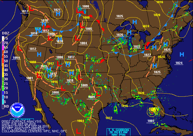 WPC Surface Fronts/Pressure Loop |
|
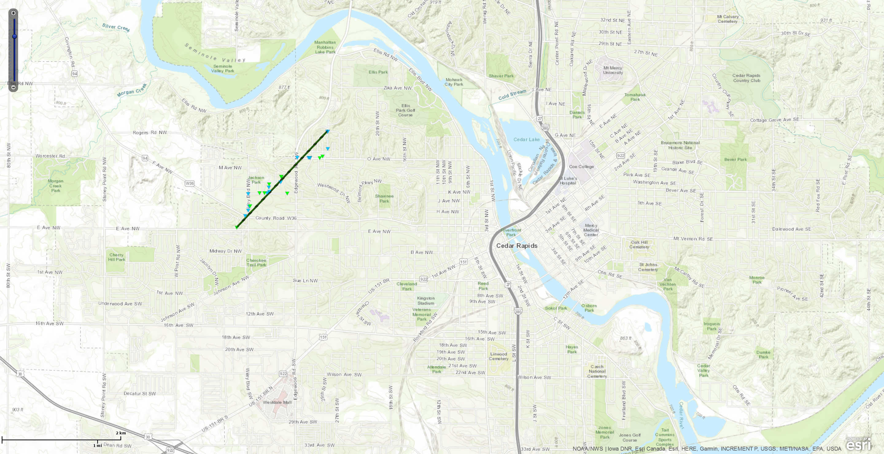
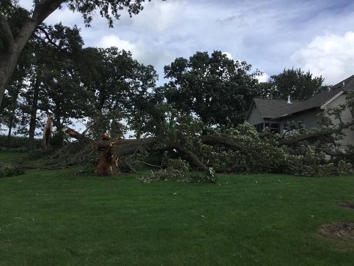
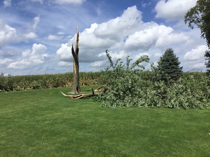
Tornado 1 - West side Cedar Rapids, IA
Track Map

|
||||||||||||||||
|
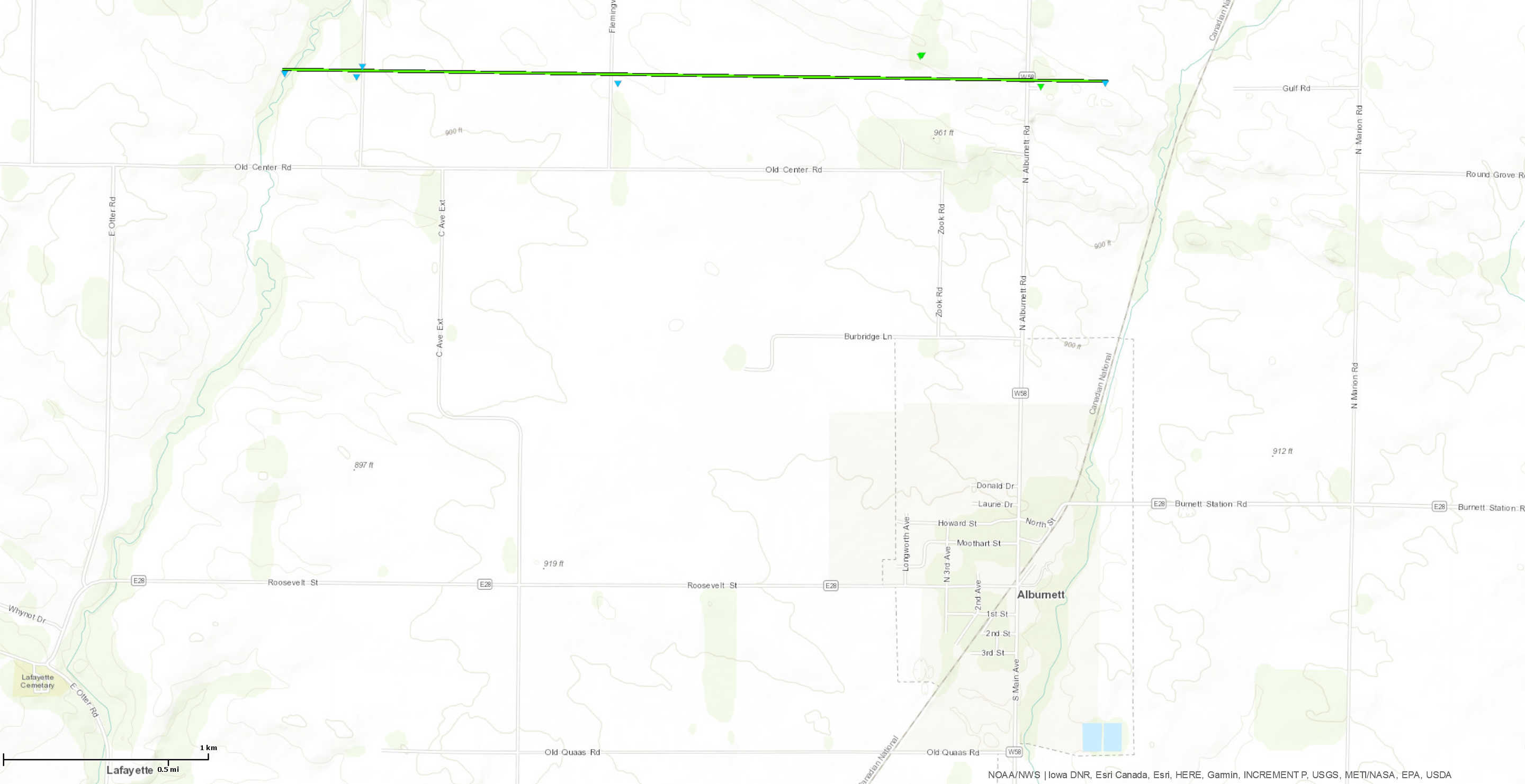
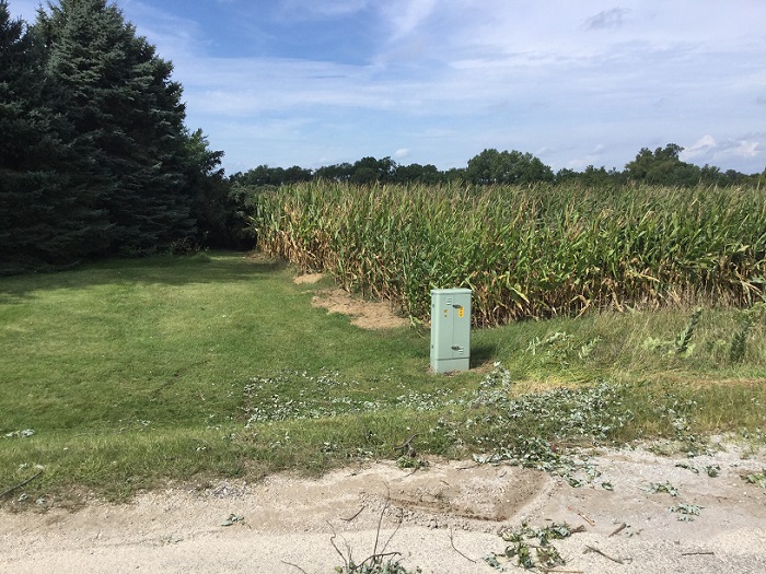
Tornado 2 - 2 NW Alburnett, IA
Track Map
|
||||||||||||||
|
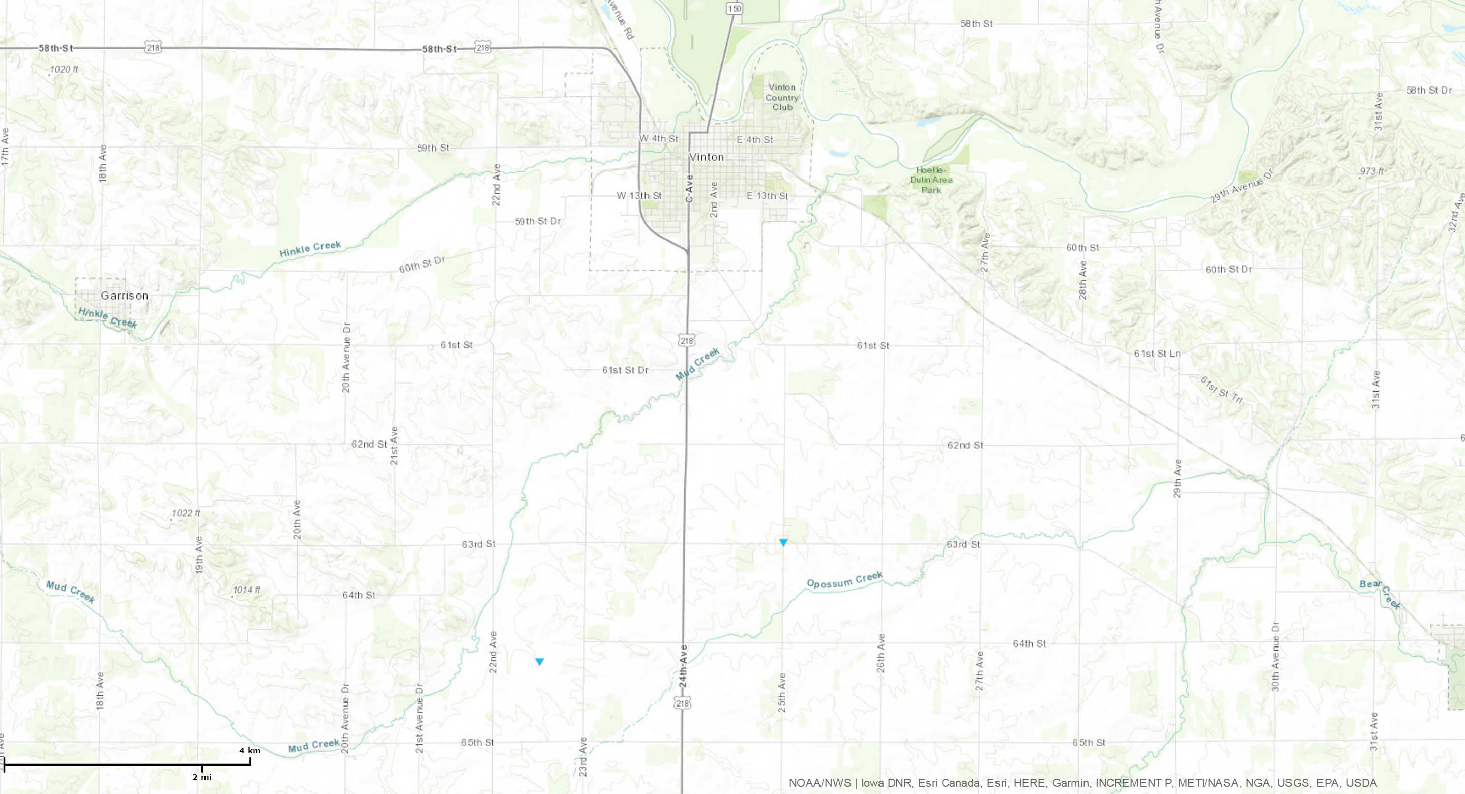
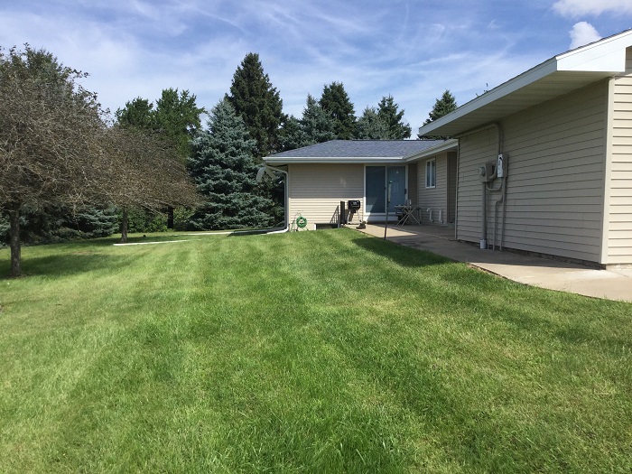
Tornado 3 - 4 SSW Vinton, IA
Track Map
|
||||||||||||||
|
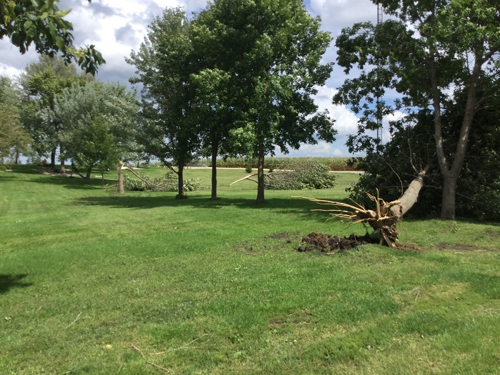
Tornado 4 - 4 SSE Vinton, IA
Track Map
|
||||||||||||||
The Enhanced Fujita (EF) Scale classifies tornadoes into the following categories:
| EF0 Weak 65-85 mph |
EF1 Moderate 86-110 mph |
EF2 Significant 111-135 mph |
EF3 Severe 136-165 mph |
EF4 Extreme 166-200 mph |
EF5 Catastrophic 200+ mph |
 |
|||||
 |
 |
 |
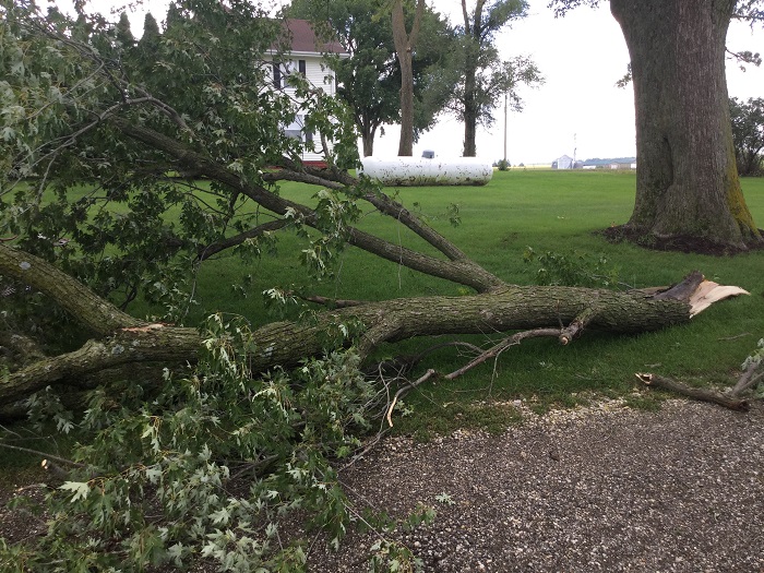
| Alburnett, IA NWS Damage Survey |
Alburnett, IA NWS Damage Survey |
Alburnett, IA NWS Damage Survey |
 |
 |
 |
| Alburnett, IA NWS Damage Survey |
Alburnett, IA NWS Damage Survey |
Alburnett, IA NWS Damage Survey |
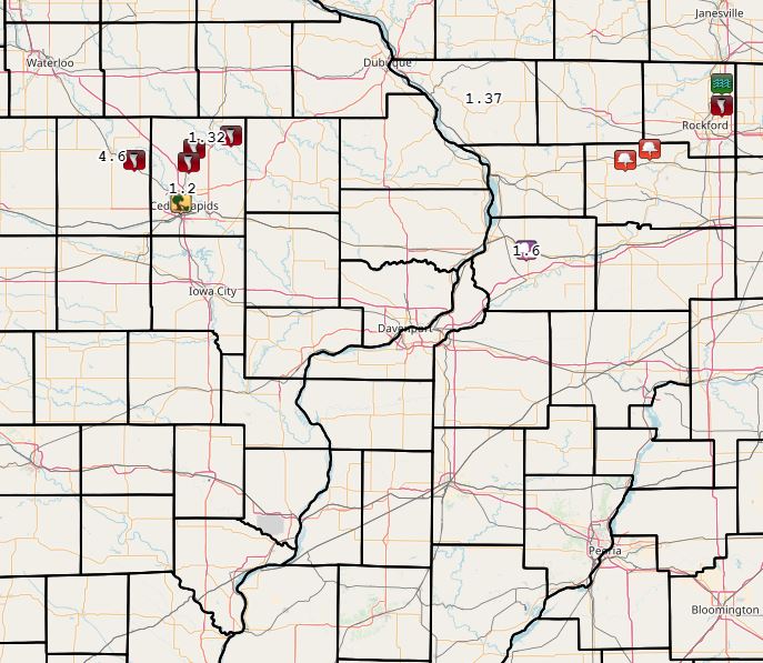
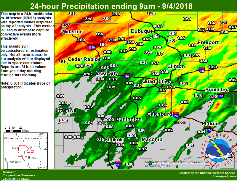
Rain Reports
| Local Rainfall Map | Regional Estimated Rainfall |
 |
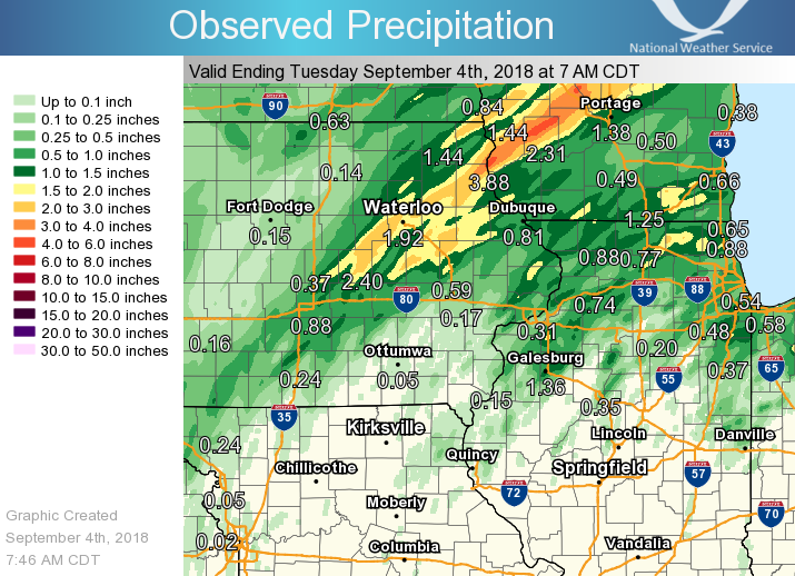 |
24 hour precipitation reports (in Inches), for eastern Iowa, northwest and west central Illinois, and northeast Missouri. Reported between Midnight and 9 AM, Monday September 03, 2018. ....IOWA.... Center Point 0.6 NNW 3.13 Muscatine 2N 2.34 Cedar Rapids 3.4 NW 2.23 Anamosa 3 SSW 2.12 De Witt 1.85 Cascade 1.81 Goose Lake 6.4 SSW 1.80 Central City 6.7 W 1.77 Davenport 0.9 WNW 1.52 Amana 4.7 W 1.48 Manchester 1.42 Dubuque #3 7 SW 1.40 Cedar Rapids 2.7 NE 1.35 Mount Auburn 2.2 NNW 1.34 Washington 1.25 Belle Plaine 1.23 Dubuque LD11 1.21 Guttenberg Dam 10 1.18 Marion 1.7 NNW 1.17 Waterloo ASOS 5 NW 1.12 Park View 0.2 WSW 1.03 Hopkinton 5.4 WSW 1.00 Toledo 3 N 0.98 Marengo 2.6 SSW 0.91 Strawberry Point 0.90 Ainsworth 7.4 N 0.88 Davenport 2.9 W 0.86 Ely 0.5 SE 0.82 Hampton 1 N 0.78 Eldridge 0.7 SSW 0.76 Eldridge 0.6 ESE 0.70 Davenport Arpt 5 N 0.69 Bettendorf 1.6 WSW 0.68 NWS Johnston* 5 NNW 0.67 Coggon 0.67 Cedar Rapids Arpt 5 SW 0.66 New London 1.5 SW 0.60 Mason City* 0 E 0.60 Bellevue LD12 0.55 Bloomfield 1 NW 0.54 Brighton 0.53 Davenport 0.9 SSW 0.53 Bettendorf 2.2 SE 0.51 Oelwein AWOS 0.48 Perry 0 W 0.46 Maquoketa 4W 0.46 Kalona 7.3 NNW 0.45 Dubuque Arpt 7 SW 0.41 Keosauqua 0.40 Salem 3.1 ESE 0.39 Delmar 2.3 NW 0.35 Beaconsfield 1 NNE 0.28 Mason City ASOS 6 W 0.28 Salem 1S 0.24 Williamsburg 0.24 Lowden 0.21 Marshalltown ASOS 4 N 0.21 Boone 1 SSW 0.19 North English 0.17 Iowa City 0.16 Marshalltown 1 NW 0.15 Donnellson 0.15 Grinnell AWOS 2 SSW 0.15 Rathbun Reservoir 2 N 0.15 Ottumwa ASOS 6 NNW 0.14 Iowa City Arpt 0.13 Parnell 0.1 SSW 0.12 Fairfield 0.08 Pella 4 N 0.06 Oskaloosa AWOS 9 ESE 0.05 Burlington Arpt 2 SW 0.04 Pella AWOS 2 WSW 0.03 Keokuk LD19 0.02 Burlington 6.5 SSW 0.00 ....ILLINOIS.... Roscoe 2SE 2.45 Freeport 2.15 Shannon 0.2 S 1.79 Chadwick 2.7 WSW 1.74 Ill. City LD16 3 WNW 1.72 Mundelein 1.53 Rochelle 1.45 Coleta 1.4 SSW 1.39 Morrison 3.2 E 1.35 Rockford ASOS 1.27 Davis 0.5 N 1.25 Quad City Arpt 3 S 1.21 Pearl City 0.4 SW 1.20 Freeport 2.0 NW 0.97 Moline 0.7 NNE 0.96 Orangeville 2.8 NW 0.92 New Boston LD17 0.81 Winslow 4.3 ESE 0.78 Galena 0.68 Steward 0.67 Aledo 0.4 NE 0.41 Coal Valley 1.9 SE 0.41 New Windsor 2.0 N 0.41 Aledo 0.37 Princeton 1.1 SE 0.25 Princeton 0.25 Alexis 1 SW 0.24 Tiskilwa 2.1 N 0.20 Paw Paw 1 E 0.18 Geneseo 2.0 NW 0.18 Gladstone LD18 0.10 Kewanee 1 E 0.05 Romeoville 0.00 Peoria ASOS 0.00 Ottawa 4 SW 0.00 Decatur Airport 0.00 Bentley 0.00 La Harpe 0.00 Jacksonville AWOS 0.00 Rochelle AWOS 0.00 Quincy Dam 21 0.00 Colchester 3.5 NE 0.00 Joliet 0.00 Quincy ASOS 0.00 St Anne 0.00 Bloomington Airport 0.00 Galesburg Arpt 3 SW 0.00 Lincoln NWS 0.00 ....MISSOURI.... Memphis 0.43 Kirksville ASOS 0.05 Canton LD20 0.02 Chillicothe 2 NW 0.01 Columbia 0.00 ....WISCONSIN.... Allenton-WWTP .6 NW 2.51 Beloit-College 1.18 Darlington 1.14 Whitewater 1.05 Viroqua 0.76 Steuben 4SE 3 NE 0.69 Brodhead 1 SW 0.65 Prairie du Chien AWOS 0.63 Madison-ASOS 0.43 La Crosse WFO 0.39 Watertown-AWOS 0.00 ....MINNESOTA.... Preston 0.80 Theilman 1SSW 0.00 |
|
Environment
 |
 |
 |
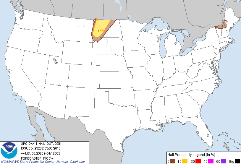 |
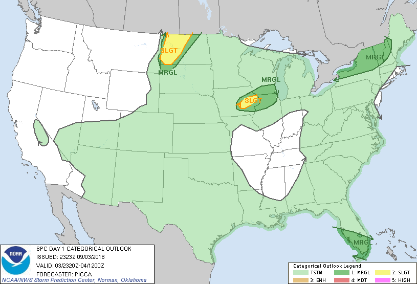
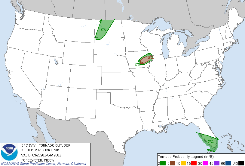
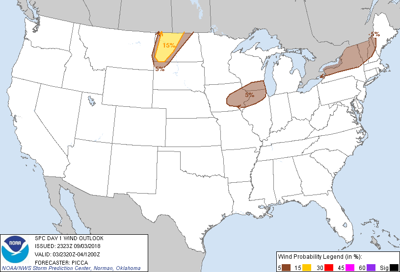
| Figure 1: SPC Day 1 Outlook (2000z) | Figure 2: SPC Day 1 Tornado Outlook (2000z) | Figure 3: SPC Day 1 Wind Outlook (2000z) | Figure 4: SPC Day 1 Hail Outlook (2000z) |
 |
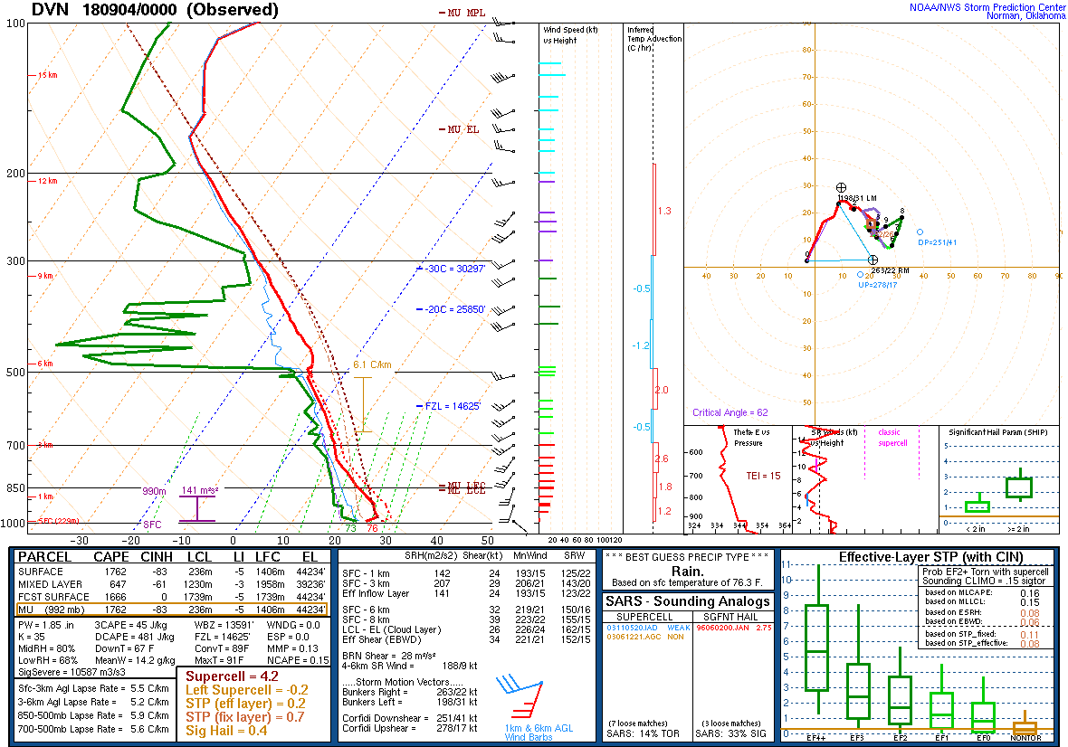 |
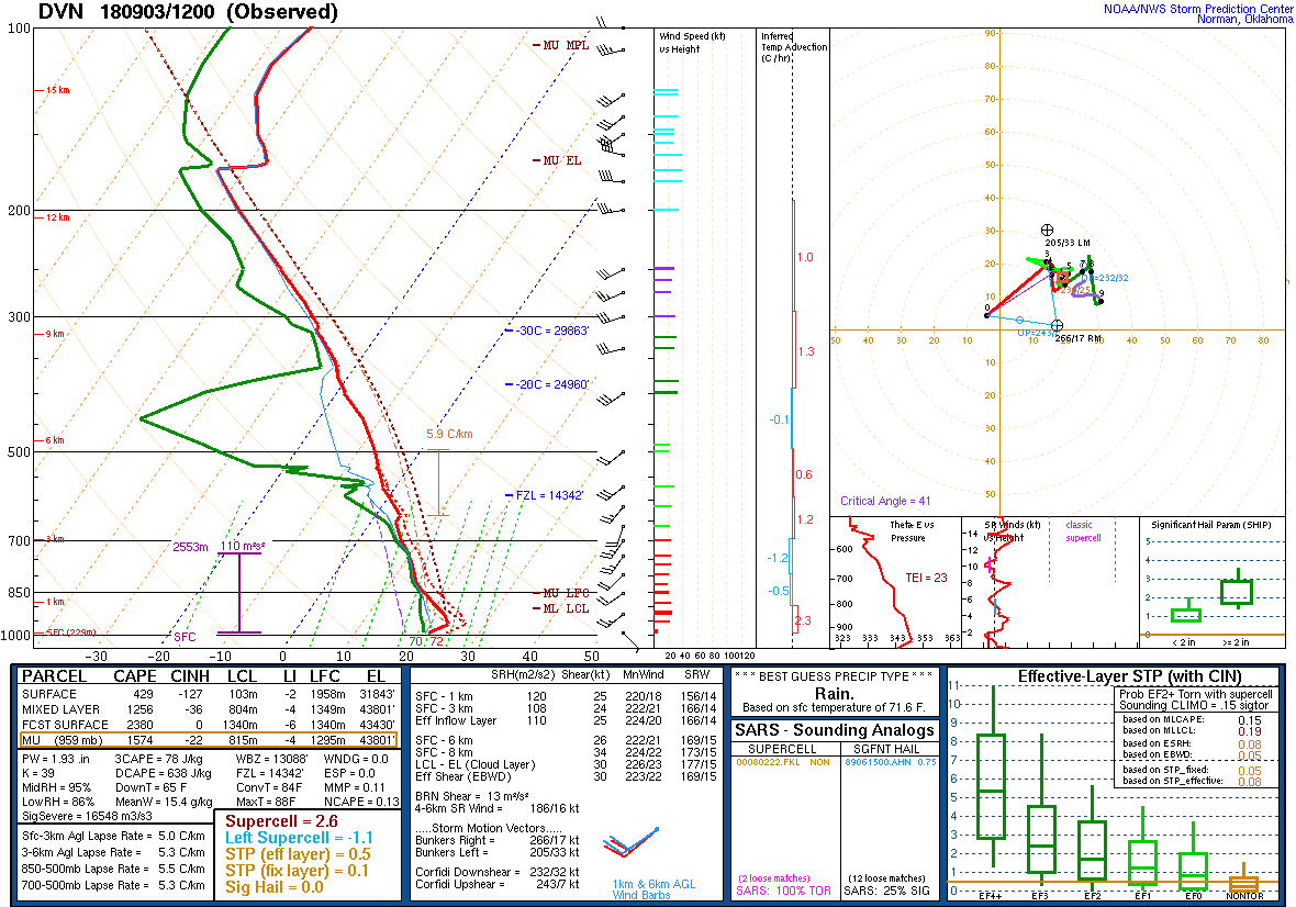
| Figure 5: DVN Sounding 9/3/18 12z | Figure 6: DVN Sounding 9/4/18 00z |
 |
Media use of NWS Web News Stories is encouraged! Please acknowledge the NWS as the source of any news information accessed from this site. |
|