Widespread life-threatening flash and urban flooding continues in south-central Texas, with considerable flooding impacts possible across central Texas. Wildfire smoke is impacting air quality across much of the Great Lakes region into southern New England and the Mid-Atlantic. Monsoonal thunderstorms may produce isolated to scattered flash flooding across the Southwest into the Great Basin. Read More >
|
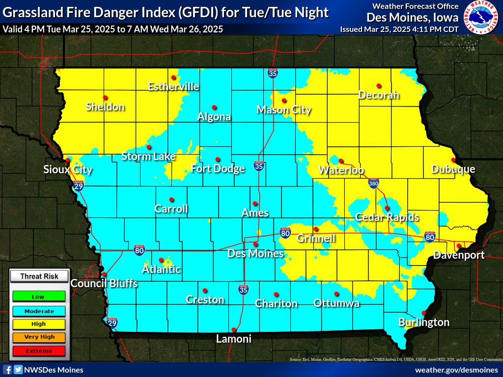
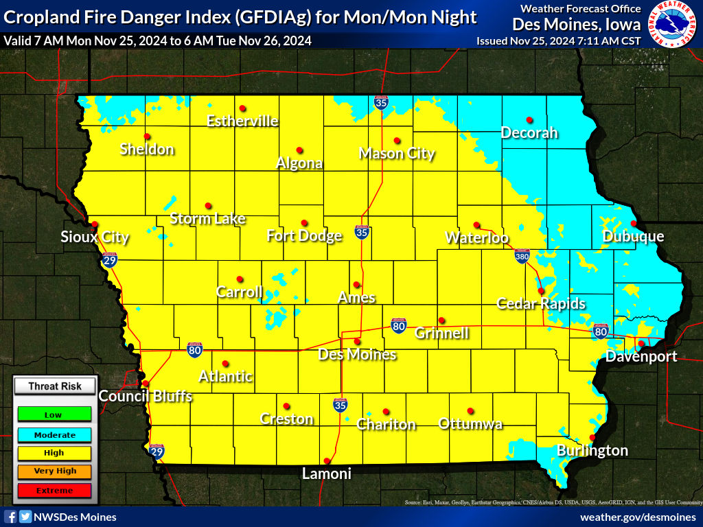
The National Weather Service in the Quad Cities is responsible for providing fire weather forecasts for eastern Iowa, northwest Illinois and northeast Missouri. The fire weather service program provides spot forecast services for the prevention, suppression, and management of forest and rangeland fires.
NWS Fire Weather Forecasts
National Fire Wx Forecast Information
Observations
Additional Fire Weather Information
Requesting a Spot Forecast (FOR OFFICIAL USE BY GOVERNMENT AGENCIES ONLY!) Note: When submitting a SPOT forecast, please request on the day of the burn (not the day prior) and include a proximity weather observation. |
|||||||||||||||||||||||||||||||||||||||||||||||||||||||||||||||||||||||||||||||||||||||||||||||||||||||||||||||||||||||||||||||||||||||||||||||||||||||||||||||||||||||||||||||||||||||||||||||||||||||||||||||||||||||||||