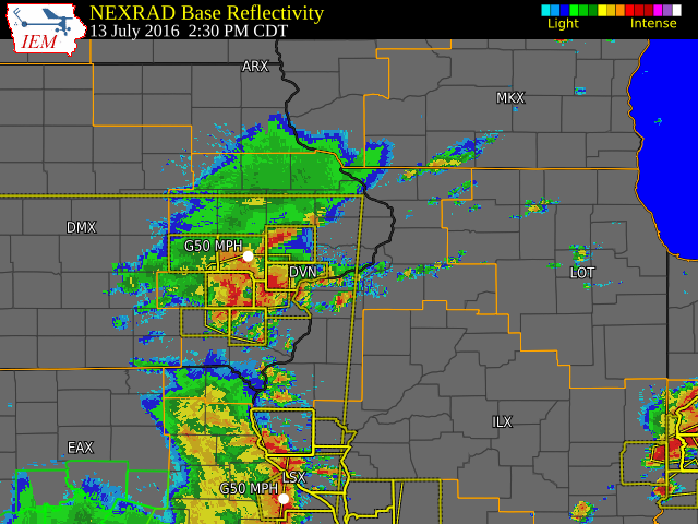
Overview
Warm and humid conditions were found across the Midwest ahead of a cold front that moved into central Iowa by the late afternoon of July 13. Scattered showers and thunderstorms developed and moved across eastern Iowa, northeast Missouri and western Illinois during the afternoon. Some of the thunderstorms along and south of Interstate 80 were severe and produced wind damage from Sigourney, IA to Muscatine, IA to Princeton, IL. These storms knocked out power to thousands of people in the Quad Cities for several hours, with numerous trees and power lines down. There was also additional thunderstorm wind damage near Macomb, IL which was associated with a line of storms moving northeastward out of Missouri. Heavy rain was also common with several locations receiving over an inch of rain in a short amount of time. The highest rainfall amounts were generally along a line from Montezuma, IA, to Muscatine, IA to Princeton, IL, where 1 to 2 inches of rain fell.
| Additional Information: | IEM Interactive Radar Loop | SPC Outlook/Reports |
 |
 |
 |
 |
 |
 |
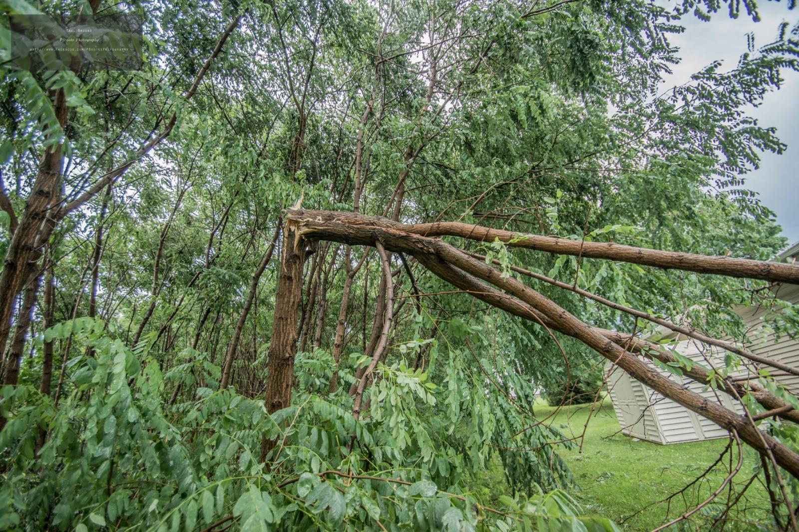
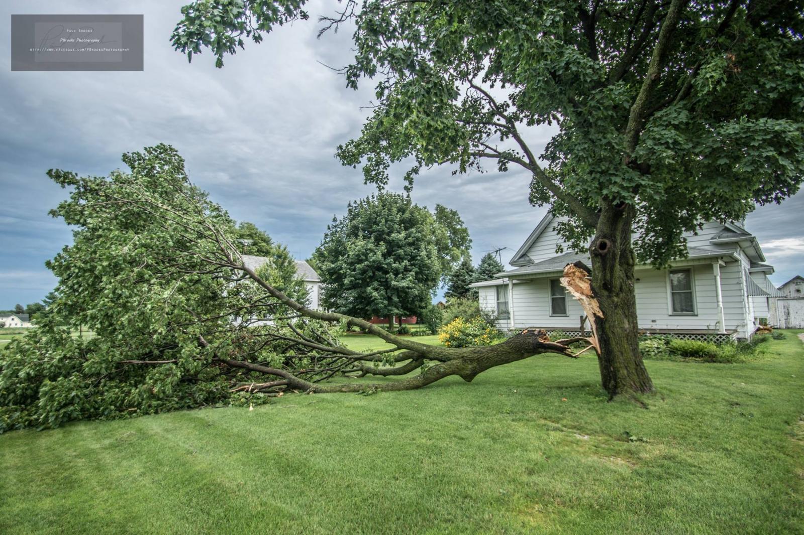
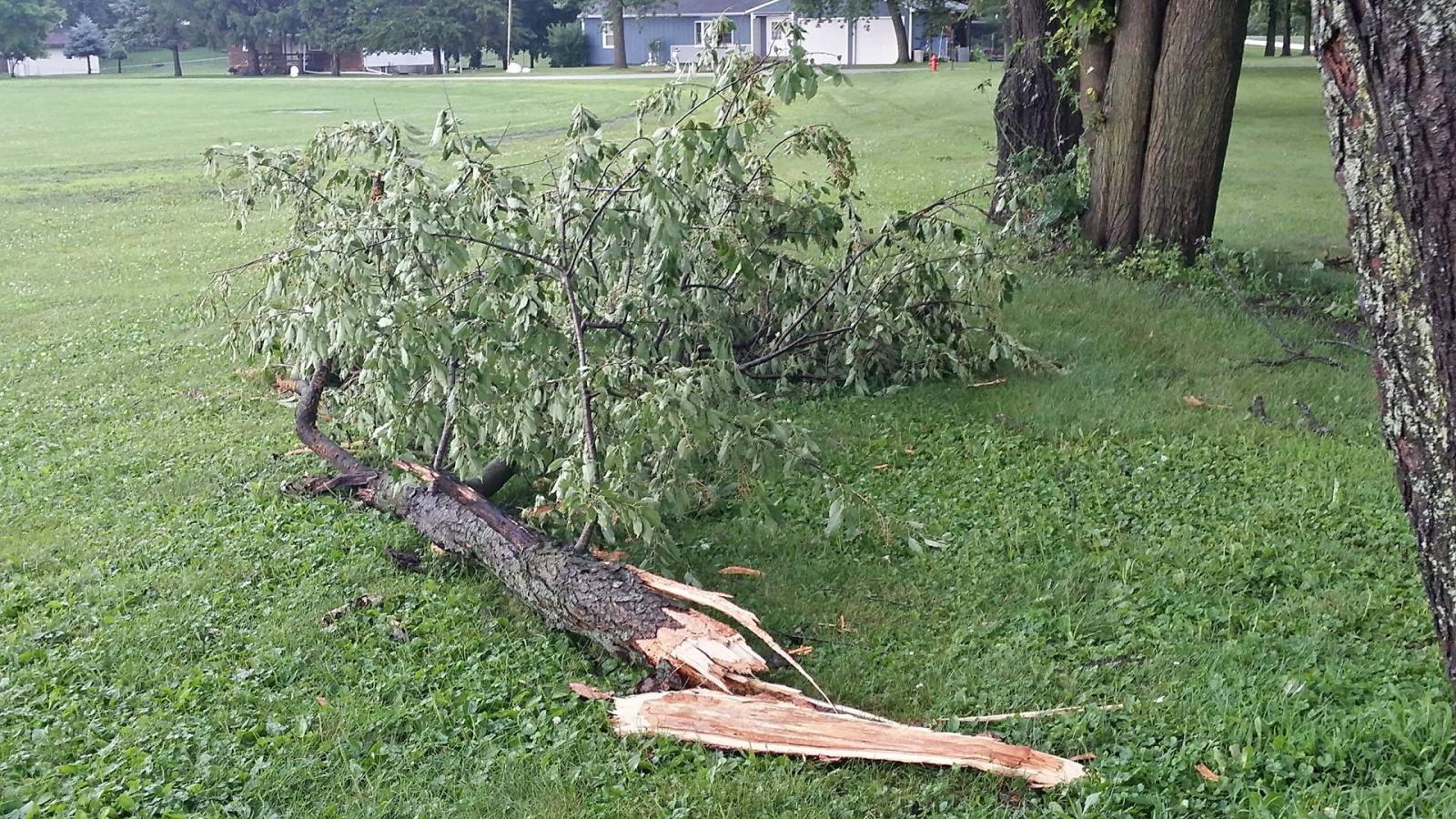
| Peartree lane, Muscatine IA (Photo: Paul Brooks) |
Peartree lane, Muscatine IA (Photo: Paul Brooks) |
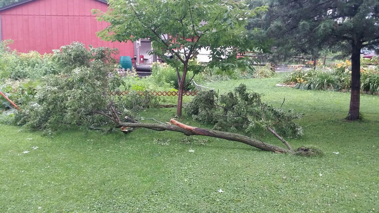
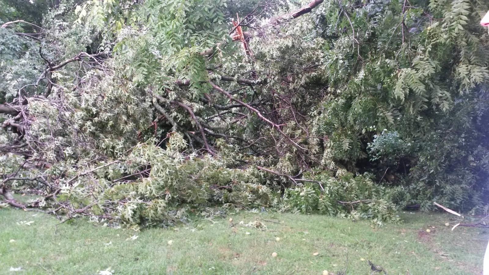
Near Wild Cat Den State Park (Photo: Paul Brooks) |
2nd St, Colona IL (Photo: Dennis Becht) |
 |
 |
 |
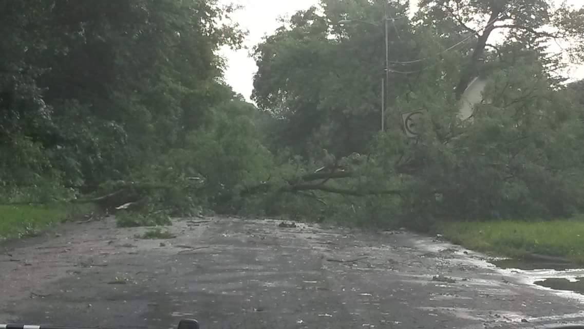 |
| 2nd St, Colona IL (Photo: Dennis Becht) |
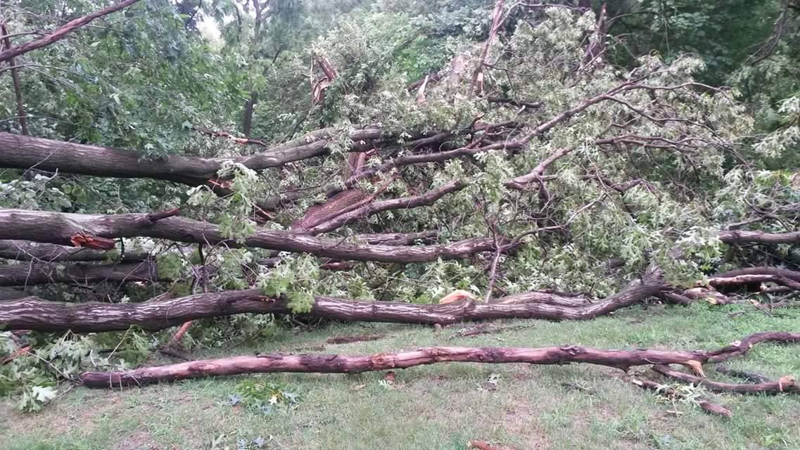
Moline, IL (Photo: Shelley Rumph) |
Moline, IL (Photo: Shelley Rumph) |
Moline, IL (Photo: Shelley Rumph) |
 |
|||
| Moline, IL (Photo: Shelley Rumph) |
PRELIMINARY LOCAL STORM REPORT...SUMMARY
NATIONAL WEATHER SERVICE QUAD CITIES IA IL
912 PM CDT WED JUL 13 2016

..TIME...   ...EVENT...      ...CITY LOCATION...     ...LAT.LON...
..DATE...   ....MAG....      ..COUNTY LOCATION..ST.. ...SOURCE....
            ..REMARKS..

0150 PM     TSTM WND DMG     NE SIGOURNEY            41.34N 92.20W
07/13/2016                   KEOKUK             IA   TRAINED SPOTTER

            3 TREES DOWN IN SIGOURNEY. REPORT WAS DELAYED. TIME
            ESTIAMTED USING RADAR.

0210 PM     TSTM WND DMG     SOUTH ENGLISH           41.45N 92.09W
07/13/2016                   KEOKUK             IA   FIRE DEPT/RESCUE

            POWER OUT IN TOWN.

0233 PM     TSTM WND GST     IOWA CITY               41.66N 91.54W
07/13/2016  M50.00 MPH       JOHNSON            IA   ASOS

0235 PM     TSTM WND DMG     WASHINGTON              41.30N 91.69W
07/13/2016                   WASHINGTON         IA   EMERGENCY MNGR

            SOME TREES DOWN IN THE CITY OF WASHINGTON.

0235 PM     TSTM WND GST     WASHINGTON              41.30N 91.69W
07/13/2016  M62.00 MPH       WASHINGTON         IA   AWOS

0240 PM     TSTM WND DMG     NW MUSCATINE            41.42N 91.07W
07/13/2016                   MUSCATINE          IA   TRAINED SPOTTER

            SEVERAL BRANCHES DOWN VARYING IN SIZE FROM 2 TO 18.5
            INCHES ALONG PEARTREE LANE. TIME ESTIMATED USING RADAR.

0244 PM     TSTM WND DMG     WNW COLUMBUS JUNCTION   41.28N 91.37W
07/13/2016                   LOUISA             IA   TRAINED SPOTTER

            SEVERE LIMBS AND TREES DOWN IN TOWN. SOME OF THE TREES
            ARE DOWN ON HOMES.

0255 PM     TSTM WND DMG     3 NE MUSCATINE          41.46N 91.03W
07/13/2016                   MUSCATINE          IA   TRAINED SPOTTER

            SEVERAL SMALL TREES SNAPPED AND BRANCHES BLOWN DOWN.

0300 PM     TSTM WND GST     NEW BOSTON              41.17N 91.00W
07/13/2016  M50.00 MPH       MERCER             IL   MESONET

            REPORT FOR LOCK DAM 17.

0308 PM     TSTM WND DMG     2 N FAIRPORT            41.47N 90.90W
07/13/2016                   MUSCATINE          IA   TRAINED SPOTTER

            16.5 INCH TREE BRANCH DOWN NEAR WILDCAT DEN STATE PARK.
            TIME ESTIMATED USING RADAR.

0316 PM     HEAVY RAIN       WNW PARNELL             41.58N 92.01W
07/13/2016  M1.85 INCH       IOWA               IA   TRAINED SPOTTER

0318 PM     HEAVY RAIN       WNW COLUMBUS JUNCTION   41.28N 91.37W
07/13/2016  M2.00 INCH       LOUISA             IA   TRAINED SPOTTER

0326 PM     TSTM WND DMG     ALEDO                   41.20N 90.75W
07/13/2016                   MERCER             IL   LAW ENFORCEMENT

            TREES COMING DOWN IN ALEDO.

0326 PM     TSTM WND DMG     1 SW MACOMB             40.46N 90.69W
07/13/2016                   MCDONOUGH          IL   TRAINED SPOTTER

            SEVERAL 5 INCH DIAMETER TREES DOWN.

0330 PM     HEAVY RAIN       CONESVILLE              41.38N 91.35W
07/13/2016  E3.75 INCH       MUSCATINE          IA   PUBLIC

0330 PM     TSTM WND DMG     ALEDO                   41.20N 90.75W
07/13/2016                   MERCER             IL   EMERGENCY MNGR

            FURNITURE BLOWN AROUND AND SEMI TRAILER BLOWN OVER AT THE
            MERCER COUNTY FAIR IN ALEDO. WINDS OF 60 MPH.

0333 PM     TSTM WND DMG     OAK GROVE               41.41N 90.57W
07/13/2016                   ROCK ISLAND        IL   PUBLIC

            LARGE POWER POLE SNAPPED HALF WAY UP NEAR 106TH AVE AND
            US 67...REPORT VIA FACEBOOK. TIME ESTIMATED FROM RADAR.

0334 PM     TSTM WND DMG     4 NE ELEANOR            41.02N 90.65W
07/13/2016                   WARREN             IL   LAW ENFORCEMENT

            LARGE BRANCHES DOWN ACROSS THE ROAD 1 MILE NORTH OF LAKE
            WARREN.

0335 PM     TSTM WND DMG     ROCK ISLAND             41.48N 90.58W
07/13/2016                   ROCK ISLAND        IL   TRAINED SPOTTER

            LARGE BRANCH BLOWN DOWN. TIME ESTIMATED.

0340 PM     TSTM WND GST     MOLINE QUAD-CITY AIRPOR 41.45N 90.50W
07/13/2016  M59.00 MPH       ROCK ISLAND        IL   ASOS

0345 PM     TSTM WND DMG     ORION                   41.35N 90.37W
07/13/2016                   HENRY              IL   LAW ENFORCEMENT

            TREES DOWN.

0347 PM     TSTM WND GST     MOLINE QUAD-CITY AIRPOR 41.45N 90.50W
07/13/2016  M59.00 MPH       ROCK ISLAND        IL   ASOS

0350 PM     TSTM WND DMG     COLONA                  41.49N 90.35W
07/13/2016                   HENRY              IL   TRAINED SPOTTER

            NUMEROUS TREE BRANCHES WERE BLOWN DOWN AROUND TOWN.

0350 PM     TSTM WND GST     2 W BETTENDORF          41.57N 90.52W
07/13/2016  E57.00 MPH       SCOTT              IA   TRAINED SPOTTER

            ESTIMATED AT INTERSTATE 74 MILEMARKER 1

0350 PM     TSTM WND DMG     5 ESE DAVENPORT         41.53N 90.51W
07/13/2016                   SCOTT              IA   NWS EMPLOYEE

            SEVERAL TREE BRANCHES ARE DOWN...SOME UP TO 1 FOOT IN
            DIAMETER NEAR THE VILLAGE OF EAST DAVENPORT. TREE LIMBS
            WERE BLOCKING THE ROAD.

0355 PM     TSTM WND DMG     COLONA                  41.49N 90.35W
07/13/2016                   HENRY              IL   TRAINED SPOTTER

            A COUPLE OF BRANCHES DOWN 3 TO 4 INCHES IN DIAMETER

0400 PM     TSTM WND DMG     GENESEO                 41.45N 90.15W
07/13/2016                   HENRY              IL   LAW ENFORCEMENT

            TREES DOWN.

0403 PM     TSTM WND DMG     GALVA                   41.17N 90.04W
07/13/2016                   HENRY              IL   LAW ENFORCEMENT

            TREES DOWN.

0406 PM     TSTM WND DMG     3 E KEWANEE             41.24N 89.87W
07/13/2016                   HENRY              IL   LAW ENFORCEMENT

            TREES DOWN.

0445 PM     TSTM WND DMG     N PRINCETON             41.38N 89.47W
07/13/2016                   BUREAU             IL   TRAINED SPOTTER

            3 INCH DIAMTER LIMB DOWN.

0446 PM     HEAVY RAIN       1 WSW SHERRARD          41.31N 90.53W
07/13/2016  M2.47 INCH       MERCER             IL   TRAINED SPOTTER
 |
 |
 |
 |
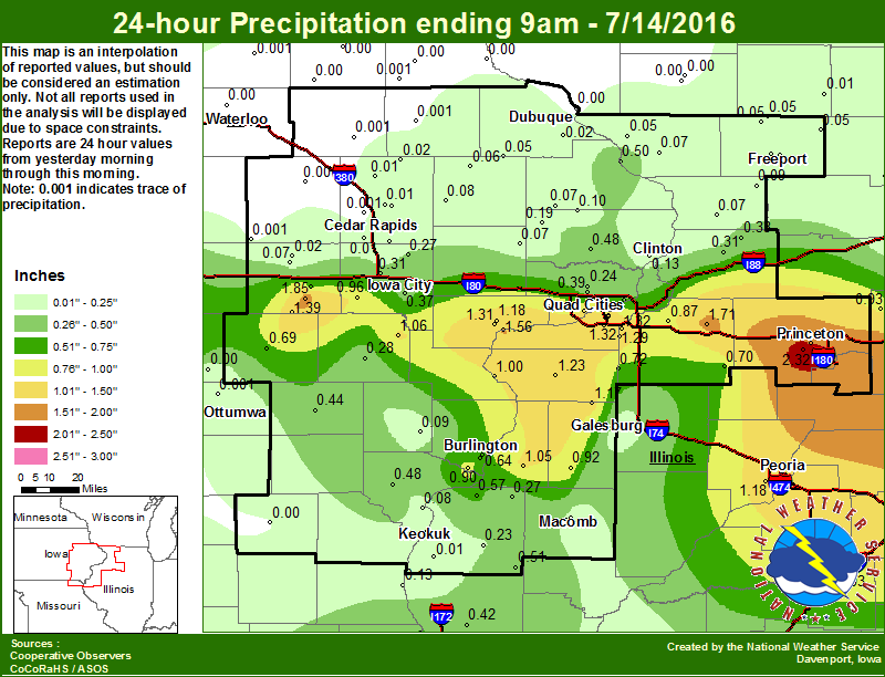
| Figure 1: Local 24-hr Rainfall |
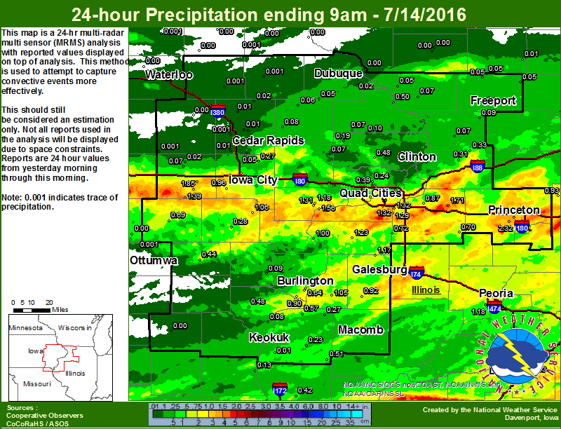
Figure 2: Local Multiple-Radar/ Multiple-Sensor 24-Rainfall |
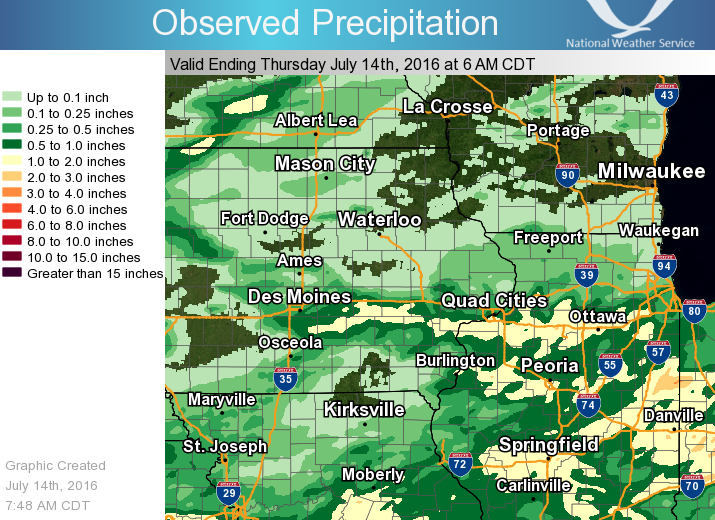
Figure 3: Regional 24-hr Rainfall |
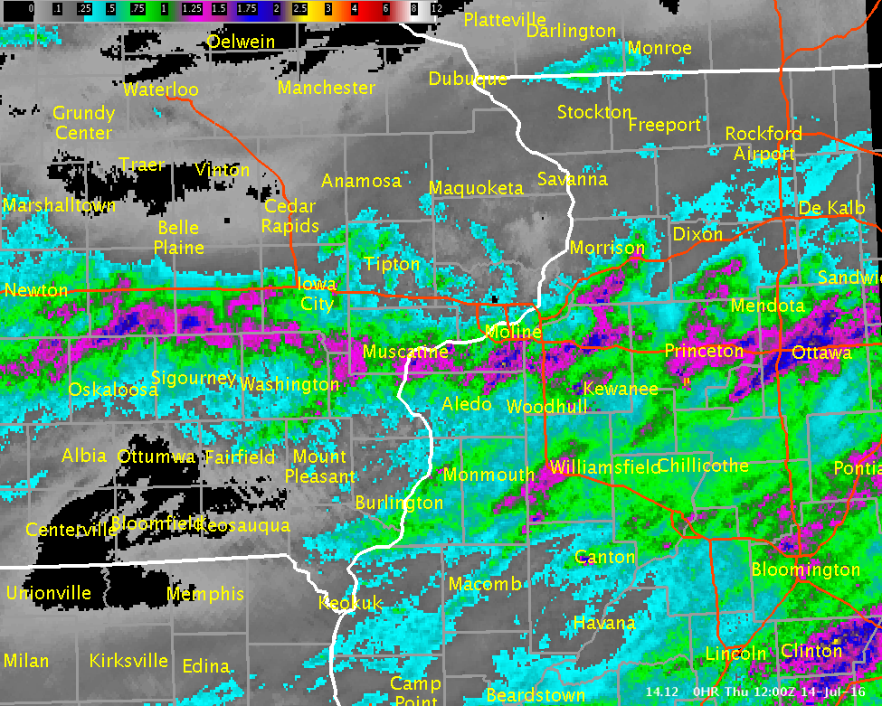
Figure 4: Multiple-Radar/ Multiple-Sensor Estimated Rainfall Ending 7 am 07/14/16 |
Public Information Statement
National Weather Service Quad Cities IA IL
841 AM CDT Thu Jul 14 2016

...24-hr Rainfall Reports...

Observations are collected from a variety of sources with varying
equipment and exposures. Not all data listed are considered official.

Location                     Amount    Time/Date       Provider
2 N Tiskilwa                 2.32 in   0700 AM 07/14   COCORAHS
Ms Rvr At Muscatine          2.03 in   0815 AM 07/14   GOES
1 S Princeton                1.97 in   0700 AM 07/14   COCORAHS
Parnell                      1.85 in   0452 AM 07/14   COCORAHS
2 NE Atkinson                1.71 in   0800 AM 07/14   COCORAHS
Cedar Rvr At Conesville      1.67 in   0800 AM 07/14   USGS
Moline                       1.49 in   0700 AM 07/14   COCORAHS
Rock Rvr At Moline           1.45 in   0730 AM 07/14   USARMY-COE
North English                1.39 in   0700 AM 07/14   COOP
1 ESE Coal Valley            1.32 in   0700 AM 07/14   COCORAHS
Quad City Intl Arpt          1.32 in   0652 AM 07/14   ASOS
2 NNE Muscatine              1.31 in   0600 AM 07/14   COCORAHS
Orion 4.1 NW                 1.29 in   0800 AM 07/14   COCORAHS
Aledo                        1.23 in   0700 AM 07/14   COOP
Iowa Rvr At Columbus Jct     1.18 in   0800 AM 07/14   USARMY-COE
Rock Rvr Near Joslin         1.18 in   0730 AM 07/14   USGS
2 N Muscatine                1.18 in   0700 AM 07/14   COOP
Alexis                       1.17 in   0715 AM 07/14   COOP
Illinois City L/d 16         1.12 in   0800 AM 07/14   COOP
English Rvr Near Parnell     1.10 in   0800 AM 07/14   USGS
Ms Rvr At Fairport           1.06 in   0830 AM 07/14   USARMY-COE
4 N Haskins                  1.06 in   0700 AM 07/14   COCORAHS
Geneseo                      1.05 in   1200 AM 07/14   COOP
Rock Island L/d 15           1.05 in   0800 AM 07/14   COOP
Moline                       1.04 in   0700 AM 07/14   COCORAHS
1 NNE Credit Island          1.03 in   0530 AM 07/14   COCORAHS
2 SSE Davenport              0.97 in   0530 AM 07/14   COCORAHS
1 NNW Williamstown           0.96 in   0700 AM 07/14   COCORAHS
Fort Madison                 0.95 in   1200 AM 07/14   COOP
Ms Rvr Near Fort Madison     0.93 in   0730 AM 07/14   USARMY-COE
Roseville                    0.92 in   0700 AM 07/14   COCORAHS
1 WSW Spring Grove           0.90 in   0700 AM 07/14   COCORAHS
1 NW Geneseo                 0.87 in   0500 AM 07/14   COCORAHS
Prairie City                 0.87 in   0600 AM 07/14   COOP
Stronghurst                  0.86 in   0823 AM 07/14   CWOP
Riverdale                    0.84 in   0630 AM 07/14   COCORAHS
Williamsburg                 0.81 in   0829 AM 07/14   CWOP
New Boston L/d 17            0.77 in   0810 AM 07/14   USARMY-COE
Skunk Rvr At Merrimac        0.74 in   0730 AM 07/14   USGS
2 NNE New Windsor            0.72 in   0600 AM 07/14   COCORAHS
Raritan                      0.70 in   0829 AM 07/14   CWOP
1 E Kewanee                  0.70 in   0700 AM 07/14   COOP
Sigourney                    0.69 in   0700 AM 07/14   COOP
2 ESE Davenport              0.66 in   0828 AM 07/14   CWOP
Edwards Rvr At New Boston    0.66 in   0730 AM 07/14   USARMY-COE
Burlington Arpt              0.64 in   0653 AM 07/14   ASOS
1 W Riverdale                0.64 in   0820 AM 07/14   CWOP
Burlington                   0.64 in   0652 AM 07/14   COCORAHS
Green Rvr At Geneseo         0.63 in   0730 AM 07/14   USGS
Henderson Crk At Oquawka     0.62 in   0730 AM 07/14   USGS
2 SSE Osborn                 0.57 in   0827 AM 07/14   CWOP
2 NE Colusa                  0.57 in   0530 AM 07/14   COCORAHS
Williamsburg                 0.54 in   0827 AM 07/14   CWOP
Ms Rvr At Burlington         0.52 in   0800 AM 07/14   USARMY-COE
Augusta                      0.51 in   0538 AM 07/14   COOP
Donnellson                   0.48 in   0700 AM 07/14   COOP
1 WNW Dewitt                 0.48 in   0700 AM 07/14   COCORAHS
Iowa City Arpt               0.43 in   0652 AM 07/14   ASOS
Coralville                   0.39 in   0800 AM 07/14   HADS
Davenport Arpt               0.39 in   0652 AM 07/14   ASOS
Macomb Arpt                  0.39 in   0655 AM 07/14   AWOS
2 ENE Argyle Lake State      0.38 in   0700 AM 07/14   COCORAHS
Wapsi Rvr At Oxford Jct      0.38 in   0745 AM 07/14   USGS
Iowa City                    0.37 in   0700 AM 07/14   COOP
Iowa Rvr At Iowa City        0.37 in   0800 AM 07/14   USGS
Kewanee Municipal            0.34 in   0818 AM 07/14   CWOP
1 SW Coleta                  0.33 in   0700 AM 07/14   COCORAHS
Pope Creek Near Keithsburg   0.32 in   0730 AM 07/14   USGS
1 WNW Oakdale                0.31 in   0700 AM 07/14   COCORAHS
2 SSW Malvern                0.31 in   0700 AM 07/14   COCORAHS
Gladstone L/d 18             0.30 in   0800 AM 07/14   COOP
3 E Iowa City                0.29 in   0820 AM 07/14   CWOP
Cedar Rvr At Cedar Bluff     0.29 in   0800 AM 07/14   USGS
Ms Rvr At Keithsburg         0.29 in   0830 AM 07/14   USARMY-COE
Hoover Creak Near West Branc 0.29 in   0745 AM 07/14   USGS
Solon 0.3 ESE                0.27 in   0700 AM 07/14   COCORAHS
La Harpe                     0.27 in   0500 AM 07/14   COOP
Walnut                       0.24 in   0816 AM 07/14   CWOP
Eldridge                     0.24 in   0800 AM 07/14   COCORAHS
Le Claire L/d 14             0.24 in   0800 AM 07/14   COOP
Bentley                      0.23 in   0630 AM 07/14   COOP
Fairfield Arpt               0.23 in   0655 AM 07/14   AWOS
1 WNW Eldridge               0.22 in   0800 AM 07/14   COCORAHS
 |
 |
 |
 |
| Figure 1: 1130 AM SPC Convective Outlook |
Figure 2: 1130 AM SPC Hail Outlook |
Figure 3: 1130 AM SPC Wind Outlook |
Figure 4: DVN 17z Sounding |
 |
Media use of NWS Web News Stories is encouraged! Please acknowledge the NWS as the source of any news information accessed from this site. |
|

