 |
 |
||
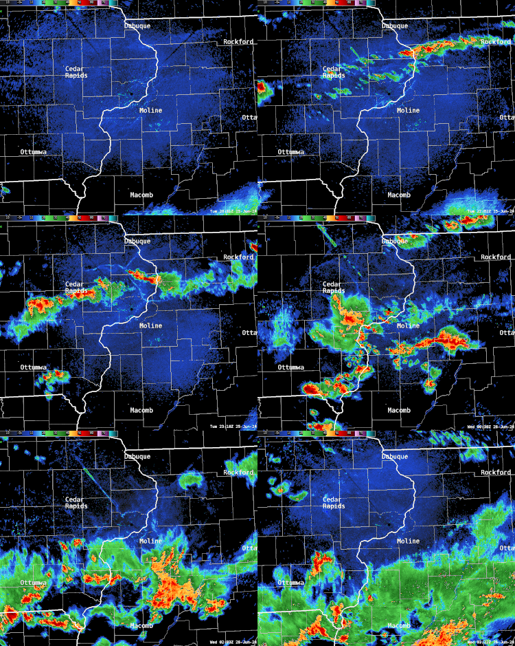
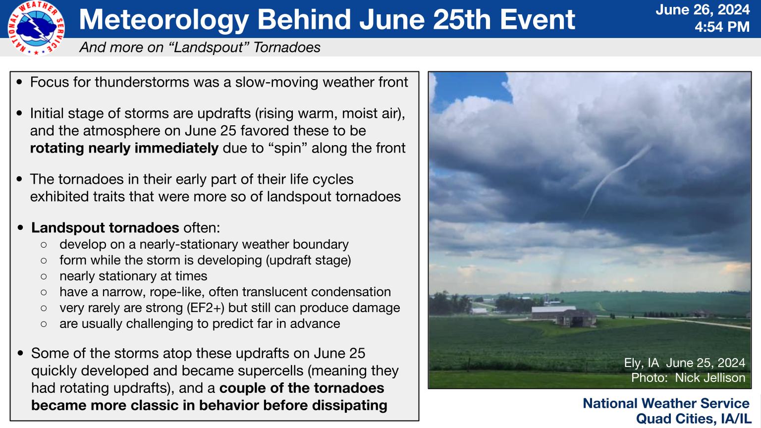
| Radar Loop: 3:30-10 P.M. | Meteorological details, including landspout tornado characteristics |
Fast Facts
Tornadoes
Individual Tornado Details (listed in chronological order)
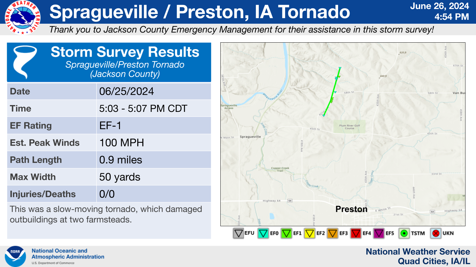
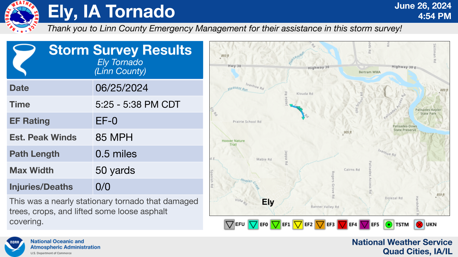
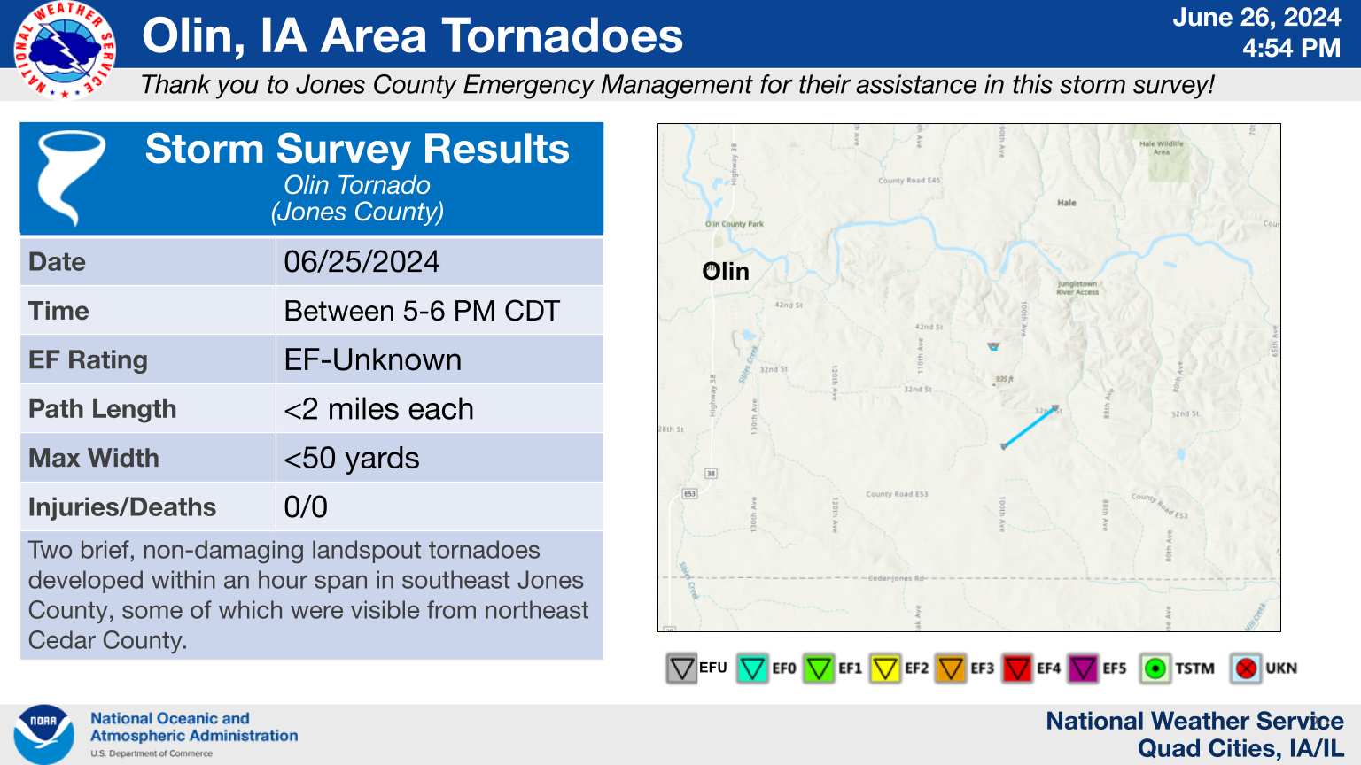
The Enhanced Fujita (EF) Scale classifies tornadoes into the following categories:
| EF0 Weak 65-85 mph |
EF1 Moderate 86-110 mph |
EF2 Significant 111-135 mph |
EF3 Severe 136-165 mph |
EF4 Extreme 166-200 mph |
EF5 Catastrophic 200+ mph |
 |
|||||
Photos & Video
 |
 |
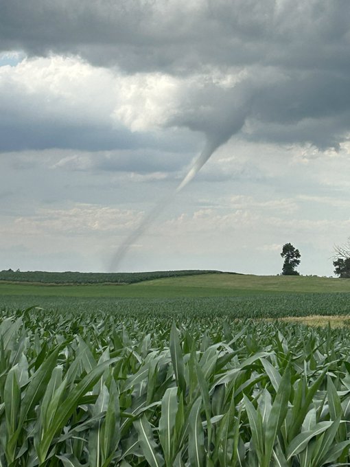 |
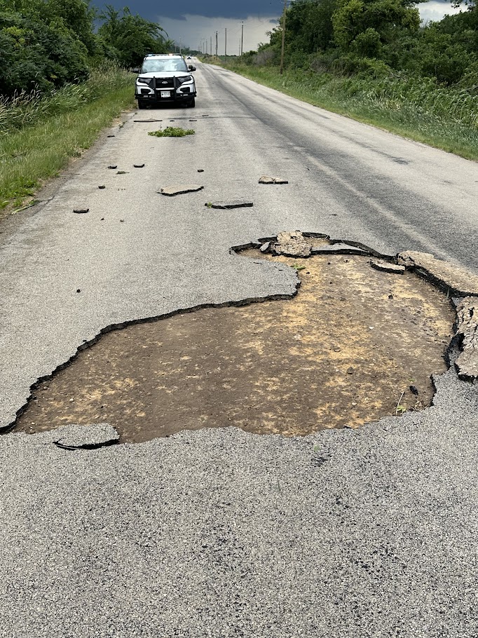
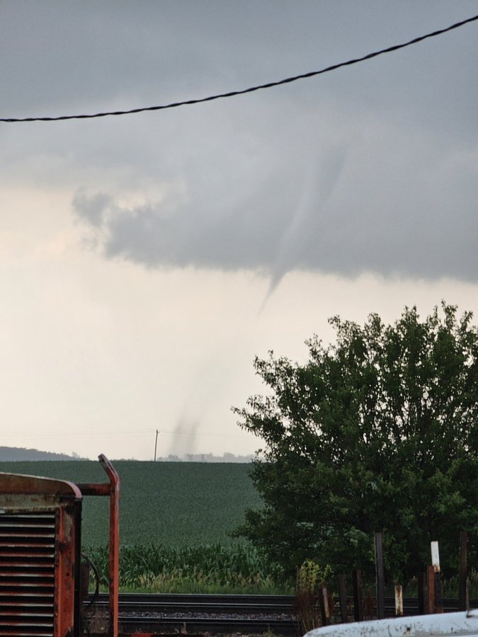
| Portion of Road Peeled Away near Jappa Road and Ivanhoe Road from Ely Tornado (Courtesy of Linn County EMA) | Olin, IA EF-U Tornado; view from Clarence (Courtesy of Levi VanOort) | Ely, IA EF-0 Tornado (Courtesy of Brett Happel) |
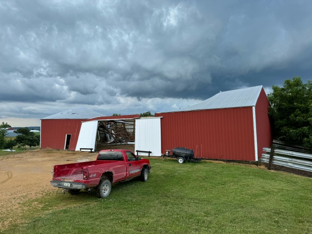 |
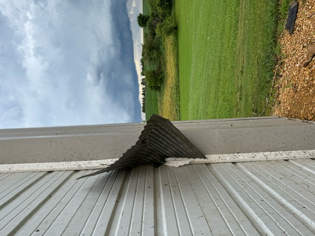 |
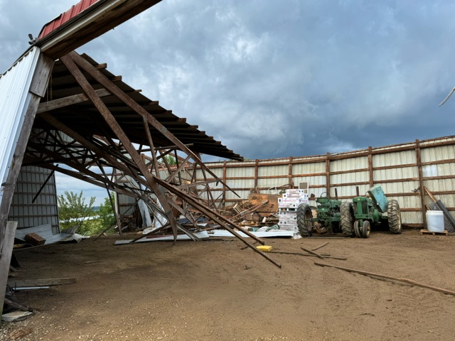 |
| Preston, IA EF-1 Tornado Damage (Courtesy of Preston Fire Dept.) | Preston, IA EF-1 Tornado Damage (Courtesy of Preston Fire Dept.) | Preston, IA EF-1 Tornado Damage (Courtesy of Preston Fire Dept.) |
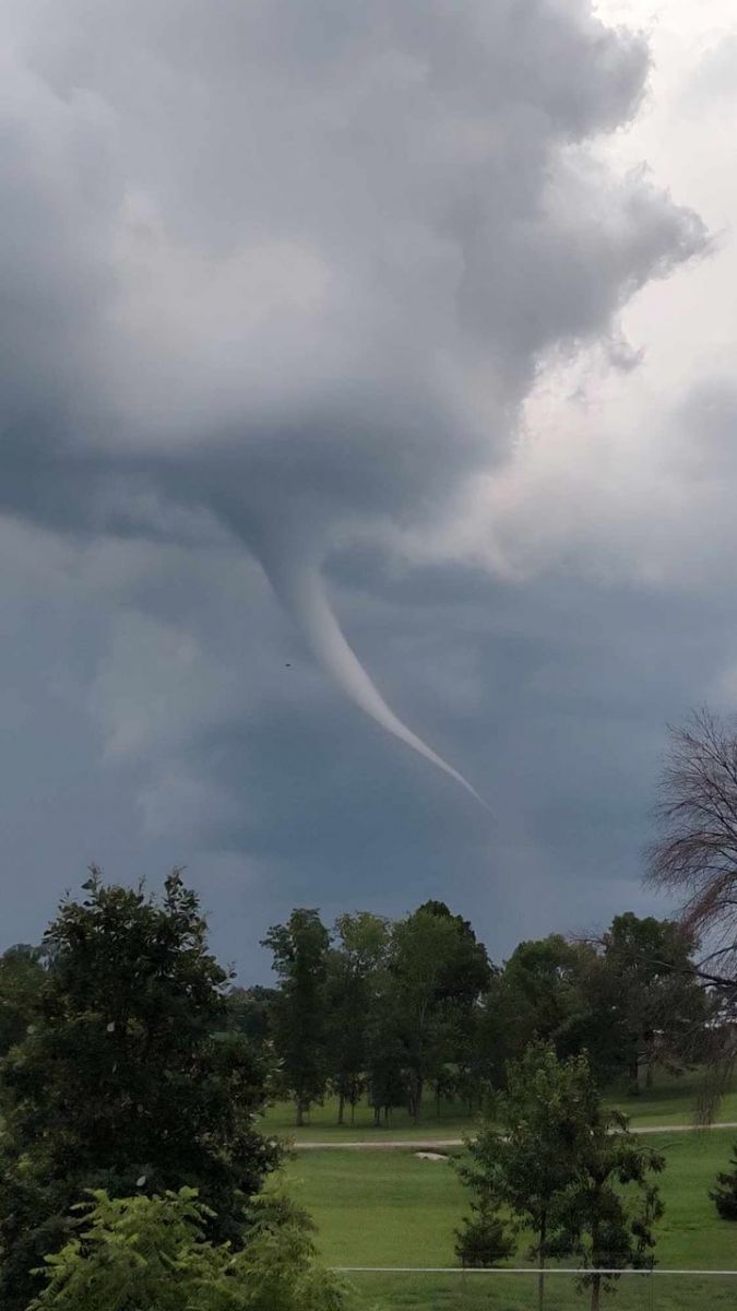 |
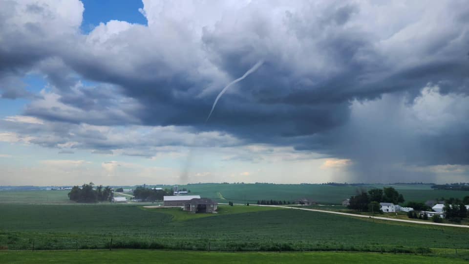 |
|
| Ely, IA EF-0 Tornado (Courtesy of Paul Dubois) | Ely, IA EF-0 Tornado (Courtesy of Nick Jellison) |
Storm Reports
|
Storm Report Map (SPC) |
 |
| Interactive Storm Report Map (SPC) |
Preliminary Local Storm Report...Summary
National Weather Service Quad Cities IA IL
806 PM CDT Wed Jun 26 2024

..TIME...   ...EVENT...      ...CITY LOCATION...     ...LAT.LON...
..DATE...   ....MAG....      ..COUNTY LOCATION..ST.. ...SOURCE....
            ..REMARKS..

0541 AM     Hail             3 ESE Davenport         41.55N 90.55W
06/25/2024  E0.88 Inch       Scott              IA   Public


0615 AM     Tstm Wnd Dmg     Tampico                 41.64N 89.79W
06/25/2024                   Whiteside          IL   Broadcast Media

            Trees down in Memorial Cemetery. Worst winds
            are based on viewer recollection.

0624 AM     Tstm Wnd Dmg     1 NNW Deer Grove        41.63N 89.70W
06/25/2024                   Whiteside          IL   Broadcast Media

            Time estimated from radar. Power lines down
            on Hahnaman Rd.

0630 AM     Tstm Wnd Dmg     Tampico                 41.63N 89.79W
06/25/2024                   Whiteside          IL   Public

            Time estimated from radar; small tree limbs
            and power lines down.

0700 AM     Tstm Wnd Dmg     4 SSE Atkinson          41.36N 89.99W
06/25/2024                   Henry              IL   Emergency Mngr

            Time estimated from radar; trees down
            intersection of E2330 Street and Mud Creek
            Rd.

0717 AM     Tstm Wnd Dmg     3 SE German Corner      41.27N 90.00W
06/25/2024                   Henry              IL   Emergency Mngr

            Time estimated from radar; trees down
            intersection of Tower Rd and Highway 81.

0722 AM     Tstm Wnd Dmg     2 WNW Kewanee           41.26N 89.97W
06/25/2024                   Henry              IL   Emergency Mngr

            Time estimated from radar; trees down at
            N750th Ave and Highway 81.

0805 AM     Tstm Wnd Dmg     1 WSW Galva             41.16N 90.06W
06/25/2024                   Henry              IL   Emergency Mngr

            Time estimated from radar; grain wagons
            blown over.

0819 AM     Tstm Wnd Dmg     1 SE Alexis             41.06N 90.56W
06/25/2024                   Warren             IL   Trained Spotter

            Numerous 4 inch and larger tree limbs down
            on the south side of the village.

1040 AM     Hail             2 ESE Bentonsport/Verno 40.72N 91.83W
06/25/2024  M1.00 Inch       Van Buren          IA   Trained Spotter


1225 PM     Tstm Wnd Dmg     2 SSW Memphis           40.43N 92.19W
06/25/2024                   Scotland           MO   Broadcast Media

            Large tree blown down over Highway 15. In
            addition, a portable shed blow from parking
            lot of store, onto a highway, where it was
            hit by a truck and destroyed. Photos sent
            confirming damage, and time estimated from
            radar data.

0503 PM     Tornado          2 WNW Van Buren         42.09N 90.40W
06/25/2024                   Jackson            IA   NWS Storm Survey

            NWS Storm Survey determined an EF1 tornado
            occurred with maximum winds near 100 mph.
            This tornado damaged outbuildings, trees,
            and crops.

0505 PM     Tstm Wnd Dmg     2 ENE Spragueville      42.08N 90.40W
06/25/2024                   Jackson            IA   911 Call Center

            Jackson county dispatch reported steel roof
            was blown off a barn north of Preston. There
            was also damage to a high voltage line
            reported. Possible tornado damage. Time
            estimated by radar.

0511 PM     Tstm Wnd Dmg     1 NW Preston            42.06N 90.41W
06/25/2024                   Jackson            IA   911 Call Center

            Tree limbs blown onto Highway 64. Time
            estimated by radar.

0525 PM     Funnel Cloud     Victor                  41.73N 92.29W
06/25/2024                   Iowa               IA   Trained Spotter

            Delayed report.

0525 PM     Tornado          2 N Ely                 41.90N 91.59W
06/25/2024                   Linn               IA   NWS Storm Survey

            NWS Storm Survey determined an EF0 tornado
            with landspout characteristics occurred with
            maximum winds near 85 mph. Damage included
            snapped large tree limbs, damaged power pole
            cross member, and lifted some loose asphalt.
            This tornado moved very little in its
            duration.

0530 PM     Tornado          2 SSW Hale              41.99N 91.08W
06/25/2024                   Jones              IA   Trained Spotter

            Nearly stationary EFU landspout tornado
            touched down in a field resulting in minor
            crop damage.

0540 PM     Funnel Cloud     Coralville              41.69N 91.60W
06/25/2024                   Johnson            IA   Trained Spotter

            Delayed report.

0550 PM     Tornado          3 S Hale                41.97N 91.07W
06/25/2024                   Jones              IA   Trained Spotter

            EFU landspout tornado touched down in a
            field resulting in minor crop damage.

0552 PM     Tstm Wnd Dmg     2 S Almont              41.95N 90.20W
06/25/2024                   Clinton            IA   Public

            Large tree branches down. Time estimated
            from radar data.

0614 PM     Tstm Wnd Dmg     3 NNE Bryant            42.00N 90.32W
06/25/2024                   Clinton            IA   911 Call Center

            Tree fell on an LP tank causing it to leak.
            Power line was also downed near the tree
            damage. Time estimated by radar.

0630 PM     Hail             4 E Maquoketa           42.07N 90.59W
06/25/2024  E2.00 Inch       Jackson            IA   Public

            Corrects previous hail report from 4 E
            Maquoketa.

0630 PM     Hail             5 NE Delmar             42.05N 90.54W
06/25/2024  E3.00 Inch       Jackson            IA   Public

            Report relayed by media. Photo confirmed.

0633 PM     Hail             5 NNE Delmar            42.07N 90.56W
06/25/2024  E1.75 Inch       Jackson            IA   Public

            time estimated from radar.

0634 PM     Hail             1 SSE Solon             41.79N 91.49W
06/25/2024  E1.75 Inch       Johnson            IA   Emergency Mngr

            time estimated from radar.

0640 PM     Hail             3 ESE Maquoketa         42.06N 90.62W
06/25/2024  E3.00 Inch       Jackson            IA   Public

            Photo on social media. Time estimated from
            radar data.

0700 PM     Tstm Wnd Dmg     2 NE Oakdale            41.72N 91.56W
06/25/2024                   Johnson            IA   Emergency Mngr

            EM relayed a report of a window blown out of
            a home. Rain spilled through the window and
            flooded the basement.

0702 PM     Hail             1 E North Liberty       41.74N 91.59W
06/25/2024  M1.00 Inch       Johnson            IA   Public


0703 PM     Tstm Wnd Gst     Iowa City Municipality  41.63N 91.55W
06/25/2024  M68 MPH          Johnson            IA   ASOS

            ASOS station KIOW Iowa City Arpt.

0706 PM     Tstm Wnd Dmg     2 NE Iowa City          41.68N 91.52W
06/25/2024                   Johnson            IA   Emergency Mngr

            Power lines down with power outages around
            dodge street. Time estimated from radar.

0720 PM     Hail             2 SSW Bentonsport/Verno 40.70N 91.87W
06/25/2024  M1.00 Inch       Van Buren          IA   Public

            Relay of a public report of dime to quarter
            size hail southeast of Keosauqua.

0730 PM     Tstm Wnd Dmg     4 ENE Adams             41.50N 91.17W
06/25/2024                   Muscatine          IA   Park/Forest Srvc

            5 large trees and many branches downed at
            Saulsbury Bridge Recreation Area. One tree
            took down a powerline. Time estimated by
            radar.

0735 PM     Tstm Wnd Dmg      Muscatine              41.42N 91.05W
06/25/2024                   Muscatine          IA   Fire Dept/Rescue

            Widespread tree limbs down in Muscatine as
            well as power poles down.

0735 PM     Tstm Wnd Gst     2 NNE Muscatine         41.44N 91.05W
06/25/2024  M60 MPH          Muscatine          IA   Trained Spotter

            estimated thunderstorm wind gust.

0735 PM     Tstm Wnd Gst     2 SSW Wilton            41.57N 91.04W
06/25/2024  M71 MPH          Muscatine          IA   Trained Spotter

            estimated thunderstorm wind gusts. location
            of the event is estimated.

0739 PM     Tstm Wnd Gst     5 N Muscatine           41.49N 91.07W
06/25/2024  E70 MPH          Muscatine          IA   Trained Spotter

            estimated thunderstorm wind gust.

0740 PM     Tstm Wnd Gst     3 WNW Muscatine         41.44N 91.13W
06/25/2024  E71 MPH          Muscatine          IA   Trained Spotter

            measured from equipment on top of the car.
            Location of gust is estimated.

0750 PM     Tstm Wnd Gst     Muscatine Municipality  41.37N 91.15W
06/25/2024  M56 MPH          Muscatine          IA   AWOS

            IADOT AWOS.

0758 PM     Flash Flood      5 SW Providence         41.24N 89.68W
06/25/2024                   Bureau             IL   Law Enforcement

            Route 40 impassable due to flooding. Sheriff
            deputy stranded.

0800 PM     Tstm Wnd Dmg     Taylor Ridge            41.39N 90.67W
06/25/2024                   Rock Island        IL   Public

            Large tree branch down. Time estimated from
            radar data.

0805 PM     Funnel Cloud     1 ENE Spring Lake       41.51N 90.70W
06/25/2024                   Scott              IA   Broadcast Media

            Funnel cloud as seen on webcam imagery.
            Estimated location.

0815 PM     Tstm Wnd Dmg     2 E Davenport           41.56N 90.56W
06/25/2024                   Scott              IA   NWS Employee

            4 inch tree branch downed by storm winds.

0819 PM     Tstm Wnd Dmg     1 N Fruitland           41.49N 90.52W
06/25/2024                   Rock Island        IL   Public

            Tree limbs broken off. Relayed via mPING.

0820 PM     Tstm Wnd Dmg     Orion                   41.35N 90.38W
06/25/2024                   Henry              IL   Law Enforcement

            Large tree and powerlines downed. Time
            updated.

0820 PM     Tstm Wnd Gst     Moline Quad-City Airpor 41.45N 90.50W
06/25/2024  M56 MPH          Rock Island        IL   ASOS


0822 PM     Tstm Wnd Gst     Davenport Municipality  41.62N 90.58W
06/25/2024  M46 MPH          Scott              IA   ASOS


0832 PM     Rain             3.5 ENE Charlie Heath M 40.59N 91.84W
06/25/2024  M2.00 Inch       Clark              MO   Public


0835 PM     Rain             2 SE Iowa City          41.64N 91.51W
06/25/2024  M1.00 Inch       Johnson            IA   Trained Spotter


0845 PM     Tstm Wnd Dmg     Cambridge               41.30N 90.19W
06/25/2024                   Henry              IL   Law Enforcement

            Cable lines downed.

0846 PM     Tstm Wnd Gst     Cambridge               41.30N 90.19W
06/25/2024  M61 MPH          Henry              IL   Public

            Measured from a PWS.

0849 PM     Tstm Wnd Gst     Mediapolis              41.01N 91.17W
06/25/2024  E60 MPH          Des Moines         IA   Trained Spotter

            Lawn furniture being tossed around. Also
            very heavy rain.

0958 PM     Tstm Wnd Dmg     3 ENE Charlie Heath Mem 40.59N 91.84W
06/25/2024                   Clark              MO   Trained Spotter

            6-inch diameter branch downed. Time
            estimated by radar.

1110 PM     Rain             3 ENE Charlie Heath Mem 40.59N 91.84W
06/25/2024  M2.05 Inch       Clark              MO   Trained Spotter

            In just over three hours.

0700 AM     Rain             2 E Iowa City           41.66N 91.49W
06/26/2024  M2.08 Inch       Johnson            IA   Cocorahs

            Cocorahs station IA-JH-34 Iowa City 2.3 E.

0800 AM     Rain             1 SE Galva              41.16N 90.03W
06/26/2024  M2.78 Inch       Henry              IL   Cocorahs

            Cocorahs station IL-HY-25 Galva.

0800 AM     Rain             2 SW Sawyer             40.68N 91.38W
06/26/2024  M2.00 Inch       Lee                IA   Cocorahs

            Cocorahs station IA-LE-20 Fort Madison 4.5
            NNW.

0800 AM     Rain             2 NNW Sawyer            40.73N 91.37W
06/26/2024  M2.04 Inch       Lee                IA   Cocorahs

            Cocorahs station IA-LE-21 Fort Madison 7.7
            N.
Rain Reports
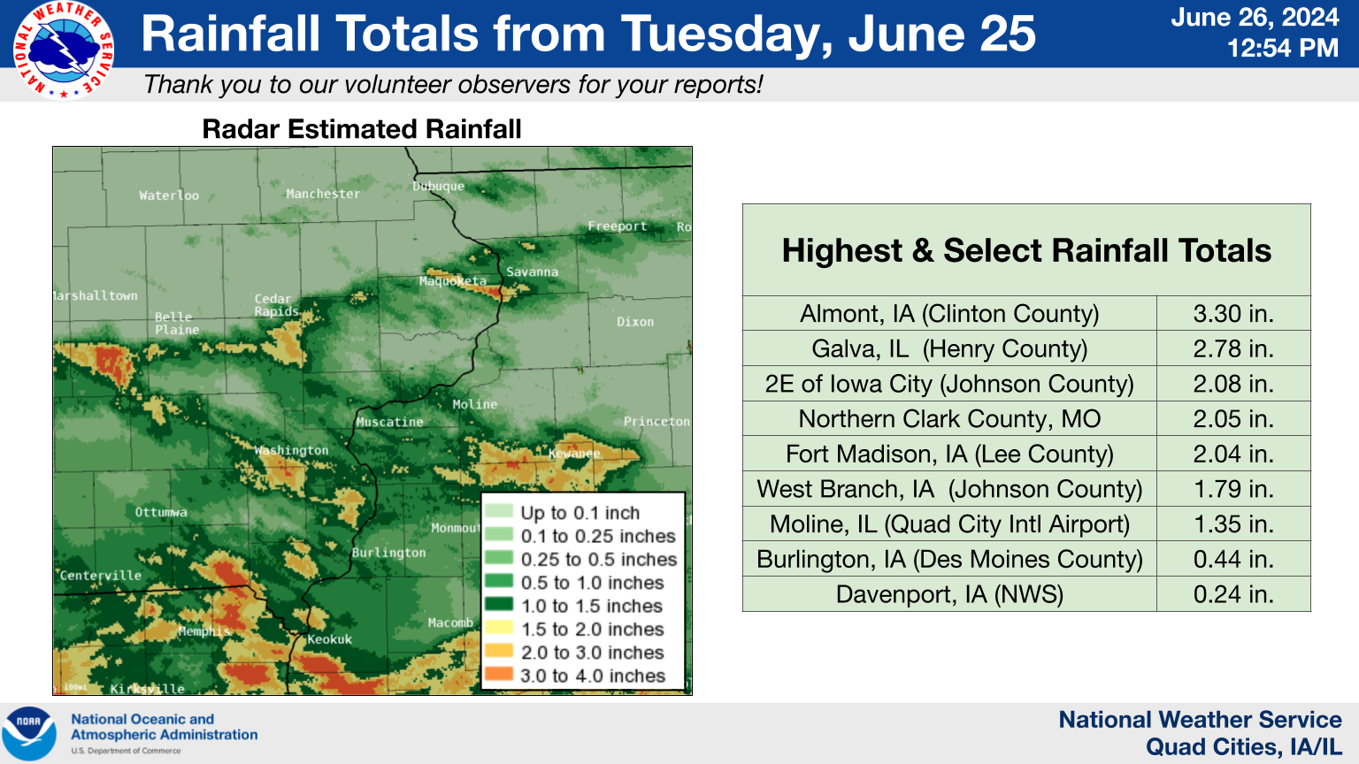 |
| Rainfall Totals |
A summary of highest rainfall reports from multiple sources can be found here.
24 hour precipitation reports (in Inches) for eastern Iowa, northwest and west central Illinois,
and northeast Missouri. Reports from the morning of Wednesday June 26, 2024.

....IOWA....
Iowa City 2.3 E                  2.08
Fort Madison 7.7 N               2.04
Grinnell 2.3 SW                  1.91
West Point 2.4 E                 1.88
West Branch 2.3 SSW              1.79
Solon 0.4 WNW                    1.68
Solon 0.3 ESE                    1.56
Grinnell AWOS 2.4 SSW            1.40
Wapello 5.4 SE                   1.36
North Liberty 0.5 NW             1.30
Yarmouth 1.9 SW                  1.17
North Liberty 0.7 SSW            1.15
Keosauqua                        1.07
Washington 5.8 SW                1.03
Muscatine 2N                     0.92
Donnellson                       0.81
Iowa City Arpt                   0.80
Washington                       0.79
West Point 7.5 NW                0.76
Davenport 0.9 WNW                0.76
Iowa City                        0.75
Hillsboro 5.8 SE                 0.50
Pella 4 N                        0.49
Fairfield 5.7 NNE                0.48
Burlington Arpt                  0.47
Burlington 0.8 SSE               0.46
Clinton 1.7 NNW                  0.46
Keokuk 3.4 NW                    0.45
Keokuk LD19                      0.45
Salem 1S                         0.43
Fort Madison 0.9 NE              0.42
Mt Pleasant 1 SSW                0.42
Centerville 0.3 NE               0.41
Davenport 1.0 NE                 0.40
Pella AWOS 1.5 WSW               0.40
Fairfield                        0.38
Davenport 4.3 NE                 0.37
Williamsburg                     0.35
Burlington 6.5 SSW               0.34
Salem 3.1 ESE                    0.32
Lowden                           0.32
New London 1.5 SW                0.30
Riverdale 0.5 N                  0.29
Fairfield 0.7 SE                 0.26
Hayesville 0.2 SW                0.26
Davenport Arpt                   0.25
Columbus Jct 2 SSW               0.25
Danville 2.9 W                   0.23
Tipton 0.3 ESE                   0.23
Tipton 0.7 N                     0.23
De Witt                          0.23
Muscatine 1.4 N                  0.22
Ainsworth 7.4 N                  0.20
Parnell 0.1 SSW                  0.20
Camanche 1.2 W                   0.17
North English                    0.16
Tipton 6.9 SSW                   0.15
Oskaloosa AWOS 9.2 ESE           0.15
Farley 0.7 S                     0.13
Oskaloosa 1.4 NNW                0.12
NWS Johnston* 4.6 NNW            0.12
Ottumwa ASOS 5.8 NNW             0.12
Le Claire 2.0 WSW                0.11
Marshalltown 1.3 NW              0.10
Marengo 2.6 SSW                  0.09
Clarence 3.9 S                   0.08
Bellevue 12.2 NW                 0.07
Wellman 4.0 E                    0.06
Eldridge 0.6 S                   0.04
Eldridge 0.7 SSW                 0.03
Oelwein AWOS                     0.03
Cedar Rapids 2.1 NW              0.02
Park View 0.2 WSW                0.01
Ely 0.5 SE                       0.01
Dyersville 1.7 ESE               0.01
Mason City 0.9 NNE               0.01
Center Junction 2.6 W            0.00
Ely 2.0 N                        0.00
Hiawatha 0.9 SW                  0.00
Fairfax 4.0 NW                   0.00
Dubuque 1.4 WNW                  0.00
Dubuque 1.0 SE                   0.00
Asbury 0.4 SW                    0.00
Hopkinton 5.4 WSW                0.00
Independence 0.6 ESE             0.00
Elkader 6SSW                     0.00
Marshalltown ASOS 4.2 N          0.00
Waterloo ASOS 5.2 NW             0.00
Marengo                          0.00
Cedar Rapids Arpt                0.00
Vinton                           0.00
Manchester                       0.00
Marengo 3.6 N                    0.00
Anamosa 5.6 E                    0.00
Marion 0.9 NE                    0.00
Cedar Rapids 5.8 N               0.00
Marion 0.4 NNW                   0.00
Robins 0.8 SE                    0.00
Marion 1.7 NNW                   0.00
Mount Auburn 2.2 NNW             0.00
Asbury 0.6 S                     0.00
Dundee 1.4 NNE                   0.00
Oelwein 1E                       0.00
Guttenberg Dam 10                0.00
Fayette 1 NW                     0.00
Mason City ASOS 6.3 W            0.00
Hampton 1 N                      0.00
Bellevue LD12                    0.00
Ames US 30 2.2 SE                0.00
Belle Plaine                     0.00
Anamosa 3 SSW                    0.00
Dubuque LD11                     0.00
Monticello 1 E                   0.00
Dubuque Arpt                     0.00
Boone 1.3 SSW                    0.00

....ILLINOIS....
Galva 0.9 SE                     2.78
Woodhull 0.3 ESE                 1.82
Alpha 2.3 N                      1.67
Peoria Arpt                      1.56
Fulton LD13                      1.30
Kewanee 1 E                      1.28
Lincoln NWS                      1.26
Galva 2.7 NE                     1.19
Quad City Arpt                   1.03
Taylor Ridge 1.1 N               1.00
Jacksonville 2E                  0.95
Galesburg                        0.85
Warsaw 5.8 SE                    0.84
Romeoville                       0.84
New Windsor 2.0 N                0.82
Gladstone LD18                   0.82
Aledo                            0.78
Bloomington Airport              0.77
Shannon 2.7 E                    0.70
Quincy Arpt                      0.70
Viola 0.4 E                      0.65
Joliet Arpt                      0.65
McNabb 1.4 NW                    0.61
Illinois City 6.7 SW             0.61
Monmouth 0.4 SE                  0.60
Steward                          0.55
Augusta                          0.53
New Boston 9.3 NNE               0.49
Ottawa 4 SW                      0.43
Freeport 4.3 W                   0.42
La Harpe                         0.35
Stronghurst 0.4 SSW              0.34
Bentley                          0.34
Mount Carroll 6.8 NNW            0.33
Decatur Airport                  0.31
Sterling 5.9 NNE                 0.29
                                 0.27
Rockford Arpt                    0.27
Macomb                           0.25
Ill. City LD16 3 WNW             0.25
Taylor Ridge 1.1 E               0.24
Rochelle Arpt                    0.24
Colchester 3.5 NE                0.23
Stockton 4.5 N                   0.23
Colona 0.5 ESE                   0.19
Lanark 4.2 NNW                   0.18
Windsor                          0.17
Lanark 5.3 N                     0.16
Ogden                            0.16
Mendota 2 SE                     0.16
Prairie City 2S                  0.14
Stockton 3.4 NNE                 0.12
St Anne                          0.12
Stockton 3 NNE                   0.12
Tuscola                          0.07
Lena 0.3 SSE                     0.04
Davis 0.5 N                      0.02
East Dubuque 1.7 SE              0.00
Winslow 4.3 ESE                  0.00
Freeport 2.9 WSW                 0.00
Freeport                         0.00
Elizabeth                        0.00
Jacksonville Arpt                0.00

....MISSOURI....
Chillicothe Arpt                 1.74
Columbia Arpt                    1.10
Kirksville Arpt                  0.92
Kahoka 0.6 S                     0.91

....WISCONSIN....
Beloit-College                   0.25
Monroe 1 W                       0.03
Viroqua                          0.00
Sullivan-NWS 2 SE                0.00
Madison Arpt                     0.00
Brodhead 1 SW                    0.00
Steuben 4SE 3 NE                 0.00
Prairie du Chien AWOS            0.00
La Crosse WFO                    0.00
Whitewater                       0.00
Watertown-Arpt                   0.00

....MINNESOTA....
Theilman 1SSW                    0.00
Grand Meadow                     0.00
Outlooks and Environment
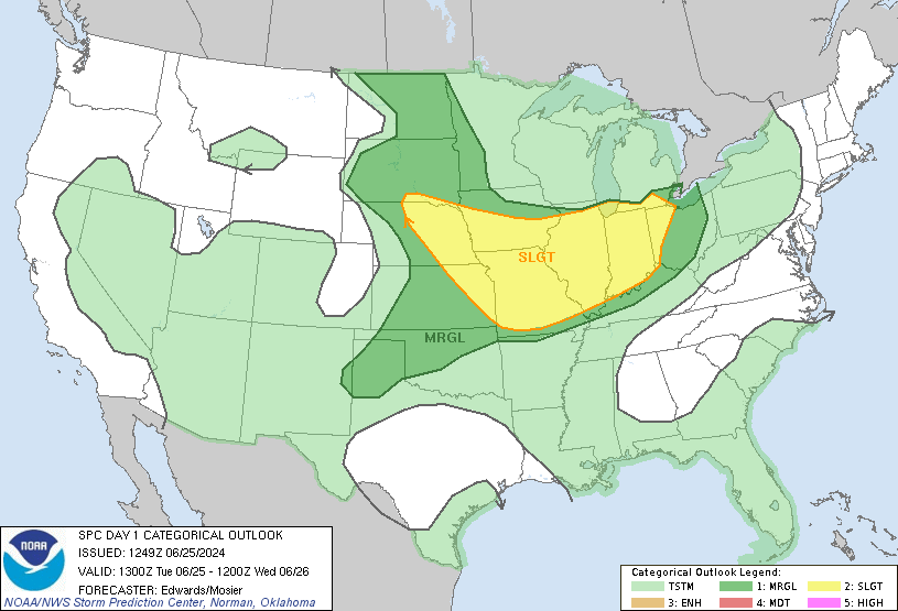
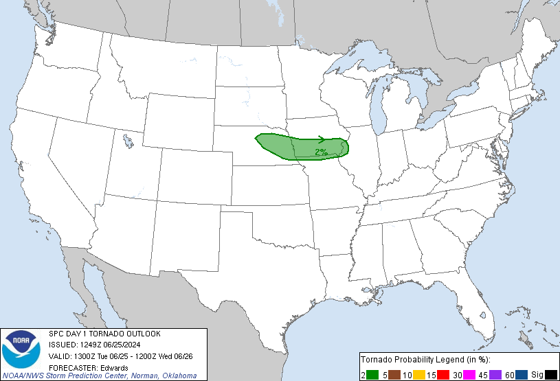
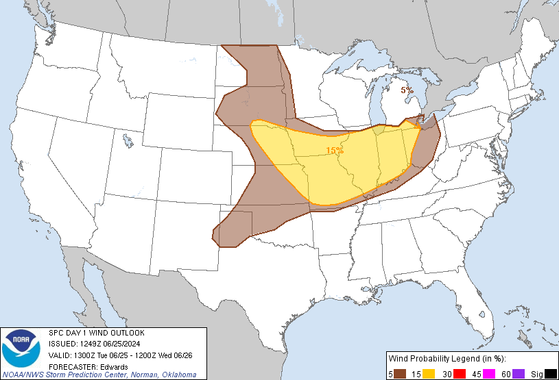
Storm Prediction Center Outlooks
 |
 |
 |
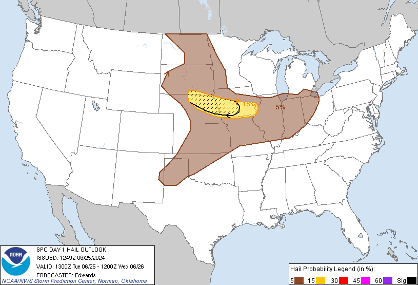 |
| SPC Day 1 1300z Outlook |
Tornado Risk Probabilities |
Severe Wind Risk Probabilities |
Severe Hail Risk Probabilities |
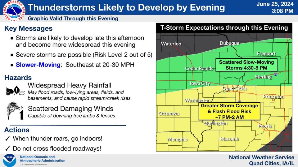
Weather Story Graphic and Watch
 |
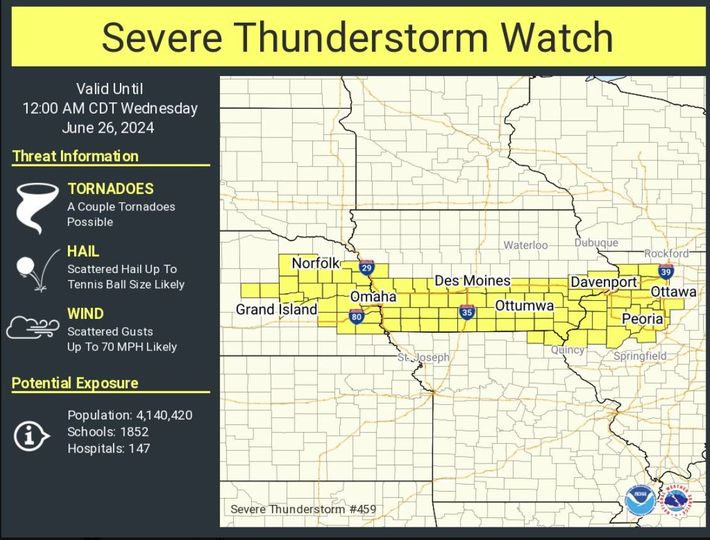 |
| Weather Story Graphic issued at 3 P.M. | Severe Watch #459 issued at 4:30 P.M. |
Local Soundings at DVN
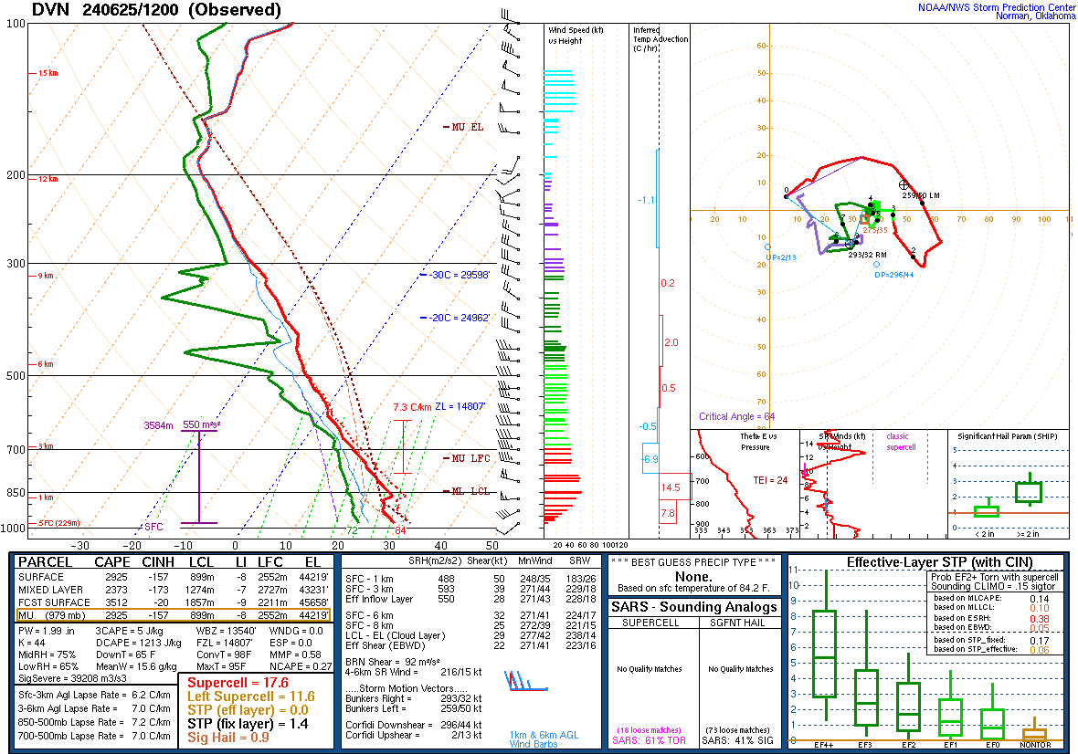 |
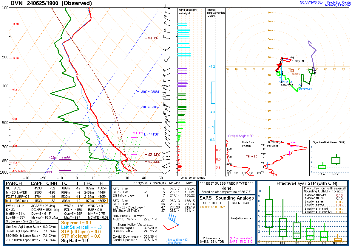 |
| 06/25/2024 - 7:00 am | 06/25/2024 - 1:00 pm |
Synoptic Environment
|
|
|
|
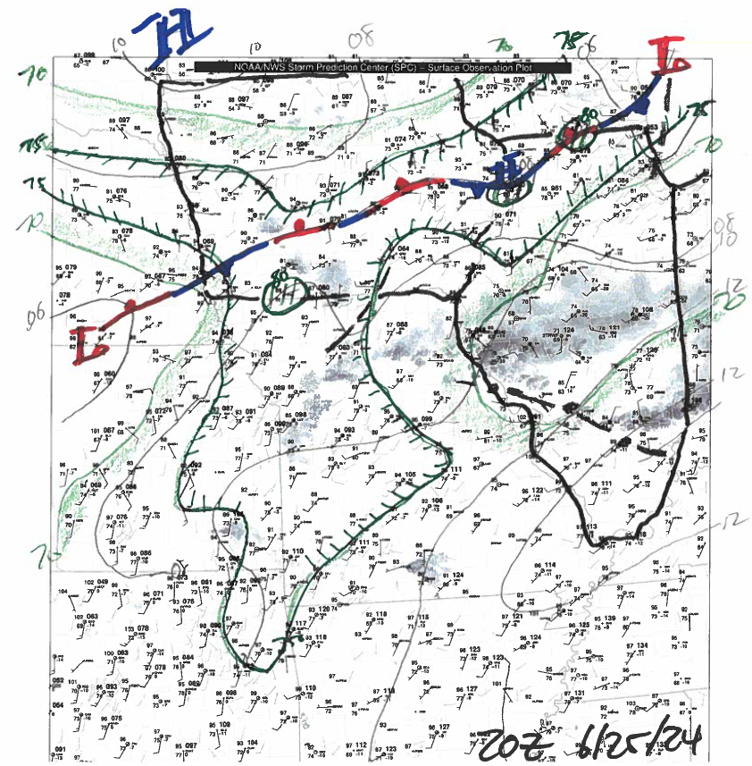 |
| 500 mb Chart at 2pm | 700 mb Chart at 2pm | 850 mb Chart at 2pm | Surface Chart at 3pm |
 |
Media use of NWS Web News Stories is encouraged! |
 |