Overview
|
|
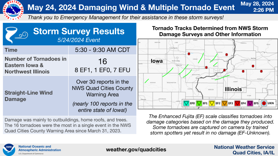 |
Tornadoes
Damage Assessment Toolkit Viewer
Damage including Tornado Tracks KMZ File for NWS Quad Cities, IA/IL CWA
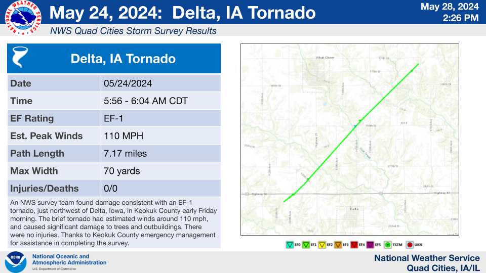
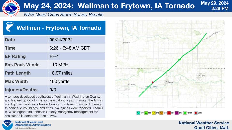
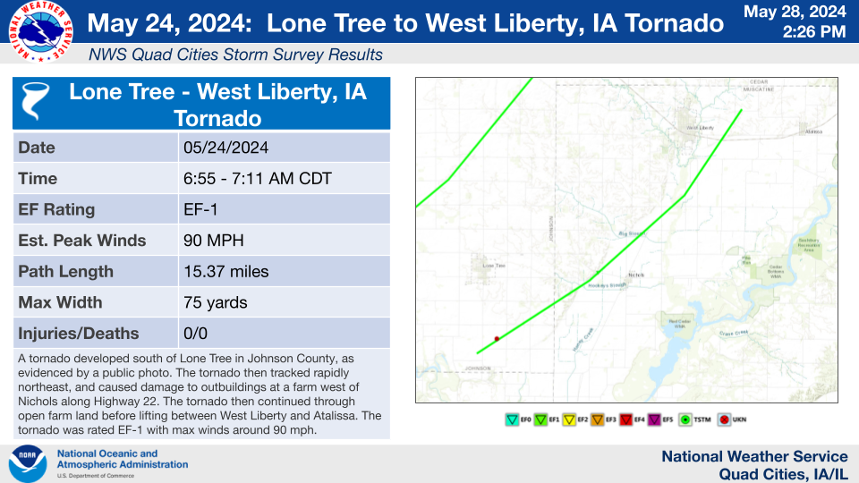
Individual Tornado Details (listed in chronological order)
.jpg)
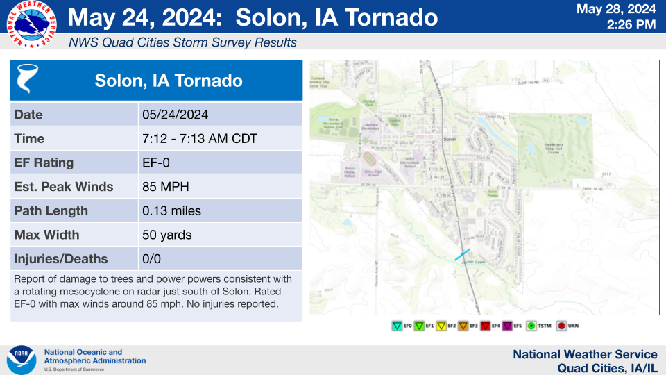
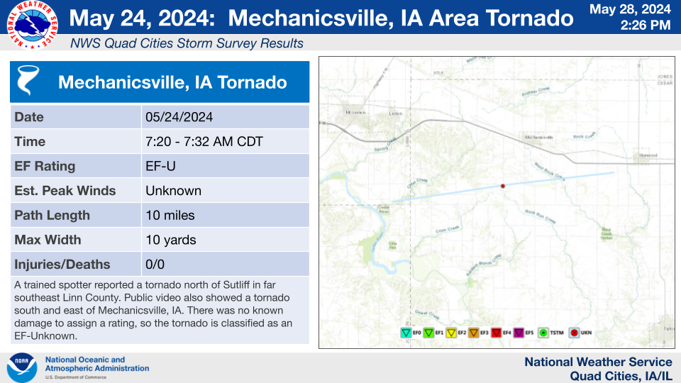
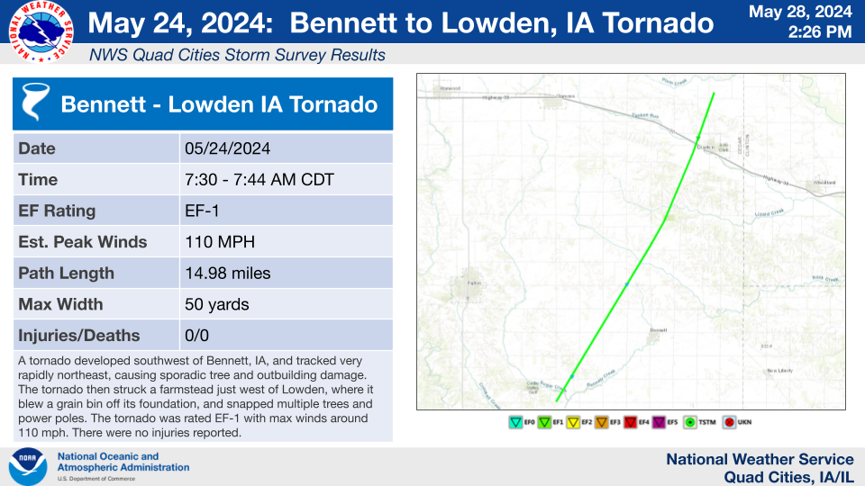
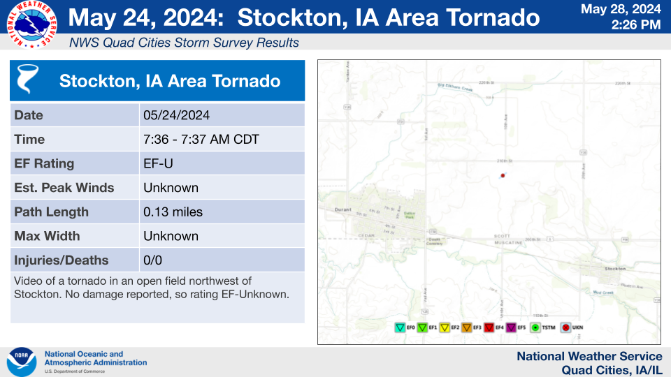
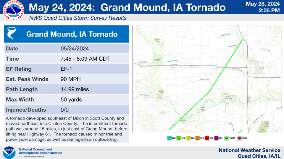
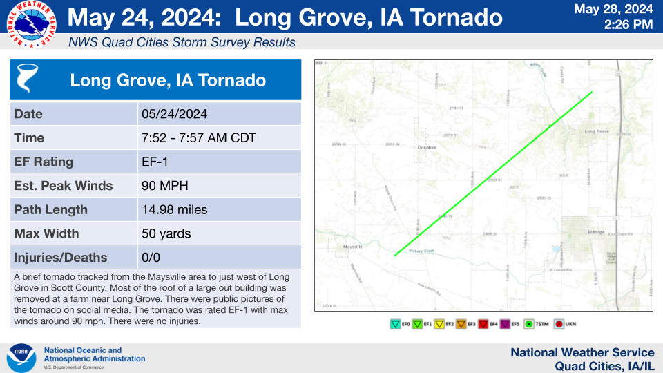
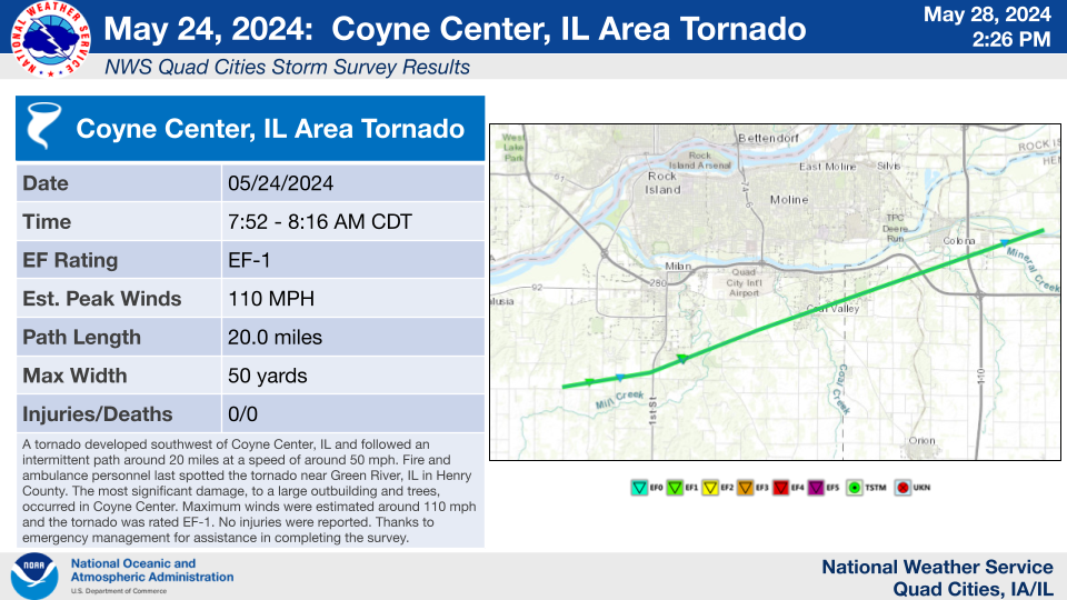
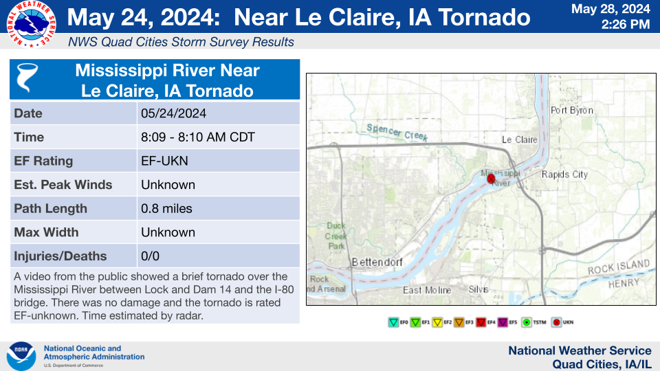
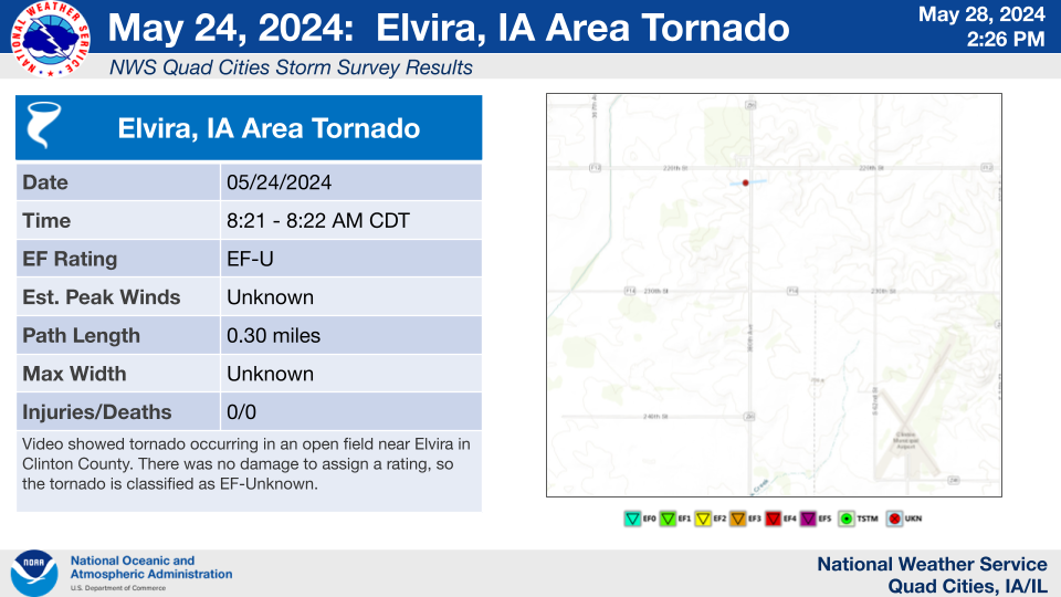
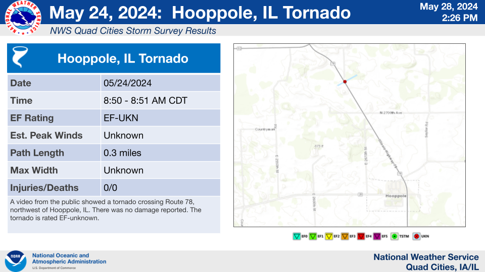
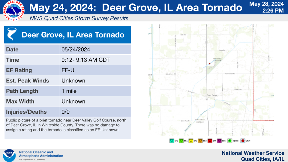
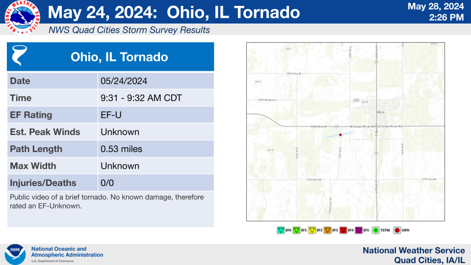
The Enhanced Fujita (EF) Scale classifies tornadoes into the following categories:
| EF0 Weak 65-85 mph |
EF1 Moderate 86-110 mph |
EF2 Significant 111-135 mph |
EF3 Severe 136-165 mph |
EF4 Extreme 166-200 mph |
EF5 Catastrophic 200+ mph |
 |
|||||
Forecasts
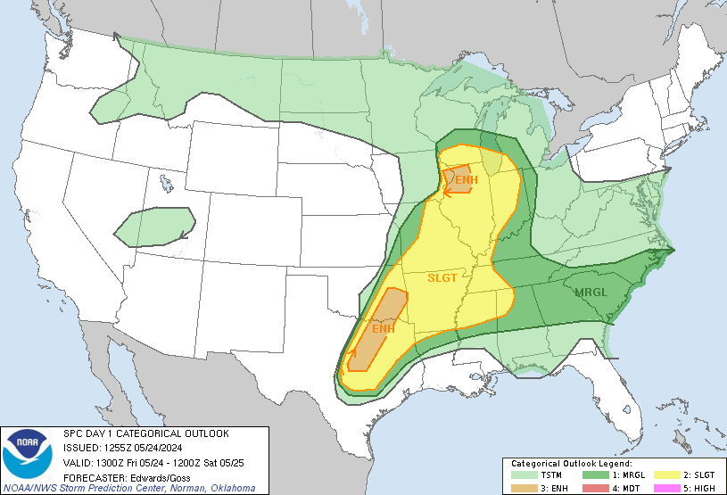
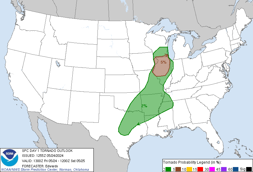
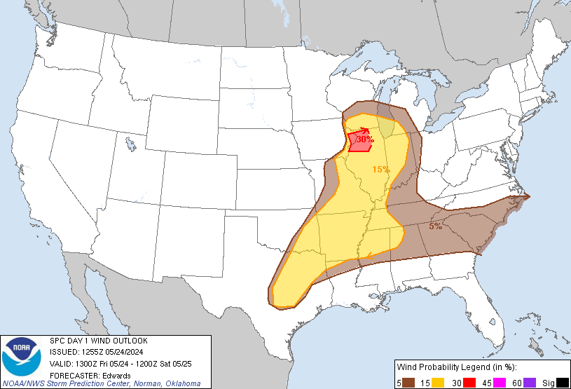
| NWS Storm Prediction Center (SPC) Day 1 Outlook (issued at 8 A.M. CDT) | |||
 |
 |
 |
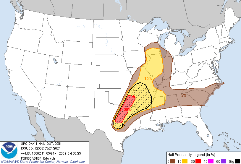 |
| SPC Convective Outlook | SPC Tornado Probability Outlook | SPC Wind Probability Outlook | SPC Hail Probability Outlook |
| NWS Severe Thunderstorm Watches | |
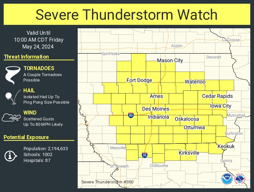 |
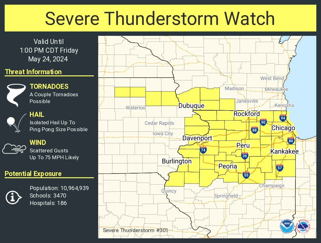 |
| May 24, 2:42 A.M.: Severe Thunderstorm Watch for Central and much of Eastern Iowa | May 24, 6:08 A.M.: Severe Thunderstorm Watch for far Eastern Iowa and all of Northern Illinois |
| NWS Quad Cities Weather Story Graphics | ||
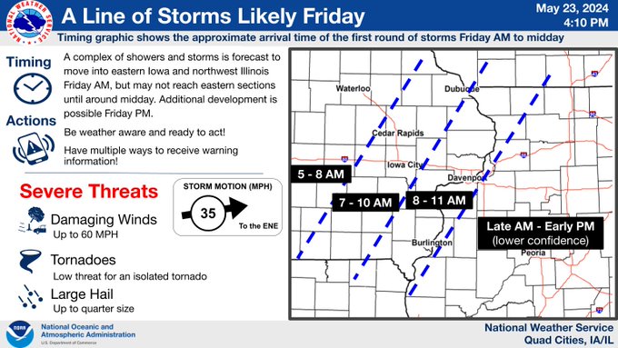 |
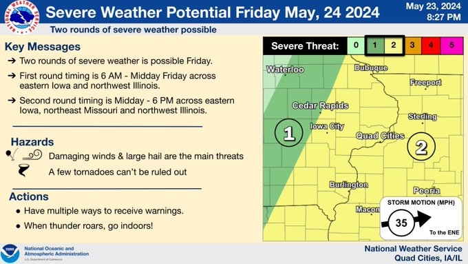 |
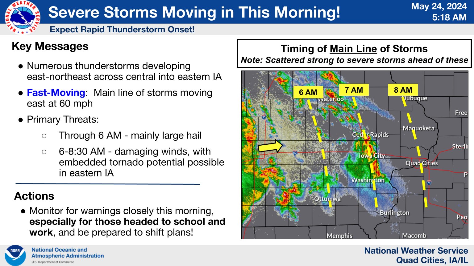 |
| May 23 Afternoon: Weather Story Graphic issued highlighting timing | May 23 Evening: Weather Story Graphic highlighting key messages, threat, and threat area | May 24 Pre-Dawn: Weather Story Graphic highlighting storms and timing |
Photos
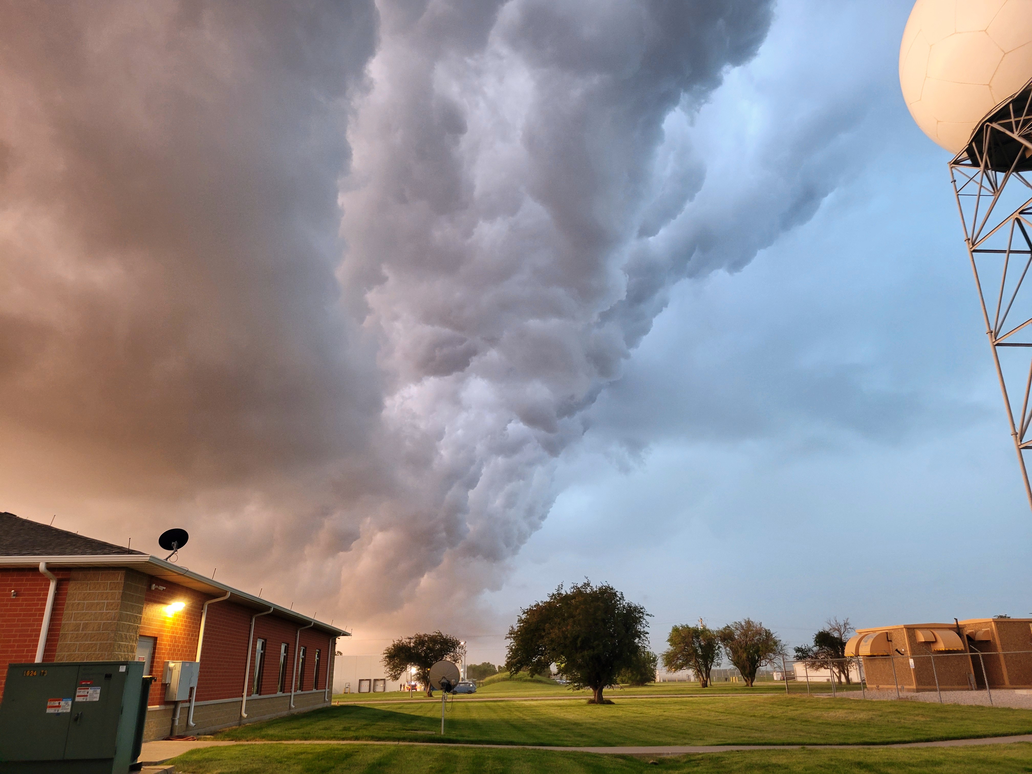 |
|
||
| View from NWS Quad Cities at passage of shelf cloud. Photo: NWS Employee. | Shelf cloud view from near border of Henderson and Knox Counties in Illinois. Photo: NWS Employee. | ||
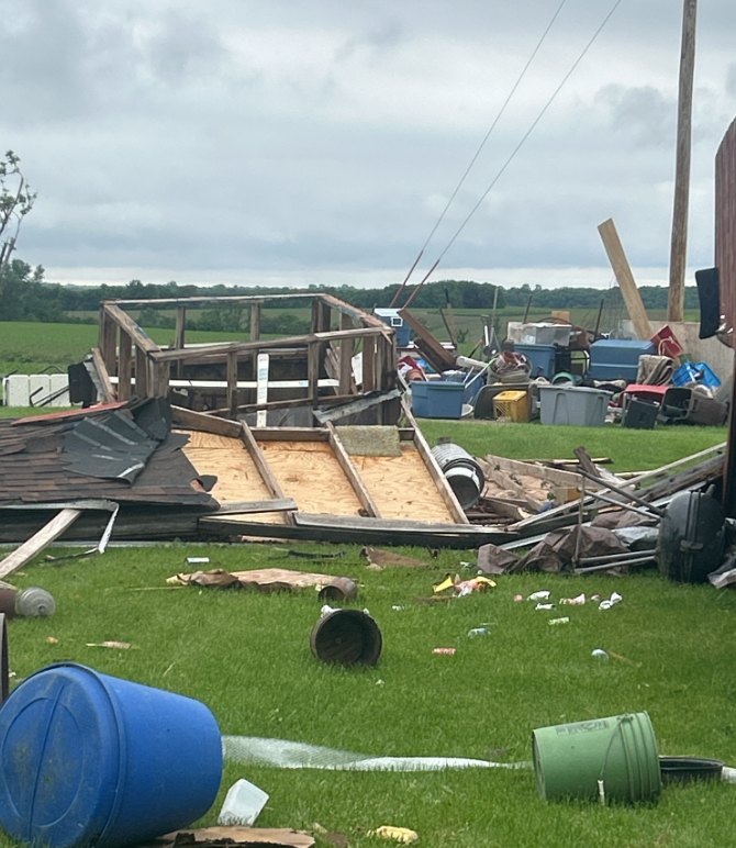 |
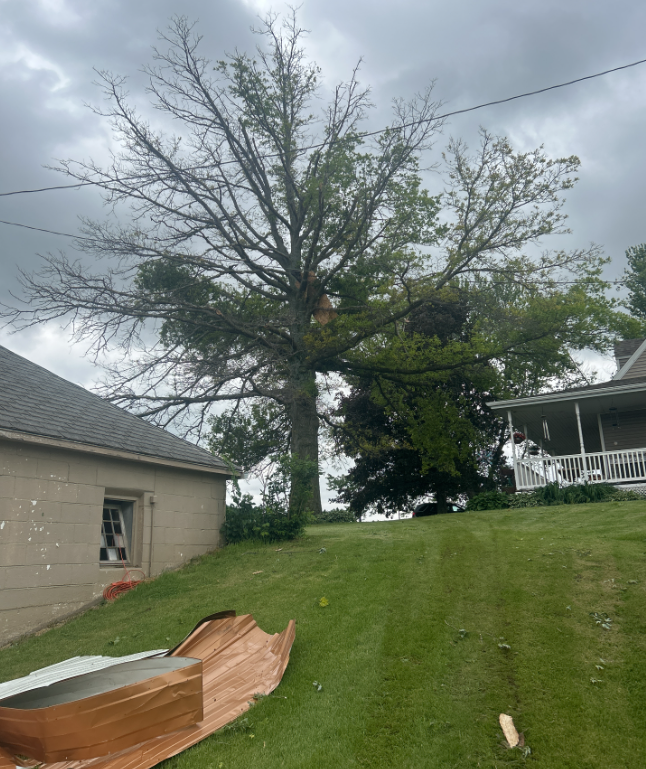 |
 |
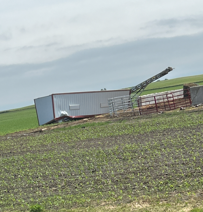 |
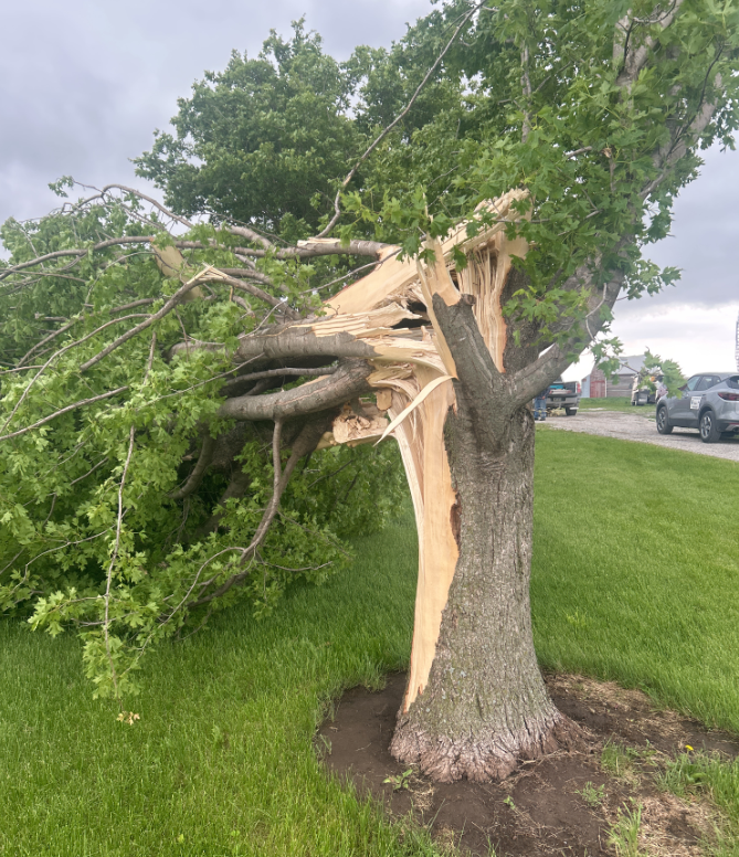
| Delta, IA (NWS Survey) |
Wellman, IA (NWS Survey) |
Riverside, IA (NWS Survey) |
Near Ground Mound, IA (NWS Survey) |
 |
||
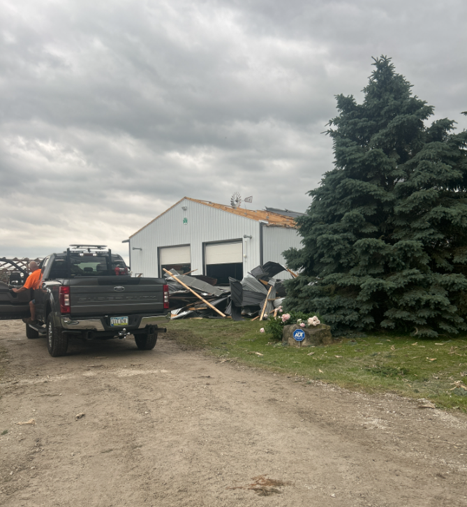
| Coyne Center, IL (NWS Survey) |
Radar
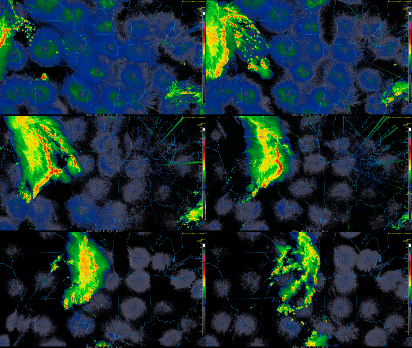 |
| Radar Loop from 1 A.M. through 12 P.M. CDT on May 24 (courtesy of College of DuPage) |
| IEM Radar Loop |
Storm Reports
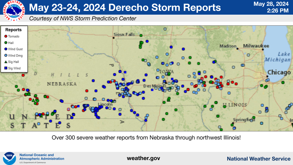 |
| SPC Storm Reports: May 23 (through 7 A.M. CDT May 24) | May 24 (after 7 A.M. CDT) |
| IEM Local Storm Reports |
Rainfall
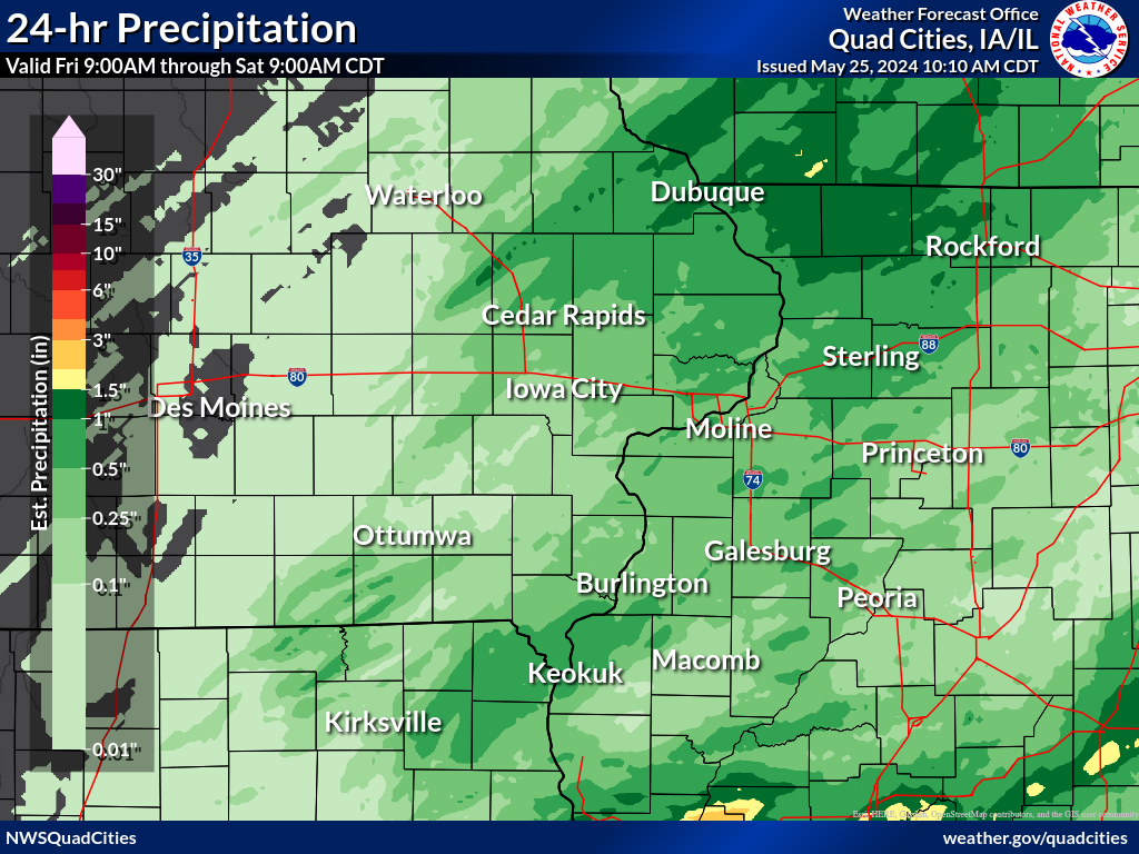 |
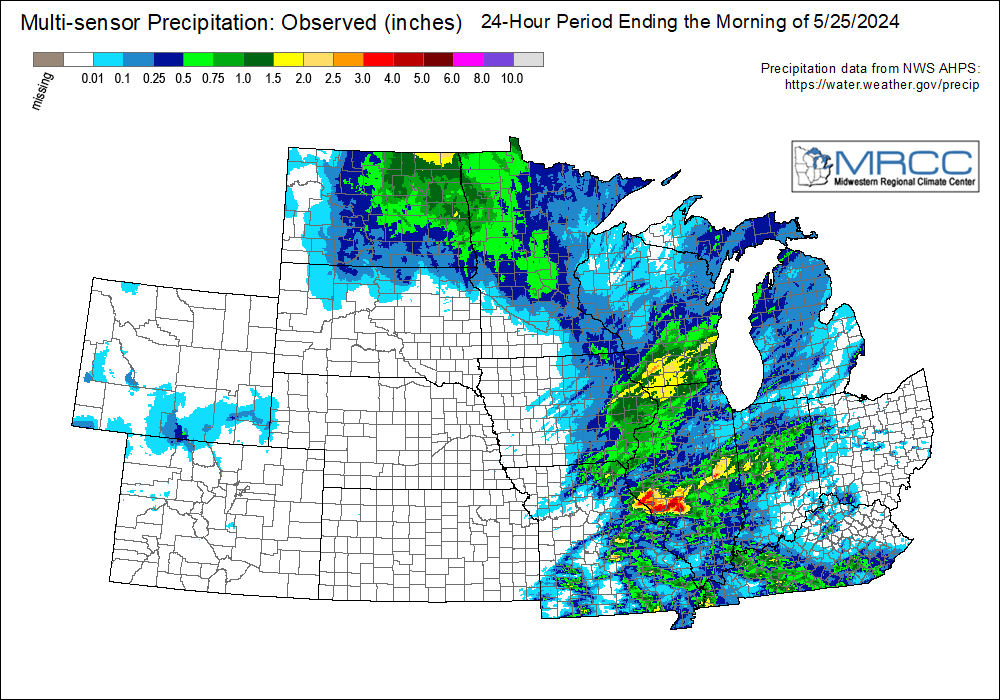 |
| Friday and Friday Night Rainfall Totals | Composite Method of Precipitation Totals Friday and Friday Night |
for eastern Iowa, northwest and west central Illinois,
and northeast Missouri. Reported between Midnight and 9 AM,
Saturday May 25, 2024.

....IOWA....
Bellevue LD12                    1.80
Bellevue 12.2 NW                 1.70
Dubuque Arpt                     1.63
Parnell 0.1 SSW                  1.55
Dubuque #3 7 SW                  1.50
Asbury 0.6 S                     1.40
Dyersville 1.7 ESE               1.38
Solon 0.4 WNW                    1.34
Central City 6.7 W               1.31
Anamosa 3 SSW                    1.30
Calamus 2.0 NE                   1.26
Dubuque 1.0 SE                   1.24
Davenport Arpt                   1.20
Cedar Rapids 2.1 NW              1.18
Dubuque 1.4 WNW                  1.15
Iowa City Arpt                   1.15
Dubuque LD11                     1.14
Yarmouth 1.9 SW                  1.12
Eldridge 0.7 SSW                 1.12
Monticello 1 E                   1.10
De Witt                          1.08
Solon 0.3 ESE                    1.07
Danville 2.9 W                   1.03
Park View 0.2 WSW                1.02
Lowden                           1.01
Wapello 5.4 SE                   1.00
Cedar Rapids Arpt                0.96
Muscatine 3.0 NE                 0.94
Farmington 3.5 W                 0.92
Farmington 2.4 W                 0.91
Muscatine 1.7 N                  0.91
Donnellson                       0.91
Muscatine 2N                     0.91
Farmington 0.3 NW                0.90
Farmington 0.4 NNW               0.89
Wapello 0.2 S                    0.88
Iowa City 2.3 E                  0.87
Fort Madison 0.9 NE              0.85
Davenport 0.9 WNW                0.84
Marion 1.7 NNW                   0.82
Davenport 4.3 NE                 0.75
New London 1.5 SW                0.73
Davenport 2.1 N                  0.70
Salem 1S                         0.70
Fort Madison 4.5 NNW             0.65
Burlington 6.5 SSW               0.64
Camanche 1.2 W                   0.62
Marion 0.9 NE                    0.62
Strawberry Point                 0.61
Anamosa 0.6 ESE                  0.59
Burlington Arpt                  0.58
Mount Auburn 2.2 NNW             0.56
Dundee 1.4 NNE                   0.55
Guttenberg Dam 10                0.47
Iowa City 2.7 E                  0.46
Robins 0.8 SE                    0.42
Belle Plaine                     0.38
Marion 0.4 NNW                   0.36
Rathbun Reservoir 2 N            0.35
Iowa City                        0.33
Centerville 0 NE                 0.32
Washington 5.8 SW                0.26
Oelwein AWOS                     0.23
Washington                       0.23
Tiffin 1.2 NE                    0.22
Pella 4 N                        0.22
Allerton 2 S                     0.22
North Liberty 0.7 SSW            0.20
Oelwein 1E                       0.20
Pella AWOS 2 WSW                 0.19
Waterloo ASOS 5 NW               0.19
Hayesville 0.2 SW                0.18
Ames US 30 2 SSE                 0.18
Ottumwa ASOS 6 NNW               0.17
Mason City 1 NNE                 0.14
Grinnell AWOS 2 SSW              0.13
Fairfield                        0.13
Oskaloosa AWOS 9 ESE             0.10
Williamsburg                     0.10
Hampton 1 N                      0.07
Marshalltown 1 NW                0.06
Marshalltown ASOS 4 N            0.03
Mason City ASOS 6 W              0.03
NWS Johnston* 5 NNW              0.01

....ILLINOIS....
Stockton 4.5 N                   2.21
Stockton 3.4 NNE                 2.12
Stockton 3 NNE                   2.12
Stockton 4.6 NW                  1.85
Lanark 5.3 N                     1.78
Elizabeth                        1.78
Decatur Airport                  1.78
Hanover 0.2 NW                   1.71
Stockton 5.9 WNW                 1.66
East Dubuque 1.7 SE              1.65
Freeport                         1.65
Davis 0.5 N                      1.62
Ogden                            1.60
Lena 0.3 SSE                     1.56
Freeport 2.9 WSW                 1.47
Winslow 4.3 ESE                  1.42
Mount Carroll 6.8 NNW            1.41
Viola 0.4 E                      1.20
Shannon 2.7 E                    1.16
La Harpe                         1.12
New Boston LD17                  1.05
Moline 0.7 NNE                   0.99
Illinois City 6.7 SW             0.97
Stronghurst 0.4 SSW              0.96
Ill. City LD16 3 WNW             0.96
Sterling 5.9 NNE                 0.90
Rock Falls 3.1 S                 0.87
Aledo                            0.87
Quad City Arpt                   0.79
Galva 0.4 NW                     0.78
Fulton LD13                      0.78
Gladstone LD18                   0.75
Colona 0.5 ESE                   0.72
Kewanee 1 E                      0.65
Tuscola                          0.62
Galesburg                        0.60
Geneseo 2.0 NW                   0.59
Windsor                          0.53
Romeoville                       0.50
Joliet Arpt                      0.47
Rockford Arpt                    0.43
Colchester 3.5 NE                0.28
Lincoln NWS                      0.28
Bloomington Airport              0.27
Quincy Arpt                      0.25
Macomb 3.8 NW                    0.24
Peoria Arpt                      0.22
Rochelle Arpt                    0.22
Macomb                           0.20
McNabb 1.4 NW                    0.19
Steward                          0.13
St Anne                          0.00
Ottawa 4 SW                      0.00
Augusta                          0.00
Jacksonville Arpt                0.00

....MISSOURI....
Chillicothe Arpt                 0.40
Kirksville Arpt                  0.33
Columbia Arpt                    0.09

....WISCONSIN....
Madison Arpt                     2.25
Brodhead 1 SW                    1.45
Beloit-College                   1.05
Whitewater                       0.88
Sullivan-NWS 2 SE                0.59
Steuben 4SE 3 NE                 0.49
Prairie du Chien AWOS            0.44
Viroqua                          0.17
La Crosse WFO                    0.15
Watertown-Arpt                   0.02
Science & Environment
Understanding Damaging Wind Thunderstorm Complexes
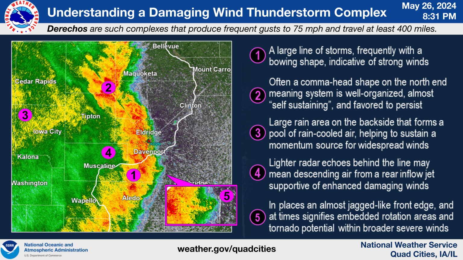 |
Surface Weather Map
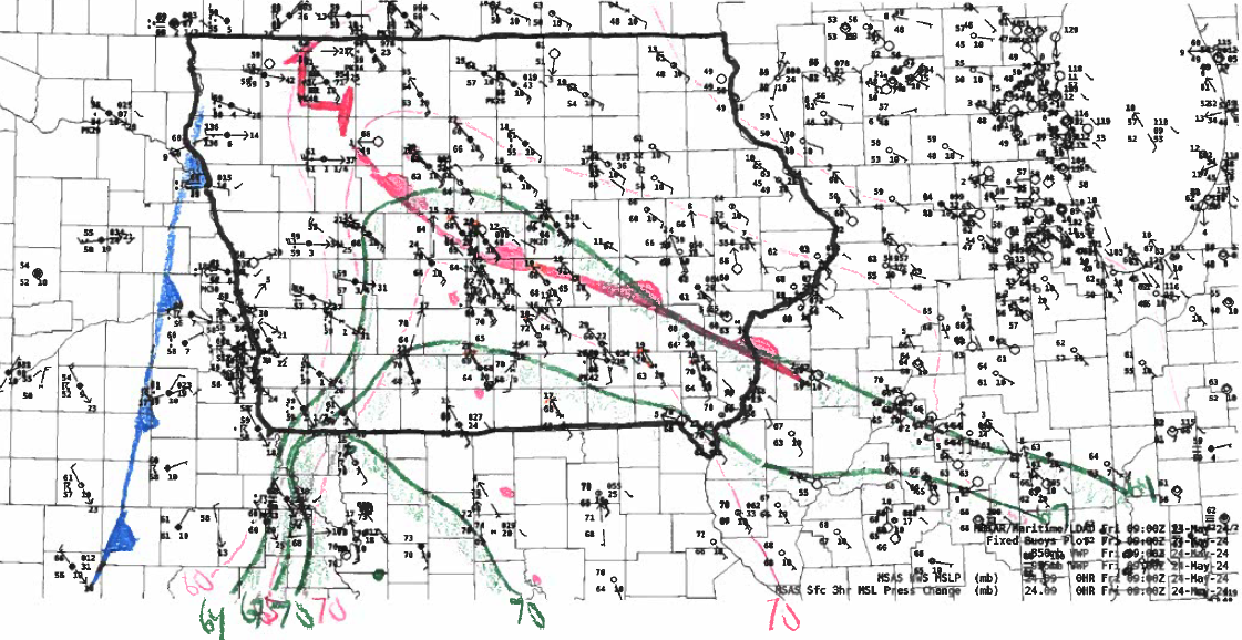 |
| 4 A.M. CDT 5/24/24 Surface Weather Map. Despite the time of day, temperatures and especially dew points were increasing markedly from the south as strong low pressure lifting into the Upper Midwest. Gusty southeast surface winds in response over the NWS Quad Cities CWA resulted in high values of low-level shear and helicity (i.e. strong turning winds with height). Dew points were reaching 70 degrees, which is notably high for a May early morning at this latitude. |
Weather Balloon Soundings
 |
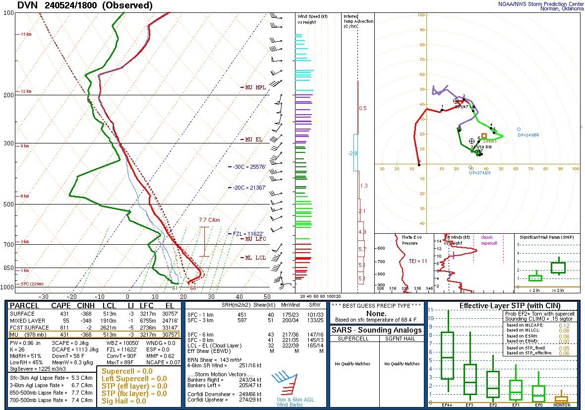 |
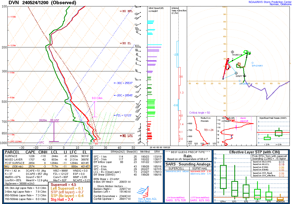
| 7 A.M. CDT (12Z) 5/24/24 DVN Sounding | 1 P.M. CDT (18Z) 5/24/24 DVN Sounding |
KDMX VAD Wind Profiler (VWP)
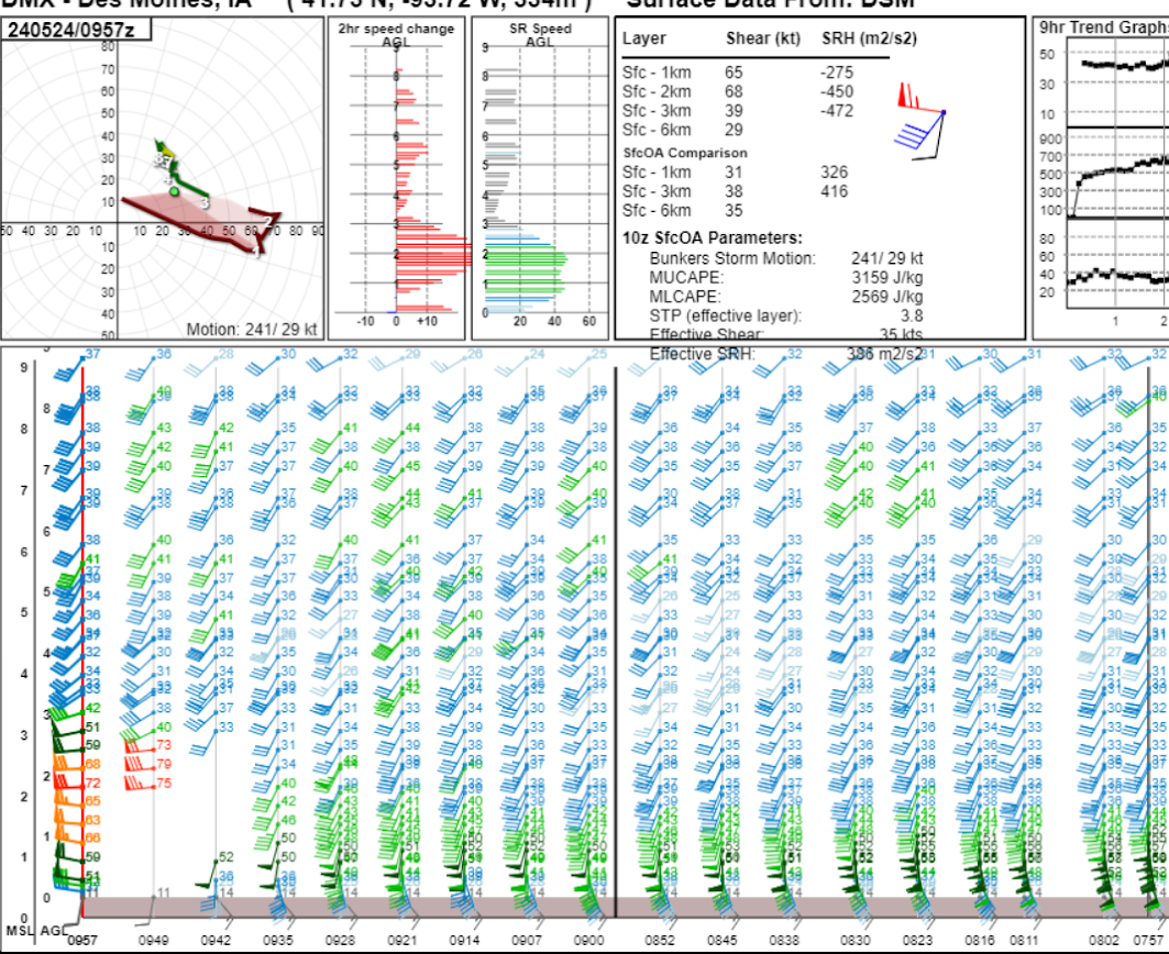 |
| 3 A.M. through 5 A.M. CDT (from right to left) 5/24/24 KDMX Radar VAD Wind Profile (VWP). This was immediately upstream of the NWS Quad Cities CWA, and represents the environment immediately ahead of the derecho (extreme values of low-level helicity) as well as the rear-inflow jet of 70-80 kt (80-95 mph) supporting it in the last two samples. |
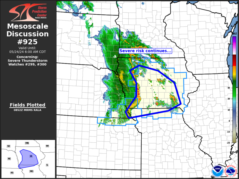
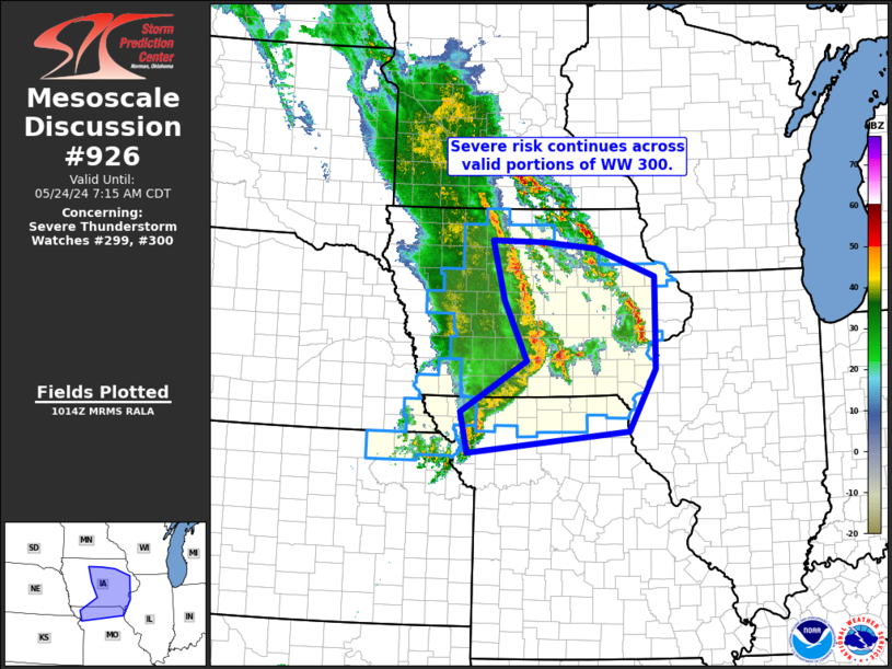
NWS Storm Prediction Center (SPC) Mesoscale Discussions
 |
 |
 |
| MD 925 | MD 926 | MD 927 |
Links
 |
Media use of NWS Web News Stories is encouraged! |
 |