Overview
|
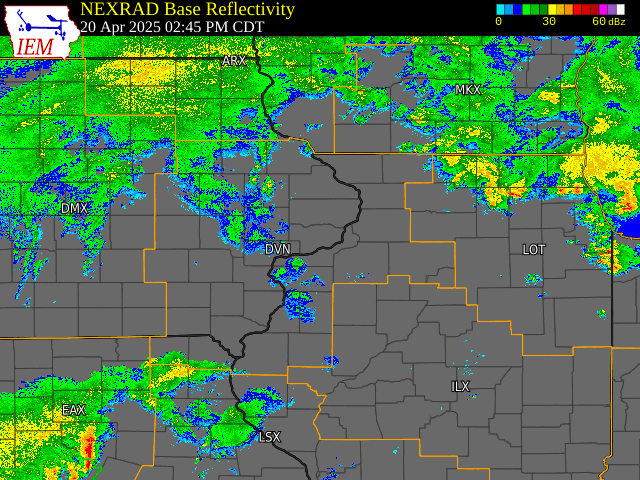
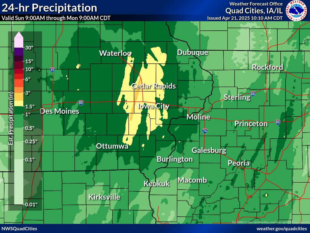
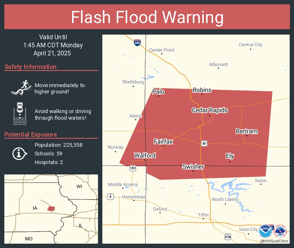
A strong low pressure moved northeast over Iowa during the afternoon and evening April 20th, 2025. This storm system brought a cool widespread rain through the morning, but by afternoon, warm moist air began moving into southeast Iowa, creating a slow moving line of thunderstorms with very heavy rain. Rainfall of 1 to 3 inches was reported over portions of eastern Iowa, especially near Cedar Rapids metro areas, where there were reports of urban flash flooding during the evening hours. Severe storms developed along the line as it moved from northeast Missouri, across southeast Iowa, into Illinois. From 730 PM to 10 PM numerous tornado warnings were issued along the line, especially from the Burlington Iowa area northeast through Geneseo Illinois. Several reports of tornadoes were seen by spotters, and scattered reports of damage to outbuildings and trees were reported as of late evening April 20. |
 |
Tornadoes
Damage Assessment Toolkit - Viewer
This section will be updated over the next few days
as damage assessments are completed.
| Downloadable KMZ File |
| Downloadable KMZ File |
| Downloadable KMZ File |
| Downloadable KMZ File |
| Downloadable KMZ File |
| Downloadable KMZ File |
| Downloadable KMZ File |
| Downloadable KMZ File |
| Downloadable KMZ File |
| Downloadable KMZ File |
The Enhanced Fujita (EF) Scale classifies tornadoes into the following categories:
| EF0 Weak 65-85 mph |
EF1 Moderate 86-110 mph |
EF2 Significant 111-135 mph |
EF3 Severe 136-165 mph |
EF4 Extreme 166-200 mph |
EF5 Catastrophic 200+ mph |
 |
|||||
Photos & Video
This section will be updated over the next few days
as photos and videos are made available for use.
| Caption (source) |
Caption (source) |
Caption (source) |
Caption (source) |
Storm Reports
| SPC Storm Reports - 4/20/2025 |
 |
Preliminary Local Storm Report...Summary
National Weather Service Quad Cities IA IL
1012 PM CDT Sun Apr 20 2025

..TIME...   ...EVENT...      ...CITY LOCATION...     ...LAT.LON...
..DATE...   ....MAG....      ..COUNTY LOCATION..ST.. ...SOURCE....
            ..REMARKS..

0847 PM     Rain             3 ENE Charlie Heath Mem 40.59N 91.84W
04/20/2025  M2.10 Inch       Clark              MO   Trained Spotter

            Rainfall total.

0802 PM     Tornado          Greenbush               40.72N 90.53W
04/20/2025                   Warren             IL   Law Enforcement

            Sheriff deputies reporting visual sighting
            of a tornado near Greenbush, IL.

0736 PM     Tstm Wnd Dmg     4 E Fandon              40.38N 90.70W
04/20/2025                   McDonough          IL   Public

            70 MPH measured wind gust and small branches
            1 inch in diameter broken. Time estimated by
            radar.

0746 PM     Tstm Wnd Dmg     1 N Macomb              40.47N 90.68W
04/20/2025                   McDonough          IL   Trained Spotter

            Large tree blown down over roof of house
            with siding damage.

0750 PM     Tstm Wnd Dmg     3 SE Macomb             40.44N 90.65W
04/20/2025                   McDonough          IL   Trained Spotter

            Several shingles lost from roof of house.
            Time estimated by radar.

0836 PM     Tstm Wnd Dmg     2 N New Windsor         41.24N 90.44W
04/20/2025                   Henry              IL   Trained Spotter

            Spotter has an anemometer reading of 65 MPH
            with a 4 inch tree limb down.

0850 PM     Tstm Wnd Dmg     Galva                   41.16N 90.03W
04/20/2025                   Henry              IL   Emergency Mngr

            Pine tree top blown off. Time estimated from
            radar data.

0910 PM     Tornado          2 ESE Osborn            41.50N 90.23W
04/20/2025                   Henry              IL   Trained Spotter

            Tornado sighted crossing Wolf Road. Trees
            snapped and over the road, power lines down.

0713 PM     Tstm Wnd Dmg     1 N Bowen               40.24N 91.06W
04/20/2025                   Hancock            IL   Public

            Relayed by 911. Damage to a roof. Time of
            the event estimated using radar.

0912 PM     Tstm Wnd Dmg     3 SSE Milo              41.16N 89.56W
04/20/2025                   Bureau             IL   Trained Spotter

            6 inch diameter tree branches down. Time
            estimated from radar data.

0845 PM     Rain             Cantril                 40.64N 92.07W
04/20/2025  M1.89 Inch       Van Buren          IA   Trained Spotter


0701 PM     Rain             2 NNW Marion            42.06N 91.61W
04/20/2025  M1.76 Inch       Linn               IA   Trained Spotter

            Updates previous rain report of 1.00 inches
            from 2 NNW Marion.

0710 PM     Rain             1 ENE Fairfax           41.93N 91.76W
04/20/2025  M1.00 Inch       Linn               IA   Trained Spotter

            still raining.

0800 PM     Rain             3 W Cedar Rapids        41.97N 91.73W
04/20/2025  M2.40 Inch       Linn               IA   Trained Spotter


0907 PM     Rain             1 NE Marion             42.04N 91.58W
04/20/2025  M2.32 Inch       Linn               IA   Trained Spotter

            Total rainfall since 9 AM this morning.

0812 PM     Rain             1 WSW Mt Hamill         40.74N 91.64W
04/20/2025  M1.55 Inch       Lee                IA   Trained Spotter

            Storm total rainfall.

0712 PM     Tstm Wnd Dmg     1 SSW Beaverdale        40.83N 91.23W
04/20/2025                   Des Moines         IA   Emergency Mngr

            5 power poles snapped.

0714 PM     Tstm Wnd Dmg     1 SSE Beaverdale        40.83N 91.21W
04/20/2025                   Des Moines         IA   Emergency Mngr

            Corrects previous tornado report from 1 SSE
            Beaverdale. DOT metal building/shed
            collapsed.

0714 PM     Tstm Wnd Dmg     1 SSE Beaverdale        40.84N 91.21W
04/20/2025                   Des Moines         IA   Emergency Mngr

            Tree reported blown down.

0714 PM     Tstm Wnd Gst     1 SE Beaverdale         40.84N 91.21W
04/20/2025  M60 MPH          Des Moines         IA   Trained Spotter

            Estimated wind speeds of 55 to 60 MPH.

0717 PM     Tstm Wnd Gst     Burlington Regional Air 40.79N 91.13W
04/20/2025  M61 MPH          Des Moines         IA   Public

            Measured a 53 knot gust. Also occurred at
            714 PM CDT.

0936 PM     Rain             Lowden                  41.86N 90.92W
04/20/2025  M1.05 Inch       Cedar              IA   CO-OP Observer

            Storm total rainfall.

0809 PM     Rain             Shellsburg              42.09N 91.87W
04/20/2025  M1.19 Inch       Benton             IA   Public

            Total rainfall so far.

0916 PM     Rain             Shellsburg              42.09N 91.87W
04/20/2025  M1.50 Inch       Benton             IA   Public

            Storm total rainfall.

0916 PM     Rain             Belle Plaine            41.90N 92.28W
04/20/2025  M1.50 Inch       Benton             IA   Trained Spotter
|
Rain Reports
  |
||||
|
||||
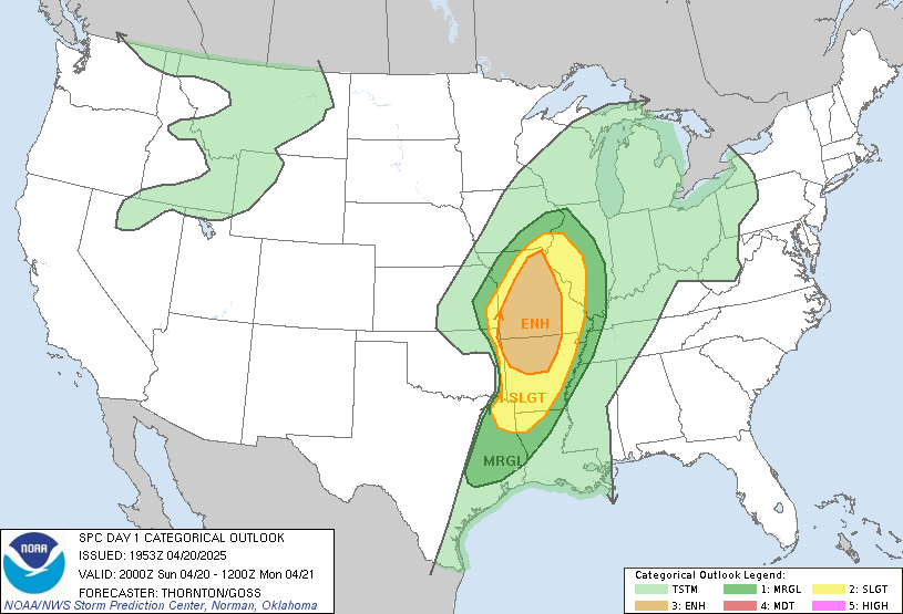
Outlooks and Environment
Storm Prediction Center Outlooks
 |
 |
 |
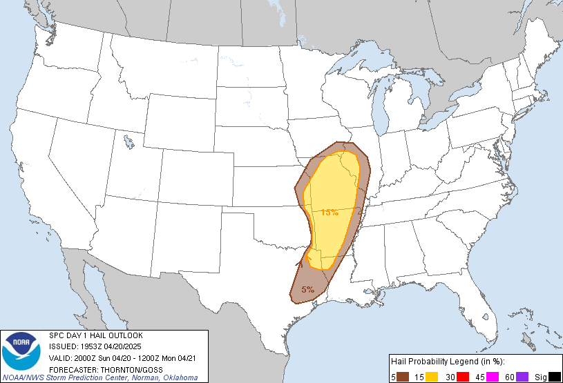 |
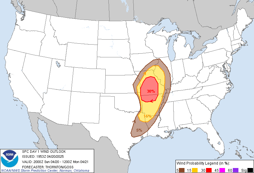
| SPC Day 1 2000z Outlook |
Tornado Risk Probabilities |
Severe Wind Risk Probabilities |
Severe Hail Risk Probabilities |
Watches and Mesoscale Discussions
 |
 |
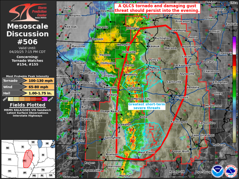 |
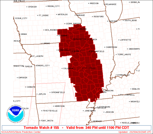
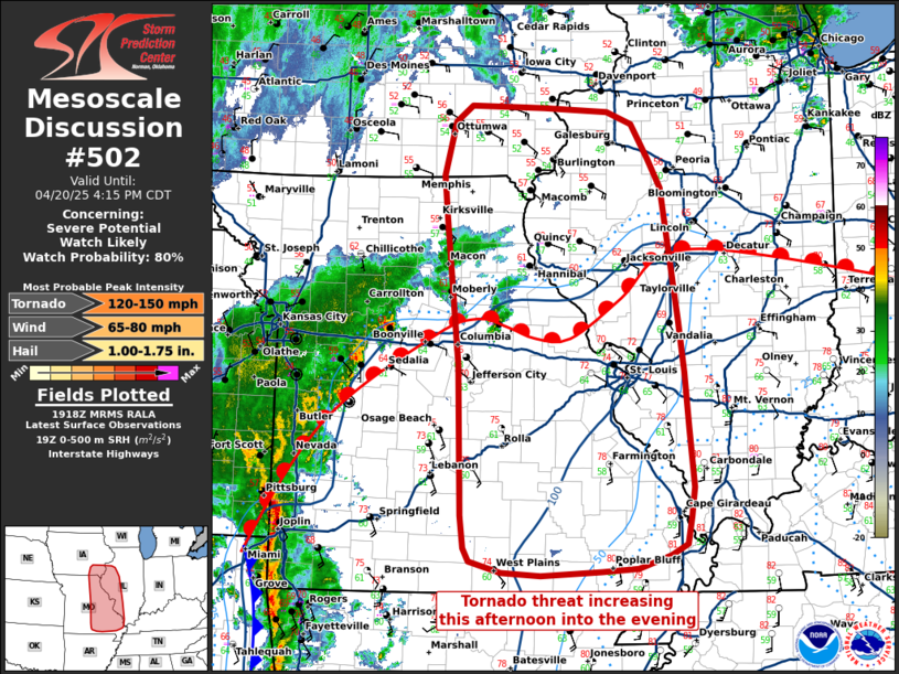
| Tornado Watch #155 | Mesoscale Discussion #502 | Mesoscale Discussion #506 |
Local Soundings at DVN
 |
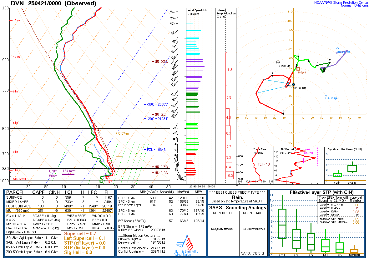 |
| 04/20/2025 - 7:00 am | 04/20/2025 - 7:00 pm |
Synoptic Environment
 |
 |
 |
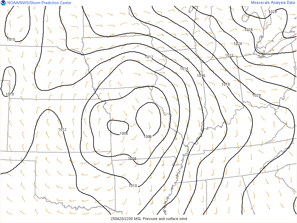 |
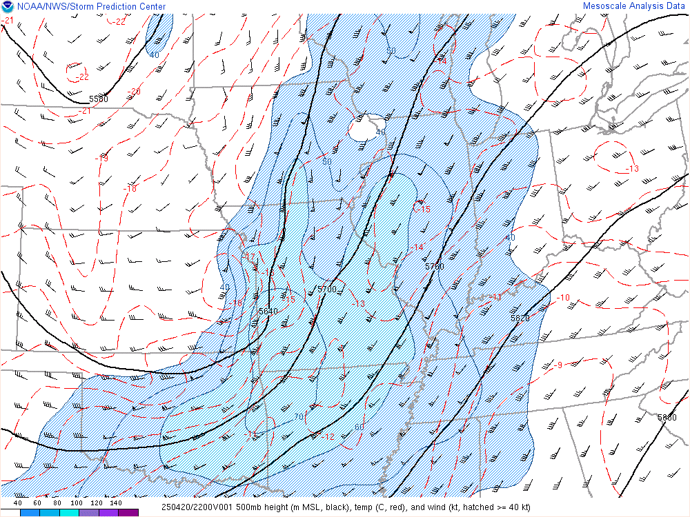
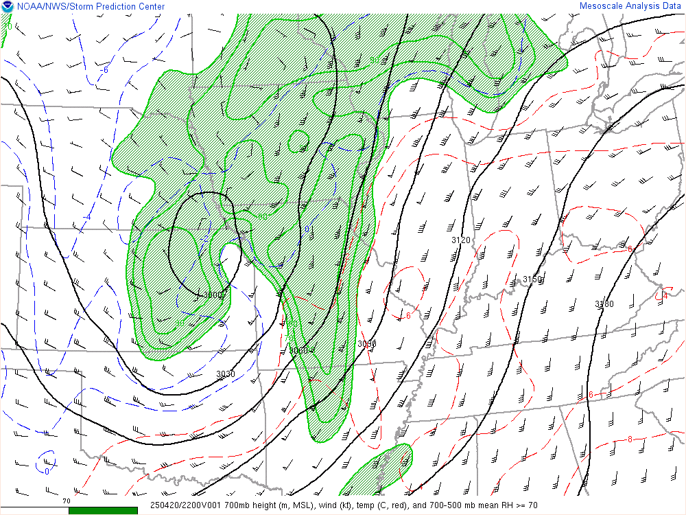
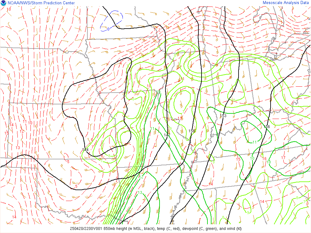
| 500 mb Chart at 5pm | 700 mb Chart at 5pm | 850 mb Chart at 5pm | Surface Chart at 5pm |
Mesoscale Environment
 |
 |
 |
 |
|
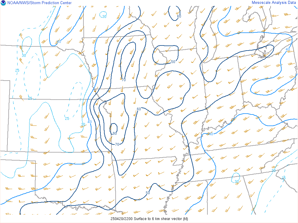
0-6 km Wind Shear Favorable for Organized Convection |
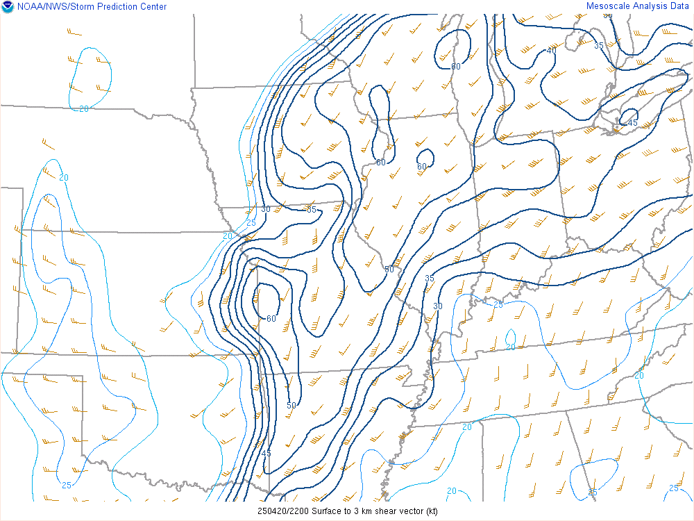
0-3 km Wind Shear Favorable for Mesovortex Development |
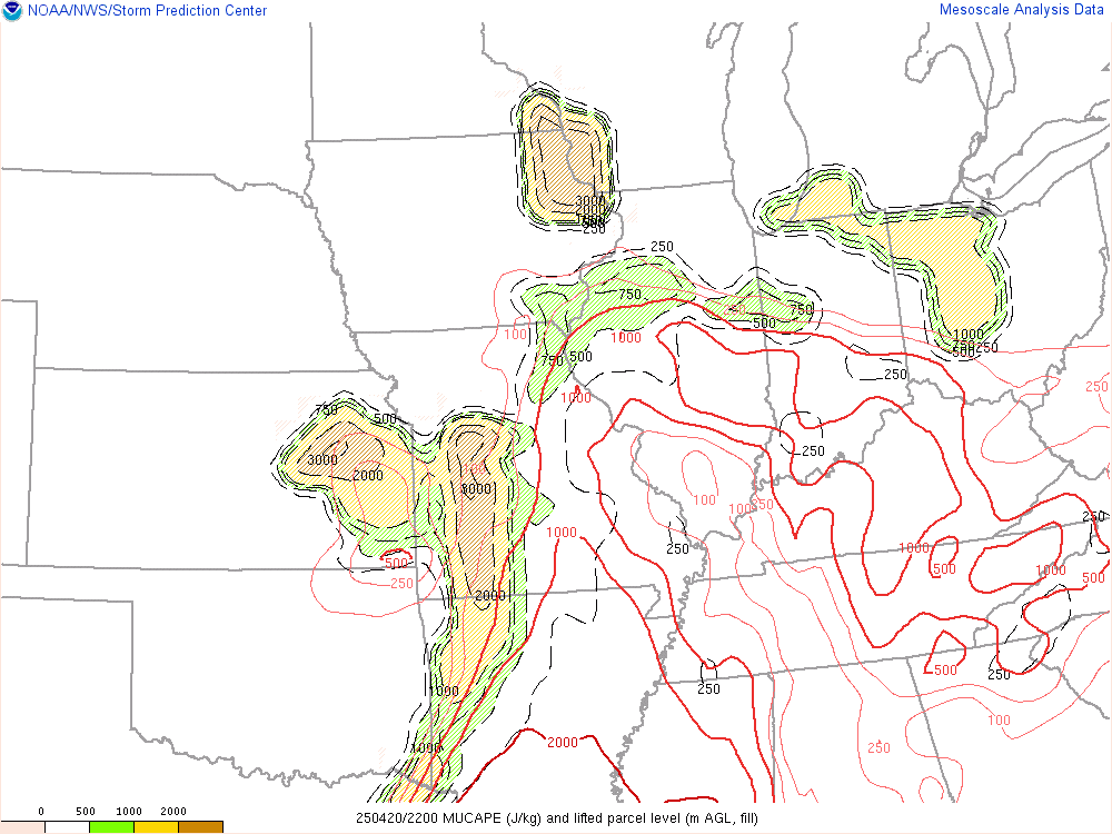
Most Unstable CAPE Instability |
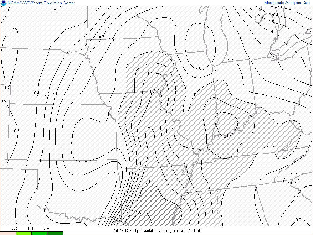
Precipitable Water Favorable for Heavy Rain |
 |
Media use of NWS Web News Stories is encouraged! Please acknowledge the NWS as the source of any news information accessed from this site. |
|