Quad Cities, IA/IL
Weather Forecast Office
|
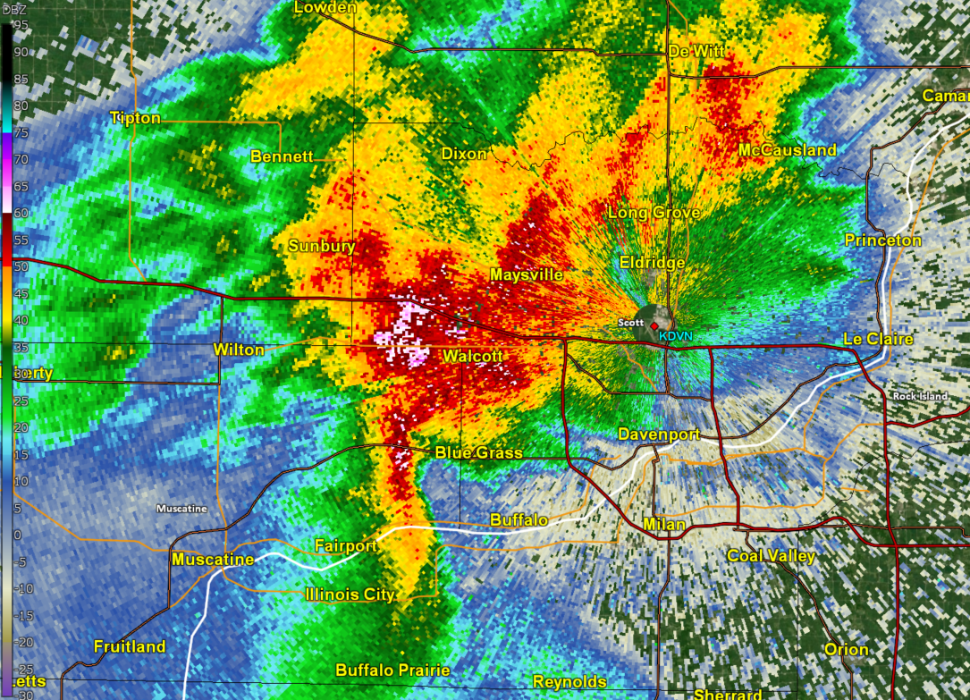
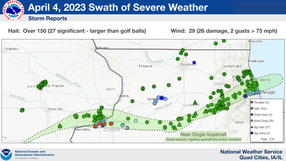
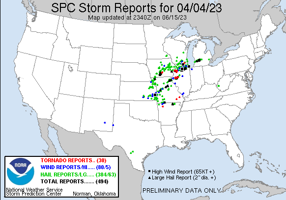
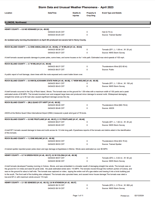
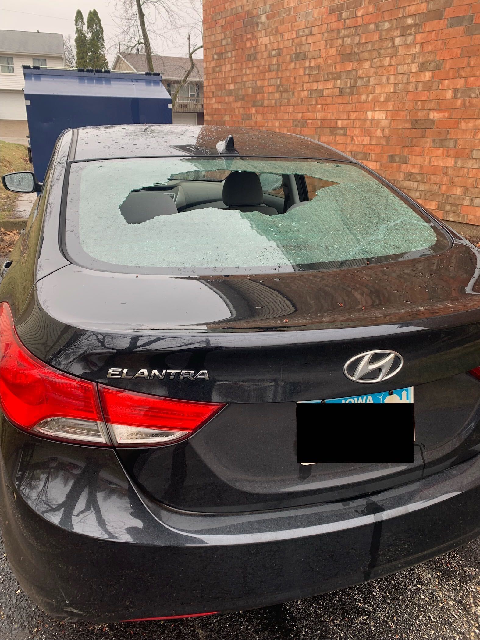
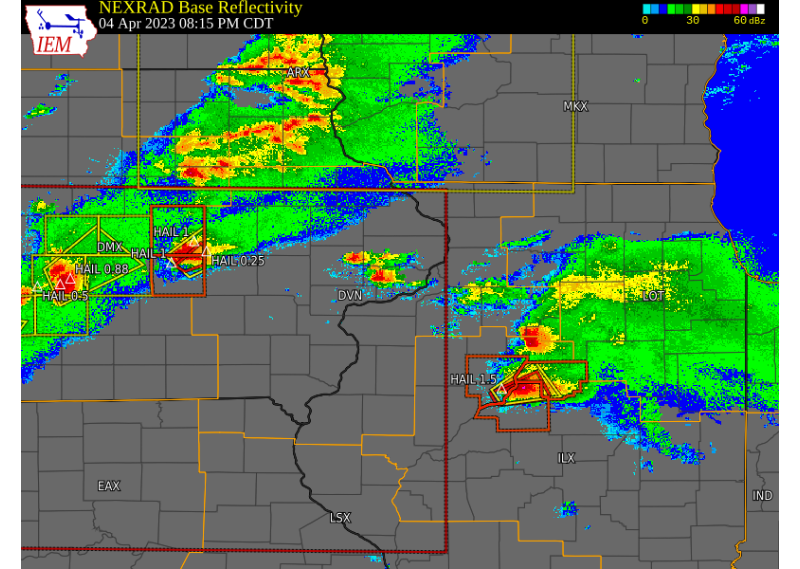
Overview Only days after the widespread tornado outbreak on March 31, 2023, multiple rounds of severe thunderstorms occurred across eastern Iowa, northwest Illinois and far northeast Missouri during Thursday, April 4 into early Friday, April 5, 2023. Round 1 of thunderstorms began during the early morning hours of April 4 as a supercell thunderstorm developed across southeast Iowa. This storm quickly intensified and became severe as it approached and moved over the Quad Cities, producing very large hail from golf ball to tea cup size. The largest hailstones were measured in and around Davenport, where tea cup size hail was measured at the North Park Mall. Despite the apparent elevated nature of the storms and a very stable low level atmosphere, a strong surge of winds was produced south of the hail core over the Illinois side of the Quad Cities metro, with the Quad City Airport ASOS measuring a wind gust near 90 MPH. Extensive damage occurred from Rock Island to Colona IL to buildings, trees and power poles, with some structures seeing ripped-off roofs. An NWS Storm Survey Team determined a few brief tornadoes did occur as well. Round 2 of severe thunderstorms arrived during the late afternoon of April 4, with all modes of severe weather seen. Most notably, am EF1 tornado developed near Industry IL, and tracked northeast through McDonough County into Fulton County. Round 3 of severe thunderstorms arrived during the late overnight hours into the morning of April 5th, as a strong cold front moved across the area. A line of storms became severe as they reached the Mississippi River, producing wind gusts to 60 MPH and large hail, and even one brief tornado. Ping pong ball sized hail was observed near Nora, IL. Surrounding Office Event Summaries |
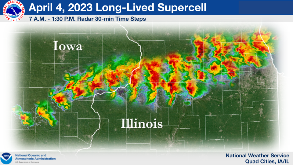
30-min radar snapshots of the initial supercell formation near Ottumwa, IL around 7 A.M. to its passage near Chicago at 1:30 P.M. |
Tornadoes:
|
Tornado #1 - 3 E Andalusia, IL
Track Map 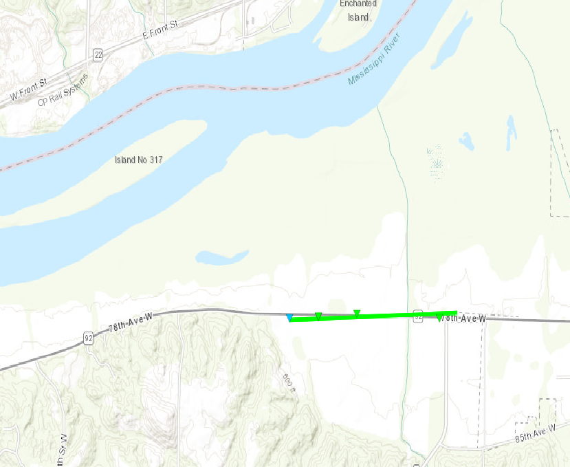 
|
||||||||||||||||
|
Tornado #2 - Rock Island, IL
Track Map 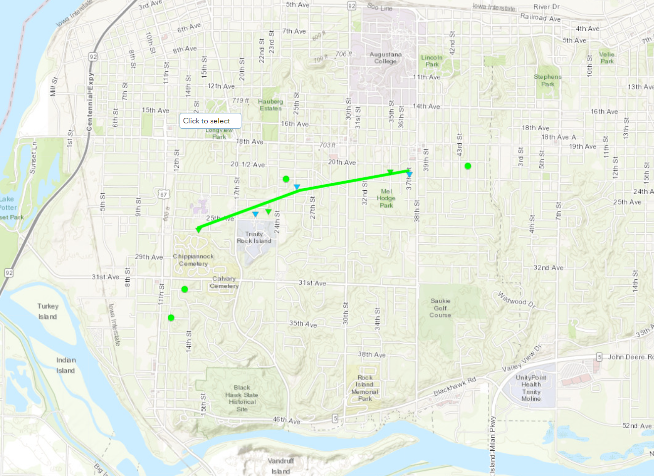 |
||||||||||||||||
|
Tornado #3 - 1 S Moline
Track Map 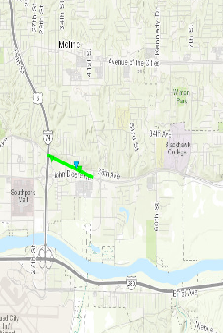
Downloadable KMZ File |
||||||||||||||||
|
Tornado #3 - Colona, IL
Track Map 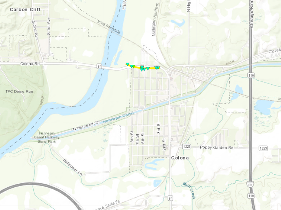
|
||||||||||||||||
|
Tornado #4 - Geneseo, IL
Track Map 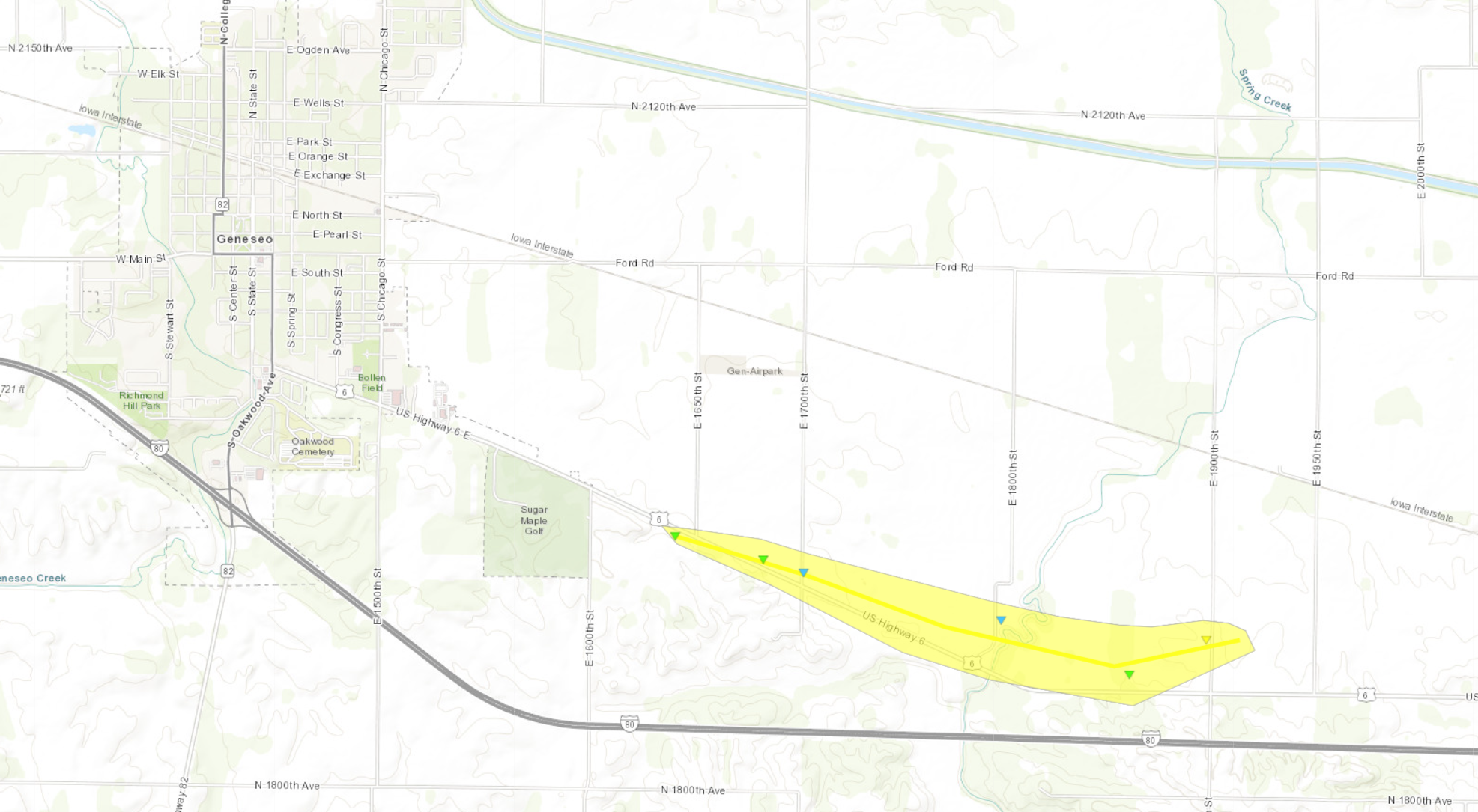
|
||||||||||||||||
|
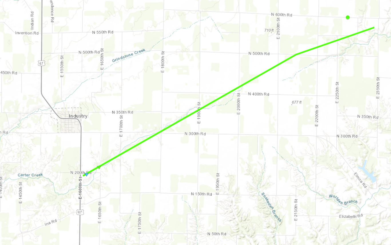
Tornado #5 - Industry, IL
Track Map
|
||||||||||||||||
|
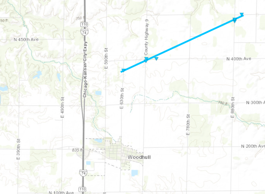
Tornado #6 - Woodhull, IL
Track Map
|
||||||||||||||||
Photos
 |
 |
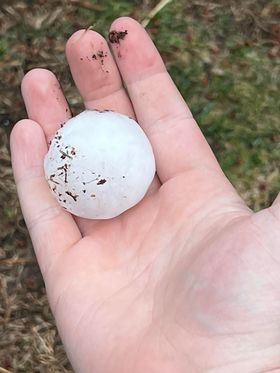 |
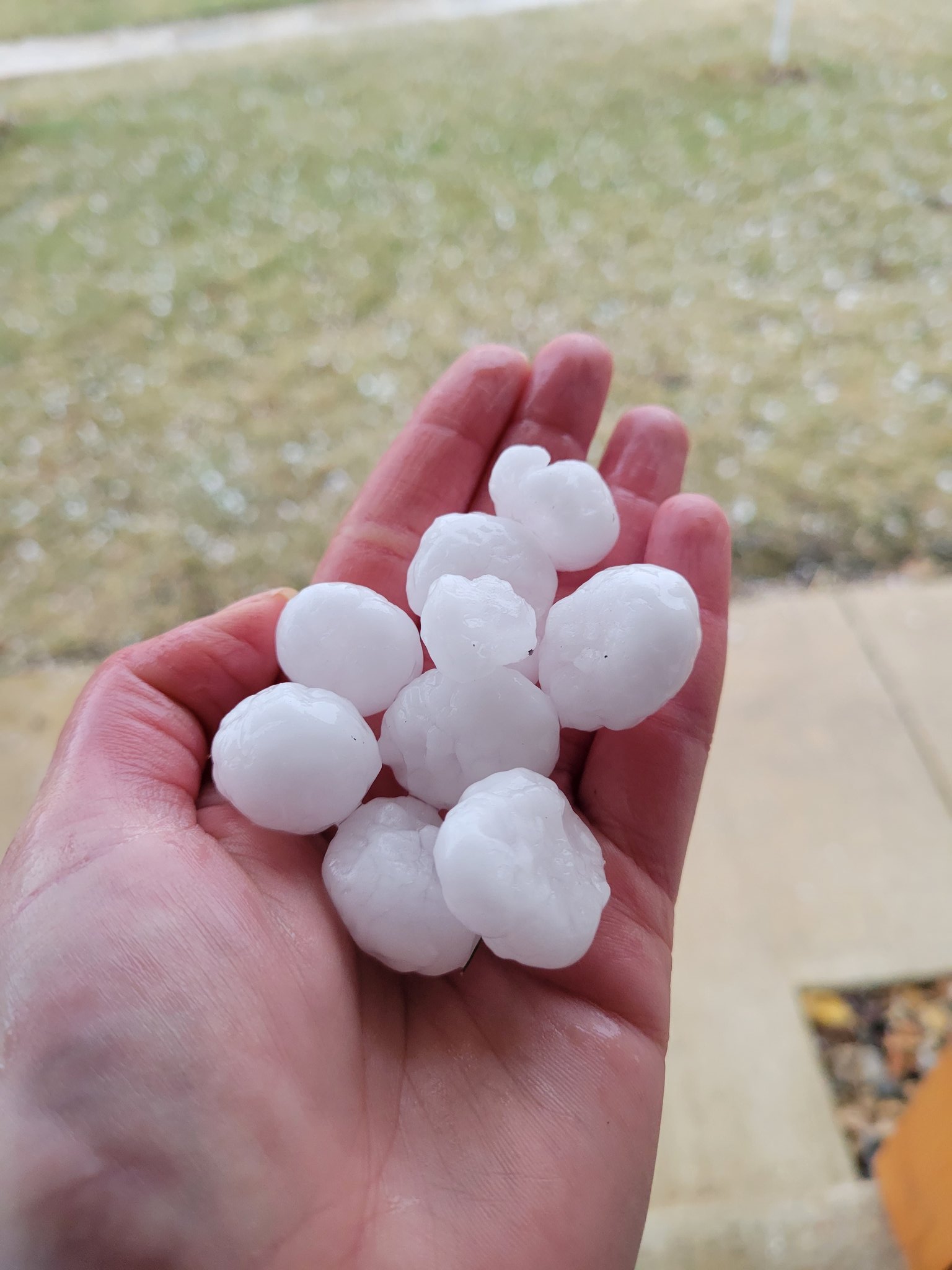
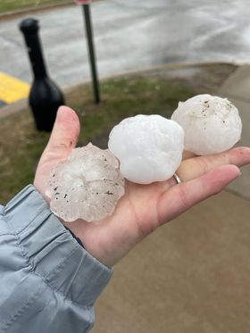
| Marion, IA (Rebecca Kopelman) |
Davenport, IA (Maureen Murray) |
Muscatine, IA (Brenda Papendorf) |
 |
 |
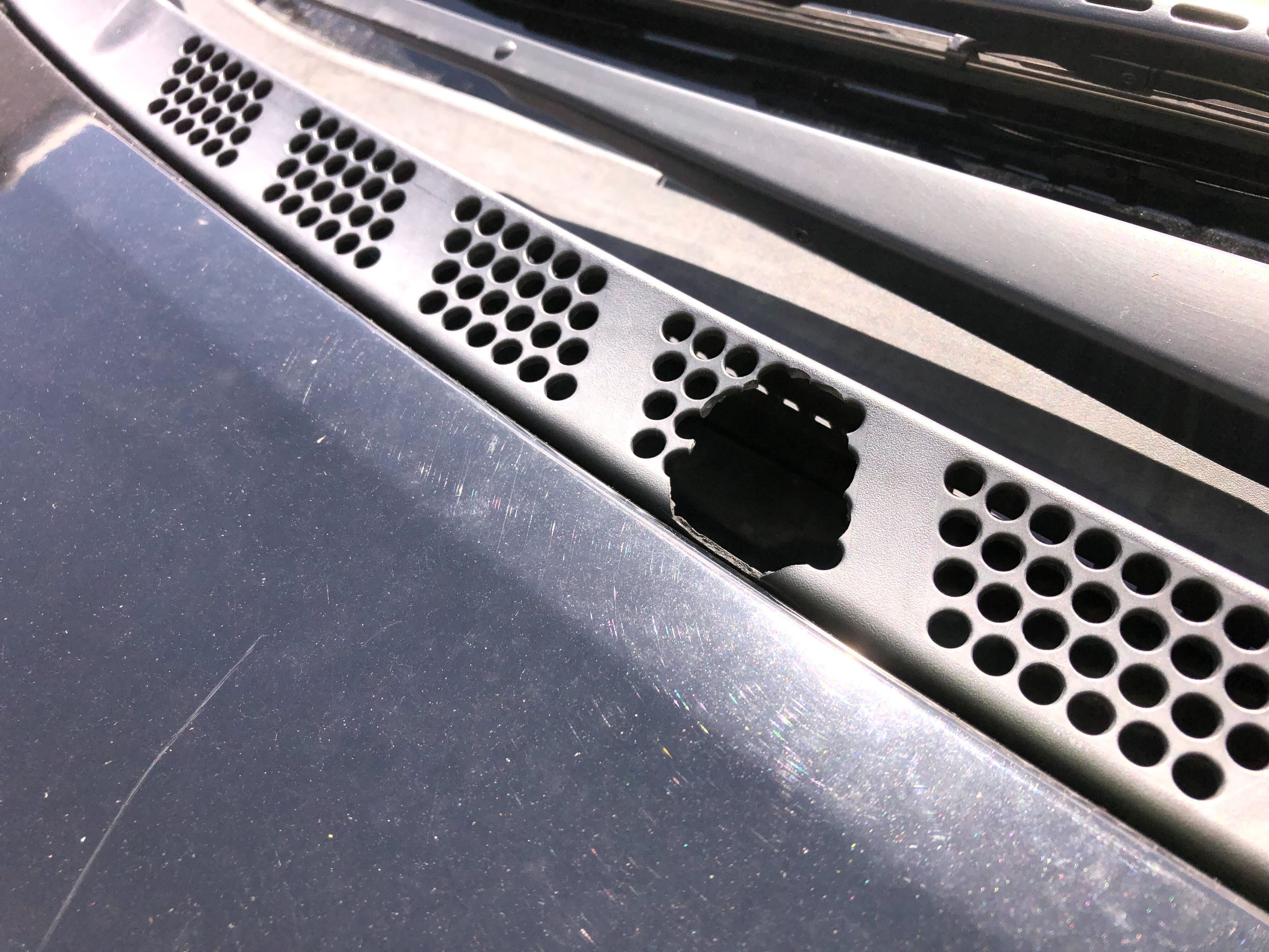 |
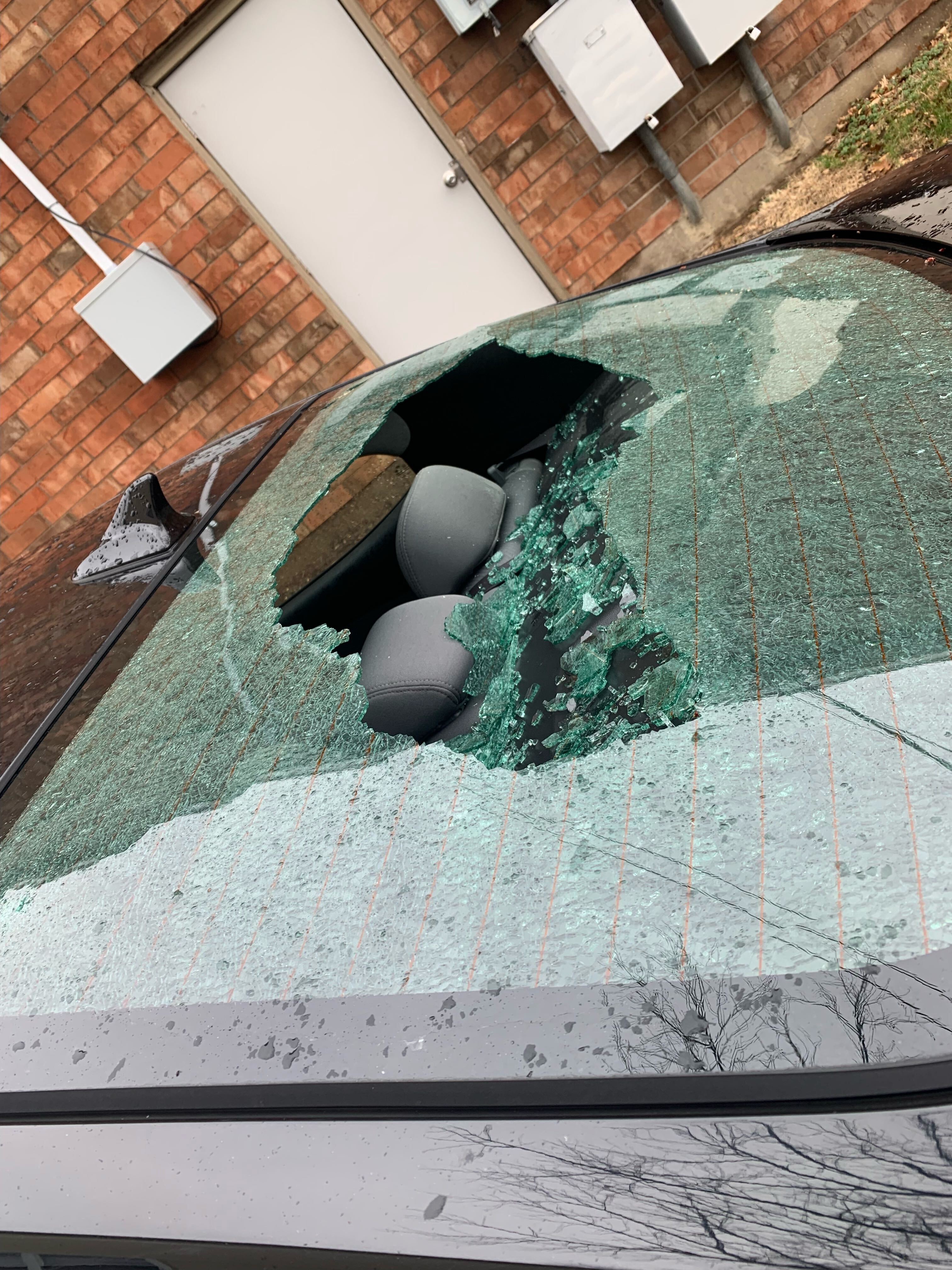
| Hail damage photos to a vehicle a little over one half mile north of the NorthPark Mall in Davenport, IA. (Kyle Bales) | ||
 |
 |
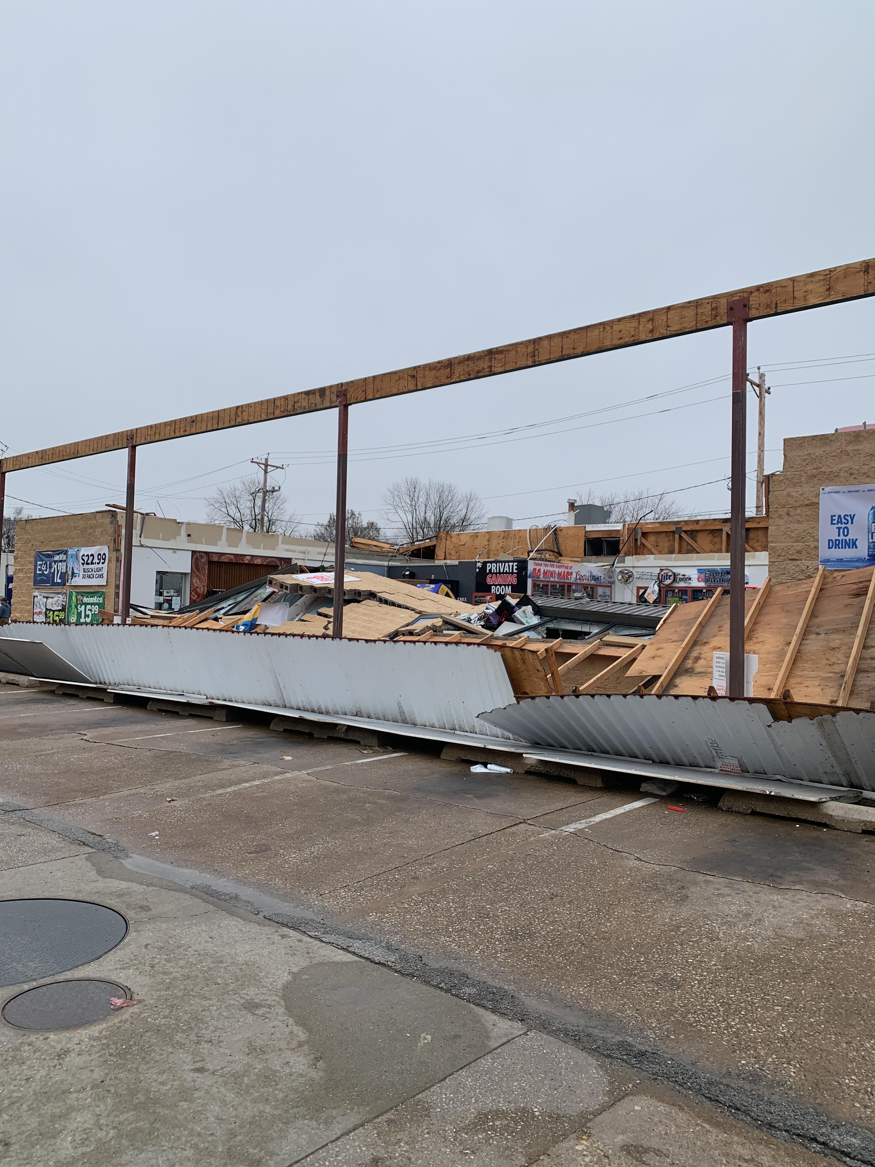 |
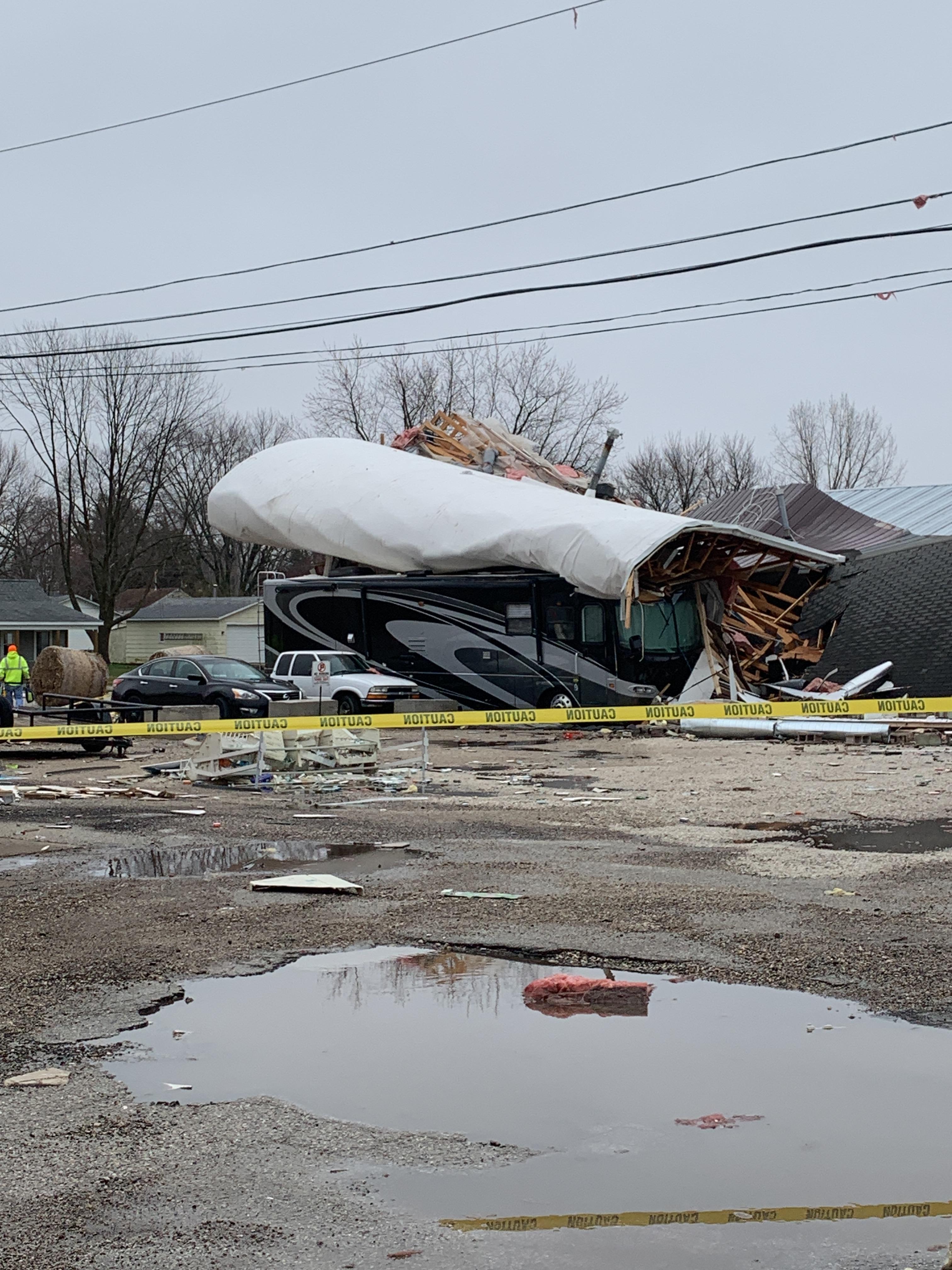
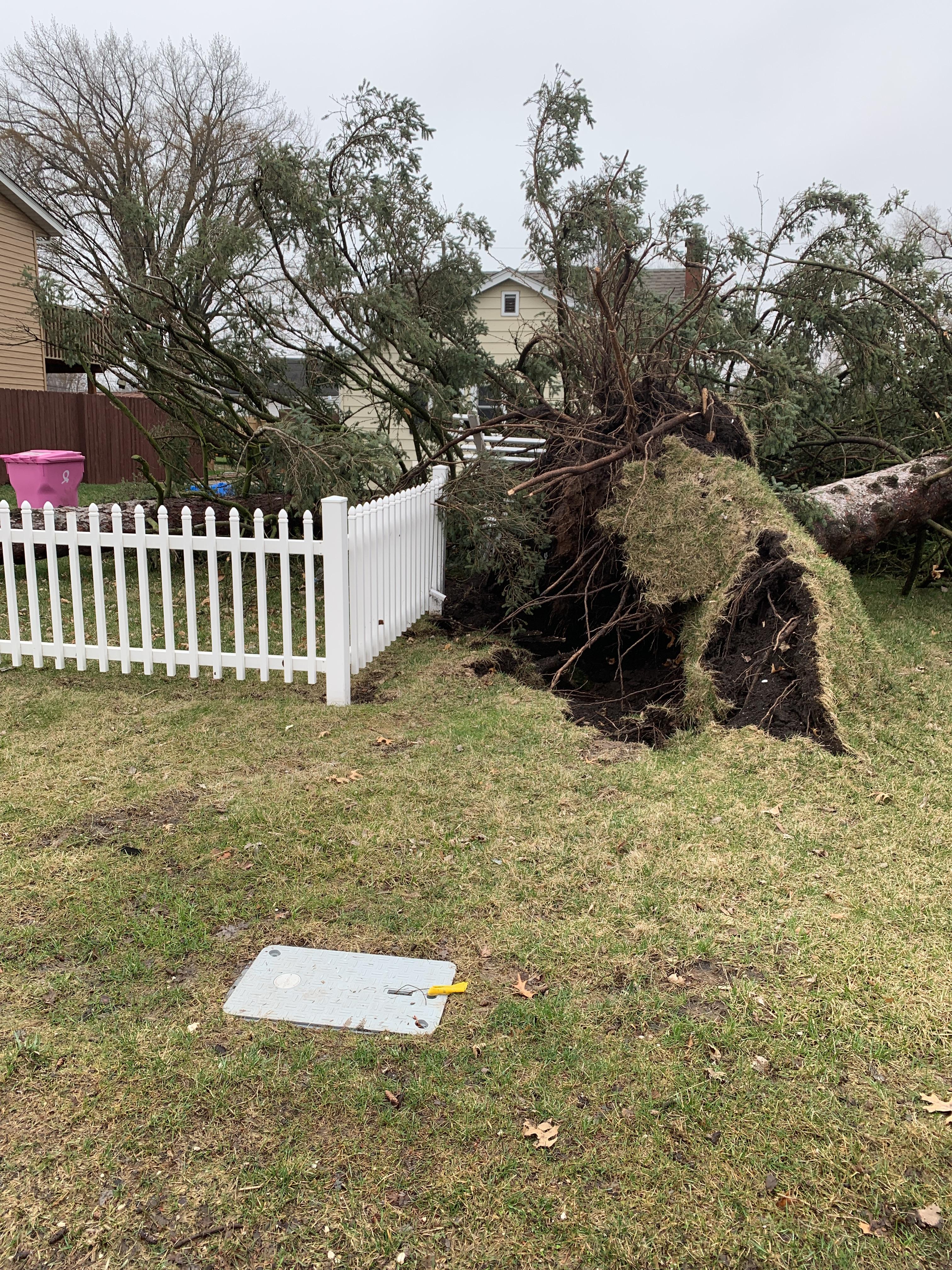
| Colona, IL Tornado Damage (NWS Survey) |
Colona, IL Tornado Damage (NWS Survey) |
Colona, IL Tornado Damage (NWS Survey) |
Radar
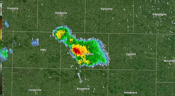 |
| April 4, 2023 7 A.M. - 1:30 P.M. storm-centric radar loop on the long-lived supercell storm from near Ottumwa, IA to Chicago, IL. |
 |
| Interactive Radar Loop - Courtesy IEM |
Environment
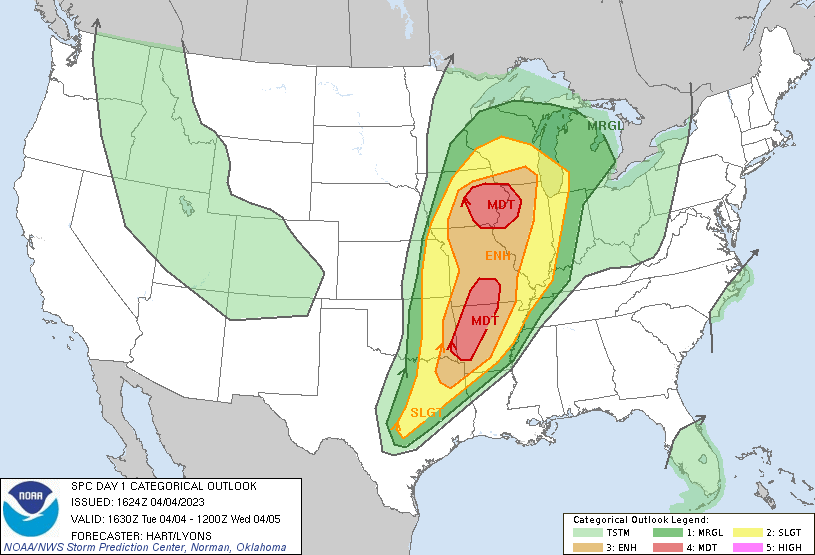
SPC Severe Weather Event Page April 4, 2023
 |
 |
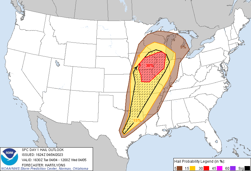 |
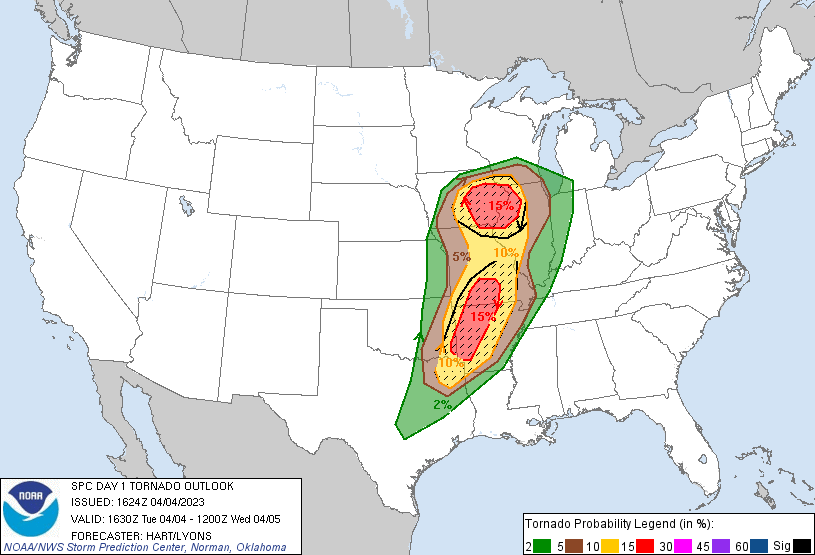
| Figure 1: SPC 1630z Day 1 Outlook | Figure 2: SPC 1630z Day 1 Tornado Probabilities | Figure 3: SPC 1630z Day 1 Hail Probabilities |
 |
 |
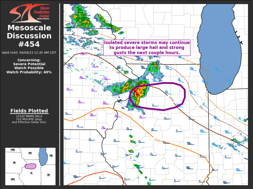 |
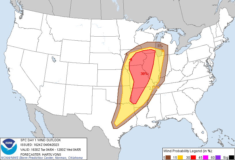
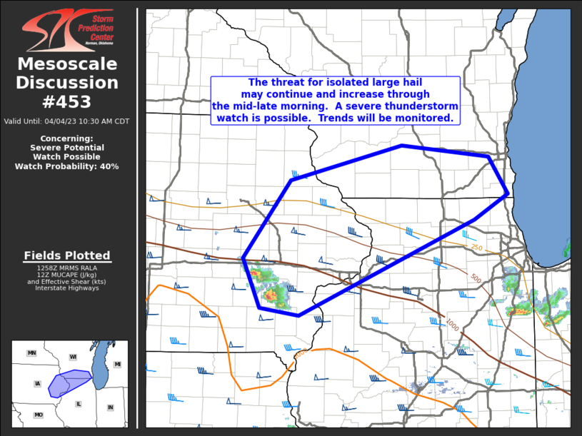
| Figure 2: SPC 1630z Day 1 Wind Probabilities | Figure 5: Mesoscale Discussion #453 | Figure 6: Mesoscale Discussion #454 |
 |
 |
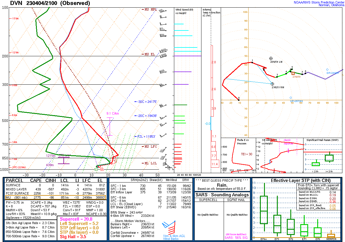 |
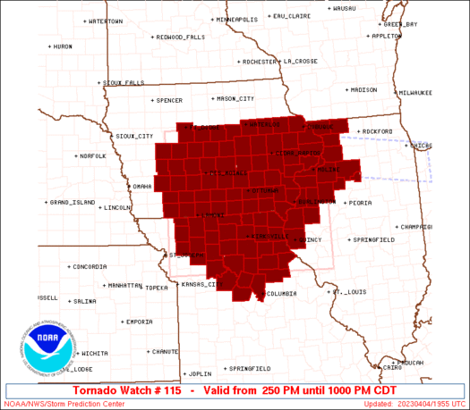
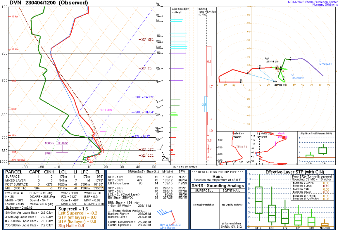
| Figure 7: Tornado Watch #115 Area | Figure 8: 12Z DVN Sounding | Figure 9: 21Z DVN Sounding |
 |
 |
|
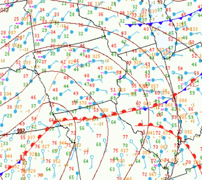
| Figure 9: 15Z Surface Analysis | Figure 10: Series of Surface Weather Maps |
Research & More
NWS Quad Cities Research & Presentations on April 4, 2023:
A Not-So-Elevated Supercell from the Quad Cities-to-Chicago Area on April 4, 2023 - David Cousins, Matthew Friedlein, and Peter Speck. Central Iowa National Weather Association (NWA) Severe Storms and Doppler Radar Conference Oral Presentation - Ankeny, IA, March 2024.
A Not-So-Elevated Supercell from the Quad Cities-to-Chicago Area on April 4, 2023 - Peter Speck, Alexander Gibbs, and David Cousins. National Weather Association (NWA) Showcase Presentation - Kansas City, MO, September 2023.
 |
Media use of NWS Web News Stories is encouraged! NWS Quad Cities Past Events Page: weather.gov/dvn/events |
|
Hazardous Weather
Watches, Warnings, & Advisories
Briefing
Hazards Page
View Local Storm Reports
Submit Report
Road Reports
Text Products
Forecasts
Fire Weather
Briefing
Hourly Forecast Graphs
Forecast Discussion
User-Defined Area
Activity Planner
Local Forecasts
Space Weather
Text Products
River Graphs
Airport Forecasts
Snow and Ice Probabilities
Winter Storm Severity Index (WSSI)
Current Conditions
Observations
Radar
Satellite
Rivers and Lakes
River Graphs
Road Reports
Drought Monitor
Text Products
Sunrise/Sunset Tables
Seasons (Equinoxes/Solstices)
Past Weather
Climate Maps
Climate Normals/Averages
Climate Records
Climate/Almanac Data
Recent Observation History
Climate Graphs
Climate Summaries
Observation Site History
Past Events
Text Products
Sunrise/Sunset Tables
US Dept of Commerce
National Oceanic and Atmospheric Administration
National Weather Service
Quad Cities, IA/IL
9040 N Harrison Street
Davenport Municipal Airport
Davenport, IA 52806-7326
563-386-3976
Comments? Questions? Please Contact Us.
Thank you for visiting a National Oceanic and Atmospheric Administration (NOAA) website. The link you have selected will take you to a non-U.S. Government website for additional information.
NOAA is not responsible for the content of any linked website not operated by NOAA. This link is provided solely for your information and convenience, and does not imply any endorsement by NOAA or the U.S. Department of Commerce of the linked website or any information, products, or services contained therein.
You will be redirected to: