Early on June 5th morning thunderstorms tracked across Iowa and into Illinois, leaving behind extensive cloud cover that was slow to dissipate during the day. Farther west a weak area of low pressure was centered across western Iowa, with a trailing cold front over the Missouri Valley. It was anticipated that breaks in the cloud cover would lead to thunderstorms development along the cold front and near the warm front/low pressure intersection (triple point). By the afternoon thunderstorms had developed, and a strongly sheared atmosphere was leading to updraft rotation, and even a few brief tornadoes in central Iowa. Despite pockets of sunshine and temperatures rising into the lower 80s, the storms along the cold front failed to intensify quickly, with weak rotation and surface wind gusts below 40mph.
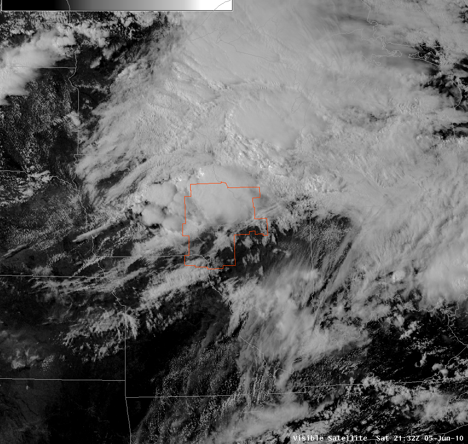
Above: Visible satellite at 430pm showing clearing ahead of the cold front in southeast Iowa and central Illinois
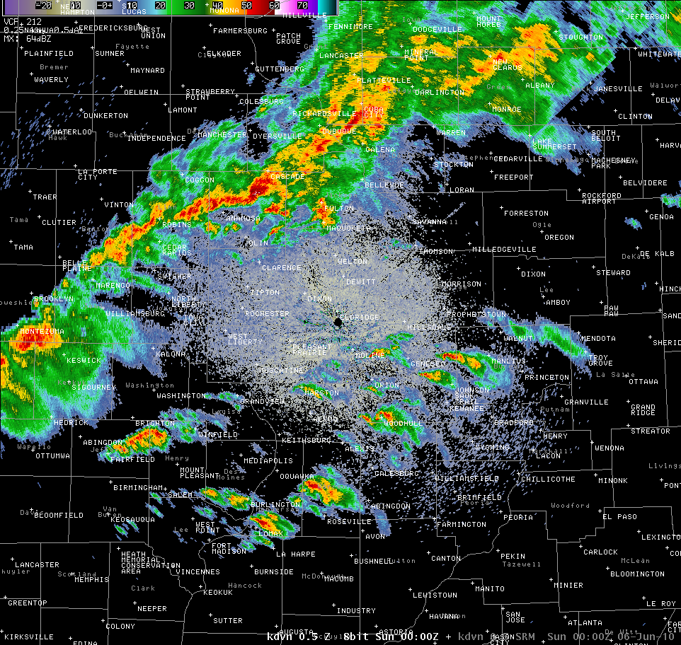
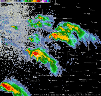
Above: Radar image at 700pm showing initial mini supercell development ahead of the cold front
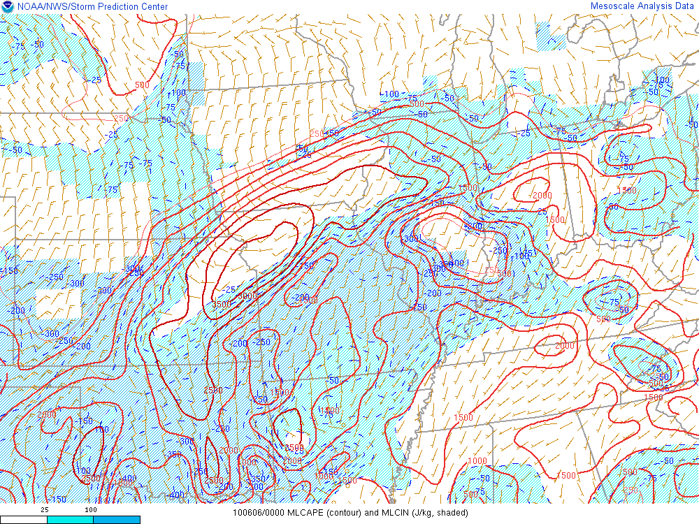
Above: CAPE, a measure of instability, at 7pm showing a moderately unstable atmosphere extending from southeast Iowa into central Illinois
Above: Helicity, an indicator of potential rotation of updrafts, showing high values east of the Mississippi River
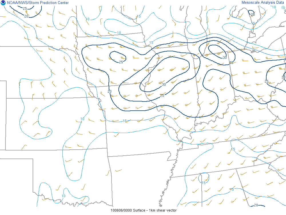
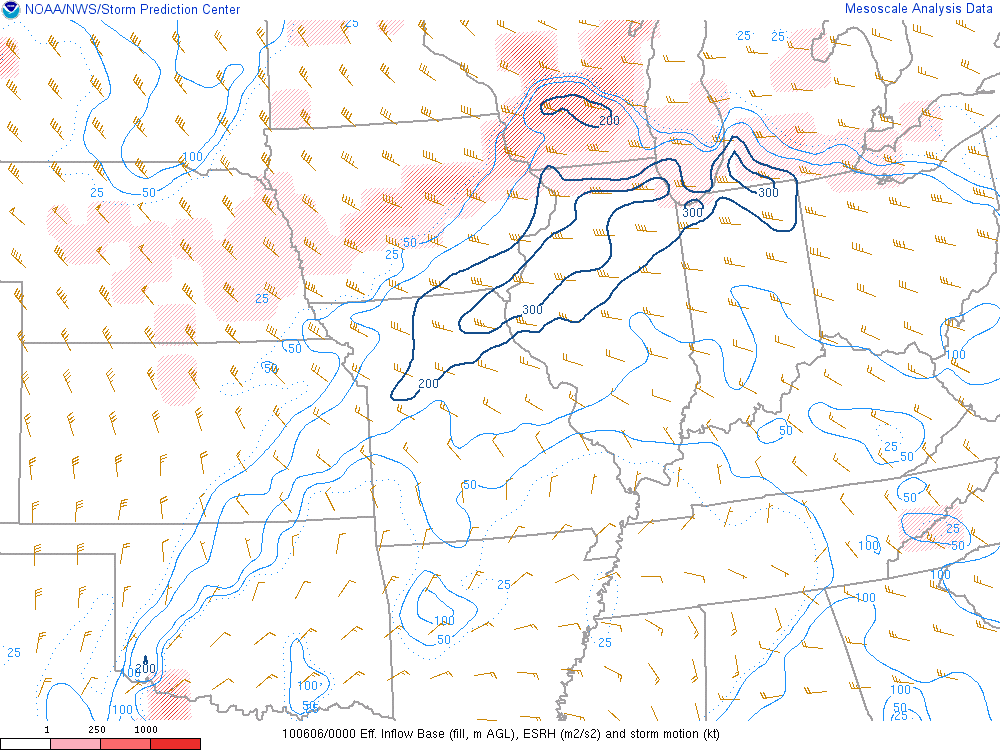
Above: Shear from 0-1km, values greater than 15kts are favorable for strong tornadoes
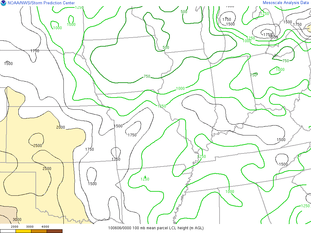
Above: Lifted condensation level, or cloud bases, showing values between 750m and 1000m at 7pm in central Illinois
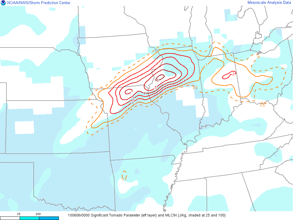
Above: Significant tornado parameter at 7pm, significant (EF2+) tornadoes are associated with values greater than or equal to 1
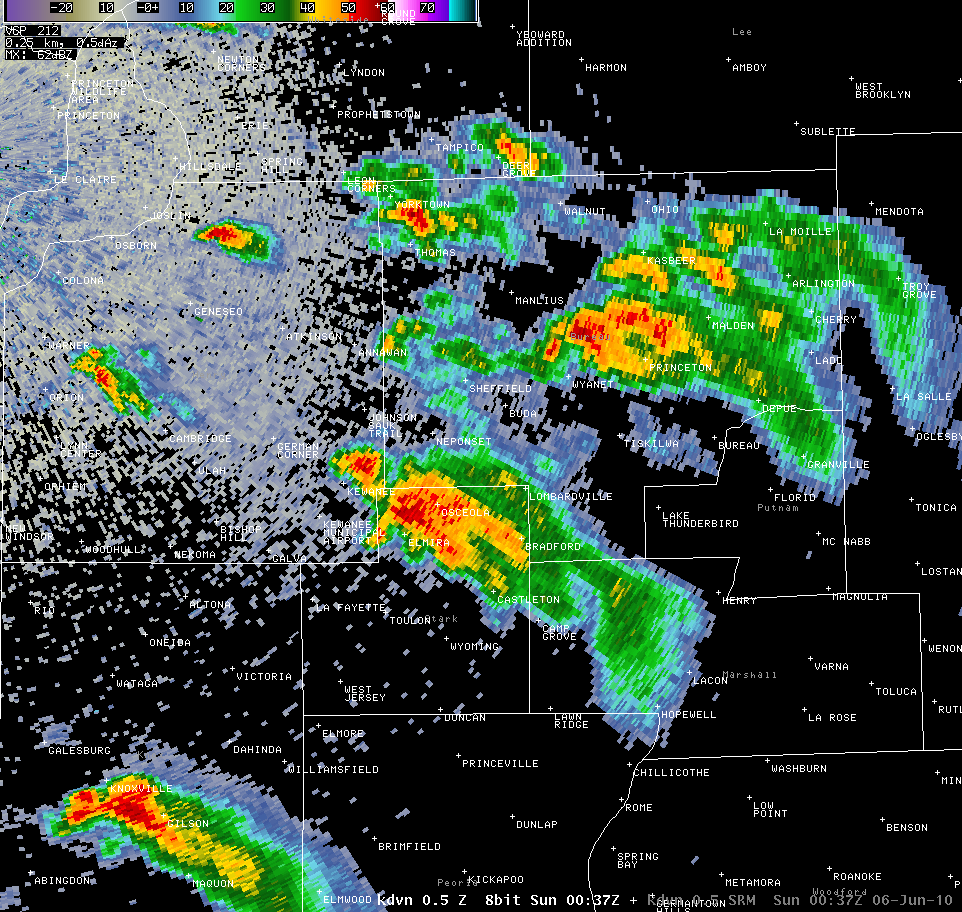
Above: Thunderstorm beginning to intensify south of Kewanee. Left is base reflectivity, right is storm relative velocity (red is away from radar, green is towards - showing rotation)
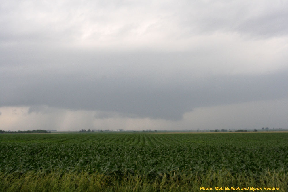
Above: Developing wall cloud, with little visible rotation, near LaFayette looking north into Henry County
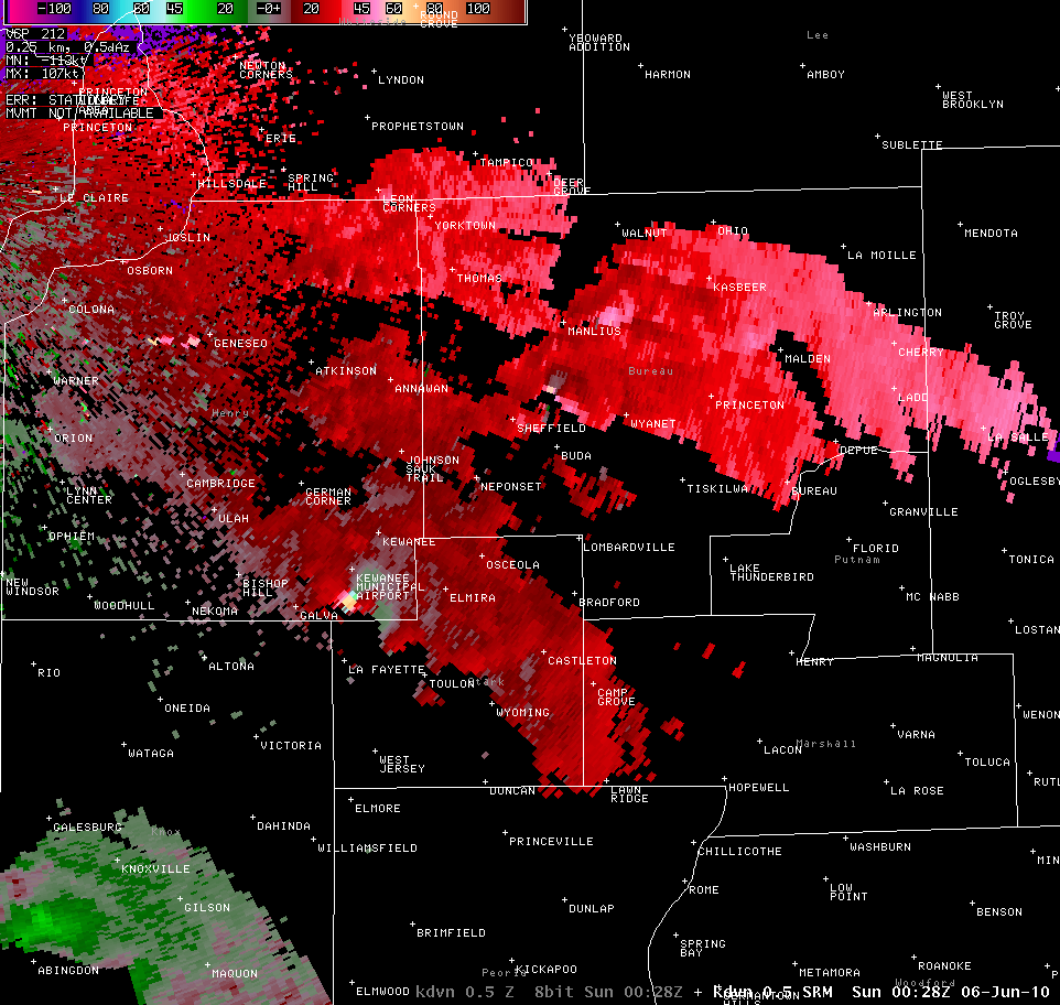
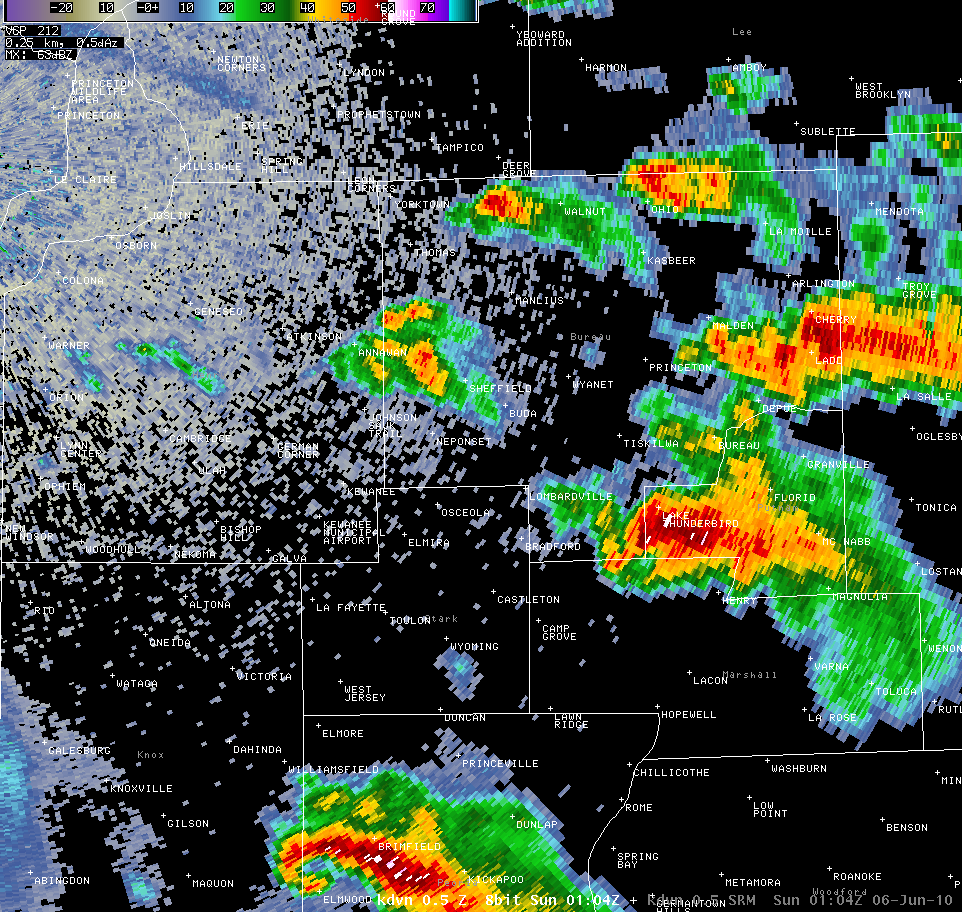
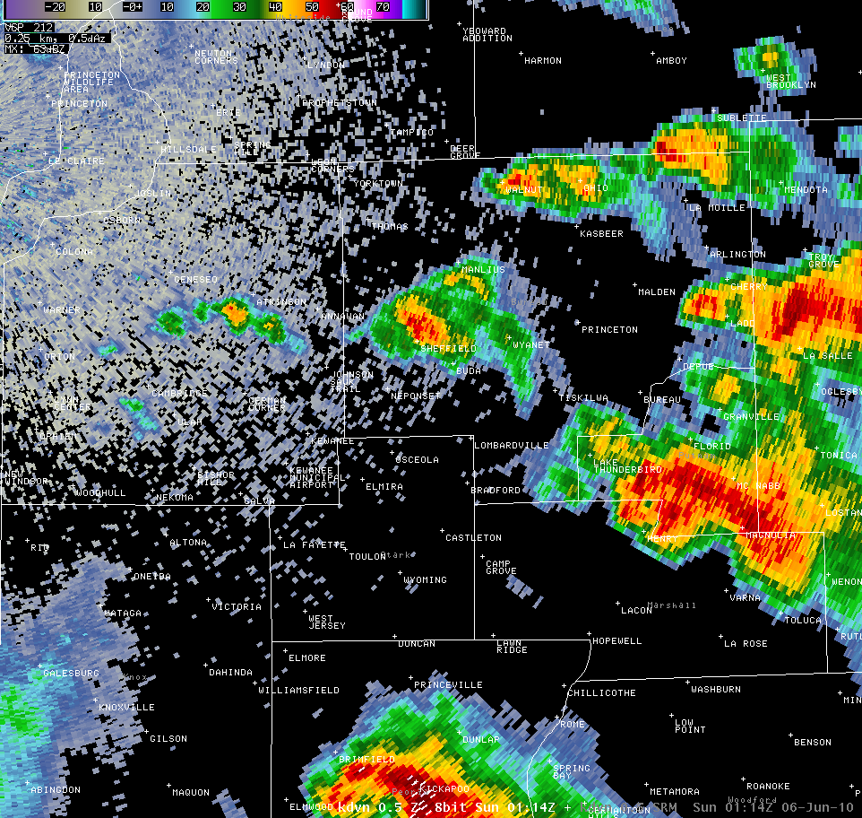
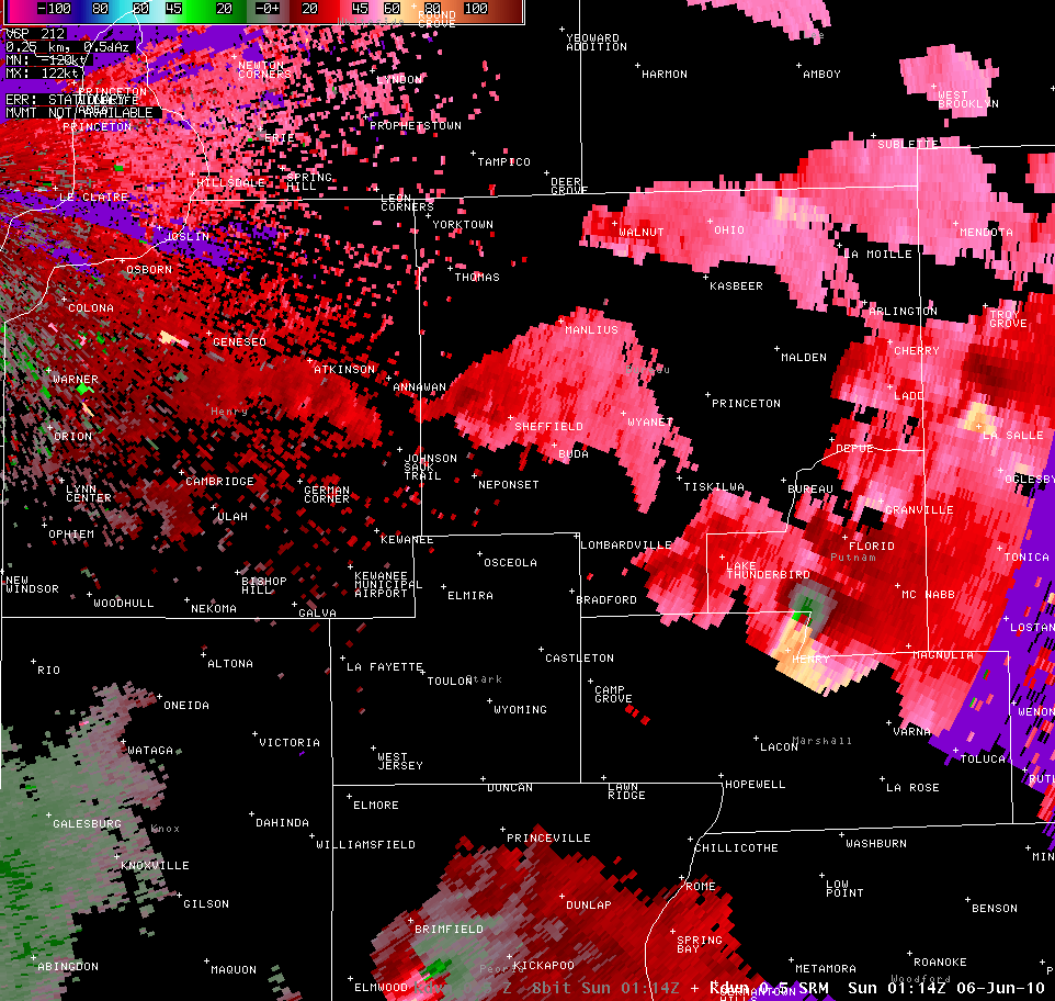
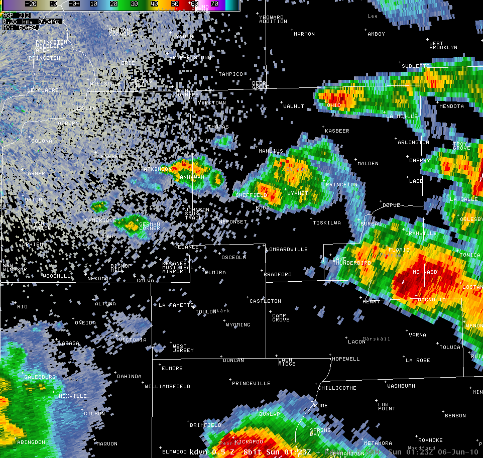
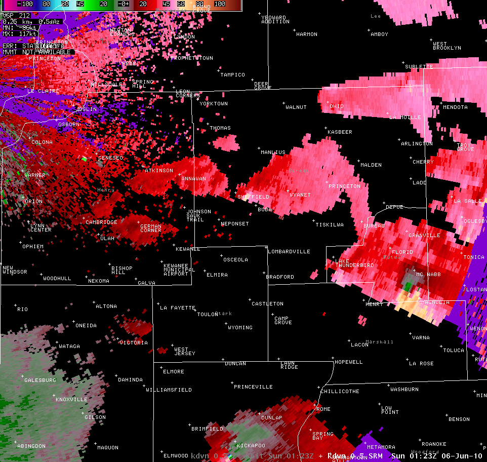
Above: Radar shortly after the tornado warning was issued for central Bureau County. Potentially tornadic circulations can be seen west of Princeton, near Elmire, and southeast of Galesburg
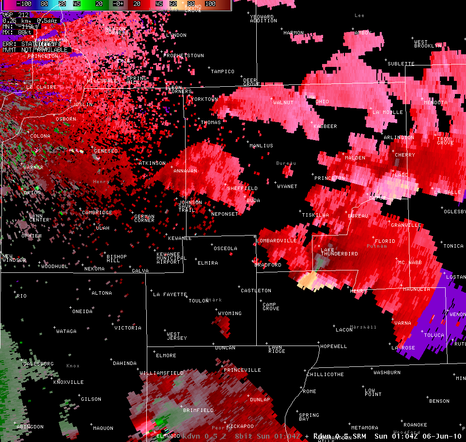
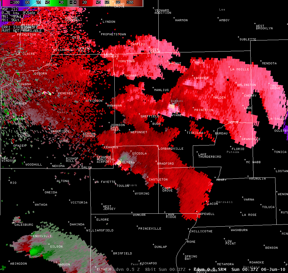
Above: Radar images of reflectivity and storm relative velocity from near the time of the preceding photographs
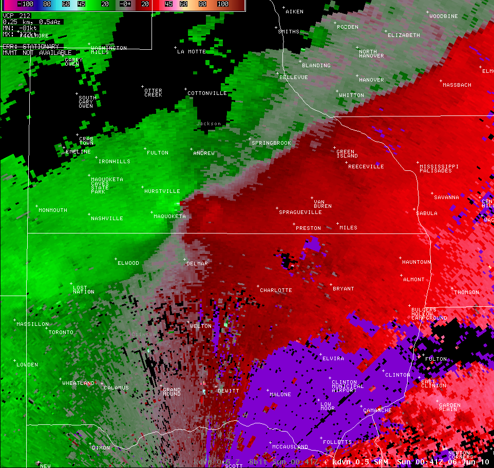
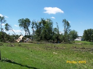
Farther northwest, along the cold front near the triple point, a persistent thunderstorm was approaching Maquoketa, Iowa. As it neared the northern edge of town it quickly spun up, showing signs of a tornadic circulation on radar for the first time. A third tornado warning was issued at 743pm, and shortly after, reports came in of tornado damage in Maquoketa. The interesting part about this storm is that it did not show the precursors to tornado development that the storms farther southeast did. Instead, the tornadic circulation showed up on radar after the tornado was already on the ground. This tornado touched down at approximately 740pm, and was on the ground for 2 ¼ miles. Tracking through the northern parts of town, the damage path was about 150 yards wide, and the majority of the damage was to trees, with many mobile homes and vehicles being damaged from falling limbs. A farmstead also lost its front porch and had several outbuildings damaged, while the elementary had its sign destroyed and a rooftop air conditioning unit moved. Based off this damage, a NWS storm survey team rated the tornado an EF1, with maximum wind speeds around 105mph. About 20 minutes later, the circulation intensified yet again, and another tornado touched down north of Goose Lake, Iowa. About 100 yards wide, and a ½ mile long, this tornado was rated an EF0 with winds of around 75mph due to tree damage in the area.
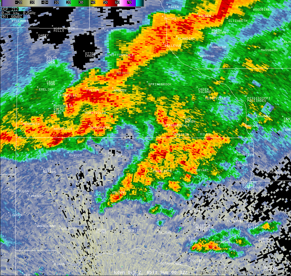
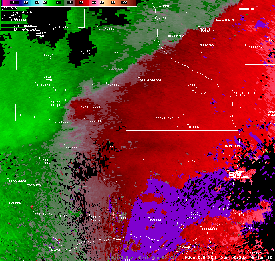

Above: Reflectivity and storm relative motion of the storm that produced the tornado in Maquoketa. Top images are before the tornado developed, bottom are when it was already on the ground.
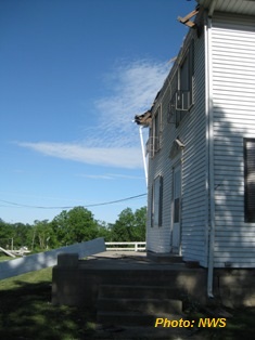
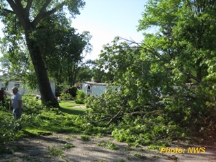
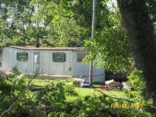
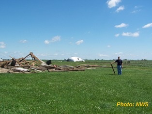
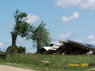
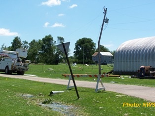
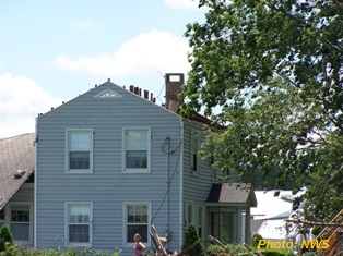
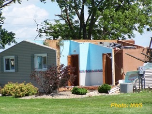
Above: NWS storm survey pictures from north side of Maquoketa
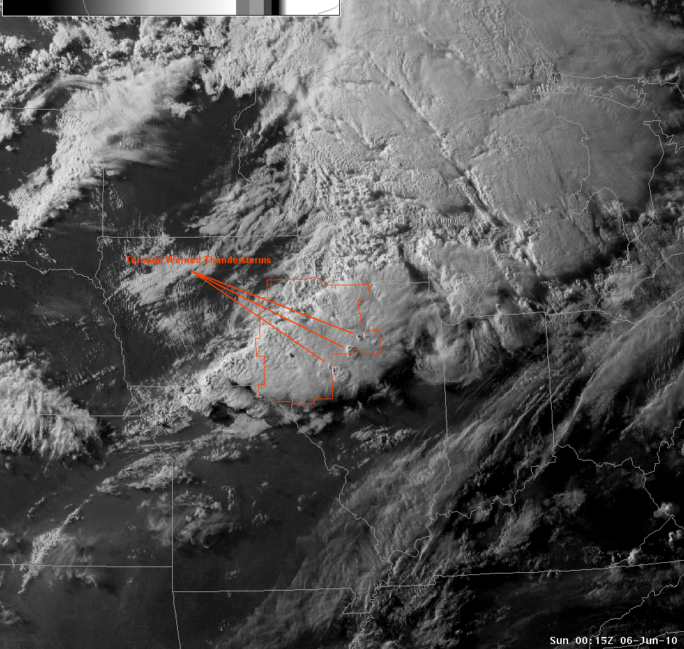
Above: Enhanced visible satellite shortly after 700pm showing overshooting tops on three tornado warned storms.
Back in extreme northern Marshall County, Illinois the thunderstorm was showing violent rotation in the lower levels on radar. At this time the tornado warning was updated to include warning of “significant structural damage” possible with this tornado. Also, by 807pm second tornado warning for this storm had been issued (the 4th of the day), because the original was nearing expiration. As the circulation passed into Putnam County at 810pm, a tornado finally touched down near the eastern shore of Sawmill Lake.
Above: Radar imagery around the time of the first tornado touchdown, as the storm is just entering extreme southeast Putnam County
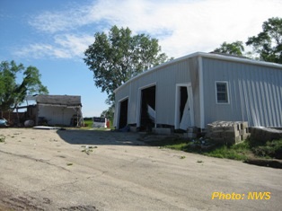
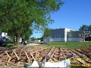
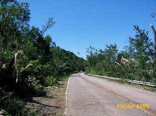
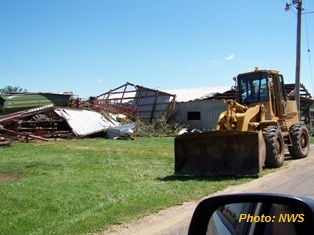
Significant tree damage occurred along Route 26, with trunks snapped and limbs scattered in all directions. The tornado continued east, towards Taylor Road, continuing shred trees and damage houses with falling limbs. Around this time a horse trailer was destroyed and parts of it carried over 300 yards. Adjacent to this damage, a field showed signs of scouring from the tornadic winds. Farther down Taylor Road a farmstead received significant damage when the tornado took half of the roof off a metal outbuilding, and totally flattened the barn. Fields nearby continued to show signs of scour, and a multivortex structure. Sheet metal and other debris was evident hundreds of yards out into fields in all directions. About ¼ mile up the road was a 400ft tall cell phone communication tower. The tornado was able to reduce the tower to nothing but twisted metal, and flattened the chain link fencing surrounding the anchor supports. Shortly before this time, a local resident snapped a photograph of a wedge tornado to her northwest from south of Route 18, near Stage Coach Road.
The tornado continued just north of Route 18, with continued destruction of farm outbuildings, grain bins and trees. Here debris was lofted hundreds of yards into adjacent fields, boards driven over a foot into the ground, and corn stalks were sheared off at the base and scattered to the east. The tornado then passed near the intersection of Routes 89 and 18, and entered into Magnolia.
Above: Radar imagery from near the time the tornado entered Magnolia
Significant damage occurred on the north side of town, as four homes lost all of parts of their roof. A trailer was also destroyed when the tornado rolled it over multiple times and into a grove of trees to the south. Scattered across town was damage to trees and outbuildings and damage done by flying debris. At the eastern edge of town, the former school gymnasium collapsed, and the roof was carried 200 yards out into a nearby field. This tornado continued east before it was determined to have lifted about 1 ¼ miles into LaSalle County at 835pm, thanks to coordination with the weather service office in Chicago. A NWS storm survey team was able to determine this tornado was on the ground for 9 ½ miles, with a maximum width of around ½ mile. It was rated an EF2 on the Enhanced Fujita scale, with maximum winds of 135mph when it toppled the cell phone tower. Within the town of Magnolia the tornado was beginning to weaken, though wind speeds were still estimated to be between 120 and 130mph.
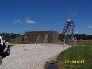
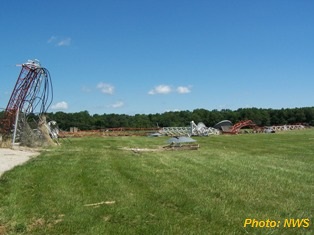
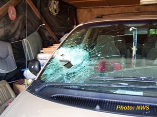
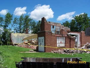
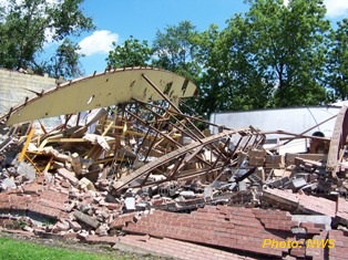
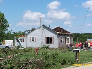
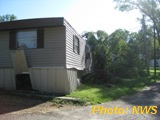
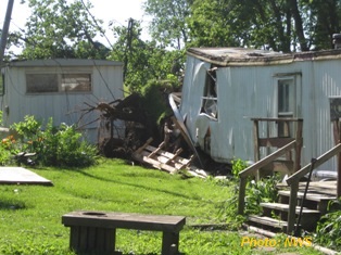
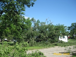
Above: NWS storm survey pictures from Putnam County
The parent supercell thunderstorm would then go on to produce multiple tornadoes all the way into Indiana, including the EF3 between Streator and Dwight, Illinois. The outbreak would continue through the evening and overnight, spreading in size to include Indiana, Michigan, Ohio and Ontario, in addition to Iowa and Illinois, with over 30 reported tornadoes.

