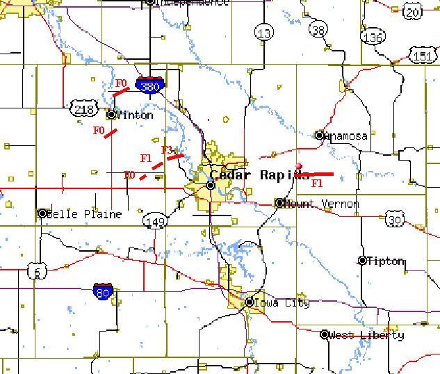
...Survey Results from Benton, Linn, and Jones County Iowa...
On Friday May 21st, severe thunderstorms moved across eastern Iowa during the afternoon, producing several tornadoes.
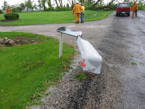
National weather service personnel conducted a damage assessment today of the storm track from near Atkins to Palo, Iowa, and a second damage path from Martelle to Morley. No injuries were reported.
Four tornadoes were identified:
- At 420 pm CDT Friday 5/21/04...
A tornado touched down briefly about 5 miles west of Atkins. No known damage at this location.
Path length: 1/8 mile
Path width: 50 yards
Rated F0 (wind estimated 72 mph or less)
- At 425 pm CDT Friday 5/21/04...
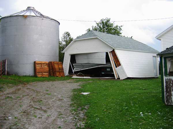
A tornado began 2 miles north of Atkins and moved northeast, damaging a few farms. Bloomsbury farms sustained the Heaviest damage on this path, including numerous trees twisted, substantial damage to the houses and outbuildings, and one building completely destroyed.
Path length: 1.7 miles
Path width: 150 yards
Rated F1 (wind estimated at 110 mph)
- At 431 pm CDT Friday 5/21/04...
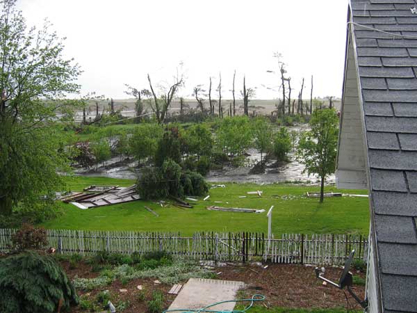
A tornado began 2 miles southwest of Palo and moved east, causing major damage. The tornado initially caused damage to a farm 2 miles southwest of Palo, where a garage and other outbuildings were destroyed. It then strengthened as it approached Palo, devastating another farm, including lofting a car and carrying it 50 feet. The roof and most walls of the house were torn off. The tornado continued across the southern edge of Palo where it destroyed a mobile home.
Path length: 3 miles
Path width: 200 yards
Rated F3 (wind estimated at 175 mph)
- At 511 pm CDT Friday 5/21/04...
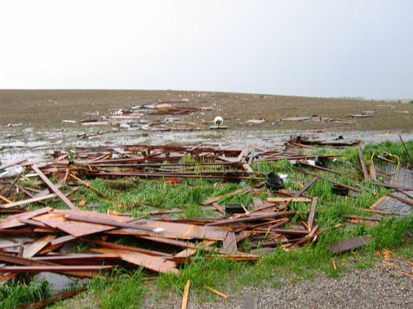
A tornado began 2 miles east of Martelle and moved east, causing sporadic damage along county road e45 toward Morley. Along this path, trees were damaged, a cattle shed was destroyed and blown across a field, houses sustained minor damage, outbuildings were damaged, and a mobile home was destroyed.
Path length: 6 miles
Path width: 100 yards
Rated F1 (wind estimated at 90 to 100 mph)
The National Weather Service would like to thank Benton and Linn County Emergency Management, local officials, and especially the affected residents for their time and assistance during the survey.
|