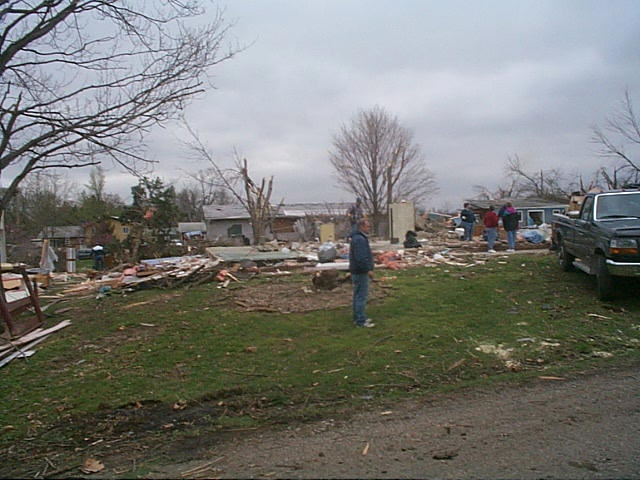
The April 8th, 1999 Tornadoes over Southeast Iowa and West Central Illinois
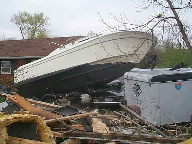
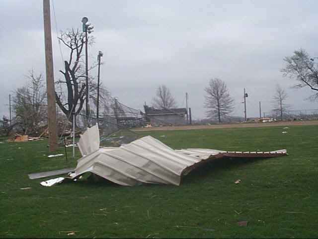
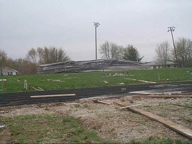
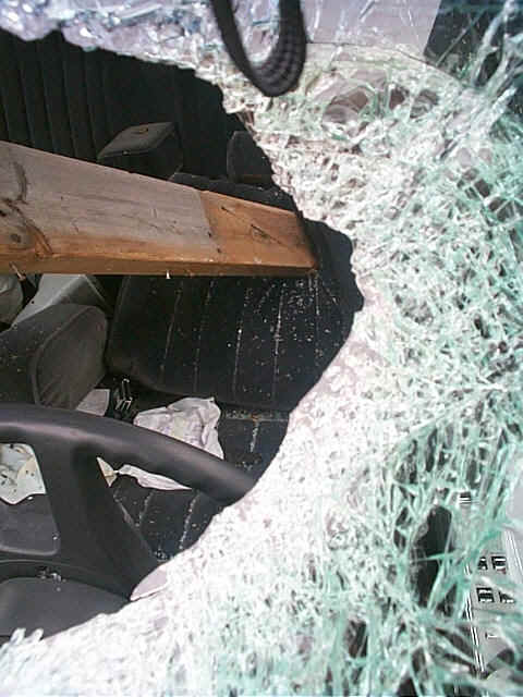
On April 8th, 1999 a strong low pressure system moved across Iowa with an attendant warm front and trailing dry line/cold front. Most of the thunderstorms developed along the dry line over eastern Nebraska and western Iowa early in the day and progressed east during the afternoon. The strongest of the tornadoes hit portions of western Hancock county, especially over Warsaw and Hamilton. F2 type damage was found in Warsaw and F3 type damage was found in Hamilton. Safety preparedness played a big role in saving lives during this event with phone calls made during the early afternoon to help with event planning. See write up and pictures.
At 500am CDT, SPC put eastern Iowa and western Illinois into a high risk area which meant that severe weather was likely over those sections...including a chance for tornadoes. As the day wore on, the local NWS Quad Cities staff noted that severe weather would likely be suppressed a little farther south...but would still include southeast Iowa and west central Illinois. This was due to the cool...stable air to the north of the warm front which stretched across southern Iowa and far northern Illinois at 300 pm CDT that afternoon. To the south of this warm front the temperatures and moisture had increased greatly during the day. Across the entire area was an atmosphere very supportive of rotating supercell thunderstorms, especially along and just north of the warm front.
Around 430pm CDT a strong thunderstorm developed over northeast Missouri and was moving rapidly to the northeast at about 40 mph. As it moved northeast it continued to close in on the west to east oriented warm front. The significance of a low level boundary such as a warm front is that, due to the temperature differences and wind direction changes on either side of the boundary, a large amount of low level horizontal vorticity (rotation on a horizontal axis) can be created. As a thunderstorm updraft moves over this region it can tilt and stretch this horizontal vorticity (rotation) and tilt it onto the vertical...thus potentially creating a tornado. This is what appeared to happen in both Jefferson county and Keokuk county on the Iowa side and in Hancock, Warren and Henderson counties on the Illinois side. A surface analysis at 500 pm CDT shows where this warm front was located. Below are links to the radar data, morning upper level analysis done by the NWS Quad Cities and also the 00Z April 9th, 1999 Davenport and Lincoln, IL soundings and hodographs, displaying the tornadic environment that evening.
|