Overview
|
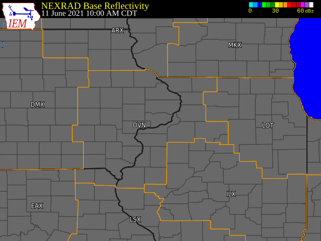
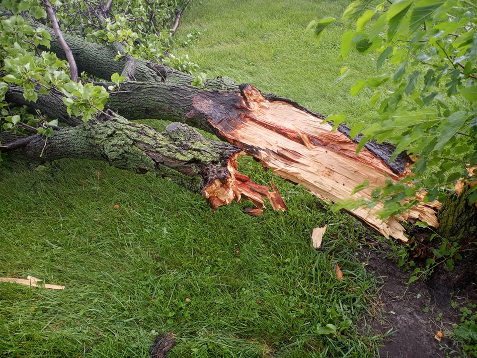
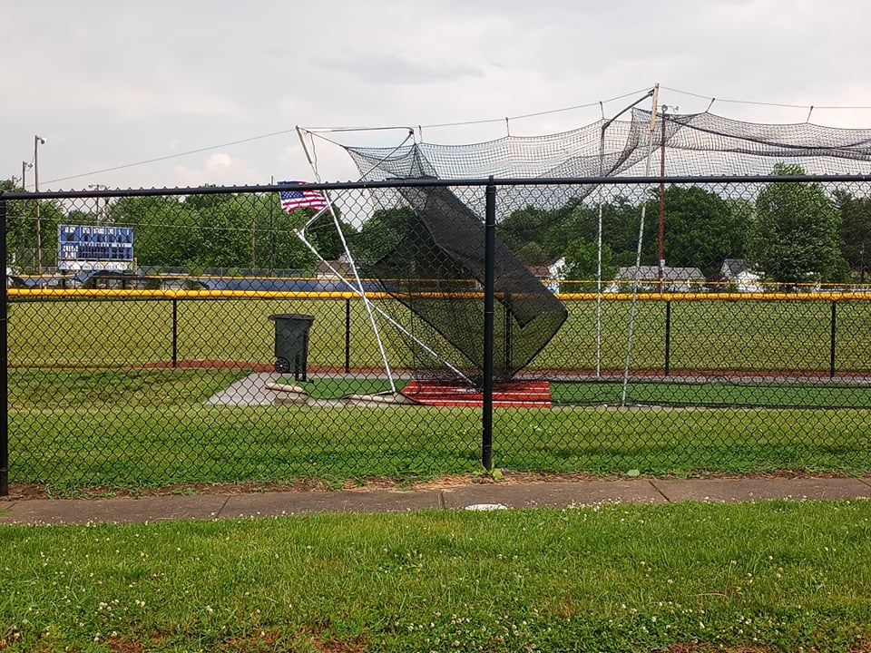
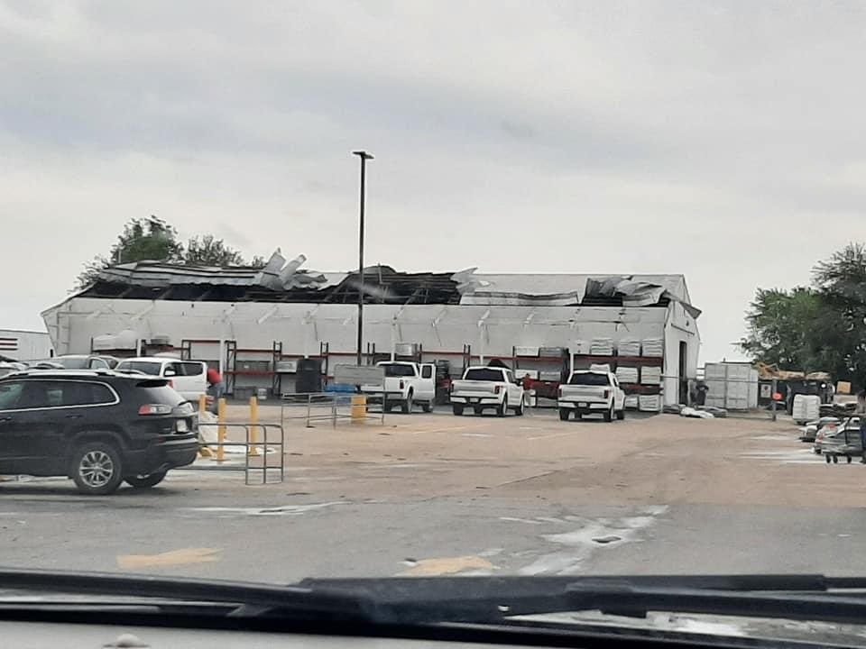
Temperatures in the 90s and high moisture in the low levels led to diurnally driven thunderstorms on Friday, June 11th. Weak upper level support kept these storms relatively isolated and short-lived. Another focus area for convection was along a remnant outflow boundary from an MCS that morning, which led to some further storm development later in the day. One storm reached severe limits, which was seen in Burlington, Iowa. This storm resulted in strong winds, over 50 mph, that lead to multiple damaged trees and some buildings damaged. |
Storm Reports
 |
 |
 |
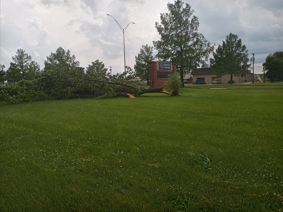 |
**Photos Courtesy of Gina Hardin, Des Moines County EMA**
PRELIMINARY LOCAL STORM REPORT...SUMMARY
NATIONAL WEATHER SERVICE QUAD CITIES IA IL
736 PM CDT FRI JUN 11 2021

..TIME...   ...EVENT...      ...CITY LOCATION...     ...LAT.LON...
..DATE...   ....MAG....      ..COUNTY LOCATION..ST.. ...SOURCE....
            ..REMARKS..

0226 PM     TSTM WND GST     BURLINGTON REGIONAL AIR 40.77N 91.13W
06/11/2021  M46 MPH          DES MOINES         IA   ASOS

            CORRECTS PREVIOUS REPORT FROM ASOS.

0231 PM     HAIL             WEST BURLINGTON         40.82N 91.18W
06/11/2021  E0.25 INCH       DES MOINES         IA   FIRE DEPT/RESCUE

            ALSO 46 MPH WIND GUST.

0232 PM     TSTM WND DMG     1 S WEST BURLINGTON     40.81N 91.18W
06/11/2021                   DES MOINES         IA   PUBLIC

            PARTIAL WOODEN FENCE COLLAPSE AT MENARDS IN
            WEST BURLINGTON.

0232 PM     TSTM WND DMG     WEST BURLINGTON         40.82N 91.18W
06/11/2021                   DES MOINES         IA   TRAINED SPOTTER

            ROOF DAMAGE TO THE CHURCH ACROSS THE STREET
            FROM THE FIRE STATION.

0233 PM     TSTM WND DMG     BURLINGTON              40.81N 91.12W
06/11/2021                   DES MOINES         IA   TRAINED SPOTTER

            CORRECTS TIME OF PREVIOUS TSTM WND DMG
            REPORT FROM BURLINGTON. LARGE GARAGE DOOR
            BLOWN IN AT A FACTORY.

0234 PM     TSTM WND DMG     1 ESE WEST BURLINGTON   40.81N 91.15W
06/11/2021                   DES MOINES         IA   PUBLIC

            PARTIAL WALL COLLAPSE AT A SMALL BUSINESS ON
            EAST AGENCY RD IN WEST BURLINGTON.

0237 PM     TSTM WND DMG     1 WSW BURLINGTON        40.80N 91.14W
06/11/2021                   DES MOINES         IA   EMERGENCY MNGR

            LARGE TREE LIMB DOWN AT NOTRE DAME HIGH
            SCHOOL.

0242 PM     TSTM WND DMG     2 ESE BURLINGTON REGION 40.78N 91.10W
06/11/2021                   DES MOINES         IA   EMERGENCY MNGR

            PART OF A TREE DOWN IN CRAPO PARK.

0242 PM     HAIL             BURLINGTON              40.81N 91.12W
06/11/2021  E0.25 INCH       DES MOINES         IA   TRAINED SPOTTER


0243 PM     TSTM WND DMG     BURLINGTON              40.81N 91.12W
06/11/2021                   DES MOINES         IA   TRAINED SPOTTER

            LARGE TREE LIMB DOWN ON A HOUSE.
 |
Media use of NWS Web News Stories is encouraged! Please acknowledge the NWS as the source of any news information accessed from this site. |
|